The Daily Weather Update from FOX Weather: Vermont cities underwater after historic rain hits the state
Start your day with the latest weather news – Vermont was one of the hardest-hit areas Monday after torrential rain flooded the state, and catastrophic river flooding will only make matters worse on Tuesday.
Torrential rain leads to shark rise of rivers in Vermont
Heavy rain that lashed New England and the Northeast on Monday has led to the sharp rise of rivers and streams across the region, with several cities and towns in Vermont now under water.
Welcome to the Daily Weather Update from FOX Weather. It’s Tuesday, July 11, 2023, and National Cow Appreciation Day. So let's brighten your "moood" by starting with everything you need to know about today's weather. You can also get a quick briefing of national, regional and local weather whenever you like with the FOX Weather Update podcast.
Vermont underwater after catastrophic flooding hits the state
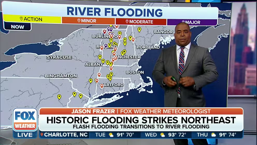
Catastrophic flooding continues Tuesday in Vermont after up to 9 inches of rain fell in parts of the state Monday, sending rivers to crests higher than Hurricane Irene levels in August 2011 and topped only by the Vermont flood of 1927 – the greatest natural disaster in the state's history.
The Winooski River at Montpelier crested at 21.02 feet Tuesday morning, surpassing the 19.05-foot crest set during Irene in 2011 to become the second-highest crest on record. This water is now flooding the streets of downtown Montpelier, Vermont's capital city.
The Winooski River at Essex Junction, just east of Burlington, is forecast to crest at 19.6 feet Tuesday afternoon, which would become the fifth-highest crest at that location. At these levels, widespread flooding occurs in the area.

(FOX Weather)
Monday's catastrophic flash flooding led to dozens of state road closures because of high water, stranding residents inside their homes.
Ludlow, in Windsor County, was one of the hardest-hit areas after torrential rainfall fell across the state. Drone video from Ludlow shows the floodwater turning roads into rivers.
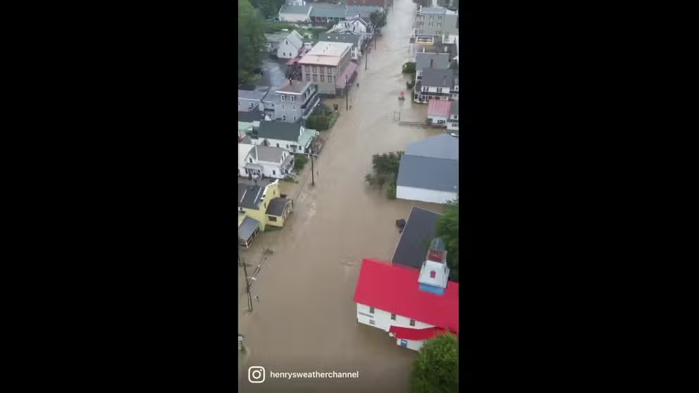
Drone video shows floodwater rushing through Ludlow, Vermont
Torrential rain fell in Vermont on Monday. Ludlow was one of the hardest hit areas in the state. (Video: henrysweatherchannel)
In Londonderry, Dana Zazinski watched the floodwater work its way up to her home as she and her dogs were forced to seek higher ground.
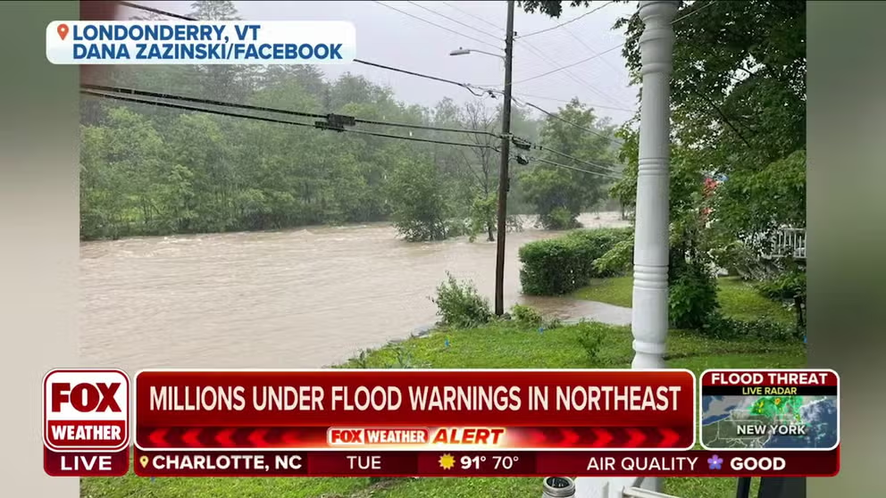
'Pretty scary:' Vermont resident describes flood water approaching her home
Dana Zazinski, of Londonderry, Vermont described watching as the West River has slowly approached her home during ongoing flooding. "This is pretty scary," Zazinski told FOX Weather.
Severe weather threat continues Tuesday in Plains
The threat of severe storms will once again target the Plains on Tuesday.
Large hail and damaging wind will be the main threats in any severe thunderstorms that develop.

(FOX Weather)
Hurricane HQ: What's happening in the tropics?
The National Hurricane Center (NHC) is eyeing an area of low pressure in the central Atlantic Ocean for potential tropical or subtropical development.
The outlined area has a medium chance for development, but the system will not pose any threat to the U.S. East Coast as it remains over open waters.

(FOX Weather)
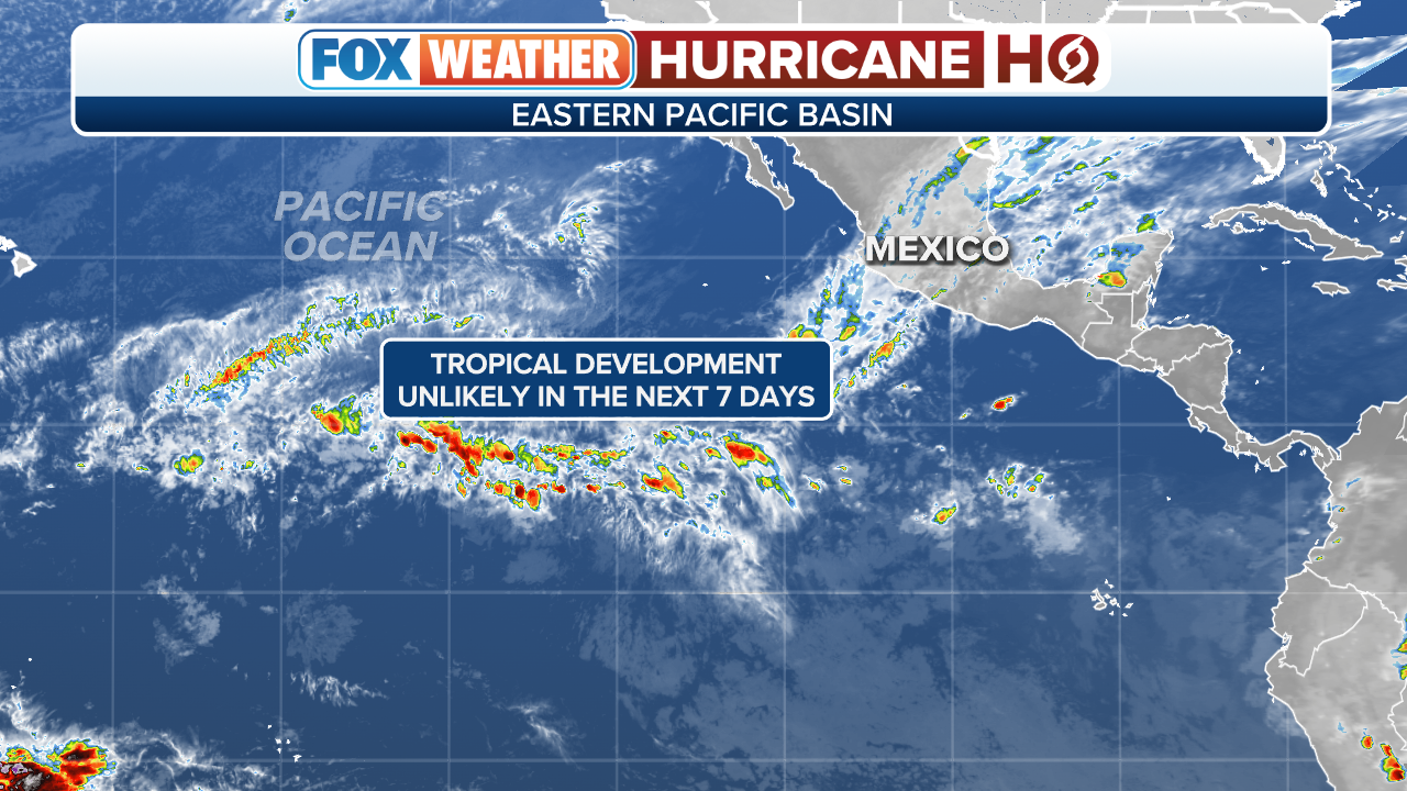
Over in the Eastern Pacific, the NHC has flagged a disturbance that has a high chance for tropical development.
Computer forecast models show the disturbance working westbound away from Mexico. However, there's a chance it could pass near Hawaii next week.
The next Eastern Pacific system that organizes into a tropical storm with winds of at least 40 mph will be named Calvin.
(FOX Weather)
Bonus reads
Before you go, here are a couple of stories we think you might enjoy.
- NASA expands Artemis moon spacesuit contracts for low-Earth orbit
- Icelandic volcano erupts for third year in a row after thousands of earthquakes reported
- Landslide destroys California homes as significant ground movement threats continue
Need more weather? Check your local forecast plus 3D radar in the FOX Weather app. You can also watch FOX Weather wherever you go using the FOX Weather app at foxweather.com/live or on your favorite streaming service.
You can share your weather pictures and videos with us anytime, anywhere, by emailing them to weather@fox.com or by adding the hashtag #FOXWeather to your post on your favorite social media platform.