Atlantic Invest 96L near the Bahamas has short window to develop as Caribbean Sea also watched for development
According to the National Hurricane Center, Invest 96L is moving into an area of strong upper-level winds and dry air, and the chances of it becoming a short-lived tropical storm are decreasing.
Atlantic Invest 96L near the Bahamas has short window to develop as Caribbean Sea also watched for development
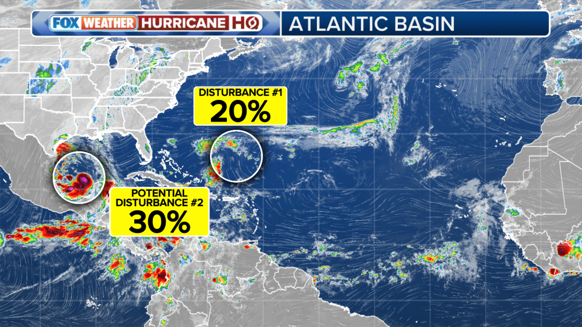
An area of low pressure east-northeast of the Bahamas in the southwestern Atlantic Ocean has only a short window to develop, while the National Hurricane Center has also flagged an area in the Caribbean Sea that's being monitored for development this week.
For the latest information, follow our updated coverage for Invest 96L and the disturbance in the Caribbean Sea at this link.
An area of low pressure east-northeast of the Bahamas in the southwestern Atlantic Ocean has only a short window to develop, while the National Hurricane Center (NHC) has also flagged an area in the Caribbean Sea that's being monitored for development this week.
Here's the latest on both systems the FOX Forecast Center is monitoring in the Atlantic Basin.
WHY THE HURRICANE SEASON WILL REMAIN ACTIVE INTO NOVEMBER
(FOX Weather)
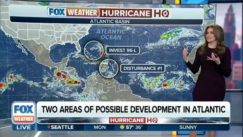
Invest 96L near the Bahamas has short window to develop
As of early Monday morning, satellite data indicated that an area of low pressure a couple of hundred miles east-northeast of the central Bahamas remained disorganized.
This system has been dubbed Invest 96L by the NHC. An invest is a naming convention used by forecasters at the NHC that allows them to run specialized computer models on systems they are investigating for possible development.
According to the NHC, Invest 96L is moving into an area of strong upper-level winds and dry air, and the chances of it becoming a short-lived tropical storm are decreasing.
The low-pressure system is expected to move slowly west-northwestward on Monday and then turn northward and northeastward Tuesday and Wednesday.
If the system can manage to get itself organized and contains sustained winds of at least 39 mph, it will be named Tropical Storm Vince.

(FOX Weather)
Caribbean Sea also being watched for development
An area of disturbed weather has formed over the eastern Caribbean Sea. This system is expected to move westward during the next several days, and environmental conditions appear conducive for gradual development.
The NHC said a tropical depression could form late this week when the system reaches the central or southwestern Caribbean Sea.
As of early Monday morning, the NHC assigned the system a medium chance of development over the next seven days.

(FOX Weather)
Tammy becomes post-tropical cyclone once again
After becoming a post-tropical cyclone last Thursday, Tammy regained tropical characteristics on Friday and was reclassified as a tropical storm. However, it didn't last long, as it already transitioned back to a post-tropical cyclone early Sunday morning nearly 700 miles to the east of Bermuda.
No further impacts are expected as the remnants of Tammy head east, then south – well away from Bermuda and any other land areas.
WHEN IS THE TYPICAL LAST HURRICANE STRIKE ON THE US COAST?
Last Saturday, Tammy made landfall as a Category 1 hurricane with 85-mph winds on the island of Barbuda in the northeastern Caribbean. Several of the northeastern Caribbean islands reported gusty winds, angry seas and tremendous rain as the heart of the storm moved by just miles to the east of many of those islands.