West Coast slammed by relentless rounds of storms with snow piling up
It was a quiet start to the new year, but the weather pattern across the U.S. will begin to get more active due to the storm systems in the West, the threat of flooding along the Gulf Coast from Texas to Florida, and the threat of the first nor’easter of 2024 to impact millions along the Interstate 95 corridor from the mid-Atlantic to the Northeast and New England this weekend.
West: No rest for the rain and snow weary
Another round of rain and snow is headed for the West Coast as a parade of storms keeps marching ashore. Find out how much snow ski resorts got and how much more they are looking forward to.
Rapid-fire storms are slamming the West Coast and will for the next seven days. Snow is piling up in the mountains while the lower elevations endure inches of rain.
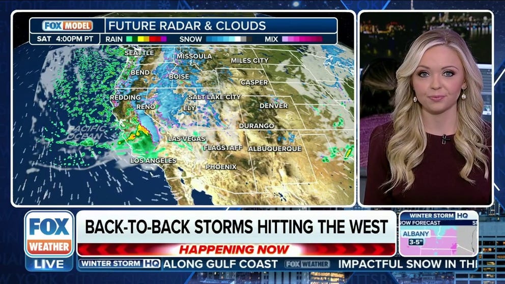
Watch the Future Radar sending a series of storms east. One impacts almost every 24 to 36 hours - in a seemingly never ending pattern with only brief clearing in between.
Storm after storm slam the West Coast for the next week.
(FOX Weather)
It's all part of a rather radical shift in the weather pattern across the U.S. that is getting more active due to the storm systems in the West, the threat of flooding along the Gulf Coast from Texas to Florida, and the threat of the first nor’easter of 2024 to impact millions along the Interstate 95 corridor from the mid-Atlantic to the Northeast and New England this weekend.
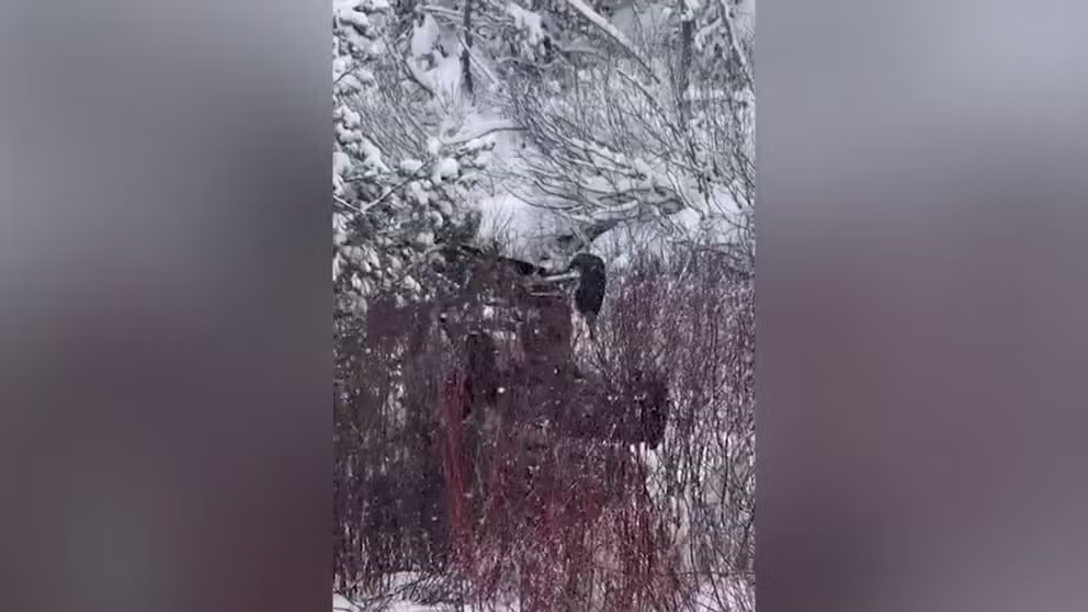
Heavy snow falls in the Sierra Nevada, Cascades
The previous round of rain and snow is just making it over the Intermountain West and ready to dump feet of snow on the Rockies. While the skiers were happy about the abundance of white stuff, drivers found the slippery roads challenging. Crews had to close sections of major highways around the Lake Tahoe region during the heaviest snow on Wednesday to clear roads and execute avalanche control.
Photos and videos show slippery roads, mounds of snow and cars that couldn't stay on the road.
VIDEO SHOWS AFTERMATH OF VEHICLE VEERING OFF ROAD, FLIPPING OVER IN SNOWY CALIFORNIA
Aftermath of vehicle veering off road, flipping over in snowy California
Video shared on Wednesday shows an upturned vehicle in a snowy ravine in the northern California town of Truckee. (Courtesy: CHP Truckee)
According to Caltrans District 3, Interstate 80 needed to be closed for about an hour because of heavy snow that led to multiple spinouts. Chains are required on all vehicles except 4-wheel-drive vehicles with snow tires on all four wheels from Truckee, California, to the Nevada state line.
6 BASIC STEPS FOR PROPERLY MEASURING SNOW
"There are only so many parts of the country that you can go to bed and wake up to fresh feet of snow," FOX Weather Meteorologist Britta Merwin said. "You get that with lake-effect and you get that in the mountains, especially the Sierra."
The NWS said 10-14 inches of snow fell, with 2 feet being recorded in the highest peaks.
"I think winter might finally be here!" posted a Tahoe resident on X. "Look at those big beautiful flakes. Woo Hoo."
DRIVING ON THE ICE AND DRIVING IN THE SNOW: WEATHER DRIVING TIPS FOR DRIVING IN INCLEMENT WEATHER
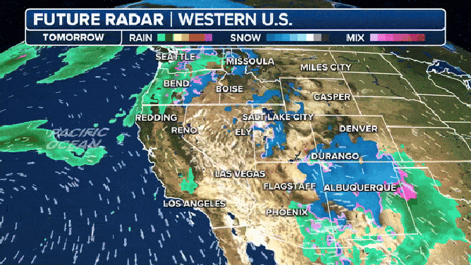
A second storm system, a dissipating cold front, moves into the Pacific Northwest late Thursday, but this won't drop much rain or snow. A more impressive system moves in on Friday.
"By Friday evening, we have a big front sweeping in and this is coming in from the Gulf of Alaska," Merwin said. "So, there’s some cold air with this system. And look at the Sierra yet again. By Saturday evening, you are slammed."
TRAVELING THIS WINTER? HERE'S WHAT TO KEEP IN YOUR CAR IN CASE YOU GET STUCK

(FOX Weather)
The NWS forecast for the Sierra is 10 to 20 inches of snow above 5,000 feet.
"The second system that’s heading toward the end of the week is going to be a powerful one for the Pacific Northwest," Merwin said. "So, the Cascades get ready for a huge dump of snow at the end of the week, and also a batch of heavy rain (in the lowlands)."
The coast gets a break on Sunday but very cold temperatures move in, even to lower elevations.
"Monday morning low temperatures look to be near to below freezing in the Central Valley as drier, colder airmass settles over the area," stated the Sacramento NWS Forecast Discussion.
"Models then point to additional disturbances moving through the area Tuesday/Wednesday in northwest flow aloft," the discussion continued.
WHICH STATE HAS THE MOST SKI RESORTS? THE ANSWER MAY SURPRISE YOU
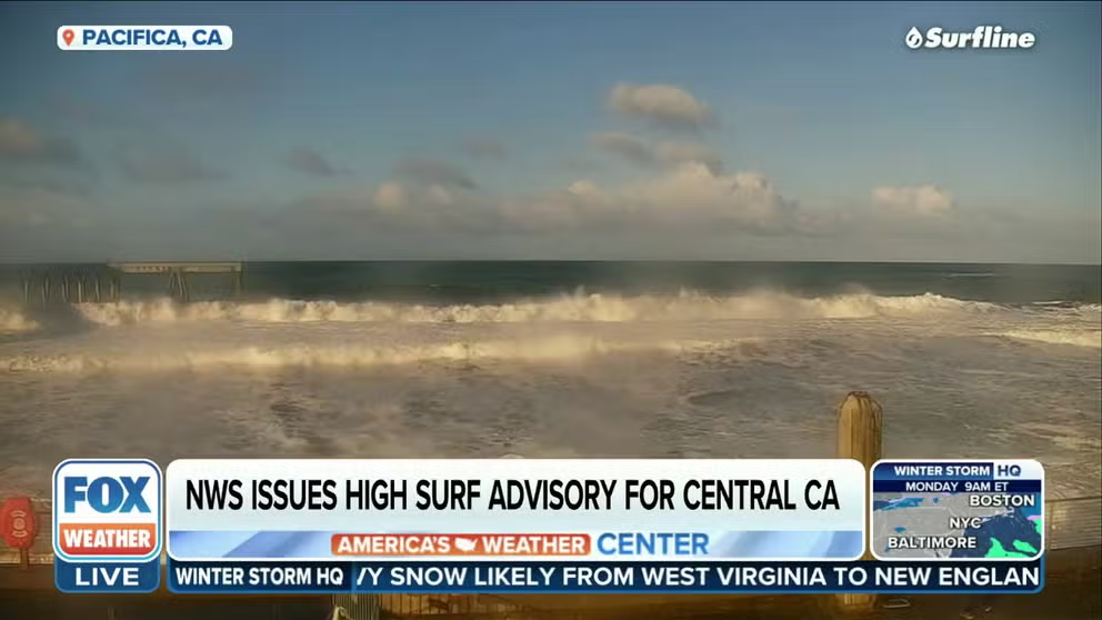
Dangerous surf again for California
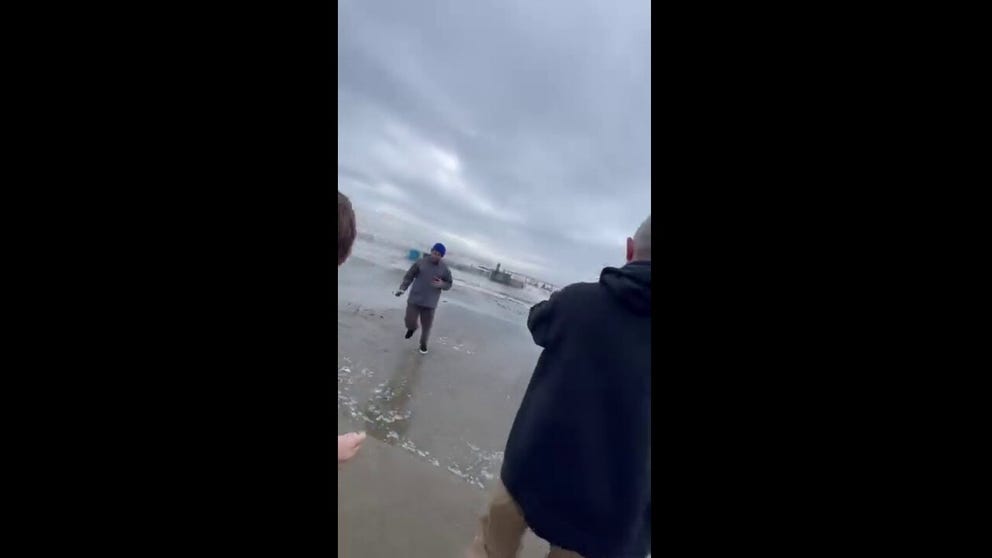
Watch: Onlookers run from surprisingly large wave
FILE: Locals in Capitola, California taking photos of the huge surf were surprised when the water crashed onto them. "Before anyone says anything, right after a bigger wave came, everyone was asked to leave and evacuate the Esplanade," posted the photographer on Facebook. "The cops were making sure everyone was safe. No one got injured due to the waves, at least no one near us. Shortly after this video, everyone received the evacuation notices and the cops evacuated anyone near."
The NWS issued High Surf Advisories for the California coast where breaking waves of 20–25 feet will again pound Northern California. Those wave height forecasts are not as extreme as last week's heavy surf and coastal flooding, but still could bring impacts.
MASSIVE WAVES FORECAST IN CALIFORNIA RENEW DANGEROUS SURF THREAT
High Surf Advisories issued as monster waves forecast in California
Another swell will bring dangerous surf to the California coast again on Wednesday and Thursday with the potential for coastal flooding this weekend. Waves up to 23 feet are possible near the San Francisco Bay area.
"At the coast, a continued threat of rough surf, tremendously high waves and coastal flooding will remain," said the FOX Forecast Center. "The same mechanism that caused the waves, strong storms spinning over the northern Pacific Ocean, will exist this week, with the largest waves expected along the West Coast (Wednesday) into Thursday and again Sunday-Monday."
CALIFORNIA BEACHES SLAMMED BY MASSIVE WAVES, COASTAL FLOODING
Storms to dump rain from California to Washington

(FOX Weather)
While the higher elevations will need shovels, snowblowers and plows, the lower elevations will need umbrellas and boots as rain pushes into the region from California to the Pacific Northwest.
The NWS says the highest rain totals will be found in Northern California, as well as western and coastal areas of Oregon and Washington.
7 FACTS YOU SHOULD KNOW ABOUT FLASH FLOODS
Rain is forecast for coastal Southern California and the Desert Southwest with a wintry mix for lower elevation valleys in the Great Basin. However, the NWS says little to no accumulation is anticipated.
Generally speaking, rainfall totals will be around an inch or two in the Interstate 5 corridor, but coastal areas from north of San Francisco through the Olympic Mountains in Washington will likely see 2–3 inches of rain, with isolated spots of 3–5 inches over higher terrain over the next week.