Mass headache: Boston snow busts but nor'easter brings blizzard 60 miles away
The nor'easter threw New England several curveballs Tuesday, bringing blizzard conditions to Cape Cod yet giving Boston the cold (rain) shoulder. Here's why.
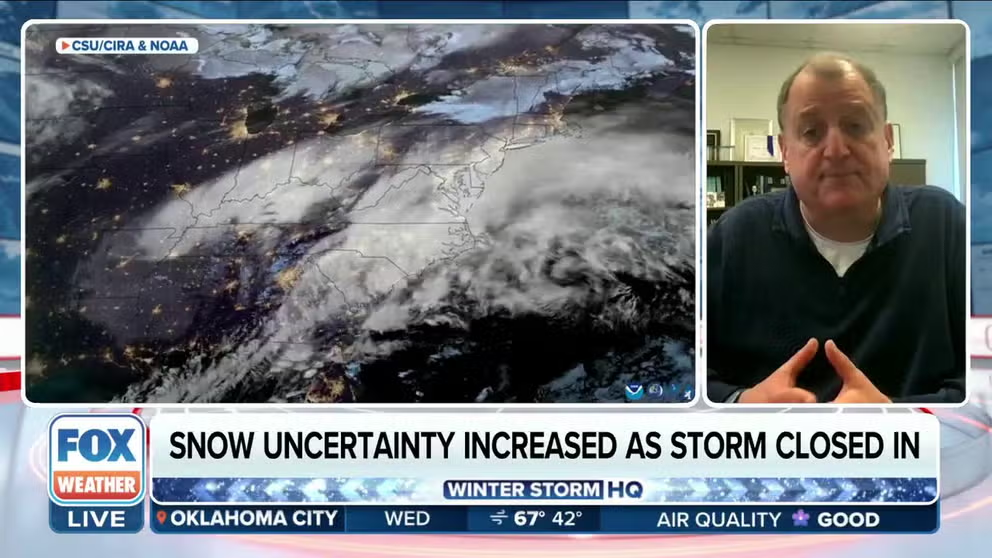
Why forecasting a nor'easter can be tricky
University of Miami CIMAS Director Ben Kirtman explains what goes into forecasting snow totals for a major winter storm and why a nor'easter can be particularly challenging.
HYANNIS, Mass. – Boston and Cape Cod may be in the same state, but they were worlds apart in their weather experiences Tuesday as a nor’easter stormed by off the New England coast.
On one hand, Boston was at times expecting a foot of snow or more on Tuesday from what forecast models were predicting during the days leading up to the storm’s arrival.
DEADLY NOR'EASTER WINDS DOWN AFTER DUMPING OVER A FOOT OF SNOW IN THE NORTHEAST
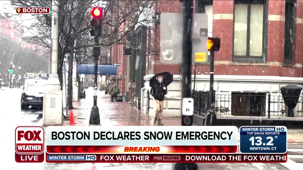
The city declared a Snow Emergency for Tuesday, canceled schools, banned street parking and hunkered down for a storm that instead gave Beantown the cold (rain) shoulder.
Boston’s Logan Airport measured a scant 0.1 inches of snow – giving the record books a consolation prize of counting the date as having measurable snow, but otherwise leaving the city bare and wet.
Boston snow emergency to end at 4 p.m. Tuesday
City officials in Boston said it will end its snow emergency at 4 p.m. Tuesday after the city was dropped from a Winter Storm Warning to a Winter Weather Advisory when computer forecast models showed a nor'easter that was expected to drop up to a foot of snow in the city tracked farther south, lowering forecast snow totals.
You can see on the map below by FOX Weather Senior Weather Data Specialist Shane Brown which areas received much less snow than the forecast charts predicted. Dark red areas are spots that received 6 inches or less snow than model predictions; dark blue means 6 inches or more snow than forecast.
Much of Massachusetts was the decided snow loser.
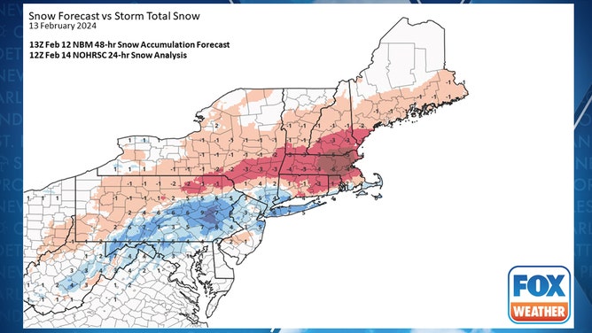
What areas received more or less snow than predicted from the nor'easter on Feb. 13, 2024. Light red -0.5 inches; Medium red: -3 inches; Dark red: -6 inches; Light blue: +0.5 inches; Medium Blue: +3 inches; Dark blue: +6 inches.
(FOX Weather)
But not all of Massachusetts.
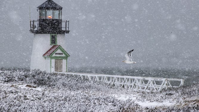
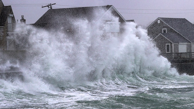
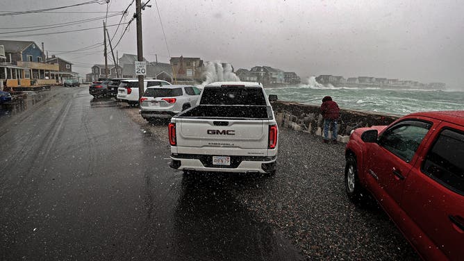
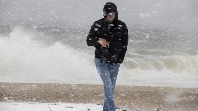
Out at Cape Cod – just 60 miles from Boston – the nor'easter kept its promise.
From noon to 3 p.m. Tuesday, Hyannis reported heavy snow, fog and winds gusting from 40-45 mph. With visibility at a quarter-mile or less through the period, it became an official blizzard.
![]() Image 1 of 9
Image 1 of 9Nantucket, MA - February 13: Brant Point Light during the height of the snowstorm gets a flyby from a gull. (Photo by Stan Grossfeld/The Boston Globe via Getty Images) ( )
![]() Image 2 of 9
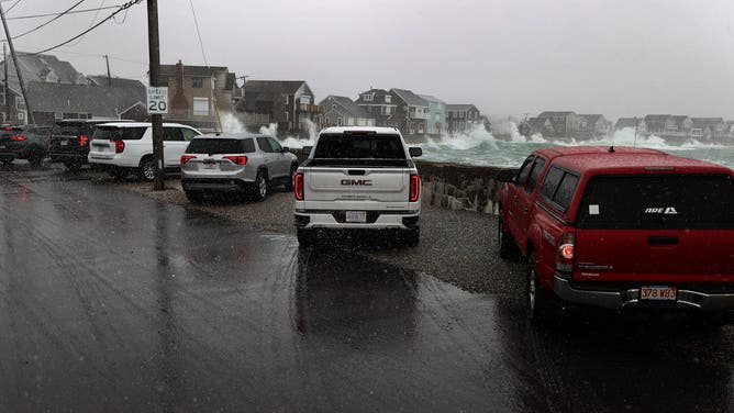
Image 2 of 9Scituate, MA - February 13: The surf crashes against the seawall at Surfside Road. (Photo by David L. Ryan/The Boston Globe via Getty Images) ( )
![]() Image 3 of 9
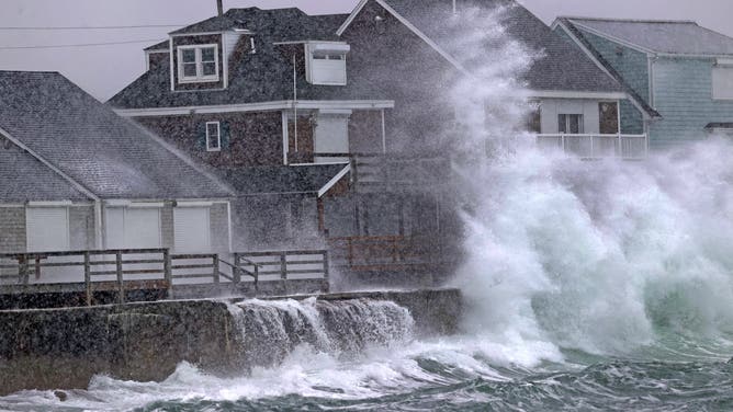
Image 3 of 9Scituate, MA - February 13: The surf crashes against the seawall at Lighthouse Road. (Photo by David L. Ryan/The Boston Globe via Getty Images) ( )
![]() Image 4 of 9
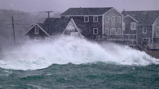
Image 4 of 9Scituate, MA - February 13: The surf crashes against the seawall at Lighthouse Road, as people in their vehicles watch. (Photo by David L. Ryan/The Boston Globe via Getty Images) ( )
![]() Image 5 of 9
Image 5 of 9Scituate, MA - February 13: The surf crashes against the seawall at Lighthouse Road. (Photo by David L. Ryan/The Boston Globe via Getty Images) ( )
![]() Image 6 of 9
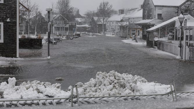
Image 6 of 9Nantucket, MA - February 13: Easy Street is flooded during the storm. (Photo by Stan Grossfeld/The Boston Globe via Getty Images) ( )
![]() Image 7 of 9
Image 7 of 9Nantucket, MA - February 13: At Sconset Beach, onlookers watch the erosion. (Photo by Stan Grossfeld/The Boston Globe via Getty Images) ( )
![]() Image 8 of 9
Image 8 of 9Scituate, MA - February 13: The surf crashes against the seawall at Lighthouse Road, as people in their vehicles watch. (Photo by David L. Ryan/The Boston Globe via Getty Images) ( )
![]() Image 9 of 9
Image 9 of 9Scituate, MA - February 13: The surf crashes against the seawall at Lighthouse Road. (Photo by David L. Ryan/The Boston Globe via Getty Images) ( )

So what happened? For Boston, it was a double whammy of a mild wind and a storm that ended up heading farther south than forecast.
"When there isn't a lot of below-freezing air place, like with this storm, storms need to ‘manufacture’ their own cold air," said FOX Weather Senior Meteorologist Greg Diamond. "This is done by evaporative cooling. When snowflakes evaporate on their way down to the ground, they cool the immediate air around them. Heavier snow equals more flakes to evaporate, which equals more cooling."
SEE IT: DEADLY NOR'EASTER LEAVES BEHIND PILES OF SNOW ACROSS THE NORTHEAST
The city was already at a disadvantage with temperatures above freezing when the storm arrived.
"And it also saw easterly winds off the warmer water. This kept them above freezing for the first half of the event," Diamond said.
Then, the storm track put a second wrench in the snow machine.
WATCH: MASSACHUSETTS AMBULANCE NARROWLY AVOIDS ROLLOVER CASH ON I-95 DURING NOR'EASTER
"The more southerly track of the storm kept the heavier snow south of Boston, so they never saw the precipitation rate get high enough to overcome above-freezing temperatures," Diamond said. "It was only when the winds began to shift to the north, and away from the water, that the temperatures were able to drop, and the snow could fall. But by then, it was too late."
Pennsylvania finds itself on the other side of the coin
On the other hand, with the more southerly storm track, Boston’s loss was Pennsylvania and Connecticut’s gain.
NOR'EASTER TURNS NEW YORK CITY INTO SNOWLOVER'S DREAM AHEAD OF VALENTINE'S DAY
Much of eastern Pennsylvania and northwestern New Jersey found themselves with much more snow than they were expecting for Tuesday, while Connecticut did get the bounty of snow that was promised – in some cases even more.
Several towns reported more than a foot of snow. West Hartford, Connecticut, had 15.2 inches, while Sussex, New Jersey, had 15 inches. Parts of eastern Pennsylvania also reported 12-15 inches of snow.
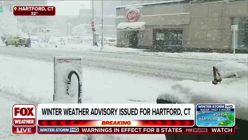
Hartford under Winter Weather Advisory as nor'easter blasts Connecticut with heavy snow
Hartford, Connecticut, has picked up more than a half foot of snow as a nor'easter blasts the Northeast and New England with heavy snow on Tuesday.
Philadelphia had a wild ride of being left on the outside of snow in initial forecasts, only to be put back in Tuesday morning with the storm track shift and a new forecast of multiple inches, then underperform the revised forecast and net just over a half-inch of snow.
It all illustrates the difficulty in tracking nor'easters where slight wobbles in the storm track can make or break a snow forecast.
HOW MANY CALORIES DOES SNOW-SHOVELING BURN? CHECK THIS HANDY CALCULATOR
"We have to remind ourselves that, you know, for a large-scale storm, a little bit of wobble and how much cold air is pushing down from the north or how much spin is coming across aloft to spin up the storm is going to affect the track of that storm a great deal in terms of ‘is it going to snow in New York or Philadelphia?’," Ben Kirtman, director of CIMAS at the University of Miami, told FOX Weather. "It's a large-scale system. And these little tiny wobbles associated with a little extra cold air coming south or a little more vorticity advection aloft but more spin aloft – that can really affect the track of the storm very late in its trajectory. And that can really change the snow totals and where that storm really goes."
While nor'easters are done for a while, renewed snow chances remain in the long-range forecast for the Northeast toward the end of this week and into next week.