How one point on a map can determine whether I-95 corridor sees snow or rain from a Northeast snowstorm
The point on the map that meteorologists focus on is the so-called "40/70 benchmark," located at 40 degrees north latitude and 70 degrees west longitude. A difference of 50 miles to the left or right of that point can have a huge implication on the forecast, and that's why uncertainty can be high even a day or two before the winter storm's arrival.
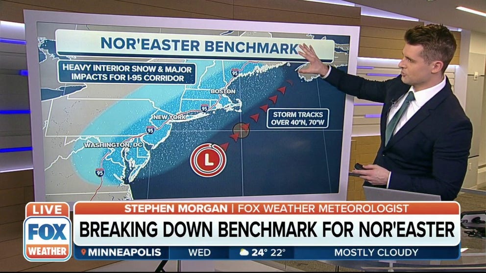
Breaking down the benchmark for a nor'easter
FOX Weather meteorologist Stephen Morgan breaks down the benchmark for a nor'easter.
How much snow will fall at my house? That's the burning question everyone wants the answer to when meteorologists say a winter storm will threaten the East Coast in the coming days.
But when the Northeast snowstorm is still a few days away, the answer to that question typically involves quite a bit of uncertainty.
We understand your frustration.
This animation illustrates how nor'easters typically form.
(FOX Weather)
The truth is, one point on a map is often key in determining who will see heavy snow and how much will pile up during the storm.
A difference of 50 miles to the left or right of that point can have a huge implication on the forecast, and that's why uncertainty can be high even a day or two before the winter storm's arrival.
WHAT MAKES A STORM A NOR'EASTER?
The point on the map that meteorologists focus on is the so-called "40/70 benchmark," located at 40 degrees north latitude and 70 degrees west longitude. For reference, that's some 80 miles south of Massachusetts' Nantucket Island.
As we get closer to the storm's arrival, computer forecast models are able to better predict if it will track near this 40/70 benchmark, ultimately raising a meteorologist's confidence in the forecast as the uncertainty decreases.
A storm track over the 40/70 benchmark
If cold air is sufficient over the Northeast, a low-pressure system tracking over this sweet spot has the potential to be a blockbuster snowstorm for parts of the region.
Many of the major winter storms that impact Boston, New York City, Philadelphia and Washington pass very close to the 40/70 benchmark during their journey northward off the East Coast. The famed "Blizzard of '96" was one such example that brought heavy snow to all those major cities.
However, as you'd imagine, not every winter storm tracks directly over this single point of latitude/longitude.
WINTER STORMS AREN'T NAMED, BUT THEY ARE RATED ON A 1-TO-5 SCALE
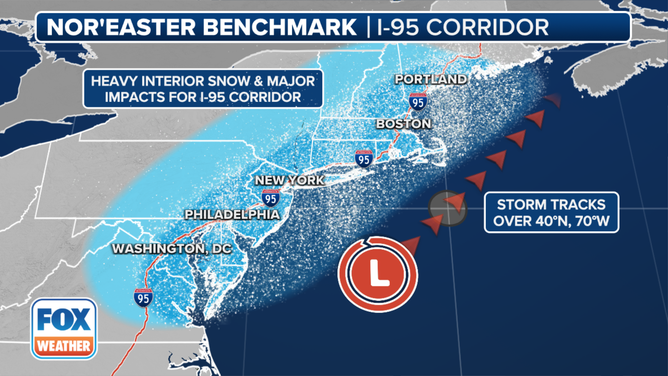
The circle shows the location of the 40/70 benchmark.
(FOX Weather)
A storm track west of the 40/70 benchmark
When low pressure tracks west of the 40/70 benchmark, the forecast gets much trickier, especially along the Interstate 95 corridor between Boston and Washington.
This western track usually pulls in warmer air from the Atlantic Ocean, which means a rain/snow line will likely set up somewhere in the Northeast, creating a forecast headache for meteorologists in cities such as New York and Philadelphia.
Determining how far inland the marine air reaches is one of the most difficult aspects of a Northeast snowstorm forecast. Near the rain/snow line, there can be tight snowfall gradients in which totals range from nothing to a few inches to more than a foot over a short distance.
WHEN IS THE PEAK TIME OF YEAR FOR MAJOR NORTHEAST WINTER STORMS?
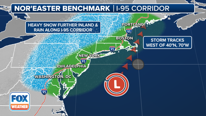
The circle shows the location of the 40/70 benchmark.
(FOX Weather)
A storm track east of the 40/70 benchmark
When the storm system tracks east of the 40/70 benchmark, it can result in a close call for the Northeast.
In this case, the heaviest snow typically remains offshore of the Eastern Seaboard. While areas along the immediate coastline can get grazed by a bit of snow, little to no snow falls farther inland.
WHICH IS THE SNOWIEST MONTH OF THE YEAR?
If you're a snow fanatic in the Northeast, this is not the track you want to see in the days leading up to the storm because any impacts would likely be minimal.
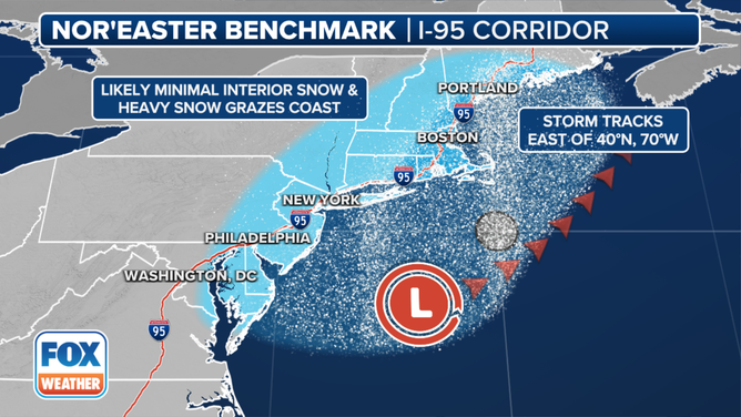
The circle shows the location of the 40/70 benchmark.
(FOX Weather)