Pattern shift to usher in coast-to-coast weather changes from Easter weekend into next week
Get ready for a break from severe weather and snow, a soggy and chilly Easter weekend in the Southeast and eventually a major warmup for the central and eastern U.S. next week.
Pattern change to usher in spring warmth
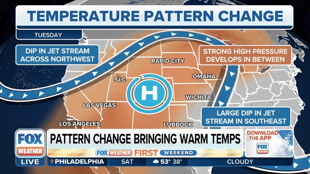
A warm weather pattern is expected to develop across a majority of the eastern U.S. next week. This is likely to bring above-average temperatures, with daytime highs possibly heading into the 70s and 80s.
The jet stream is reconfiguring itself across the U.S. as we head into Easter weekend, providing a variety of weather changes from coast to coast into next week.
For the past several weeks, a southward dip in the jet stream has set up over the West before punching eastward into the Plains, Midwest and East, triggering a series of deadly severe weather outbreaks in the central U.S. At the same time, high pressure remained parked over the Southeast and provided a taste of summer to Florida and the Gulf Coast.

(FOX Weather)
That stubborn pattern is finally changing, with a northward bulge in the jet stream – an upper-level area of high pressure – building across the West and bringing a temporary end to the parade of storms that has relentlessly targeted California and the Pacific Northwest.

(FOX Weather)
Here's what this change in the jet stream pattern means for the nation's weather for Easter weekend and into next week.
Break from severe weather
Following a severe weather outbreak in the Midwest and South that killed at least six people earlier this week, the forecast for the next several days should provide a welcome sigh of relief for millions of Americans.
The threat of severe weather and tornadoes is expected to remain low from Friday through the weekend and into much of next week.
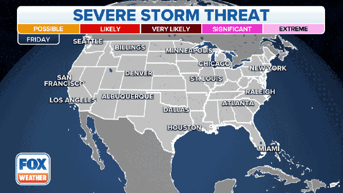
The severe weather outlooks from Friday, April 7, through Wednesday, April 12, 2023.
(FOX Weather)
According to the FOX Forecast Center, the four-day period from March 18-21 was the last time the U.S. had a multiday stretch without severe storms in the forecast.
THE SPC 5-POINT SEVERE THUNDERSTORM RISK CATEGORY SCALE EXPLAINED
If current outlooks verify, this stretch could last at least seven days from Friday through Thursday of next week. This would be unusual for April, which kicks off the most active three-month period for tornadoes.

A calendar showing the highest severe weather risk for each day in March 2023. March 18-21 was the last time the U.S. had a multiday stretch without severe storms in the forecast.
(FOX Weather)
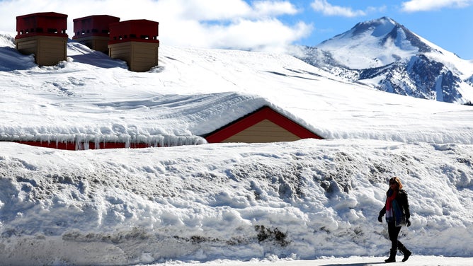
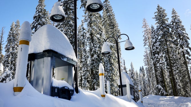
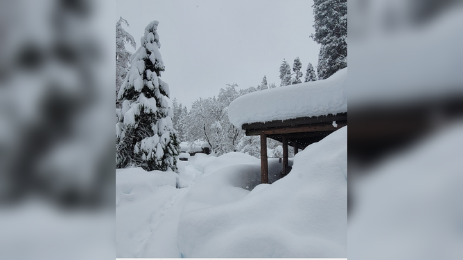
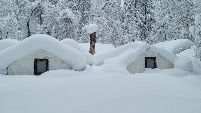
Break from snow in West, Plains
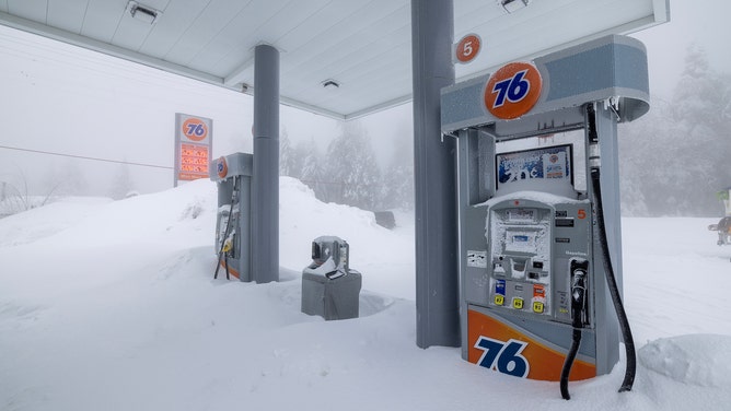
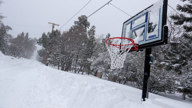
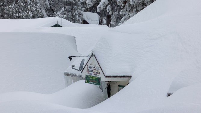
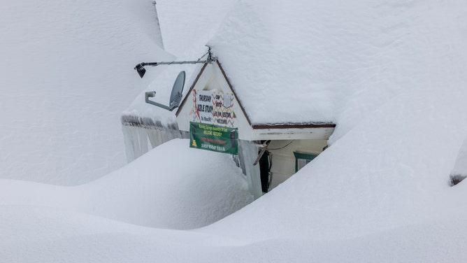
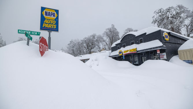
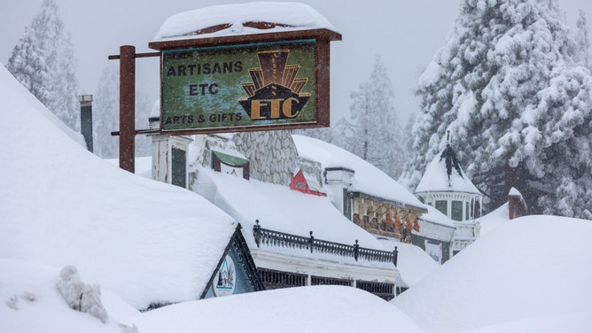
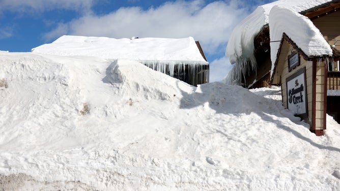
California’s snowpack is officially the greatest on record statewide, according to the California Department of Water Resources (DWR), so it's probably not an understatement to say that snow-fatigue has officially set in.
CALIFORNIA'S HISTORIC SNOWFALL WILL LEAD TO HISTORIC FLOODS, OFFICIALS SAY
The Golden State’s snowpack was measured at a whopping 237% of average on April 1. Only the winters of 1983, 1969 and 1952 recorded a snowpack that was more than 200% averaged across California.
![Sierra Nevada Heavy Snows]() Image 1 of 36
Image 1 of 36RUNNING SPRINGS, CA - MARCH 01: With no customers in sight, a gas station is one of the few businesses that remains open in the mountains though gas supplies are becoming limited as residents throughout the San Bernardino Mountains continue to be trapped in their homes by snow on March 1, 2023 in Running Springs, California. . (Photo by David McNew/Getty Images) ( )
![Southern California Begins To Dig Out From Series Of Massive Snow Storms]() Image 2 of 36
Image 2 of 36SUGARLOAF, CA - MARCH 01: Many streets are deserted as snow trapped residents in their homes and kept visitors away from resort areas in the San Bernardino Mountains where successive storms dumped more snow than has been seen in years on Wednesday, March 1, 2023 in Sugarloaf, CA. (Brian van der Brug / Los Angeles Times via Getty Images) ( )
![Sierra Nevada Heavy Snows]() Image 3 of 36
Image 3 of 36RUNNING SPRINGS, CA - MARCH 01: A church is shown buried under snow in the San Bernardino Mountains area where residents continue to be trapped on March 1, 2023 in Running Springs, California. San Bernardino County has declared a state of emergency as communities remain buried after a series of blizzards shut down all roads into the mountains, leaving the area running low on gas, food and supplies. (Photo by David McNew/Getty Images) ( )
![Heavy snow in Sierra Nevada]() Image 4 of 36
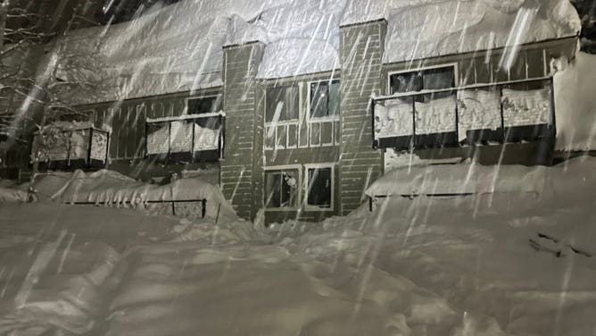
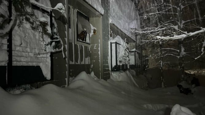
Image 4 of 36Heavy snow buries an apartment building in Placer County, California. (Placer County Sheriff's Office)
![Heavy snow in Sierra Nevada]() Image 5 of 36
Image 5 of 36Heavy snow buries an apartment building in Placer County, California. (Placer County Sheriff's Office)
![Heavy snow in Sierra Nevada]() Image 6 of 36
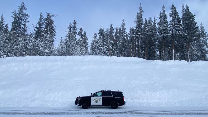
Image 6 of 36A California Highway Patrol vehicle sits parked along a massive snowbank at Interstate 80's Donner Summit on March 1, 2023. (California Highway Patrol)
![Heavy snow in Sierra Nevada]() Image 7 of 36
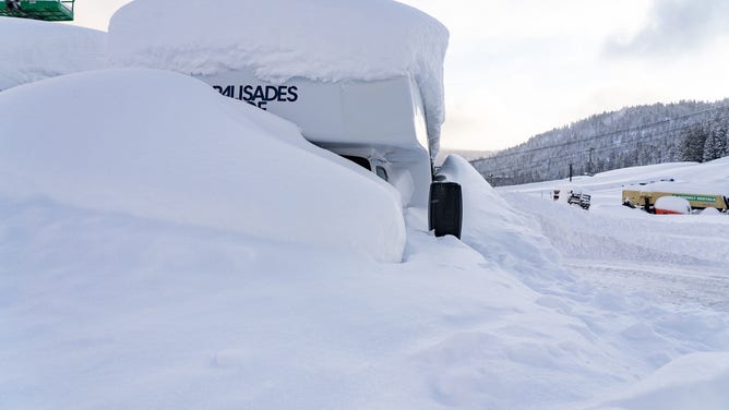
Image 7 of 36Mound of snow cover much of the Palisades Tahoe Ski Resort on March 1, 2023. (Palisades Tahoe Resort)
![Heavy snow in Sierra Nevada]() Image 8 of 36
Image 8 of 36Mound of snow cover much of the Palisades Tahoe Ski Resort on March 1, 2023. (Placer County Sheriff's Office)
![Sierra Nevada Heavy Snows]() Image 9 of 36
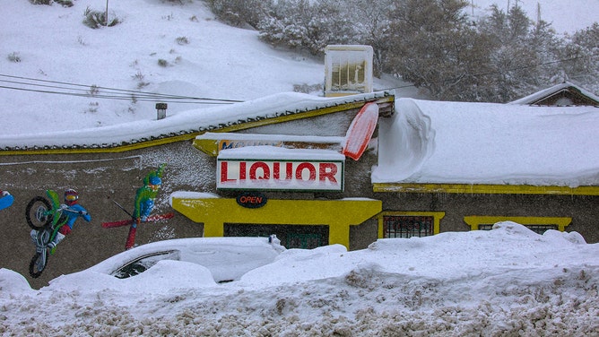
Image 9 of 36Phelan, CA - March 01: A snow covered liquor store along Highway 138 on Wednesday, March 1, 2023 in Phelan, CA. (Irfan Khan / Los Angeles Times via Getty Images) ( )
![Sierra Nevada Heavy Snows]() Image 10 of 36
Image 10 of 36RUNNING SPRINGS, CA - MARCH 01: A vehicle is abandoned along a highway as residents throughout the San Bernardino Mountains remain trapped in their homes on March 1, 2023 near Running Springs, California. San Bernardino County has declared a state of emergency as communities remain buried after a series of blizzards shut down all roads into the mountains, leaving the area running low on gas, food and supplies. (Photo by David McNew/Getty Images) ( )
![Sierra Nevada Heavy Snows]() Image 11 of 36
Image 11 of 36RUNNING SPRINGS, CA - MARCH 01: A residential street near a school is seen as residents throughout the San Bernardino Mountains remain trapped in their homes on March 1, 2023 in Running Springs, California. San Bernardino County has declared a state of emergency as communities remain buried after a series of blizzards shut down all roads into the mountains, leaving the area running low on gas, food and supplies. (Photo by David McNew/Getty Images) ( )
![Sierra Nevada Heavy Snows]() Image 12 of 36
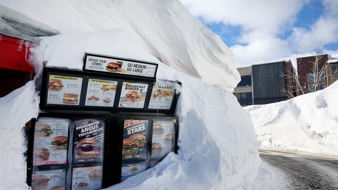
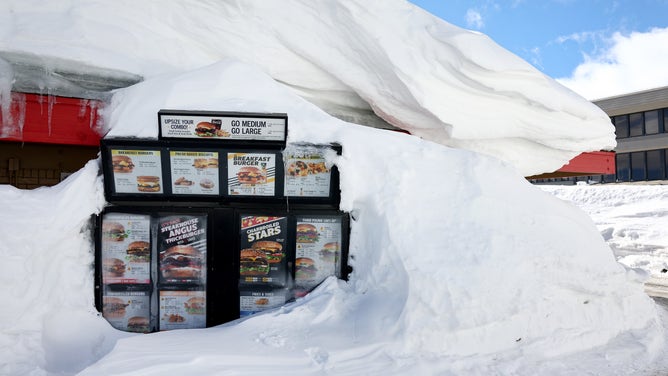
Image 12 of 36MAMMOTH LAKES, CALIFORNIA - JANUARY 22: A Carl's Jr. drive-through menu is partially buried in a snowbank after a series of atmospheric river storms brought heavy snowfall to the region on January 22, 2023 in Mammoth Lakes, California. California was slammed by a barrage of atmospheric river storms which ended last week and delivered massive amounts of snowfall to the Sierra Nevada mountains raising California’s snowpack to nearly 250 percent above average. Meltwater from California’s snowpack provides an essential source of water to the state and the widespread precipitation has led to a lower drought status as reservoirs have begun to fill. (Photo by Mario Tama/Getty Images) ( )
![Sierra Nevada Heavy Snows]() Image 13 of 36
Image 13 of 36RUNNING SPRINGS, CA - MARCH 01: Snows falls over a closed business as residents throughout the San Bernardino Mountains continue to be trapped in their homes by snow on March 1, 2023 in Running Springs, California. San Bernardino County has declared a state of emergency as communities remain buried after a series of blizzards shut down all roads into the mountains, leaving the area running low on gas, food and supplies. (Photo by David McNew/Getty Images) ( )
![v]() Image 14 of 36
Image 14 of 36YOSEMITE, CA - FEBRUARY 23: Snow blankets Yosemite National Park in California, United States on February 23, 2023 as winter storm alerted in California. (Photo by Tayfun Coskun/Anadolu Agency via Getty Images) ( )
![Sierra Nevada Heavy Snows]() Image 15 of 36
Image 15 of 36RUNNING SPRINGS, CA - MARCH 01: Snow deepens as residents throughout the San Bernardino Mountains remain trapped in their homes on March 1, 2023 in Running Springs, California. San Bernardino County has declared a state of emergency as communities remain buried after a series of blizzards shut down all roads into the mountains, leaving the area running low on gas, food and supplies. (Photo by David McNew/Getty Images) ( )
![Sierra Nevada Heavy Snows]() Image 16 of 36
Image 16 of 36RUNNING SPRINGS, CA - MARCH 01: The open sign is still on at a business nevertheless shut down by the weather as residents throughout the San Bernardino Mountains remain trapped in their homes on March 1, 2023 in Running Springs, California. San Bernardino County has declared a state of emergency as communities remain buried after a series of blizzards shut down all roads into the mountains, leaving the area running low on gas, food and supplies. (Photo by David McNew/Getty Images) ( )
![]() Image 17 of 36
Image 17 of 36SOUTH LAKE TAHOE, CALIFORNIA - JANUARY 20: A 'Santa Claus DR' road sign is partially buried in snow after a series of atmospheric river storms on January 20, 2023 near South Lake Tahoe, California. California was slammed by a barrage of atmospheric river storms over the last three weeks which led to record rainfall, widespread flooding and 20 deaths. The storms also delivered massive amounts of snowfall to the Sierra Nevada mountains raising California’s snowpack to nearly 250 percent above average. Meltwater from California’s snowpack provides an essential source of water to the state and the widespread precipitation has led to a lower drought status as reservoirs have begun to fill. (Photo by Mario Tama/Getty Images) ( )
![Sierra Nevada Heavy Snows]() Image 18 of 36
Image 18 of 36RUNNING SPRINGS, CA - MARCH 01: A church is shown buried under snow in the San Bernardino Mountains area where residents continue to be trapped on March 1, 2023 in Running Springs, California. San Bernardino County has declared a state of emergency as communities remain buried after a series of blizzards shut down all roads into the mountains, leaving the area running low on gas, food and supplies. (Photo by David McNew/Getty Images) ( )
![Sierra Nevada Heavy Snows]() Image 19 of 36
Image 19 of 36RUNNING SPRINGS, CA - MARCH 01: Snow grows deeper as residents throughout the San Bernardino Mountains continue to be trapped in their homes by snow on March 1, 2023 in Running Springs, California. San Bernardino County has declared a state of emergency as communities remain buried after a series of blizzards shut down all roads into the mountains, leaving the area running low on gas, food and supplies. (Photo by David McNew/Getty Images) ( )
![Sierra Nevada Heavy Snows]() Image 20 of 36
Image 20 of 36RUNNING SPRINGS, CA - MARCH 01: Snow deepens as residents throughout the San Bernardino Mountains remain trapped in their homes on March 1, 2023 in Running Springs, California. San Bernardino County has declared a state of emergency as communities remain buried after a series of blizzards shut down all roads into the mountains, leaving the area running low on gas, food and supplies. (Photo by David McNew/Getty Images) ( )
![Sierra Nevada Heavy Snows]() Image 21 of 36
Image 21 of 36MAMMOTH LAKES, CALIFORNIA - JANUARY 22: A Carl's Jr. drive-through menu is partially buried in a snowbank after a series of atmospheric river storms brought heavy snowfall to the region on January 22, 2023 in Mammoth Lakes, California. California was slammed by a barrage of atmospheric river storms which ended last week and delivered massive amounts of snowfall to the Sierra Nevada mountain's raising California’s snowpack to nearly 250 percent above average. Meltwater from California’s snowpack provides an essential source of water to the state and the widespread precipitation has led to a lower drought status as reservoirs have begun to fill. (Photo by Mario Tama/Getty Images) ( )
![Sierra Nevada Heavy Snows]() Image 22 of 36
Image 22 of 36MAMMOTH LAKES, CALIFORNIA - JANUARY 22: A person walks past a snowbank in front of a restaurant after a series of atmospheric river storms brought heavy snowfall to the Sierra Nevada mountains on January 22, 2023 in Mammoth Lakes, California. California was slammed by a barrage of atmospheric river storms which ended last week and delivered massive amounts of snowfall to the Sierra Nevada mountain's raising California’s snowpack to nearly 250 percent above average. Meltwater from California’s snowpack provides an essential source of water to the state and the widespread precipitation has led to a lower drought status as reservoirs have begun to fill. (Photo by Mario Tama/Getty Images) ( )
![Sierra Nevada Heavy Snows]() Image 23 of 36
Image 23 of 36YOSEMITE NATIONAL PARK, CALIFORNIA - JANUARY 20: Gas pumps are partially buried in snow, at a service station closed for the winter, after a series of atmospheric river storms on January 20, 2023 in Yosemite National Park, California. California was slammed by a barrage of atmospheric river storms over the last three weeks which led to record rainfall, widespread flooding and 20 deaths. The storms also delivered massive amounts of snowfall to the Sierra Nevada mountains raising California’s snowpack to nearly 250 percent above average. Meltwater from California’s snowpack provides an essential source of water to the state and the widespread precipitation has led to a lower drought status as reservoirs have begun to fill. (Photo by Mario Tama/Getty Images) ( )
![Southern California Begins To Dig Out From Series Of Massive Snow Storms]() Image 24 of 36
Image 24 of 36Wrightwood, CA - March 01: Norma Miro, from La Puente, shovels snow out of the driveway of the rental property she shared with her family for the last week in Wrightwood so they can move their vehicles on Wednesday, Mar. 1, 2023. The mountain community remains closed as crews work to clear roads following a second heavy snow storm in the last week hit the area. Only residents and essential workers are being allowed into the area. Mountain High Ski Resort, near Wrightwood, has received 115 inches of snow in the last week. (Photo by Will Lester/MediaNews Group/Inland Valley Daily Bulletin via Getty Images) ( )
![Southern California Begins To Dig Out From Series Of Massive Snow Storms]() Image 25 of 36
Image 25 of 36SUGARLOAF, CA - MARCH 01: Fresh snow kept residents in their homes and visitors away from resort areas in the San Bernardino Mountains where successive storms dumped more snow on Wednesday, March 1, 2023 in Sugarloaf, CA. (Brian van der Brug / Los Angeles Times via Getty Images) ( )
![Sierra Nevada Heavy Snows]() Image 26 of 36
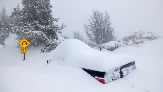
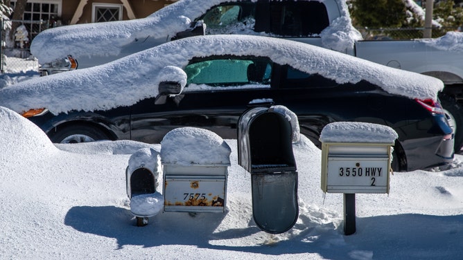
Image 26 of 36Wrightwood, CA - March 01: Snow covered cars and mailboxes along Highway 2 on Wednesday, March 1, 2023 in Wrightwood, CA. (Irfan Khan / Los Angeles Times via Getty Images) ( )
![Sierra Nevada Heavy Snows]() Image 27 of 36
Image 27 of 36MAMMOTH LAKES, CALIFORNIA - JANUARY 22: A snowbank is viewed in front of a hotel after a series of atmospheric river storms brought heavy snowfall to the region on January 22, 2023 in Mammoth Lakes, California. California was slammed by a barrage of atmospheric river storms which ended last week and delivered massive amounts of snowfall to the Sierra Nevada mountains raising California’s snowpack to nearly 250 percent above average. Meltwater from California’s snowpack provides an essential source of water to the state and the widespread precipitation has led to a lower drought status as reservoirs have begun to fill. (Photo by Mario Tama/Getty Images) ( )
![Sierra Nevada Heavy Snows]() Image 28 of 36
Image 28 of 36MAMMOTH LAKES, CALIFORNIA - JANUARY 22: A person walks past a snowbank in front of a restaurant after a series of atmospheric river storms brought heavy snowfall to the region on January 22, 2023 in Mammoth Lakes, California. California was slammed by a barrage of atmospheric river storms which ended last week and delivered massive amounts of snowfall to the Sierra Nevada mountains raising California’s snowpack to nearly 250 percent above average. Meltwater from California’s snowpack provides an essential source of water to the state and the widespread precipitation has led to a lower drought status as reservoirs have begun to fill. (Photo by Mario Tama/Getty Images) ( )
![Sierra Nevada Heavy Snows]() Image 29 of 36
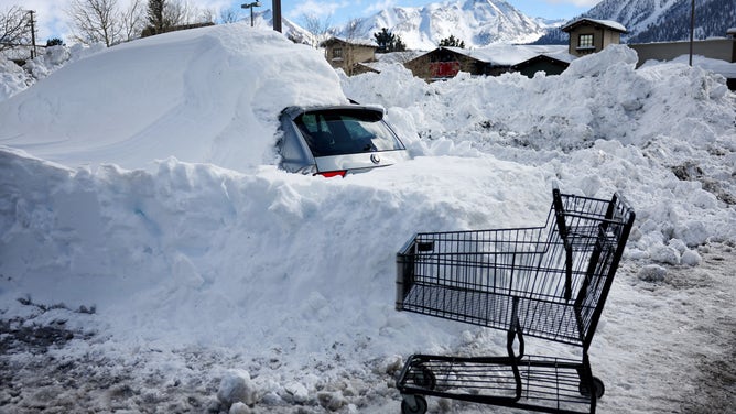
Image 29 of 36MAMMOTH LAKES, CALIFORNIA - JANUARY 22: A car remains buried in snow after a series of atmospheric river storms brought heavy snowfall to the region on January 22, 2023 in Mammoth Lakes, California. California was slammed by a barrage of atmospheric river storms which ended last week and delivered massive amounts of snowfall to the Sierra Nevada mountains raising California’s snowpack to nearly 250 percent above average. Meltwater from California’s snowpack provides an essential source of water to the state and the widespread precipitation has led to a lower drought status as reservoirs have begun to fill. (Photo by Mario Tama/Getty Images) ( )
![Sierra Nevada Heavy Snows]() Image 30 of 36
Image 30 of 36MAMMOTH LAKES, CALIFORNIA - JANUARY 22: A person walks past a snowbank in front of a restaurant and bar after a series of atmospheric river storms brought heavy snowfall to the region on January 22, 2023 in Mammoth Lakes, California. California was slammed by a barrage of atmospheric river storms which ended last week and delivered massive amounts of snowfall to the Sierra Nevada mountains raising California’s snowpack to nearly 250 percent above average. Meltwater from California’s snowpack provides an essential source of water to the state and the widespread precipitation has led to a lower drought status as reservoirs have begun to fill. (Photo by Mario Tama/Getty Images) ( )
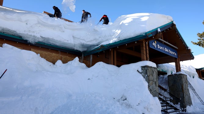
![Sierra Nevada Heavy Snows]() Image 31 of 36
Image 31 of 36MAMMOTH LAKES, CALIFORNIA - JANUARY 22: Workers remove snow from a rooftop after a series of atmospheric river storms brought heavy snowfall to the region on January 22, 2023 in Mammoth Lakes, California. California was slammed by a barrage of atmospheric river storms which ended last week and delivered massive amounts of snowfall to the Sierra Nevada mountains raising California’s snowpack to nearly 250 percent above average. Meltwater from California’s snowpack provides an essential source of water to the state and the widespread precipitation has led to a lower drought status as reservoirs have begun to fill. (Photo by Mario Tama/Getty Images) ( )
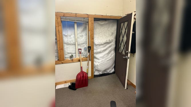
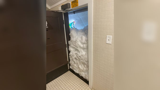
![Sugar Bowl Snow]() Image 32 of 36
Image 32 of 36Feet of snow leave the door covered to the marketing office of the Sugar Bowl Ski Resort in California after the latest winter storm pummeled the Sierra Nevada on Feb. 28, 2023. (Sugar Bowl Ski Resort)
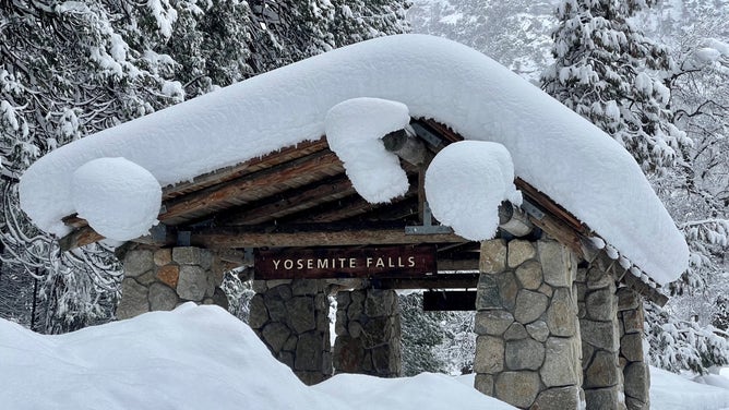
![Yosemite National Park]() Image 33 of 36
Image 33 of 36Yosemite has experienced significant snowfall in all areas of the park, with snow up to 15 feet deep in some areas and the park’s closure on Feb. 25. (Yosemite National Park)
![Heavy Snow at Yosemite Park]() Image 34 of 36
Image 34 of 36Yosemite has experienced significant snowfall in all areas of the park, with snow up to 15 feet deep in some areas and the park’s closure on Feb. 25. (Yosemite National Park)
![Heavy Snow at Yosemite Park]() Image 35 of 36
Image 35 of 36Yosemite has experienced significant snowfall in all areas of the park, with snow up to 15 feet deep in some areas and the park’s closure on Feb. 25. (Yosemite National Park)
![Heavy Snow at Yosemite Park]() Image 36 of 36
Image 36 of 36Yosemite has experienced significant snowfall in all areas of the park, with snow up to 15 feet deep in some areas and the park’s closure on Feb. 25. (Yosemite National Park)


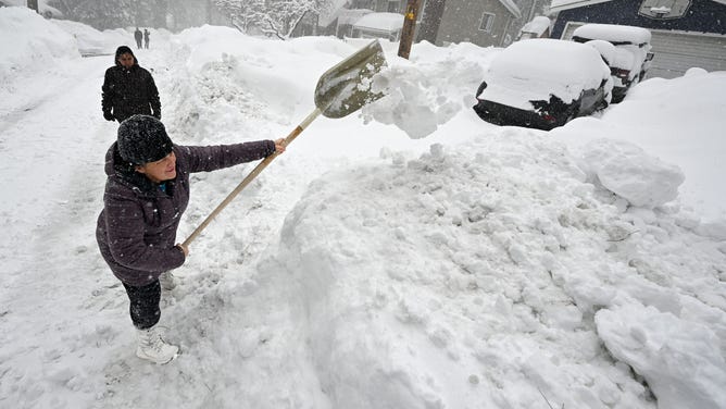
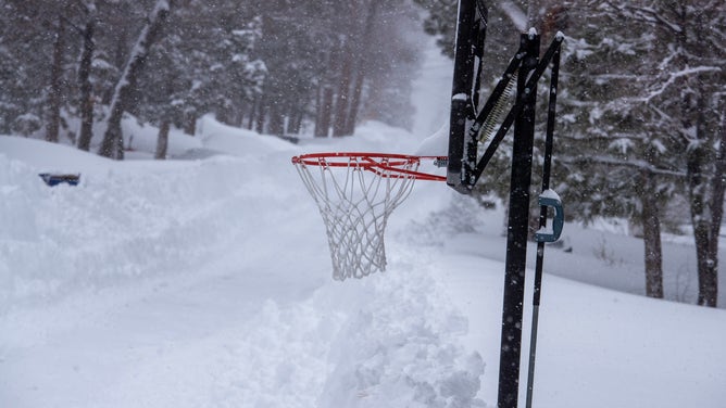

Additionally, a record-setting blizzard buried the northern Plains under feet of snow earlier this week. In Casper, Wyoming, it was the largest snowstorm on record with an astounding 37.4 inches of snow piling up between April 3 and 4. On April 3 alone, 26.7 inches was measured in Casper, also a record for its single snowiest calendar day.
APRIL IS SURPRISINGLY THE SNOWIEST MONTH OF THE YEAR IN THESE AREAS
The weather pattern change means these regions will get a much-deserved break from the relentless snow.
Most places from the West to the northern Plains, Upper Midwest and northern Great Lakes are predicted to see little to no snow through Easter weekend and into at least early next week.
WHEN CAN YOU EXPECT THE LAST SNOW OF THE SEASON?

(FOX Weather)
Soggy, chilly Southeast with drought relief for Florida
A stalled-out cold front across the Southeast will lead to a period of soggy, chilly weather through Easter Sunday. This comes after several days of summerlike heat with temperatures in the upper 80s and lower 90s earlier this week.
The rain and thunderstorms are expected to impact Masters Tournament in Augusta, Georgia, this weekend, which could end up as one of the wettest on record. If play gets suspended and the tournament is forced to finish on Monday, it would be the first time the Masters finishes on a Monday in 40 years.
HOW WEATHER CAN MAKE OR BREAK YOUR GOLF GAME
Another ingredient adding to the Easter weekend misery in the Southeast will be the chilly temperatures. Cities from Virginia to the Carolinas to Georgia will be stuck in the 40s and 50s on Saturday after temperatures climbed into the upper 80s and lower 90s during the first half of the workweek.

(FOX Weather)
Florida will see some good news out of this wet pattern. The state has slipped into its worst drought since 2012, according to the U.S. Drought Monitor, with more than 50% of the state experiencing severe drought conditions.
Major warmup for central, eastern US after Easter
As the jet stream continues to reconfigure itself into early next week, a dome of high pressure is expected to develop across the central and eastern U.S. That will allow much warmer air to infiltrate areas east of the Rockies, leading to what could be a taste of summerlike warmth by the middle or end of next week.
Temperatures could climb into the 80s as far north as southern New England later next week, with 70s likely all the way into parts of northern New England.
However, that means the West will cool down again, especially the Pacific Northwest, where NOAA's Climate Prediction Center forecasts the highest likelihood of below-average temperatures next week.

(FOX Weather)