April blizzard dumps feet of snow in Plains, Upper Midwest
As much as 20-33 inches of snow have fallen so far across parts of the Northern Plains and Midwest, where Blizzard Warnings lingered into Wednesday and some interstates and highways across the Dakotas remained closed.
Feet of snow dumped on Plains
FOX Weather's Stephen Morgan has snow totals from the storm that brought blizzard conditions to so many across the Northern Plains. The storm is finally pushing east.
A powerful coast-to-coast storm that brought blizzard and whiteout conditions to parts of the Plains and Upper Midwest this week is exiting the region.
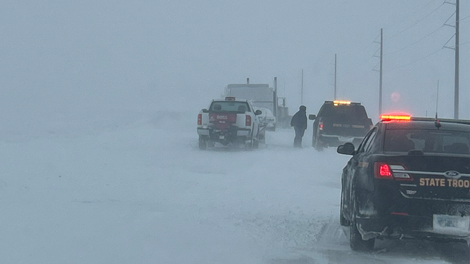
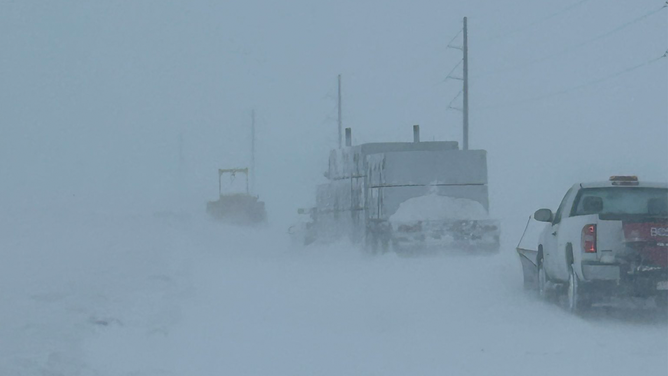
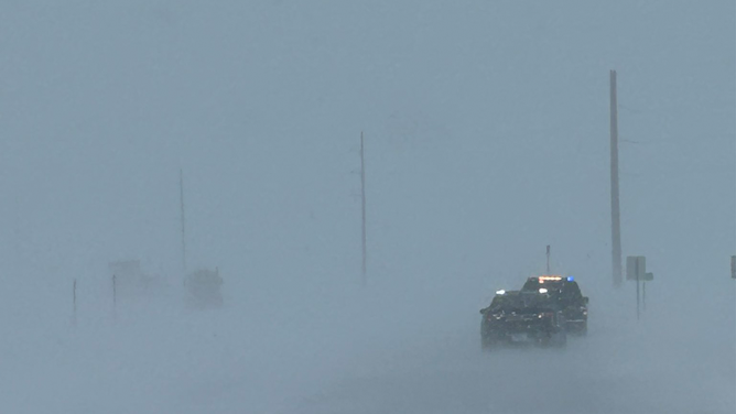
Some snow totals reached over 30 inches amid ferocious winds. The wind-driven snow severely impacted travel as many roads and highways in the region, including Interstates 90 and 29, were shut down because of blinding snow, numerous crashes and spin-outs.
At one point on Tuesday, Blizzard Warnings stretched more than 800 miles from Wyoming to Minnesota.
This included the cities of Pierre and Aberdeen in South Dakota and Bismarck, Grand Forks and Fargo in North Dakota.
Gusty winds push east throughout the night, making the Thursday morning commute less treacherous.

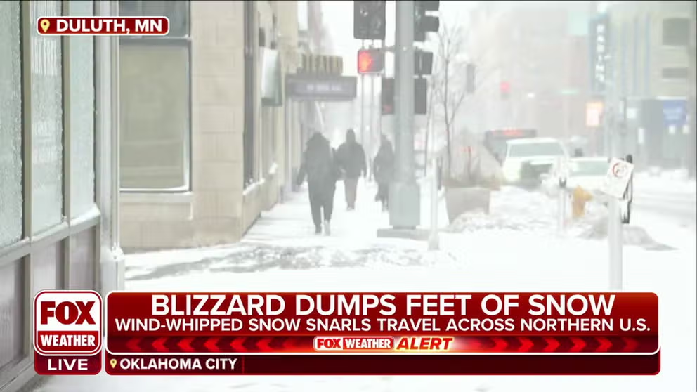
Spring blizzard whips Plains, Midwest
FOX Weather's Brandy Campbell talks to people in Duluth, Minnesota to find out if they were surprised by the spring snow and cold.
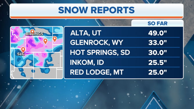
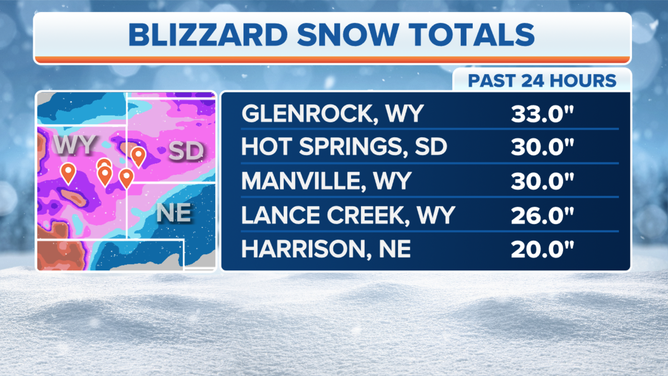
How much snow fell?
Glenrock, Wyoming, picked up nearly 3 feet of snow. Hot Springs, South Dakota and Manville, Wyoming, picked up 30 inches of snow.
Lance Creek, Wyoming, also picked up more than 2 feet of snow, with 26 inches reported.
![Blizzard conditions are seen in South Dakota on April 4, 2023.]() Image 1 of 10
Image 1 of 10Blizzard conditions are seen in South Dakota on April 4, 2023. (South Dakota Highway Patrol)
![Cars and trucks are seen suck on the side of a road in South Dakota during a blizzard on April 4, 2023.]() Image 2 of 10
Image 2 of 10Cars and trucks are seen suck on the side of a road in South Dakota during a blizzard on April 4, 2023. (South Dakota Highway Patrol)
![Wind-driven snow is seen on a highway in South Dakota during a blizzard on April 4, 2023.]() Image 3 of 10
Image 3 of 10Wind-driven snow is seen on a highway in South Dakota during a blizzard on April 4, 2023. (South Dakota Highway Patrol)
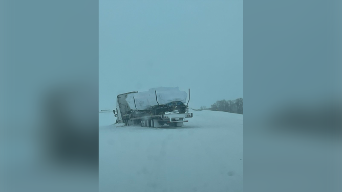
![A photo showing a stuck semi near the Peever exit on Interstate 29 in South Dakota on April 4, 2023.]() Image 4 of 10
Image 4 of 10A photo showing a stuck semi near the Peever exit on Interstate 29 in South Dakota on April 4, 2023. (South Dakota Highway Patrol)
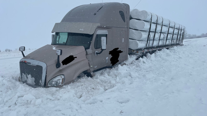
![A photo showing a tractor-trailer stuck in snow near the New Effington exit on Interstate 29 in South Dakota on April 4, 2023.]() Image 5 of 10
Image 5 of 10A photo showing a tractor-trailer stuck in snow near the New Effington exit on Interstate 29 in South Dakota on April 4, 2023. (South Dakota Highway Patrol)
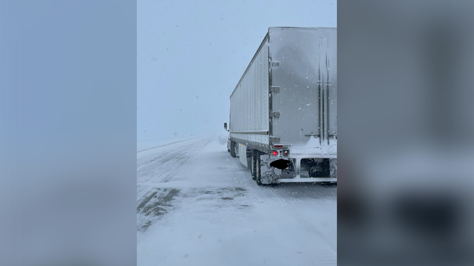
![A photo showing a tractor-trailer stuck in snow in South Dakota. The South Dakota Highway Patrol says road and visibility conditions are rapidly deteriorating in the northeastern corner of the state.]() Image 6 of 10
Image 6 of 10A photo showing a tractor-trailer stuck in snow in South Dakota. The South Dakota Highway Patrol says road and visibility conditions are rapidly deteriorating in the northeastern corner of the state. (South Dakota Highway Patrol)
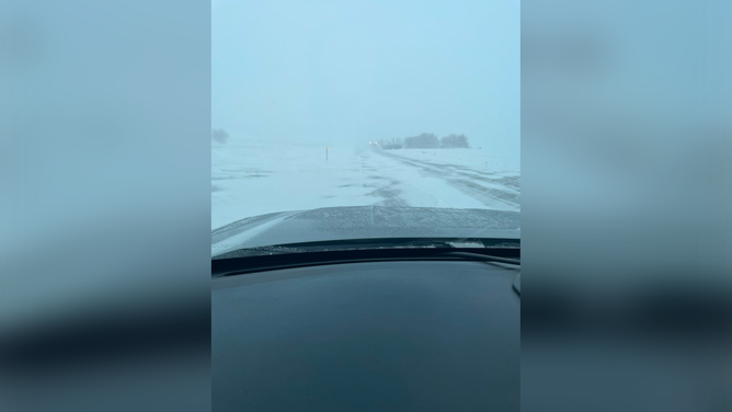
![A photo showing snowy conditions on Interstate 29 two miles south of the Grant/Codington County line in South Dakota on April 4, 2023.]() Image 7 of 10
Image 7 of 10A photo showing snowy conditions on Interstate 29 two miles south of the Grant/Codington County line in South Dakota on April 4, 2023. (South Dakota Highway Patrol)
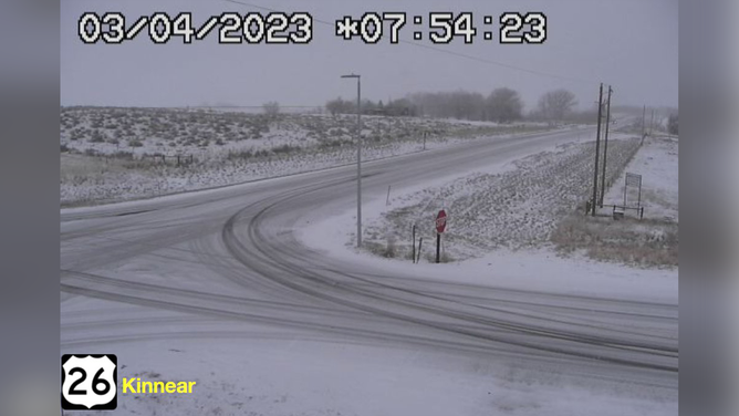
![A photo showing snow-covered roads on Route 26 in Kinnear, Wyoming, on April 4, 2023.]() Image 8 of 10
Image 8 of 10A photo showing snow-covered roads on Route 26 in Kinnear, Wyoming, on April 4, 2023. (Wyoming Department of Transportation)
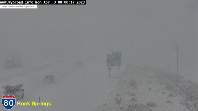
![A photo showing snowy conditions on Interstate 80 in Rock Springs, Wyoming, on April 3, 2023.]() Image 9 of 10
Image 9 of 10A photo showing snowy conditions on Interstate 80 in Rock Springs, Wyoming, on April 3, 2023. (Wyoming Department of Transportation)
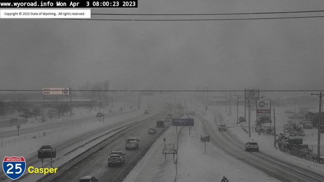
![A photo showing snow-covered roads on Interstate 25 in Casper, Wyoming, on April 3, 2023.]() Image 10 of 10
Image 10 of 10A photo showing snow-covered roads on Interstate 25 in Casper, Wyoming, on April 3, 2023. (Wyoming Department of Transportation)
And the snow will stick around on the ground for a while. Temperatures are expected to be in the 20s in places like Fargo and Bismarck in North Dakota, while cities like Minneapolis will see temperatures around 40 degrees.
Snow totals from April storm.
(FOX Weather)
And the snow will stick around on the ground for a while. Temperatures are expected to be in the 20s in places like Fargo and Bismarck in North Dakota, while cities like Minneapolis will see temperatures around 40 degrees.
With the storm system farther into Canada Thursday, the only lingering effects from the potentially record-breaking blizzard will be in northeastern Minnesota, northern Wisconsin and portions of Michigan’s Upper Peninsula.
Blizzard totals from April storm.
(FOX Weather)