What to expect this week: Warm, dry in northern tier, daily Plains storms and another Florida soaking
A weather pattern known as a "Rex block" will persist over most of the eastern U.S. this week. This pattern features a strong high-pressure system parked to the north of an upper-level low-pressure system, and that will keep much of the Midwest and Northeast very warm and dry throughout the week. Meanwhile, Florida and the Plains will see multiple rounds of storms that provide soaking rainfall.
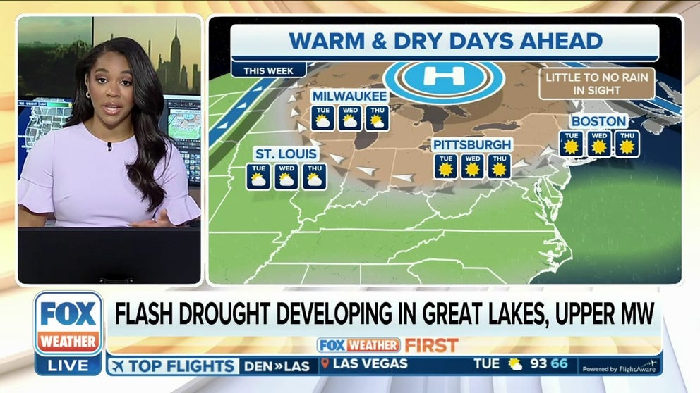
Flash drought developing in Great Lakes, Upper Midwest
The lack of rain over the past few weeks across the Great Lakes and Upper Midwest is likely to lead to a flash drought, in which drought rapidly develops over a short period of time.
While no major storm systems are expected to impact the U.S. this week, there are still a few weather concerns the FOX Forecast Center will monitor closely across the nation.
Here's what to know as we enter the final days of May and look ahead to the start of June.
1. Summerlike week for Midwest, Northeast with building heat
A stretch of warm, dry days is expected across the northern tier this week as a weather pattern known as a "Rex block" persists over most of the eastern U.S. This pattern – a strong high-pressure system parked to the north of an upper-level low-pressure system – will keep much of the Midwest and Northeast very warm and dry throughout the week. Record highs could be threatened by Thursday and Friday as several cities make a run at 90 degrees for the first time this season.
According to the FOX Forecast Center, the lack of rain over the past few weeks across the Great Lakes and Upper Midwest is likely to lead to a flash drought, in which drought rapidly develops over a short period. For example, Chicago O'Hare hasn't recorded more than a half-inch of rain within 24 hours in nearly 50 days, and its biggest rain event this month was on May 8 when 0.16 inches fell. The next chance of significant rainfall will be this weekend – at the earliest.
WHEN TO EXPECT THE FIRST 90-DEGREE DAY IN YOUR CITY

(FOX Weather)
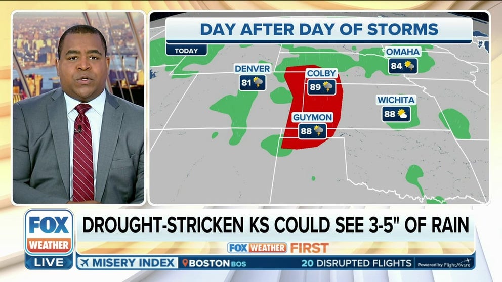
2. Daily storms for drought-stricken Plains
It'll be a rinse-and-repeat kind of week as the Rex block keeps the threat of daily showers and thunderstorms in the forecast each day from the northern Rockies through the Plains.
Rain easing drought conditions in Central Plains
It'll be a rinse and repeat kind of week as a blocking pattern keeps the threat for daily showers and storms every day this week from the Northern Rockies to Texas.
This is good news for the central Plains, which currently has the worst drought conditions in the country. This week's storms will have the potential to produce very heavy rainfall, providing the parched region with a much-needed soaking. Parts of the exceptional drought area in Kansas could see 3 to 5 inches of rain over the next seven days.
A few of these thunderstorms could become severe. Damaging winds and hail are the main threats with these storms, but the tornado threat will remain low.

(FOX Weather)
3. Florida braces for more widespread storms later this week
After 4 to 10 inches of rain fell across parts of Florida last week, the Sunshine State has seen a relative lull in the precipitation over the past few days with only a handful of scattered storms across the state. This break will last through Tuesday, but it will be short-lived.
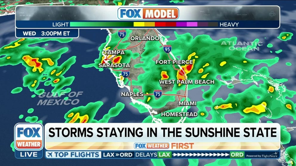
More widespread thunderstorms, torrential rain eyes Florida after brief break
Torrential rain and thunderstorms are expected across Florida starting Wednesday that will last through the weekend, but the precipitation should help to improve drought conditions in the state.
A slow-moving upper-level disturbance will traverse the Gulf of Mexico and park itself over Florida later this week. This will result in numerous thunderstorms that develop each day starting Wednesday, which will significantly increase in coverage on Thursday and beyond.
Multiple inches of rain can be expected throughout the Sunshine State, and some instances of flooding are likely.
PEAK FLASH FLOOD SEASON IN U.S. BEGINS IN JUNE

(FOX Weather)