Florida’s soggy, stormy pattern to stretch into Memorial Day weekend
The heaviest rain this week will be focused on the eastern half of the state, with widespread 2- to 3-inch rainfall totals by the middle of the week. According to the FOX Forecast Center, some areas may even see between 5 and 8 inches of rain by the time we get to the end of the week.
Up to 8 inches of rain for parts of Florida through holiday weekend
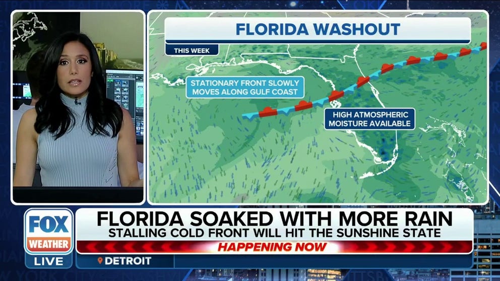
A stationary front stalled over Florida which will keep the Sunshine State anything but through the holiday weekend. Expect afternoon downpours every day, Meteorologist Marissa Torres tells us how much rain fill fall.
Florida’s rainy season is getting off to a bumpy start this week as a stubborn pattern of onshore flow brings a steady diet of drenching rain and thunderstorms to the Sunshine State, increasing the risk of flooding.
A cold front will stall over the Sunshine State which will anchor unsettled weather over the state every day this week. The FOX Forecast Center said, "This is an "unusually strong start to the rainy season."
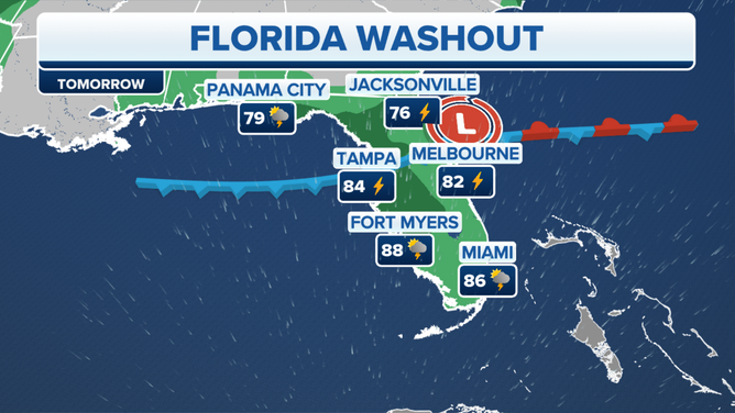
Wednesday's forecast.
(FOX Weather)
It won't take much afternoon heating to trigger daily showers and thunderstorms.
May is typically when the daily thunderstorm pattern begins in Florida, which usually accounts for a bulk of the state’s annual rainfall and why Florida is the lightning capital of the U.S.
LIGHTNING SAFETY: WHEN THUNDER ROARS, EVEN TAKING OUT THE TRASH CAN TURN DEADLY
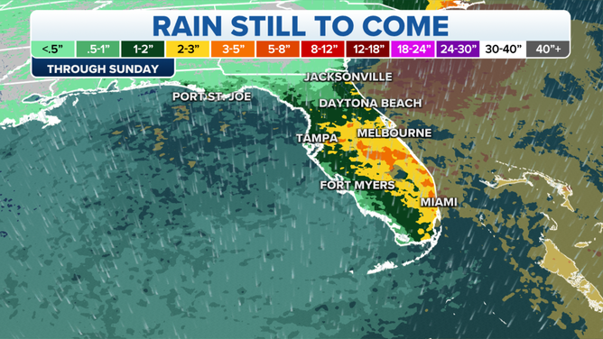
Rain forecast through Sunday.
(FOX Weather)
The heaviest rain this week will be focused on the eastern half of the state, with widespread 2- to 3-inch rainfall totals by the middle of the week.
According to the FOX Forecast Center, some areas may even see between 5 and 8 inches of rain by the time we get to the end of the week.
DEBUNKING 7 MYTHS ABOUT LIGHTNING
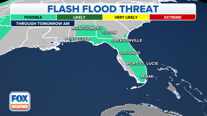
Flash flood threat overnight.
(FOX Weather)
Because of the threat of heavier rain in the northern part of the state and the Florida Panhandle, Flood Watches have been posted for the area through early Wednesday morning.
And with the more active weather pattern setting up, Florida will also be at risk of severe thunderstorms.
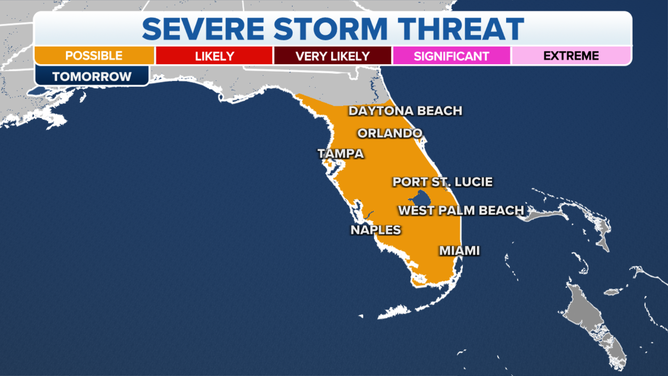
Wednesday's severe threat.
(FOX Weather)
Severe storms are possible across the Sunshine State every afternoon from Panama City and Port St. Joe in the Panhandle through Orlando and Melbourne in Central Florida and into Miami and Fort Lauderdale in South Florida.
The threat of damaging wind gusts will stretch from the Florida Panhandle through South Florida. However, the risk of large hail will mostly be found on the eastern side of the state from the Daytona Beach area south through Orlando, Melbourne, West Palm Beach, Fort Lauderdale and Miami.
Possible tropical development off Southeast coast by Memorial Day weekend
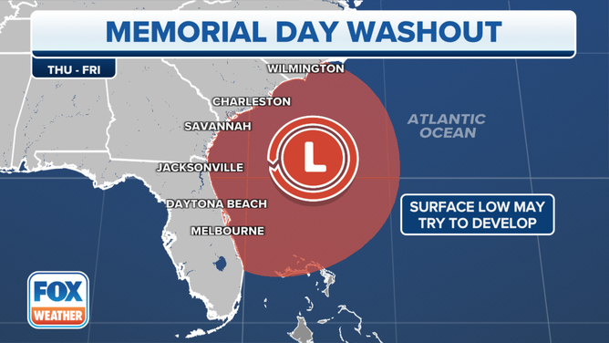
The setup for a possible tropical disturbance off the Southeast coast later this week or over the Memorial Day weekend.
(FOX Weather)
A low could develop in the upper levels of the atmosphere along the stationary front draped across the state. The combination of both features will mean a period of extremely heavy rain, rough surf and gusty winds will impact coastal regions of the Southeast later this week and into the Memorial Day weekend.
If the development of a low-pressure system occurs over a warm area of the Atlantic Ocean off the Southeast coast, it’s within the realm of possibility that a weak tropical system could spin up off the coast, but the impacts from rain, surf and wind would be the same regardless of tropical development.
Impact on drought
Nearly half of Florida is in some form of drought right now, with the worst levels reported along the Gulf coast side of the peninsula from near Cedar Key south to near Fort Myers. It appears most of the rain this week will fall across interior and Atlantic portions of the state, doing little to alleviate the worst of the drought.

(FOX Weather)