Severe storms could pack a punch in Tennessee Valley, mid-South on Sunday
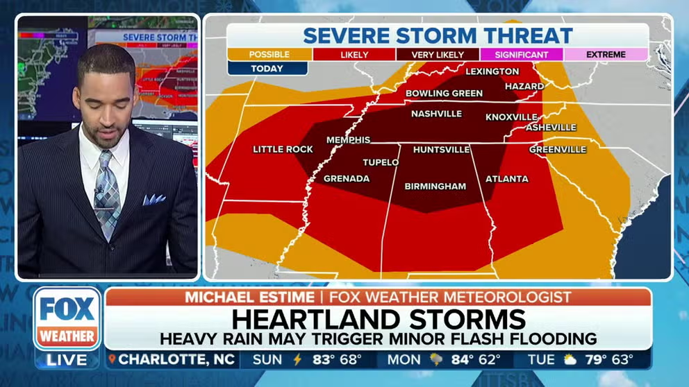
Memphis and Nashville in Tennessee and Birmingham in Alabama are among the cities facing the highest threat of severe weather on Sunday.
Severe storms expected in Tennessee Valley, mid-South on Sunday
After a relatively quiet stretch of weather across the southern U.S., severe weather is back in the forecast for millions of people from parts of the Plains to the Tennessee Valley and mid-South on Sunday.
After a relatively quiet stretch of weather across the southern U.S., severe weather is back in the forecast for millions of people from parts of the Plains to the Tennessee Valley and mid-South on Sunday.
NOAA's Storm Prediction Center (SPC) has highlighted an area from eastern Arkansas to Kentucky, Tennessee, northern Mississippi, northern Alabama and northwestern Georgia as having the highest risk of severe thunderstorms that could produce large hail, damaging winds and perhaps an isolated tornado later in the afternoon and into the evening hours.
US ALREADY STRUCK BY 7 SEPARATE BILLION-DOLLAR WEATHER DISASTERS THROUGH APRIL

(FOX Weather)
Memphis and Nashville in Tennessee and Birmingham in Alabama are included in the level 3 out of 5 threat zone on the SPC’s severe thunderstorm risk category scale.
"These storms are going to bow out a little bit," FOX Weather meteorologist Craig Herrera said. "And, you know, when they do that, a lot of the wind comes from these storms, hits the surface and really just branches out."
The fast-moving nature of this storm system means there’s a reduced threat of flash flooding, which usually requires storms to move repeatedly over the same area for a long duration.
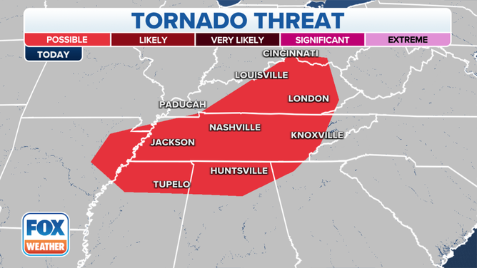
![The tornado threat on Sunday, June 11, 2023.]() Image 1 of 3
Image 1 of 3The tornado threat on Sunday, June 11, 2023. ( )
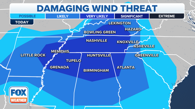
![The damaging wind threat on Sunday, June 11, 2023.]() Image 2 of 3
Image 2 of 3The damaging wind threat on Sunday, June 11, 2023. ( )
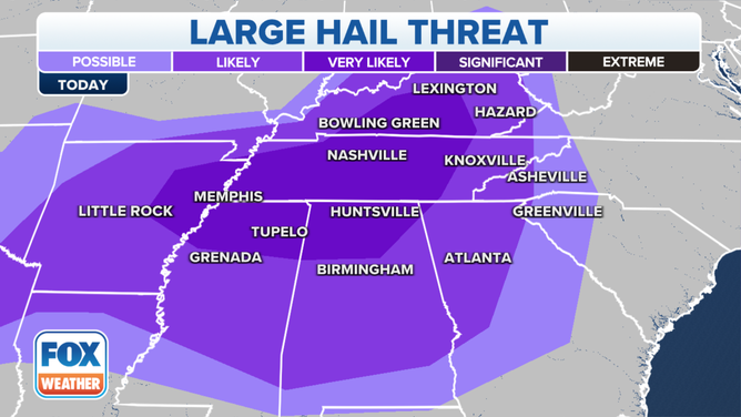
![The large hail threat on Sunday, June 11, 2023.]() Image 3 of 3
Image 3 of 3The large hail threat on Sunday, June 11, 2023. ( )
Active weather pattern comes after a quiet May
The threat of thunderstorms could buck a trend of below-average severe storm activity that has been observed for several weeks. Nearly a dozen states east of the Rockies had no reports of severe weather during May, which was the quietest since at least 2004.
The potential for a less-active severe weather season was expected by the FOX Forecast Center, with the exit of La Niña and a march toward El Niño.
Research completed by various private, government and educational groups has found that neutral-ENSO conditions – neither El Niño nor La Niña – tend to produce tornado and hail events that are more in line with average or slightly below average, and El Niños can be even quieter.
SCORCHING SUMMER PREDICTED ACROSS US WITH NO AREAS FORECAST TO BE COOLER THAN AVERAGE
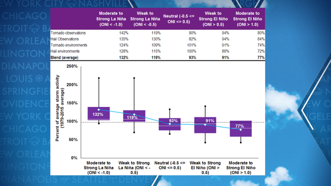
Hail and tornado activity vs. the state of atmosphere.
(Willis Re / Columbia University / FOX Weather)