What is a ‘bow echo’?
This radar signature tells meteorologists when storms contain dangerous winds
What is a bow echo?
This type of radar signature gets the attention of meteorologists.
From rotation to large hail, there are lots of things that weather radar can tell meteorologists about storms.
Radars can also help forecasters find which storms contain dangerous winds, and that is where a "bow echo" comes into play.
The term was coined in 1971 by Ted Fujita, the same man who created the Fujita scale for tornado rankings. This radar signature gets its name from the bowed shape of the storm being scanned.
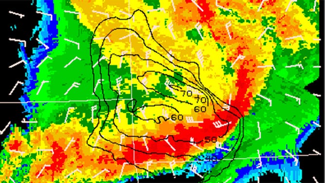
A "bow echo" is seen on a storm in Missouri in 2009.
(NSSL/NOAA)
It is caused by strong winds that are flowing out of the storm, called the outflow. The wind hits the ground and spreads out. The edge of the storm’s bow is usually where the leading edge of these strong winds is located.
When meteorologists see a bow echo, it will usually result in a severe thunderstorm warning being issued, because these types of storms are notorious for producing damaging, straight-line winds. Sometimes systems that produce these types of storms can create a specific type of damaging wind event called a "derecho" – a long-lived, widespread wind storm associated with a fast-moving storm.
Storms with bow echoes can also produce tornadoes, especially on the northern side of the bow. That is where rotation is more likely.
If you notice a bow echo appearing on radar with a storm near your location, it’s best to move indoors and stay away from windows until it passes.