Tropical development possible off Southeast coast, in Caribbean Sea
If a tropical storm forms, it will be named Vince – the second-to-last name on the 2023 Atlantic Ocean naming list.
Watching for tropical development off Southeast coast, Caribbean Sea
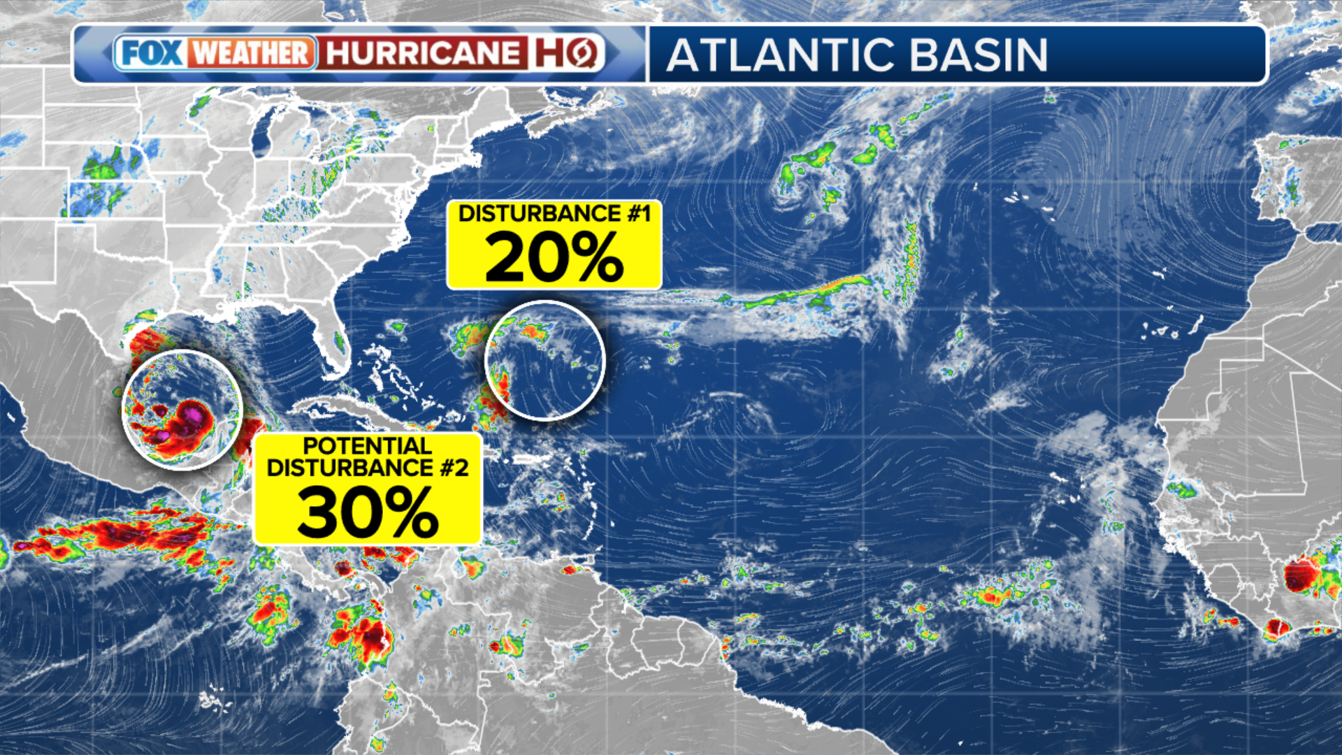
The 2023 Atlantic hurricane season will officially end on Nov. 30, but the tropics are not yet ready to shut down. The National Hurricane Center is tracking two areas of weather in the Atlantic this week.
Editor's note: This story is no longer being updated. New information on this topic can be found here.
The 2023 Atlantic hurricane season will officially end on Nov. 30, but the tropics are not yet ready to shut down. The National Hurricane Center (NHC) is tracking two areas of weather in the Atlantic this week.
(FOX Weather)
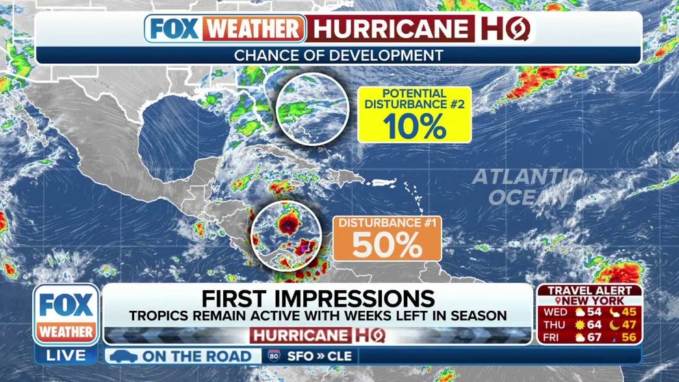
Caribbean Sea (Invest 98L)
According to the NHC, a disturbance in the Caribbean Sea has a medium chance of development.
A trough of low pressure over the southwestern Caribbean Sea is producing disorganized showers and thunderstorms, and environmental conditions appear marginally conducive for development of this system over the next couple of days.
The system has been dubbed Invest 98L by the NHC. An invest is a naming convention used by the NHC that allows them to run specialized computer models on systems being monitored for possible development.
Forecasters at the NHC said a tropical depression could form by this weekend as the system begins moving northeastward across the western and central Caribbean Sea.
WHY THE HURRICANE SEASON WILL REMAIN ACTIVE INTO NOVEMBER

(FOX Weather)
Those with interests in Jamaica, Cuba, Haiti, the Dominican Republic, the southeastern Bahamas and the Turks and Caicos Islands are urged to monitor the progress of this system.
Regardless of development, the NHC said the system has the potential to produce heavy rain over portions of the Caribbean coast of Central America and the Greater Antilles through this weekend.
If a tropical storm forms, it will be named Vince – the second-to-last name on the 2023 Atlantic Ocean naming list.
Southeast coast
Another potential disturbance is located off the Southeast coast of the U.S.
The NHC said a non-tropical area of low pressure is expected to develop near South Florida by Thursday and then move northeastward across the Bahamas and off the East Coast of the U.S. late this week and into the weekend.
Although development into a tropical depression or storm appears unlikely, this system is expected to produce gusty winds and heavy rain across portions of South Florida, the Florida Keys and the Bahamas during the next couple of days, the NHC noted.

(FOX Weather)
Late in the season
The possibility of development is late in the season but not unusual. According to climatology, the last tropical cyclone of the Atlantic season forms about Nov. 19. Hurricane season officially ends on the last day of November.
For the Lower 48, the normal time period for a possible direct strike would be over by the time either of these systems develops.
The record for the latest hurricane strike on the mainland U.S. is Kate's landfall in Florida on Nov. 21, 1985.