Invest 98L in Caribbean gets better odds of developing while Southeast coast odds nil
If a tropical storm develops, it will take the name Vince. That is the next-to-last name on the 2023 Atlantic Ocean list.
Invest 98L being watched for tropical development in Caribbean Sea
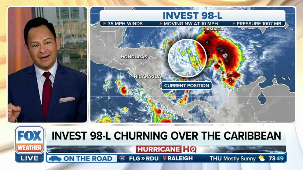
A tropical disturbance in the west-central Caribbean Sea has been dubbed Invest 98L by the National Hurricane Center. It could develop into a tropical depression over the next day or two.
Editor's note: This story is no longer being updated. New information about this topic can be found here.
Hurricane season may end this month, but that’s not keeping the tropics from remaining active.
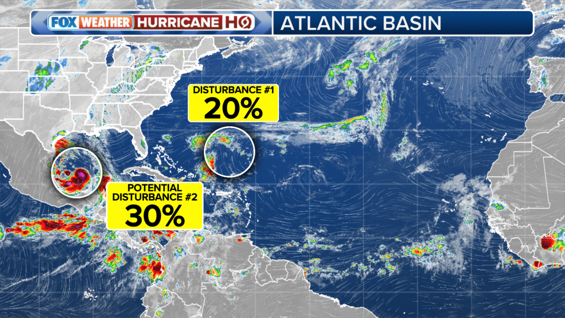
The National Hurricane Center (NHC) has designated a disturbance in the Caribbean Sea that has been tracked for several days as Invest 98L. Forecasters are also watching a cluster of storms off the Southeast coast for potential development.
If a tropical storm develops, it will take the name Vince. That is the next-to-last name on the 2023 Atlantic Ocean list.
Here is a closer look at each of these systems.
(FOX Weather)
Invest 98L
A tropical disturbance in the west-central Caribbean Sea has been dubbed Invest 98L. An invest is a naming convention used by the NHC that allows forecasters to run specialized computer models on systems being monitored for possible development.
Invest 98L has a high chance of development. According to the NHC, a tropical depression could form over the next day or two as the system moves northeastward toward Jamaica, Haiti and eastern Cuba. Hurricane Hunters are expected to investigate the disturbance Thursday afternoon. NHC forecasters said alerts could be issued Thursday for parts of the Greater Antilles.
TOP 5 STRONGEST HURRICANES EVER RECORDED IN ATLANTIC BASIN

(FOX Weather)
Regardless of development, this system is expected to produce heavy rain that could result in flash flooding and mudslides over portions of the Greater Antilles through this weekend.
Interests in Jamaica, Cuba, Haiti, the Dominican Republic, the southeastern Bahamas and the Turks and Caicos Islands are urged to monitor the system's progress over the coming days.
Southeast coast
A non-tropical area of low pressure off the Southeast coast, between South Florida and the northwestern Bahamas, has a low chance of development. It is forecast to bring gusty winds and heavy rain to portions of the Atlantic coast of Florida and the Bahamas during the next day or so.
The system will then move northeastward off the East Coast of the U.S., with rain and gusty winds possible in parts of the Northeast later Friday and into Saturday.
EL NIÑO IMPACTS ON HURRICANE SEASON

(FOX Weather)