Drone video captures dramatic bird's-eye view of historic Fort Lauderdale flooding
According to the National Weather Service’s Weather Prediction Center, more than 25 inches of rain fell in the Fort Lauderdale area on Wednesday. Once confirmed by the NWS, this event would set a new 24-hour, statewide rain record.
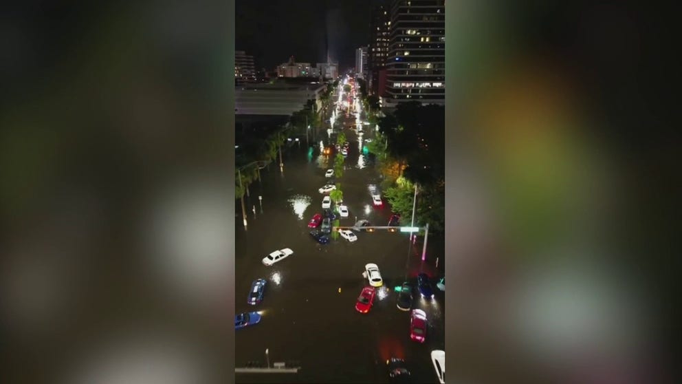
Drone video of downtown Fort Lauderdale captures extent of flooding
Drone video of downtown Fort Lauderdale shows countless cars trapped in high water after the city experienced extreme flooding on Wednesday.
FORT LAUDERDALE, Fla. – Torrential rain in South Florida continued on Thursday, one day after the first Flash Flood Emergency on record was issued in Broward County.
The extent of the historic flooding in Fort Lauderdale was seen in drone video that showed numerous cars that had been submerged and destroyed by the rapidly rising water.
According to the National Weather Service’s Weather Prediction Center, more than 25 inches of rain fell in the Fort Lauderdale area on Wednesday. Once confirmed by the NWS, this event would set a new 24-hour statewide rain record.

Flooding in Ft. Lauderdale. April 13, 2023.
(FOX Weather / FOX Weather)
The previous record of 23.28 inches of rain in a 24-hour period was reported in Key West, Florida.
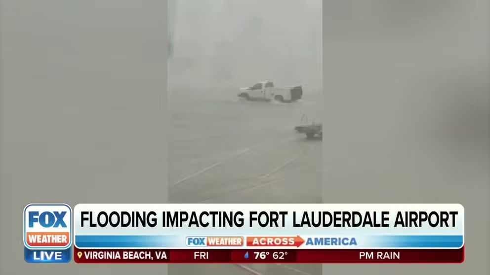
VIDEO: SOUTH FLORIDA SEES MORE THAN A FOOT OF RAIN IN JUST HOURS, FLOODING FORT LAUDERDALE AIRPORT
Drone video recorded in Fort Lauderdale shows numerous cars left abandoned and submerged in the rapidly rising floodwaters along what would typically be a busy street.

Drone video shows cars that were submerged and destroyed during historic flooding in Fort Lauderdale, Florida.
(Twitter/@douglasthron777)
No one can be seen in the video, but the blinking hazard lights of the flooded cars give an eerie look to what is likely at least a 1-in-1000-year flooding event.
According to FOX Weather meteorologist Ian Oliver, a 1-in-1,000-year flooding event doesn't mean it will be another 1,000 years before flooding of this magnitude will be experienced in Fort Lauderdale. Instead, it means "one-tenth of 1% is the chance of that happening in any given year," Oliver added.
Emergency declared in Fort Lauderdale due to historic flooding
Heavy rain falls in Fort Lauderdale, flood threat continues
Heavy rain falls in Fort Lauderdale, Florida on Thursday and the threat of flooding continues. A Flash Flood Warning is in place for Broward County until 7:30 pm ET. (Credit: @robertmeister20/Twitter)
The city of Fort Lauderdale declared an emergency because of the historic flooding, and first responders have been out in full force, responding to numerous rescue calls.
Fort Lauderdale City Hall has been closed because the facility is without power, and the first floor of the building has been flooded. City officials said the city activated its Emergency Operations Center because of the ongoing situation.
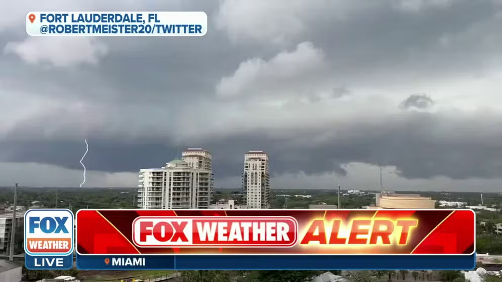
Storm clouds moving into Fort Lauderdale on Thursday
Lightning captured on video as storms approach Fort Lauderdale, Florida on Thursday. A Flash Flood Warning is in effect for Broward County until 7 pm ET.
In addition, the flooding forced the closure of Fort Lauderdale-Hollywood International Airport (FLL) on Wednesday.
Some passengers braved the floodwaters, pulling their suitcases behind them.
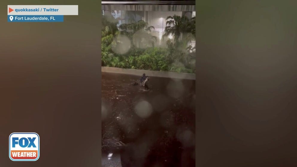
Travelers carry luggage through floodwaters at Fort Lauderdale airport. April 12, 2023.
Travelers carry their luggage through floodwaters at Fort Lauderdale-Hollywood International Airport. (Credit: quokkasaki / Twitter)
Due to flooding and debris on the airfields, the airport remained closed on Thursday. However, officials said the airport is expected to reopen 9 a.m. Friday.
"The delayed timeframe is to accommodate final daylight inspections to determine the airfields’ readiness to resume safe flight operations," they said.
'It was pretty wild': Passenger gets stuck at Fort Lauderdale airport during flooding
Chris Nowinski, a passenger that got stuck at Fort Lauderdale-Hollywood International Airport during flash flooding, said cars were submerged in water on Wednesday when torrential rain hit the area. The airport plans to reopen on Friday at 5am ET.
In the meantime, a total of 33 flights between Wednesday and Thursday have been diverted from FLL to the Miami International Airport (MIA), according to the Communications Director at MIA Thursday afternoon.
Flooded homes and businesses
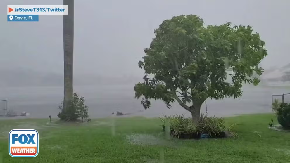
Strong winds and heavy rain slam Davie, FL
Strong winds and heavy rain slam Davie, Florida on Thursday. (Credit: @SteveT313/ Twitter)
GULF COAST STORM SYSTEM EXPECTED TO PRODUCE TROPICAL DOWNPOURS, STRONG STORMS AGAIN ON THURSDAY
Rain continued to pour across the region. In the nearby town of Davie, palm trees were blowing in the wind and rain Thursday afternoon.
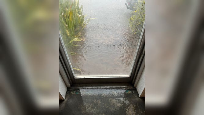
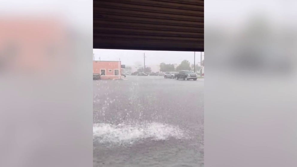
Floodwaters also crept into buildings across the region, and videos and photos show water rushing inside.
Flooding in Fort Lauderdale, Florida. April 12, 2023.
(@JHay97 / Twitter / FOX Weather)
One video shows a garage door opening, showing the copious amounts of water on city streets.
Ft. Lauderdale area flooded by Gulf Coast storm. April 12, 2023.
The storm dropped a torrential amount of rain in South Florida Wednesday. (Courtesy: @JHay97 / Twitter)
Just south of Fort Lauderdale, the Dania Beach area saw some of its streets turn into rivers, and further south in Sunny Isles Beach, cars were seen trying to drive through flooded roadways.
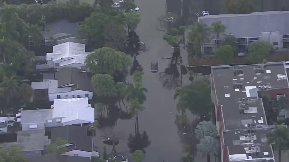
Aerial view shows cars stranded in streets, flooded neighborhoods across Fort Lauderdale
An aerial view shows cars stranded in streets and flooded neighborhoods across Fort Lauderdale on Thursday.
SOUTHEAST COULD SEE SEVERE STORMS, TORNADOES THURSDAY BEFORE THREAT SHIFTS TO PLAINS THROUGH WEEKEND
More torrential rain is expected across South Florida through the rest of the week, raising concerns of more flooding across the region.
Thursday afternoon, Florida Gov. Ron DeSantis declared a state of emergency for Broward County, where Fort Lauderdale is located.
Storms march across the South
There's also the threat of severe weather in the Southeast, including Alabama, Georgia and Florida.
The Storm Prediction Center expects tornadoes, damaging wind and even hail to be possible.
There is a Level 3 out of 5 enhanced risk of severe thunderstorms across parts of southern Georgia and extreme southeastern Alabama. The threat for severe weather will diminish along the Gulf Coast on Friday as the center of circulation pushes into the Carolinas.