Gulf Coast storm system expected to produce tropical downpours, strong storms again on Thursday
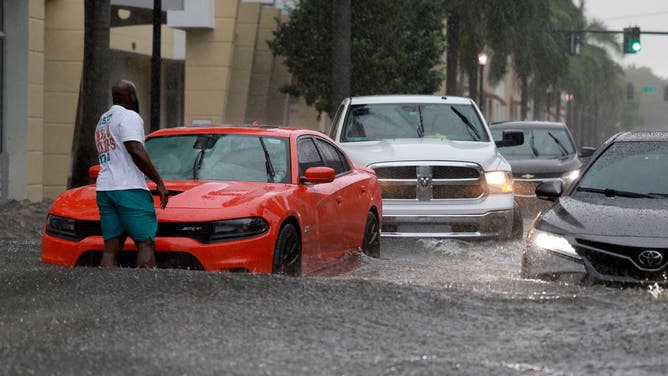
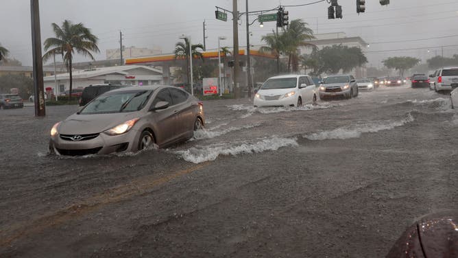
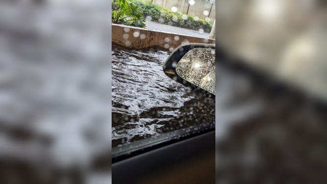
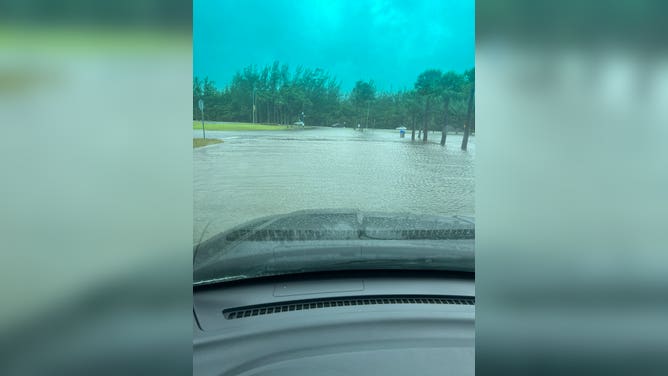
The FOX Forecast Center said rain has been off with a developing area of low pressure that will slowly linger before moving onshore Thursday or Friday. Communities north of Miami saw more than 6" of rain which led to flooding and the temporary closure of the Fort Lauderdale-Hollywood International Airport.
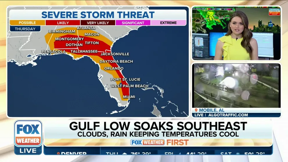
Gulf low soaks the Southeast, severe threat looms for Thursday
Additional rounds of rain are continuing along the Gulf Coast. Rain is ongoing as developing area of low pressure just offshore will slowly linger before moving inland Thursday. The threat for flooding continues as soils are already saturated from recent rains.
A low-pressure system developing in the Gulf of Mexico continues to send bands of showers and thunderstorms ashore along the Gulf Coast, with the threat of heavy rain and isolated tornadoes expected through Friday.
The risk of flooding extends from New Orleans through the Florida Panhandle and could be enhanced during times of high tide, when drainage is limited due to high sea levels.
"Because of this upper-level low, it is going to end up increasing the winds," FOX Weather meteorologist Jason Frazer said. "And any time you get a low-pressure system, you get that counterclockwise rotation, so there is a chance that we could, unfortunately, see some coastal flooding."
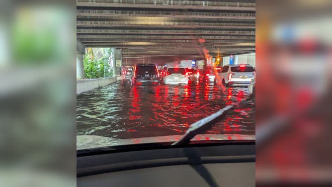
Storms produced record rainfall in parts of Miami-Dade and Broward counties that flooded cars and caused significant flooding at the Fort Lauderdale-Hollywood International Airport. Photos from outside the terminal showed passengers wading through water around a foot deep, and FlightAware.com reported some delays were more than two hours long.
After the heaviest rain fell, the local National Weather Service office issued a Flash Flood Emergency for the Fort Lauderdale to Hollywood area due to what forecasters said was a life-threatening flooding event.
VIDEO: SOUTH FLORIDA SEES MORE THAN A FOOT OF RAIN IN JUST HOURS, FLOODING FORT LAUDERDALE AIRPORT
![Severe Weather Passes Through South Florida]() Image 1 of 6
Image 1 of 6Cars drive around a stalled car in a flooded street on April 12, 2023 in Dania Beach, Florida. Heavy rain passed through the South Florida area causing some area flooding. (Joe Raedle)
![Severe Weather Passes Through South Florida]() Image 2 of 6
Image 2 of 6DANIA BEACH, FLORIDA - APRIL 12: Cars drive through a flooded street on April 12, 2023 in Dania Beach, Florida. Heavy rain passed through the South Florida area causing some area flooding. (Joe Raedle)
![Flooding at the Fort Lauderdale-Hollywood Int'l Airport]() Image 3 of 6
Image 3 of 6Flooding at the Fort Lauderdale-Hollywood Int'l Airport (@MNPLYGUY / Twitter)
![Flooding at the Fort Lauderdale-Hollywood Int'l Airport]() Image 4 of 6
Image 4 of 6Flooding at the Fort Lauderdale-Hollywood Int'l Airport (@MNPLYGUY / Twitter)
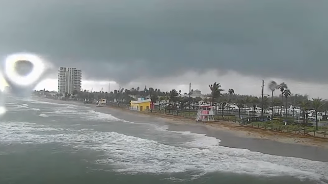
![Dania Beach Pier and Beach Cam]() Image 5 of 6
Image 5 of 6Dania Beach Pier and Beach Cam during a Tornado Warning on Wednesday, (Dania Beach Pier and Beach Cam)
![Flooding on the FIU Biscayne Bay Campus]() Image 6 of 6
Image 6 of 6Flooding on the FIU Biscayne Bay Campus in North Miami. (FIU Police)
Thursday's threat zone
The storm system is expected to help produce heavy rain along Interstates 10, 75 and 95 on Thursday, possibly leading to additional flooding and severe weather.
Rainfall amounts of 1 to 2 inches will be common from New Orleans to Miami with some communities seeing more than 3 inches in the heaviest storms.
Where storms encounter more unstable air, the Storm Prediction Center expects tornadoes, damaging wind and even hail to be possible.

(FOX Weather)
The SPC has highlighted a zone that runs from Alabama into Georgia and extending southeastward across the eastern Florida Peninsula for having the best chance of seeing storms that could be strong or severe.
Cities in the threat zone from possible severe storms include Jacksonville and Miami, Florida, Montgomery, Alabama, and Savannah, Georgia.
Coastal Flood Warnings and Advisories are also in effect for many counties along the Gulf Coast as higher than average tides are expected to continue through the week.
The threat for severe weather will diminish along the Gulf Coast on Friday as the center of circulation pushes into the Carolinas.

(FOX Weather)