Accelerating 'Super' El Niño expected to suppress Atlantic hurricanes, bring stormy pattern to southern US
While a historically strong El Niño is expected to virtually shut down hurricane formation in the open waters of the Atlantic this year, the stormy pattern for the southern U.S. could actually generate tropical activity in the northern Gulf and along the Southeast Coast.
Bryan Norcross previews impacts of brewing Super El Niño
FOX Weather Hurricane Specialist Bryan Norcross breaks down how a brewing Super El Niño will impact this hurricane season in both the Atlantic and Pacific basins. Plus, Bryan also previews new AI tools FOX Weather will use to help track cyclones this year.
Recent data from the Pacific Ocean shows that the transition to what is expected to be a "Super El Niño" climate pattern is accelerating, which could suppress the upcoming Atlantic hurricane season and also spell a wet winter for the entire Southern Tier of the U.S.
NEW DATA REVEALS 100% CHANCE OF STRONG ‘SUPER’ EL NIÑO FORMING THIS YEAR

Tropical Storm Bret as it makes its way west.
(NOAA)
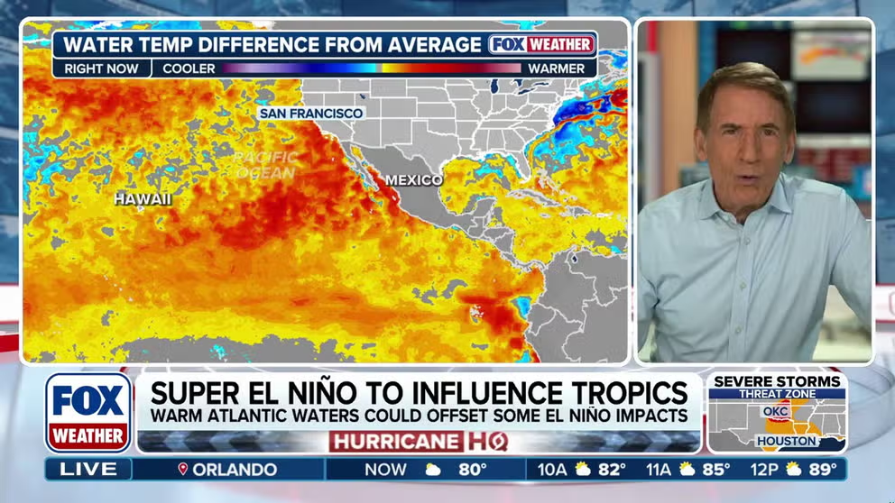
Water temperatures in the central Pacific Ocean have already begun to warm to the 0.5 degrees Celsius threshold, the benchmark qualification for El Niño, which is expected to completely develop sometime this summer.

Days away from start of Eastern Pacific hurricane season, Atlantic season around the corner
The main headline heading into this season is the rapidly developing El Niño. Typically, El Niño impacts the Atlantic basin by increasing upper-level wind shear, which creates a more hostile environment for storm development and can reduce the overall number of tropical systems. Meanwhile, the Eastern Pacific hurricane season begins Friday where El Niño is forecast to increase tropical activity.
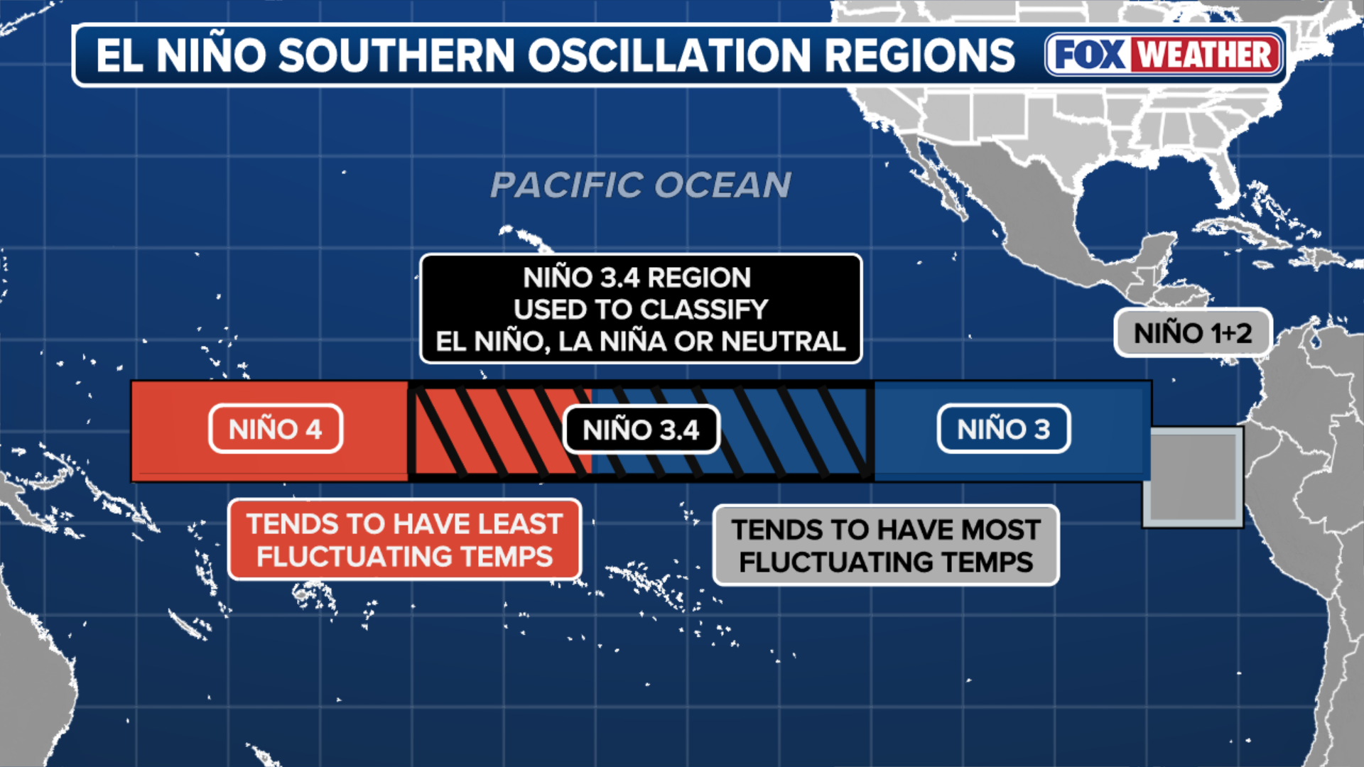
El Niño is one of three phases of a climate cycle called the El Niño-Southern Oscillation (ENSO). It describes natural temperature changes in the central Pacific Ocean that alter atmospheric circulation and can greatly influence global weather.
WHAT ARE EL NINO AND LA NINA CLIMATE PATTERNS?
El Niño describes warmer than average water across the equatorial Pacific, while La Niña describes colder than average water conditions, and ENSO neutral refers to a state where temperatures are close to average.
(FOX Weather)
During El Niño, above-average water temperatures in the central and eastern Pacific Ocean produce strong winds that hinder tropical development in the Atlantic and enhance development in the Eastern Pacific, where hurricane season begins this Friday.

El Niño impact on hurricane season.
(FOX Weather / FOX Weather)
Furthermore, computer forecast models suggest that this summer's El Niño will not only likely be a "Super El Niño" — which is declared when water temperatures in the Central Pacific reach at least 2 degrees Celsius — but also one of the strongest El Niño events ever observed.
EL NIÑO EXPECTED TO DRIVE ATLANTIC STORM ACTIVITY AS COUNTDOWN TO HURRICANE SEASON BEGINS
While sea surface temperatures are beginning to reach 0.5 degrees Celsius in the Central Pacific, these are just instantaneous observations.
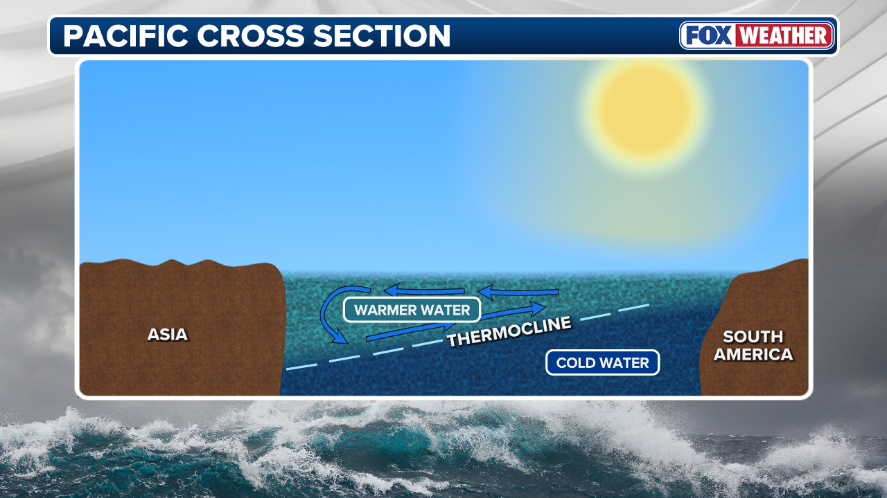
The most dramatic changes are occurring 100 to 200 meters below the surface.
(FOX Weather)
According to the FOX Forecast Center, a massive pool of warm water that has been building in the Western Pacific is now "sloshing" eastward.
Driven by winds from the west and several other physical factors, this warm water will reach the El Niño zone sometime this summer, further increasing temperatures.
There is currently a very high probability that El Niño conditions will persist through the end of 2026.
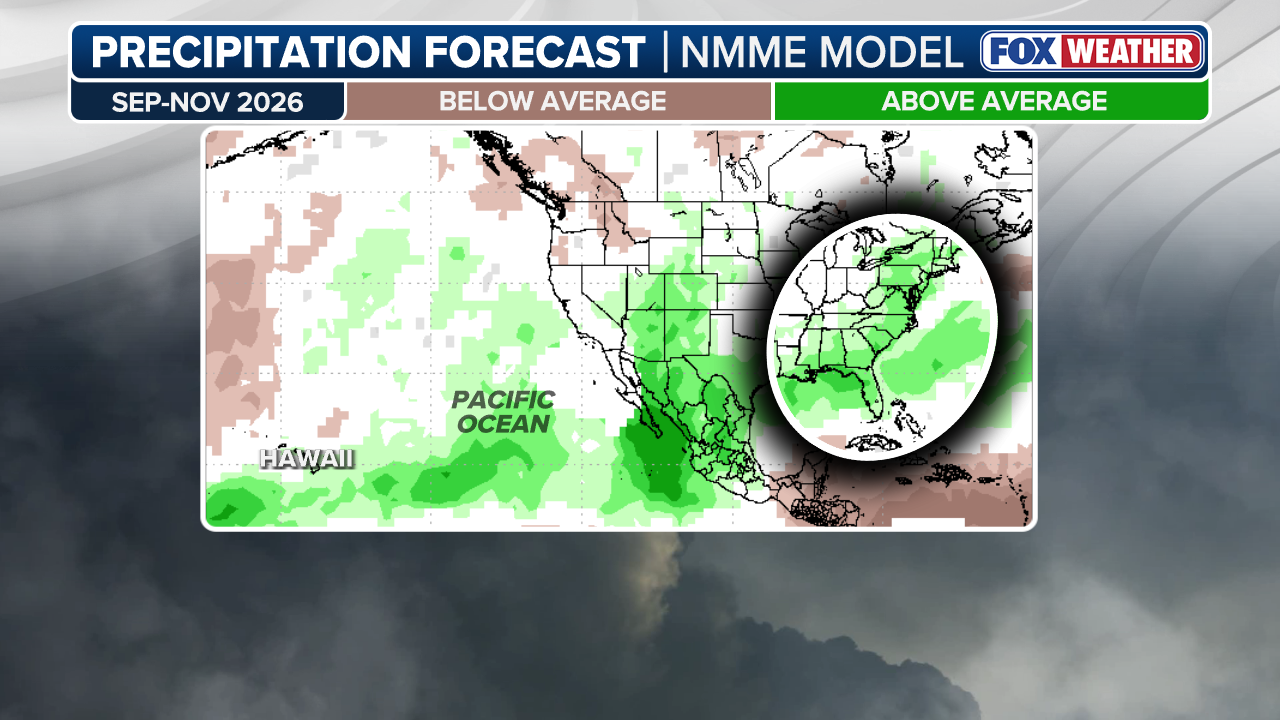
As El Niño strengthens, it will begin to "bend" the Pacific jet stream, which acts as an atmospheric conveyor belt for storms and is responsible for most of the rain seen across the Lower 48.
(FOX Weather)
Long-range forecast models predict that El Niño will strengthen the jet stream and shift it southward, leading to a wetter-than-average pattern for California and the South in the second half of the year and through the winter months.
HOW TO FIND YOUR HURRICANE EVACUATION ZONE
While such a strong El Niño is expected to virtually shut down hurricane formation in the open waters of the Atlantic this year, the stormy pattern for the southern U.S. could actually generate tropical activity in the northern Gulf and along the Southeast coast.
In fact, the long-range European forecast model predicts near-normal tropical activity close to the U.S. mainland.
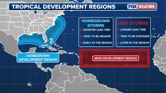
Where tropical systems form plays a role in their track and development.
(FOX Weather / FOX Weather)
Both the FOX Forecast Center and FOX Weather Hurricane Specialist Bryan Norcross cautioned that it only takes one storm to cause major impacts.
The Atlantic hurricane season lasts from June 1 to Nov. 30.
Meanwhile, this El Niño is expected to supercharge the Eastern Pacific Hurricane season, which begins this Friday and where sea surface temperatures are already 2 to 3 degrees above average.