What are El Niño and La Niña climate patterns?
Each cycle typically lasts around 9-12 months but there is not a regular schedule for when the globe enters a La Niña or El Niño state. A warming of the ocean surface indicates an El Niño could be in charge, while a decreasing of water temperatures leads to a La Niña.
The meaning of El Nino and La Nina
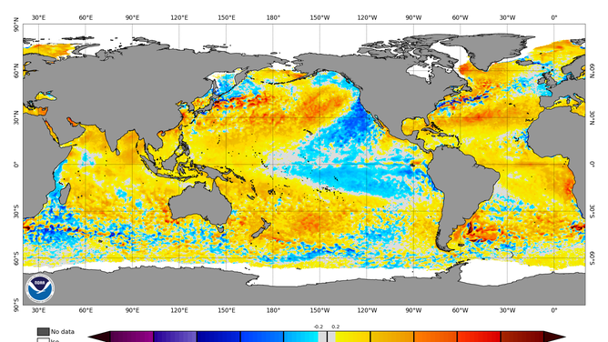
The status of whether the world is being impacted by an El Nino or a La Nina is determined by water temperatures in the central and eastern Pacific. (NOAA)
Water temperatures in the Pacific play a prominent role in climate patterns around the world and fall under a classification known as the El Niño-Southern Oscillation (ENSO). The climate phenomenon is constantly evolving and statuses such as La Niña, El Niño and La Nada help experts convey the state of the ENSO and what weather patterns could follow.
When conditions are considered to be normal, trade winds blow warm water from the Western Hemisphere around the Pacific’s equator to the Eastern Hemisphere. This period is typically referred to as neutral, or La Nada, and impacts are felt worldwide.
The National Oceanic and Atmospheric Administration says natural influences such as pressure changes, excessive rainfall and temperature swings can play a significant role in changing the state of the Pacific and when extremes are reached the world can be in either a La Niña or El Niño.
Red periods of time indicated above average water temperatures and blue patches indicate below normal water temperatures.
(NOAA)
FARMER’S ALMANAC DECLARES PARTS OF US ‘HIBERNATION ZONE’ WITH PREDICTED ‘GLACIAL, SNOW-FILLED WINTER
What to know about El Niño
During El Niño, trade winds are usually weak, which keeps warm water backed up in parts of the eastern and central Pacific.
To officially be considered an El Niño, a three-month temperature anomaly of at least +0.5 °C must be reached in crucial parts of the region.
Warmer water leads to an increase in available moisture, and jet stream changes go along for the ride.
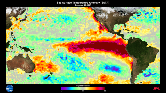
Classic El Niño during 1997
(NOAA)
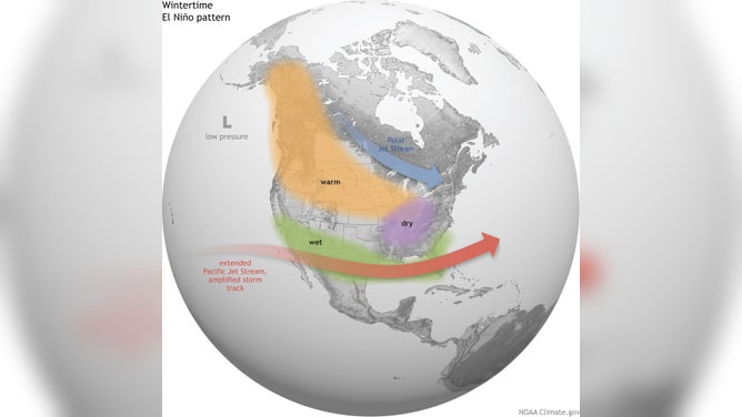
Typically, during an El Niño, the Pacific jet stream is more robust and provides more moisture for the southern U.S. This pattern can lead to flooding across the Gulf Coast and the Southeast.
Drier conditions are usually experienced in the northern tier of the country, and warmer air can prevail.
The increased water temperatures and a decrease in upper-level winds in the eastern and central Pacific can lead to an increase in hurricanes, but as part of Mother Nature’s balancing act, the Atlantic basin can be hostile to tropical cyclone development.
Significant El Niño cycles include: 1986-1987; 1991-1992; 1993; 1994; 1997-1998; and 2015-2016.
Classic El Niño set up
(NOAA)
LA NINA WINTER 2022-23 COULD MEAN TORNADO OUTBREAKS, BLIZZARDS AND EVERYTHING IN BETWEEN
The little-known La Nada
The ENSO is considered to be in a neutral state when regions of the central and eastern Pacific have anomalies between 0.5 °C and -0.5 °C.
Similar to the El Niño and La Niña extremes, neutral conditions impact weather across the country and around the globe.
Typically, there are fewer changes in the jet stream, meaning more regional patterns may dominate local weather.
Forecasters have been unable to find significant trends from the dozens of ENSO neutral events, meaning everything cold to warm and dry to wet patterns are a possibility.
Significant neutral cycles include: 1990-1991; 1993-1994; 2003-2004; 2012-2013; 2013-2014
HOW TO WATCH FOX WEATHER ON TV
What to know about La Niña
The most well-known phase of the ENSO cycle is La Niña.
The world is considered to be in a La Niña when water temperature anomalies are at least -0.5 °C.
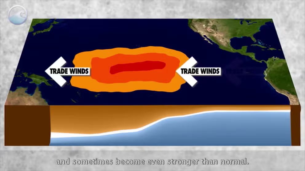
During this phase, easterly trade winds are usually strong, which create an upwelling of colder waters off of South America.
Classic La Niña during 2021.
(NOAA)
The northern jet is typically more amplified, meaning the southern tier of the country tends to be drier and warmer weather, and the northern half is usually colder and can see more precipitation than usual.
Cooler waters and increased atmospheric winds tend to lead to a decrease in tropical activity in large parts of the Pacific, but the Atlantic usually is the opposite.
Warm waters and less shear over the Atlantic basin during a La Niña event have caused some of the busiest hurricane seasons on record for the Gulf of Mexico, Caribbean and Atlantic.
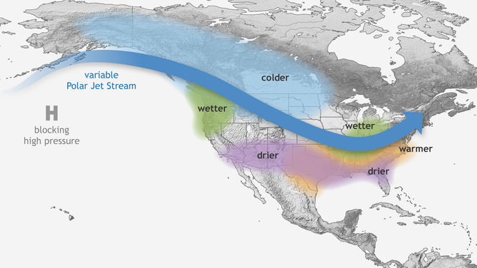
Typical wintertime impacts of La Niña across the United States.
(NOAA)
Usually the ENSO acts like a seesaw, flipping between La Niña and El Niño more frequently than what the world has experienced over the last several years.
NOAA’s Climate Prediction Center believes the winter of 2022-2023 will be part of a rare three-peat, where La Niña has been in control of weather patterns for several back-to-back years.
Significant La Niña cycles include: 1988-1989; 1995; 1998; 2007; and 2011.