Severe storms target 130M from Texas to New England after Midwest blasted by tornadoes and hail
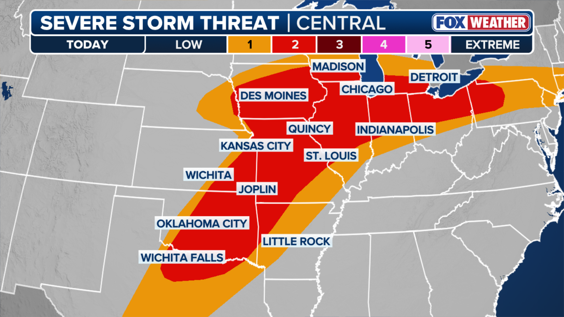
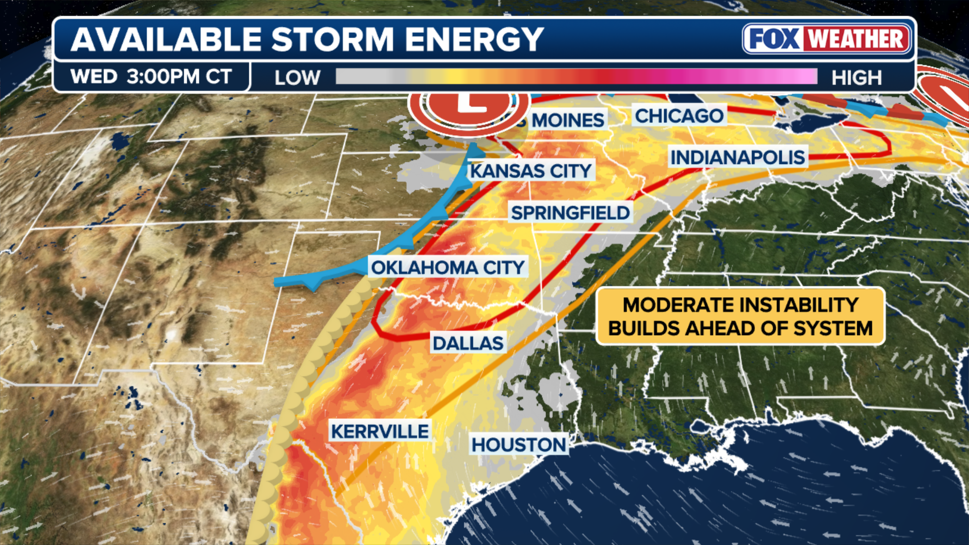
Wednesday's threat has shifted slightly east, but a broad Level 2 out of 5 risk of severe thunderstorms covers a corridor including parts of North Texas, the Southern Plains, the Midwest and the Ohio Valley, according to NOAA's Storm Prediction Center (SPC).

Severe storms to reload over 130M from Texas to New England after Midwest blasted by tornadoes, hail
Areas that were slammed by tornadoes, massive hail, and damaging wind gusts on Tuesday will see another round of storms Wednesday afternoon. This Level 2 out of 5 severe storm risk stretches from the southern Plains to the Midwest and also includes portions of the Ohio Valley and Northeast.
Over 130 million people across more than 12 states were hit with another round of severe weather on Wednesday.
This follows Tuesday's storms that produced tornadoes across southern Wisconsin and damaging wind gusts from Texas to New England.

FOX Weather Meteorologist Haley Meier and her team intercept a tornado in Wyoming, Iowa, in the FOX Weather Beast.
(FOX Weather Beast / FOX Weather)
Wednesday's threat shifted slightly east, but a broad Level 2 out of 5 risk of severe thunderstorms covers a corridor including parts of North Texas, the Southern Plains, the Midwest and the Ohio Valley, according to NOAA's Storm Prediction Center (SPC).
A Level 1 threat covered a wider area including the Dallas metro area and Texas Hill Country. To the north, the risk extended across parts of the Mid-Atlantic and Northeast, including northern New Jersey and New York City.
(FOX Weather)
A spring severe weather pattern has taken hold across much of the country, with Wednesday's atmospheric setup resembling Tuesday's conditions.
DANGEROUS TORNADOES AND HAIL SLAM THE MIDWEST, PLAINS
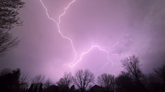
Rounds of storms once again developed over Iowa and charged east along a stalled front draped over southern Wisconsin and Michigan, where thousands of customers remain without power.
More than 100,000 customers were without power across the Midwest and the Great Lakes at the height of Tuesday's severe weather, including 65,000 in Michigan alone, according to PowerOutage.us. That number has since decreased.
![Hail pelts cars in Marion, Indiana.]() Image 1 of 6
Image 1 of 6Hail pelts cars in Marion, Indiana. (Wilhelm Mann via Storyful)
![Ping pong ball-sized hail blasts Middleton, Wisconsin, Tuesday.]() Image 2 of 6
Image 2 of 6Ping pong ball-sized hail blasts Middleton, Wisconsin, Tuesday. (Jaxon Brow via Storyful)
![]() Image 3 of 6
Image 3 of 6Lightning flashes over Davis, Illinois Tuesday. (Cari)
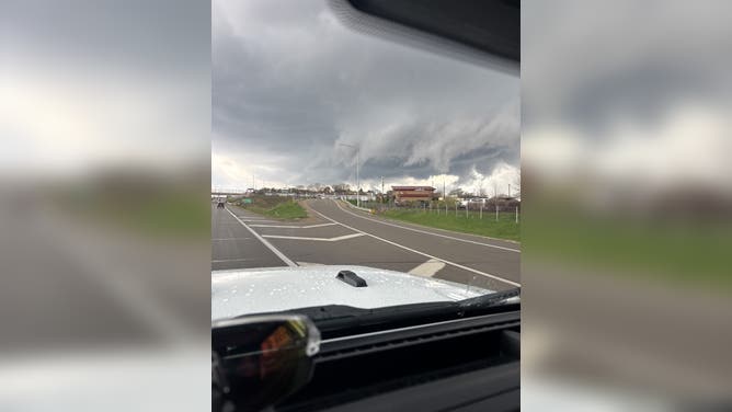
![Storms loom over Madison, Wisconsin, Tuesday.]() Image 4 of 6
Image 4 of 6Storms loom over Madison, Wisconsin, Tuesday. (Robert Reyes)
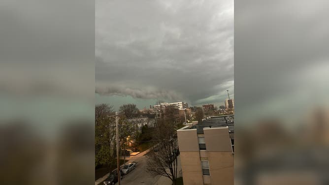
![]() Image 5 of 6
Image 5 of 6Ominous thunderstorm with hail core looms in the distance over Milwaukee. (Madeline)
![Severe weather leaves trees down in Colgate, Wisconsin.]() Image 6 of 6
Image 6 of 6Severe weather leaves trees down in Colgate, Wisconsin. (Aleksis)


Radar-confirmed tornadoes touched down in Iowa, Illinois, Wisconsin and Michigan and National Weather Service (NWS) crews will conduct damage assessment surveys later Wednesday.
Waukesha County, Wisconsin, was one of the areas hardest hit by the storms.
POPULAR MICHIGAN BRIDGE DESTROYED AS RIVER HITS HISTORIC FLOOD LEVEL
A tornado caused significant damage to buildings in Sussex. Video from FOX6 Milwaukee showed a power line snapped and several piles of debris with insulation around several buildings.

Baseball-sized hail in Oconomowoc, Wisconsin, Tuesday.
(Eric Owens / FOX Weather)
Some 10 miles north, FOX Weather viewers shared images of numerous downed trees in Colgate. Large baseball-sized hail pelted Oconomowoc, also in Waukesha County.
FOX6 Milwaukee staff also had to shelter-in-place as a tornado-warned storm moved through the metro area Tuesday night. Three-inch hail was reported by the NWS in Madison, Wisconsin.
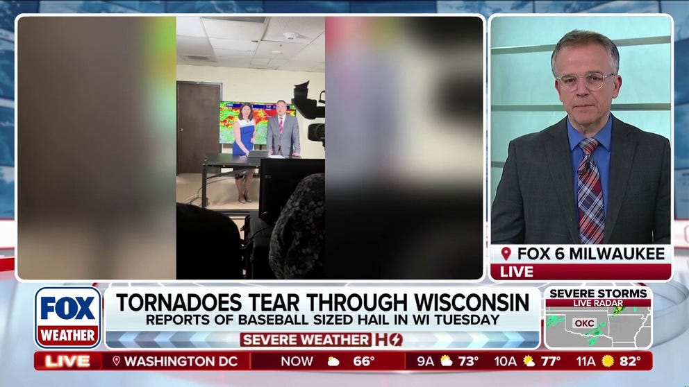
FOX6 Milwaukee staff shelter-in-place during Tornado Warning
FOX6 Milwaukee staff sheltered-in-place during Tornado Warning Tuesday night
Parts of eastern Iowa also saw large hail, as well as several tornadoes, including a long rope tornado in Wyoming, Iowa, that was intercepted by FOX Weather Meteorologist Haley Meier and the FOX Weather Beast team.

'TORNADO ON THE GROUND': FOX Weather Storm Tracking Team intercepts tornado in Iowa
'TORNADO ON THE GROUND' 🌪️: FOX Weather Meteorologist Haley Meier and the FOX Weather Beast Team intercept a tornado in Wyoming, Iowa, as a dangerous severe weather outbreak unfolds.
Powerful wind gusts also took down power poles and blocked several main roads in Ann Arbor, Michigan.
The city said emergency workers responded to more than 75 severe weather calls Tuesday and are working to remove debris.

Severe weather snapped trees and power poles in Ann Arbor, Michigan Tuesday.
(The City Of Ann Arbor — Government/Facebook / FOX Weather)
Wednesday: Severe weather threat reloads across Midwest, Plains
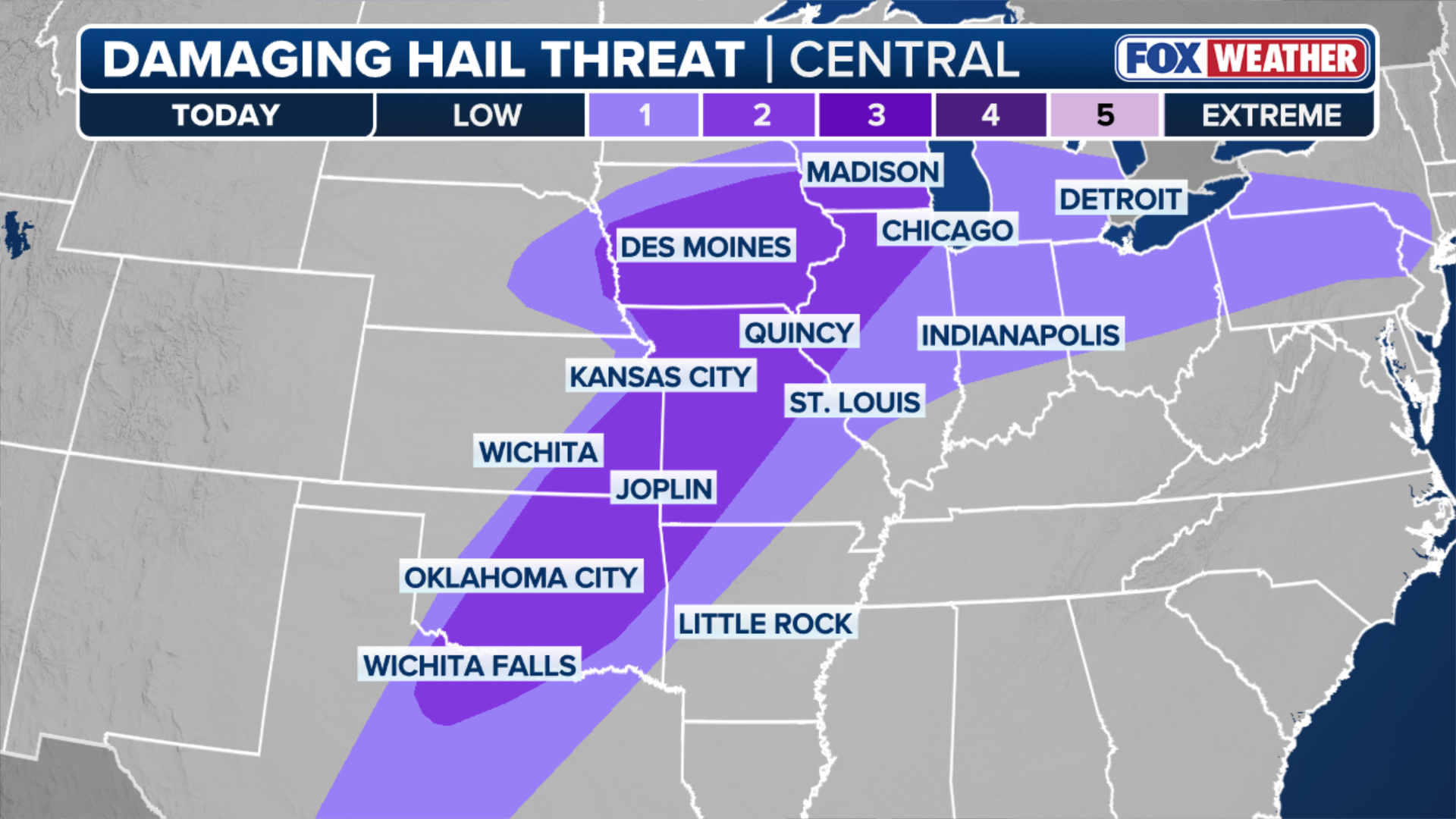
Supercell thunderstorms started to form across Missouri, Iowa, and western Illinois, with large hail being the main hazard. Flash flooding was also seen in areas across this region as storms repeatedly move over the same areas.
FLOOD THREAT INCREASES ACROSS GREAT LAKES AMID HEAVY RAINFALL, RAPID SNOWMELT
(FOX Weather)
Another dryline — the boundary between dry air from the west and warm, moist air from the Gulf — set up across eastern Kansas, Oklahoma and West Texas.
(FOX Weather)
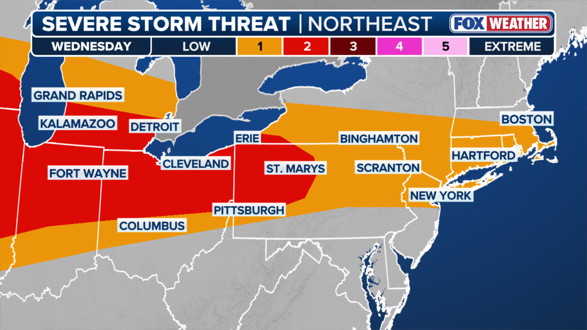
Farther north, record warmth in the Ohio Valley and the Mid-Atlantic fueled scattered thunderstorms packing hail and damaging wind gusts.
Cleveland and Pittsburgh were under a Level 2 risk of severe thunderstorms.
More storms developed through the day and tracked east through the evening, weakening as they reached the coast.
(FOX Weather)
Weaker storms are lingering across parts of the Deep South, the Mid-Atlantic and Northeast through Thursday morning.
Most of the country will finally see a break in the severe weather Thursday, except for storms that could produce hail across New York's Capital Region, Central New York and the Finger Lakes Thursday afternoon.