

Dangerous tornadoes and hail slam the Midwest, Plains as severe weather expands over 130M
There were numerous confirmed tornadoes Tuesday across a corridor stretching from eastern Iowa into southern Wisconsin and northern Illinois, which was under a Level 3 out of 5 risk of severe thunderstorms, according to the Storm Prediction Center (SPC). Among the most notable, was one tornado that was warned with debris signature on radar near Elroy, Wisconsin. Another was captured on camera by our own FOX Weather Beast in Wyoming, Iowa.
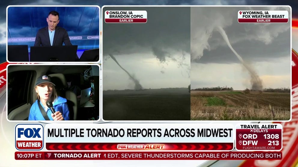
Live Storm Tracking: Severe weather marathon continues
After a full day of monitoring severe storms, FOX Weather Meteorologist Haley Meier provides a final update, recapping the widespread outbreak and key impacts observed throughout the day.
Parts of the Midwest and the Plains were once again in the bull's eye of expansive severe weather that covered more than 130 million people from Texas to New York.
There were numerous confirmed tornadoes Tuesday across a corridor stretching from eastern Iowa into southern Wisconsin and northern Illinois, which was under a Level 3 out of 5 risk of severe thunderstorms, according to the Storm Prediction Center (SPC).
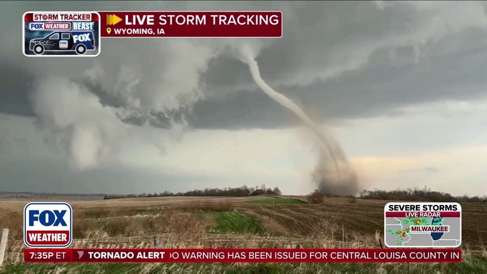
'TORNADO ON THE GROUND': FOX Weather Storm Tracking Team intercepts tornado in Iowa
'TORNADO ON THE GROUND' 🌪️: FOX Weather Meteorologist Haley Meier and the FOX Weather Beast Team intercept a tornado in Wyoming, Iowa, as a dangerous severe weather outbreak unfolds.
Among the most notable, was one tornado that was warned with debris signature on radar near Elroy, Wisconsin, around 5:50 PM CT.
Another tornado was captured on camera by our own FOX Weather Beast in Wyoming, Iowa. This was a classic rope tornado stretching across an open field before lifting back into the clouds.
![FOX Weather Meteorologist Haley Meier tracks tornado that touched down in Truman, Minnesota, on Monday afternoon.]() Image 1 of 3
Image 1 of 3FOX Weather Meteorologist Haley Meier tracks tornado that touched down in Truman, Minnesota, on Monday afternoon. (Jarrod Maloney/FOX Weather)
![Golf ball-sized hail falls across Faribault, Minnesota Monday.]() Image 2 of 3
Image 2 of 3Golf ball-sized hail falls across Faribault, Minnesota Monday. (@PETeacher2021 via Storyful)
![Golf ball-sized hail falls across Faribault, Minnesota Monday.]() Image 3 of 3
Image 3 of 3Golf ball-sized hail falls across Faribault, Minnesota Monday. (@PETeacher2021 via Storyful)
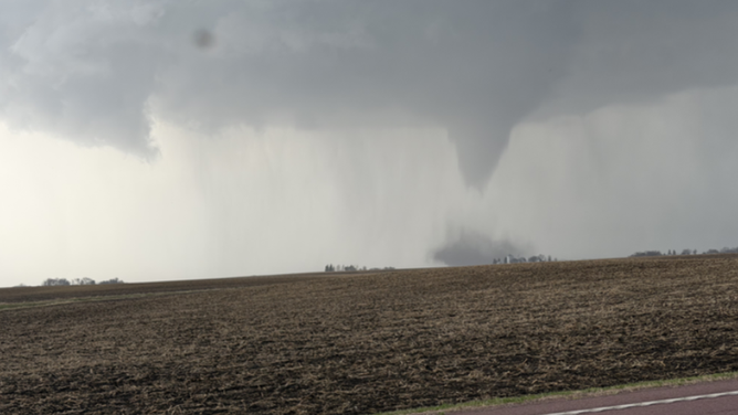


Some areas also reported significant hail, ranging from 2.75 to 3.25 inches in diameter, including Madison, WI, Plainville, WI and Black Earth, WI. There were also reports of this large hail causing structural damage.
In addition, damaging wind gusts reached up to 88 mph in some locations, including Dubuque, IA.
The storms also had a significant impact on infrastructure, with more than 32,000 customers without power in Wisconsin, according to PowerOutage.us.
FLOOD THREAT INCREASES ACROSS GREAT LAKES AMID HEAVY RAINFALL, RAPID SNOWMELT
Meanwhile, parts of the Southern Plains from Central Oklahoma, including Oklahoma City, to portions of North Texas including Wichita Falls, were under a tornado risk and experienced large hail where a dryline — the boundary between dry air from the west and warm, moist air from the Gulf — set up Tuesday afternoon.

(FOX Weather)
This all came after severe storms on Monday dropped damaging tornadoes and hail across Minnesota, Wisconsin and Kansas.
A second round of severe thunderstorms will ignite from Texas to New York on Wednesday, with the flood threat mounting for parts of the Midwest and Great Lakes, which have seen several consecutive days of heavy rain.
Power outages were reported across Miami, Franklin and Linn counties in eastern Kansas early Tuesday after tornado-warned storms blasted across the region Monday night.
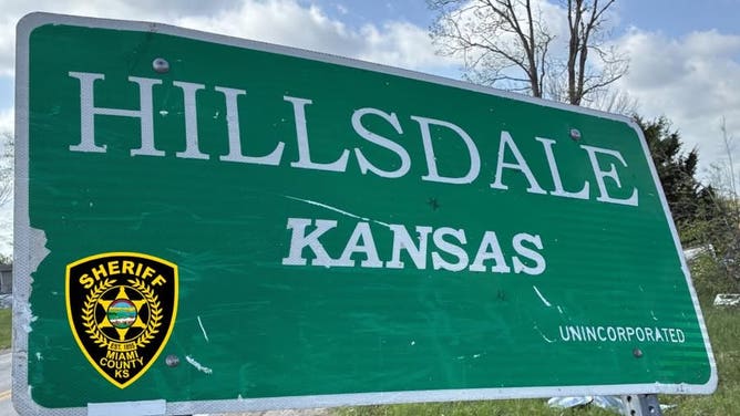
Hillsdale, Kansas welcome sign damaged by tornado-warned storm.
(Miami County Sheriff's Office/Facebook / FOX Weather)
A tornado injured two people and destroyed homes and businesses after ripping through part of Hillsdale, Kansas, shortly after 8 p.m. local time on Monday, the Miami County Sheriff's Office said.
Several RVs and campers were also overturned and roads to the community were closed as police guarded unsecured homes and buildings. A local school is serving as a shelter for those displaced.
Severe weather also damaged buildings in Ottawa, Kansas, but no injuries have been reported, city officials said.
Severe thunderstorms produced several tornadoes across parts of Minnesota Monday, including one spotted by FOX Weather Meteorologist Haley Meier during live storm coverage outside of Truman, Minnesota. Significant tornado damage has not been reported across the state.
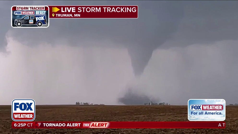
Tornado touches down and rips across farmland in Minnesota
MUST-SEE MOMENT🌪️: FOX Weather Meteorologist Haley Meier provides live updates on the ground in Truman, Minnesota, as a tornado touches down and rips across farmland directly in front of Exclusive Storm Tracker Corey Gerken.
Exclusive FOX Weather Storm Tracker Corey Gerken also confirmed a tornado near Amboy, Minnesota, Monday afternoon.
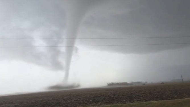
Exclusive FOX Weather Storm Tracker Corey Gerken captured footage of a tornado near Amboy, Minnesota Monday afternoon.
(Exclusive FOX Weather Storm Tracker Corey Gerken / FOX Weather)
Storms also produced widespread hail, including golf ball-sized hail in the southern part of the state, along where the warm front set up, south of Minneapolis.
An active spring weather pattern has developed across the Central U.S. with severe thunderstorms likely throughout the week, including another significant tornado threat expected across parts of the Plains and Midwest on Friday.
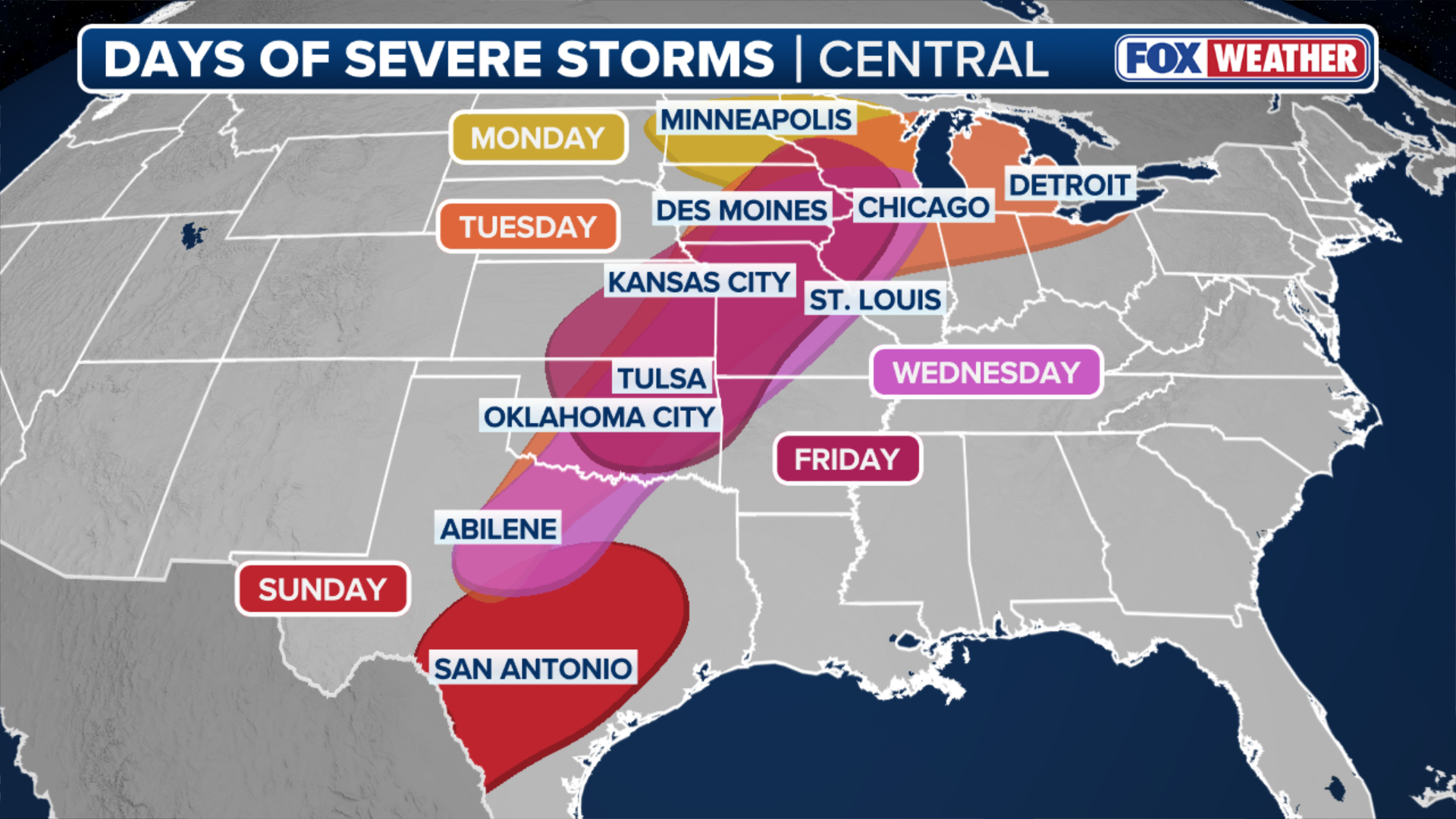
(FOX Weather)
Tuesday: Tornado threat impacts Milwaukee, Chicago and Detroit areas
The severe weather threat expanded Tuesday, covering more than 130 million people, spanning more than 1,500 miles from the Big Bend of Texas through parts of New England.
The SPC issued a Level 3 out of 5 severe risk of severe thunderstorms across parts of eastern Iowa, southern Wisconsin, northern Illinois, and southern Michigan, including Chicago, Milwaukee and Detroit.
EVACUATIONS REMAIN AS BRUSH FIRE EXPANDS TO 1,500 ACRES NEAR MAJOR FLORIDA INTERSTATE
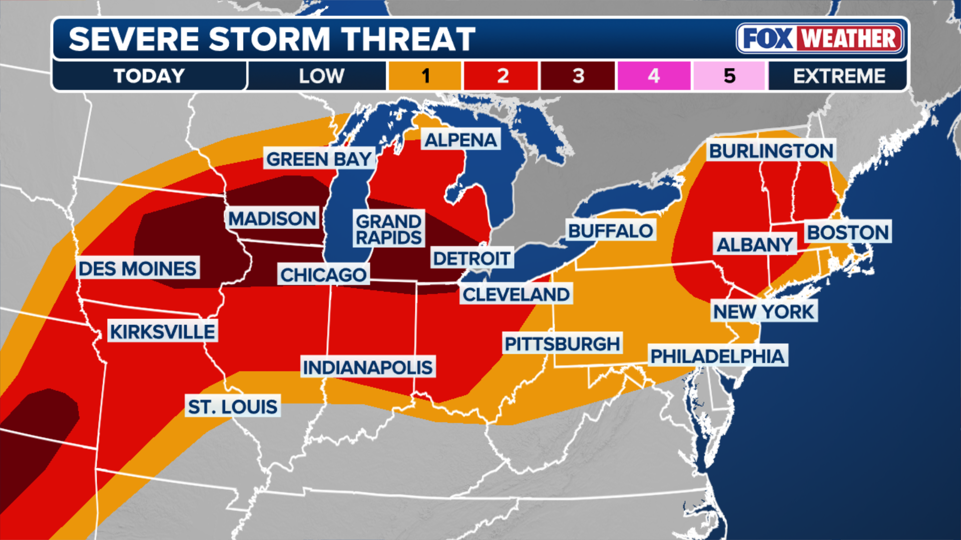
(FOX Weather)
A warm front will be re-established across this Level 3 threat area and will amplify storms that cross this boundary. These storms are expected to produce large hail, 2 to 3 inches in diameter, particularly north of where that front set up beginning mid-to-late afternoon.
WHAT IS A SUPERCELL THUNDERSTORM?
Conditions were ripe for supercell thunderstorms capable of producing strong EF-3+ tornadoes along or south of the warm front.
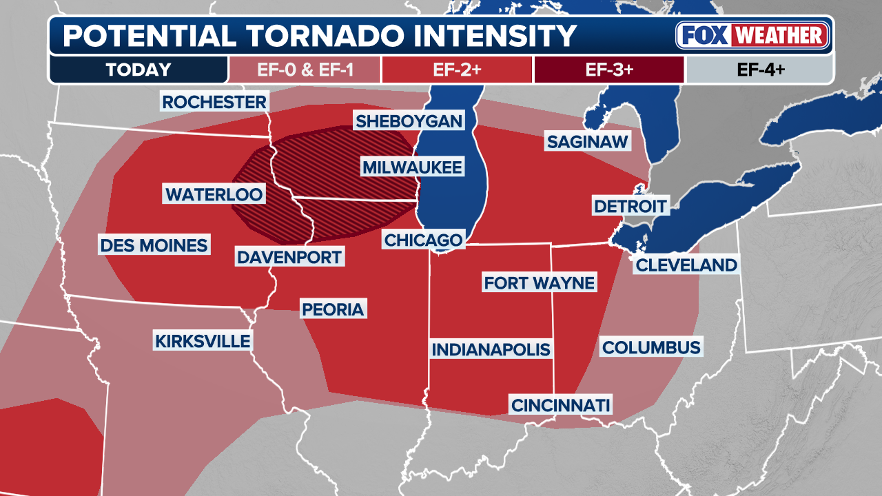
(FOX Weather)
In the southern theater of Tuesday's threat, severe storms capable of producing large hail and tornadoes fired along the dryline, which set up over Oklahoma and West Texas.
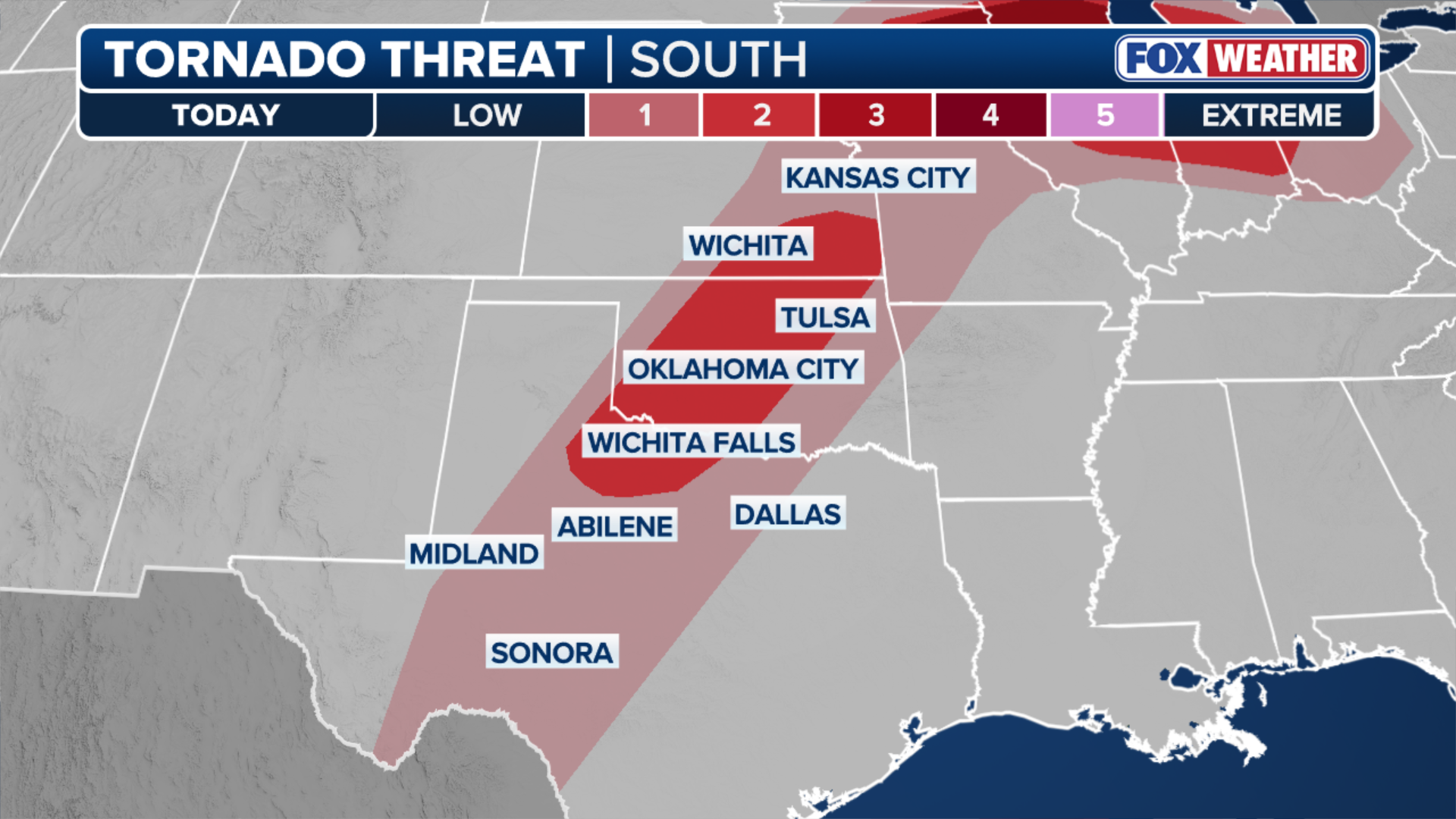
(FOX Weather)
Storms that produced damaging hail across the Midwest on Monday tracked into Upstate New York late Tuesday morning and reached New England Tuesday evening.
A Level 2 severe storm threat includes Burlington, Vermont, Albany, New York and Scranton, Pennsylvania, with damaging wind gusts being the main hazard with the potential for isolated tornadoes.
Wednesday: Third round of storms for Central US; potential for flash flooding
On Wednesday, storms are expected to shift toward the Mississippi River Valleys, with the possibility for damaging wind gusts, hail and tornadoes primarily across a corridor that includes the Plains, the Midwest, the Great Lakes and the Ohio Valley.
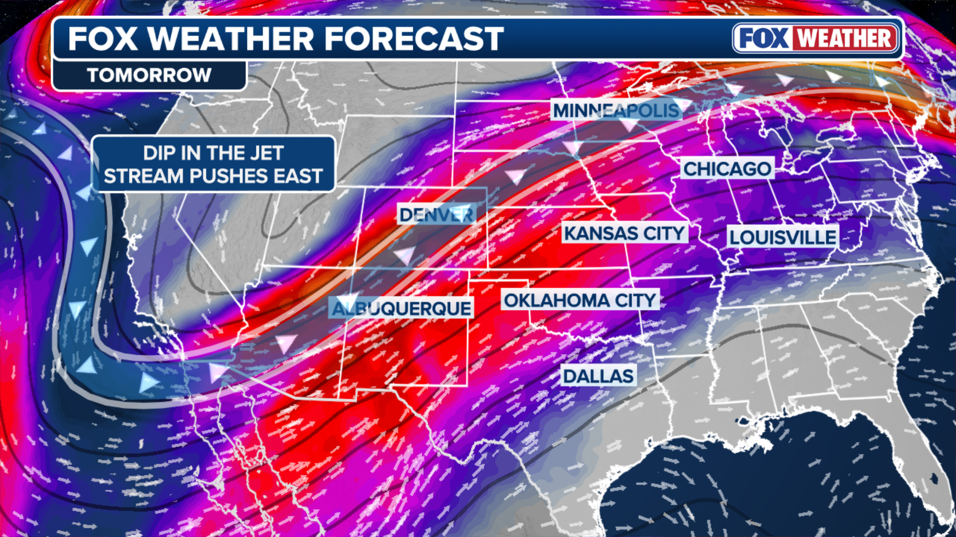
(FOX Weather)
In addition to the severe component, thunderstorms will release heavy moisture from the atmosphere, leading to downpours producing 1 to 2 inches of rain.
Localized flooding was reported in Oconto, Kewaunee and Brown counties in Wisconsin Tuesday, when officials said numerous roads were flooded and vehicles were stranded.
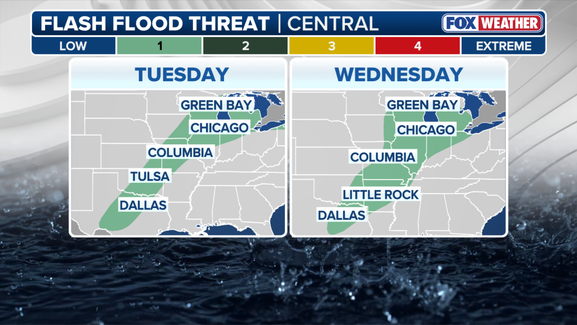
(FOX Weather)
A Level 1 out of 4 risk of flash flooding covers that same corridor from Texas to western New York.