Severe storm threat brewing for nearly 50 million across Midwest, Ohio Valley ahead of winter flashback freeze
Behind the cold front driving Thursday's storms, much of the Midwest and Northeast could see temperatures drop back into the 30s and 40s.

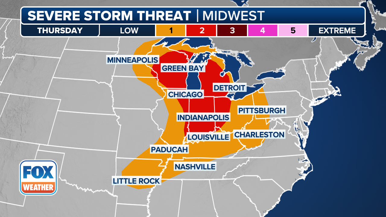
Severe weather threat for Midwest, Ohio Valley ramping up for Thursday
Dangerous hail, strong gusty winds and even some tornadoes are possible across Illinois, Indiana and Ohio during severe storms on Thursday evening. The Storm Prediction Center upgraded the risk for parts of the region to a level 3 out of 5, and warned hail 2+ inches in diameter are possible.
Severe storms will target nearly 50 million people beginning Thursday afternoon across parts of the Midwest and Ohio Valley with hail, damaging wind gusts and possibly tornadoes, as a cold front sweeps through the region leaving frigid winter-like temperatures in its wake.
WINTER DELIVERS FINAL PUNCH TO NORTHEAST WITH SNOW AS HEAVY RAIN TARGETS THE SOUTHEAST
The system will race south and east through Thursday night, reaching the Mid-Atlantic by Friday morning. Widespread soaking rain is expected for much of the East Coast through Friday, causing potential travel delays even as storms become less severe.

(FOX Weather)
A strengthening dip in the jet stream over eastern Canada will drive the cold front through the Great Lakes and into the Ohio Valley, as the system moves around a large heat dome that is currently baking the western part of the country.
Thunderstorms are expected to develop along this cold front beginning Thursday afternoon.
The Storm Prediction Center issued a 3 out of 5 severe risk for areas in eastern Illinois, northern Indiana and parts of western Ohio for Thursday. Cities in the level 3 area include Peoria, Illinois, Indianapolis and Fort Wayne.
A Level 2 out of 5 risk of severe thunderstorms covers most of eastern Illinois, Indiana, southern Michigan and western and central Ohio. This includes the area just east of St. Louis, as well as the Chicago and Columbus, Ohio metro areas.
(FOX Weather)
The main hazard associated with these storms will be large, egg-sized hail, but a tornado cannot be ruled out — particularly across Illinois and Indiana.
Depending on exactly when storms develop Thursday afternoon, rain and severe weather could impact several Major League Baseball's Opening Day games, specifically the Chicago Cubs hosting the Washington Nationals, as well as games being hosted in Cincinnati and St. Louis.
HAWAII RECOVERS FROM DEVASTATING FLOODS AFTER BACK-TO-BACK KONA LOW SYSTEMS DRENCH STATE
Severe storms will persist through the night as the front moves south and east.

(FOX Weather)
With slower moving storms as the cold front slows down slightly into Thursday night, flash flooding is possible. Rainfall rates are expected to increase overnight from Western Pennsylvania into central Illinois, and a widespread 1 to 2 inches of rain is likely.
SPLIT IN THE POLAR VORTEX COULD MEAN ONE LAST HURRAH FOR WINTER ACROSS THE NORTHERN TIER
As the front pushes south into the Southeast by Saturday, thunderstorms may linger, although they are expected to weaken.

(FOX Weather)
Winter's last gasp
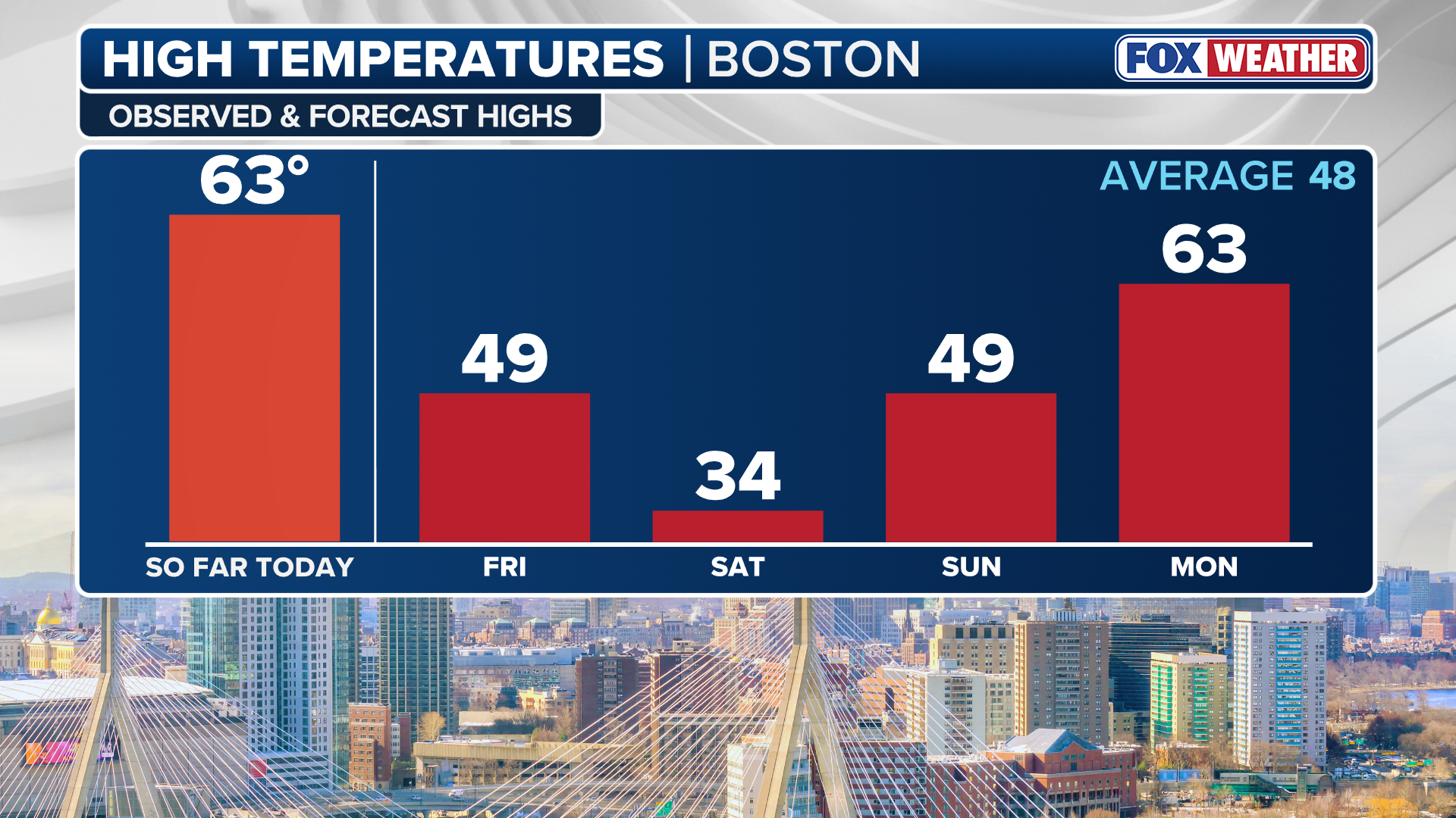
As we approach Thursday, temperatures will continue to feel more like spring, or even summer, for millions across the Midwest, Mid-Atlantic and parts of the Northeast.
Cities such as New York City and Detroit will climb into the mid to upper 60s, while areas such as St. Louis and Columbus, Ohio, could be even warmer, flirting with the upper 80s to near 90 degrees.
U.S. COAST GUARD RESCUES 7 PEOPLE AND A DOG AFTER THE WORST FLOODING IN 20 YEARS HITS HAWAII
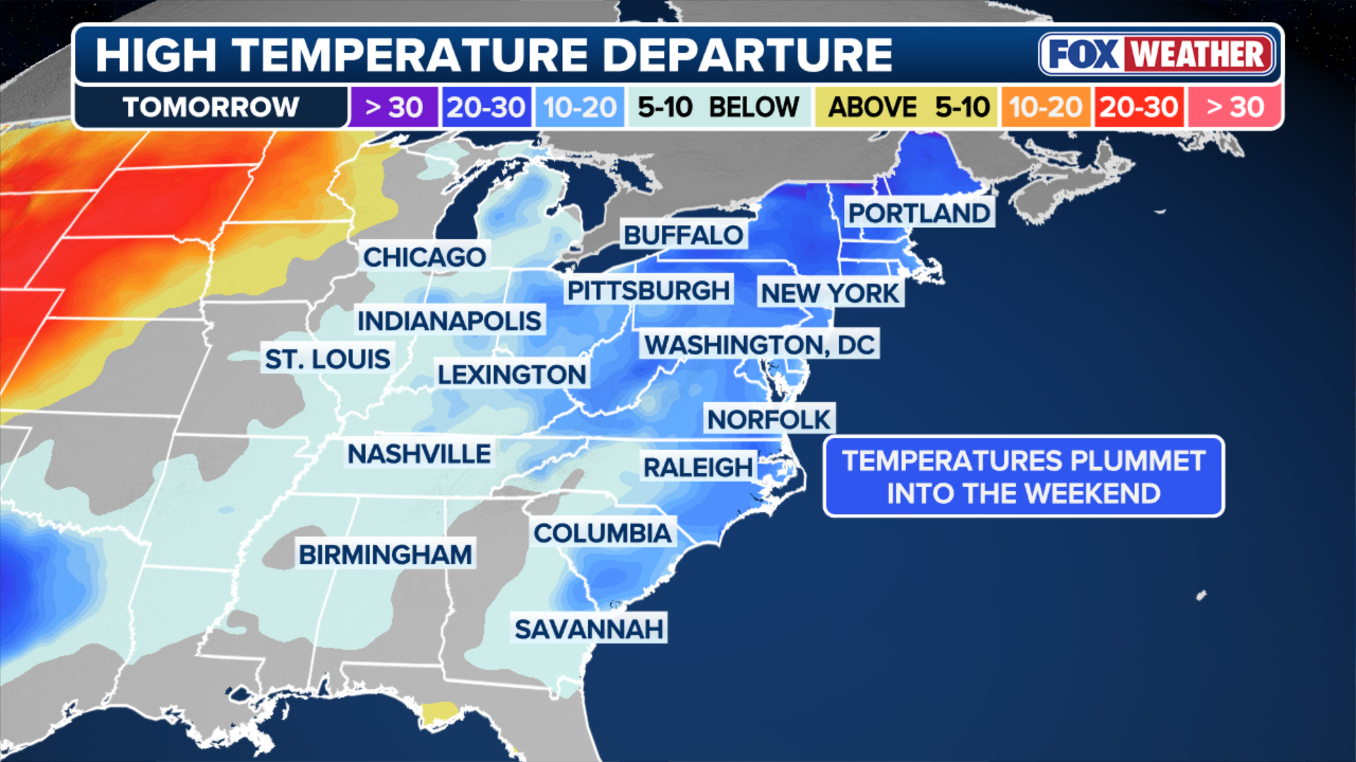
Behind the system, much colder air will surge in. A steady northerly wind will pull in the colder air, plummeting temperatures.
(FOX Weather)
After nearly 300 million Americans experience above-average temperatures on Thursday, that number will drop sharply by Saturday, when nearly 160 million will be below average. High temperatures on Friday and Saturday be about 10 to 15 degrees below average for late March.
Temperatures across the Northeast and Great Lakes will drop into the 30s and 40s on Saturday, while the Mid-Atlantic will fall back into the 50s after experiencing 70-degree days earlier.
Wind chills could make it feel more like the teens and single digits across interior portions of the Northeast, according to the FOX Forecast Center.
(FOX Weather)
Millions of people are expected to wake up to below-freezing temperatures and gusty winds to start the weekend.
This frigid air will continue into Sunday, as high pressure builds in, causing a calm and crisp end to the week.
Check back for updates on this developing story.