

This nor’easter may follow the same path as Superstorm Sandy, but it’s nothing like it
The potential impacts have led some to compare the upcoming nor’easter to Superstorm Sandy that crashed ashore near Atlantic City, New Jersey, on Oct. 29, 2012.
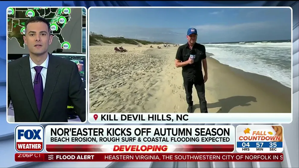
Brewing nor'easter off to a strong start to begin fall
NOR'EASTER TRACKER 🌀: FOX Weather Senior Correspondent Robert Ray reports from Kill Devil Hills, North Carolina, where waves are beginning to surge amid developing nor'easter conditions this week.
THE TAKEAWAY
- The first nor’easter of the fall is developing and is raising questions about whether the storm could become another Superstorm Sandy.
- The two storms are fundamentally different, aside from both impacting the Northeast and having non-tropical characteristics during part of their life cycles.
The first nor’easter of the fall is developing, bringing gusty winds and rain to parts of the East Coast and raising questions about whether the storm could become another Superstorm Sandy.
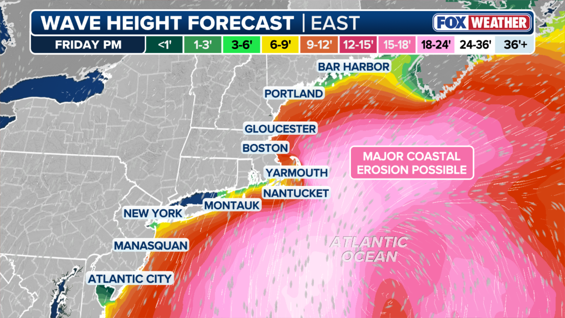
The storm is forecast to bring a prolonged period of pounding surf, significant beach erosion and coastal flooding, with impacts beginning days before the nor’easter tracks northward toward the Northeast.
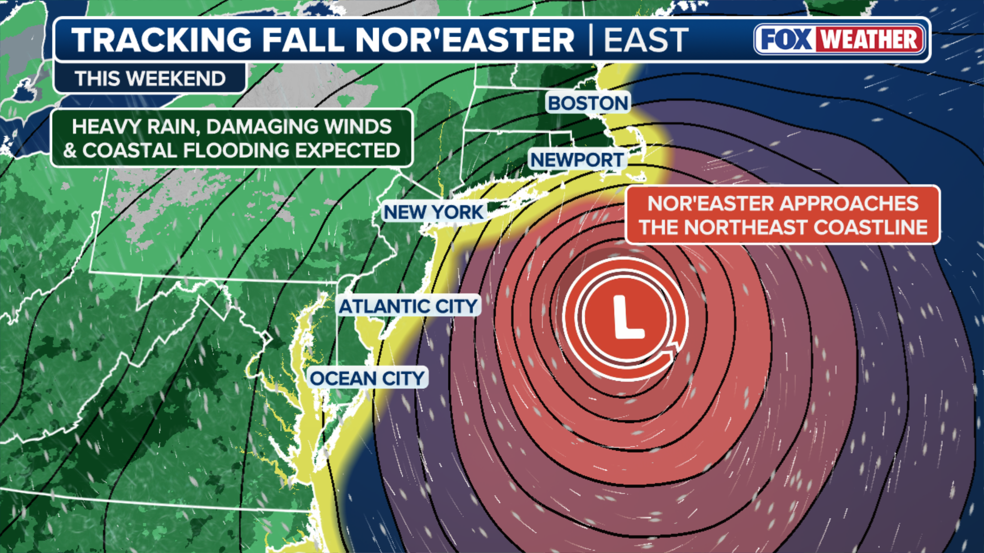
(FOX Weather)
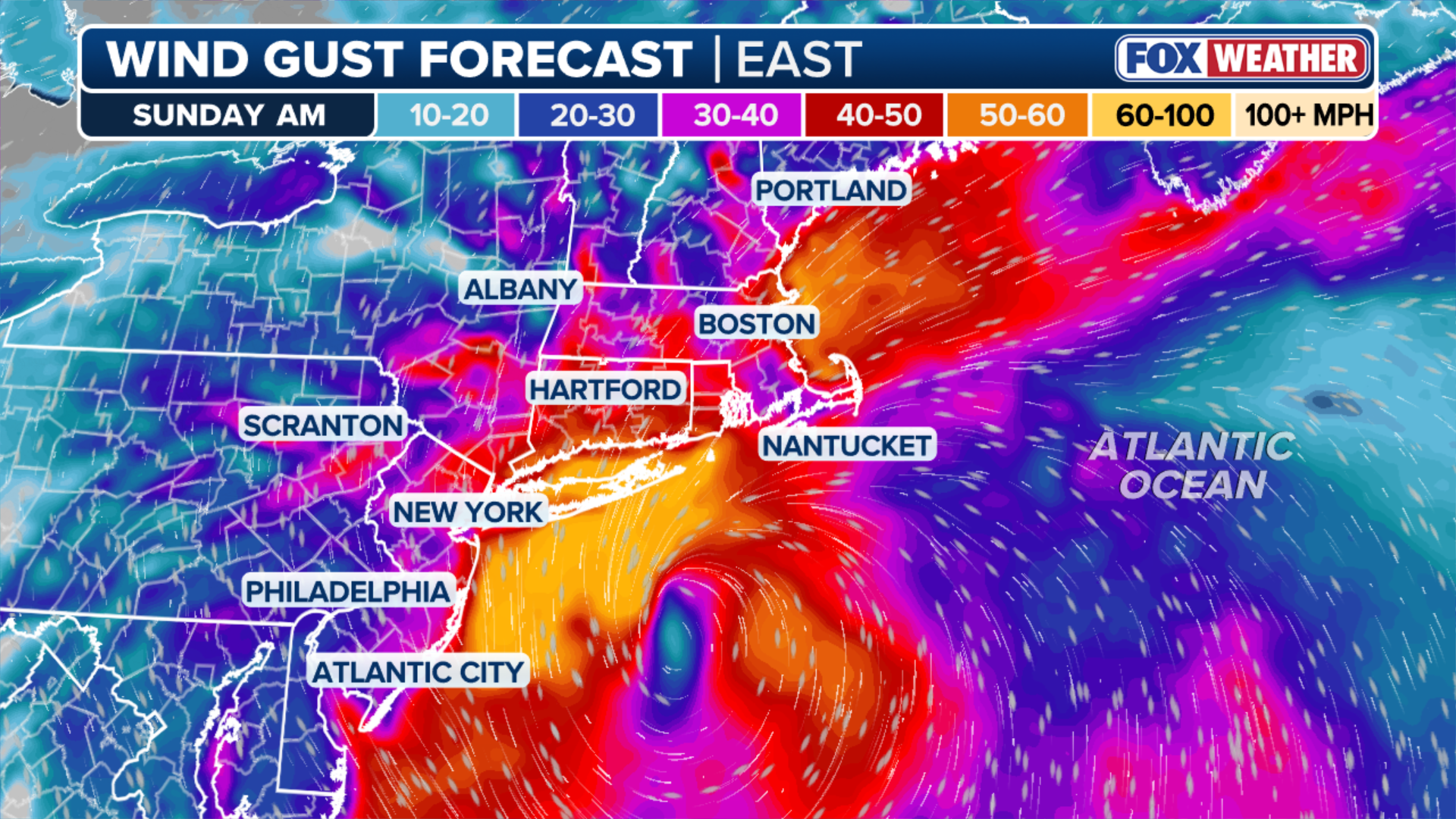
Once the storm strengthens near New England, a tightening pressure gradient is expected to bring the strongest winds to the region, with wind gusts potentially exceeding 60 mph and waves reaching 15 to 18 feet along the coast.
Peak onshore winds, high astronomical tides and trapped coastal water could create the greatest risk for significant coastal inundation and structural flooding along east-facing shores, including Boston Harbor, Cape Cod and the North and South shores.
WHAT IS COASTAL EROSION AND WHY IS IT DANGEROUS?
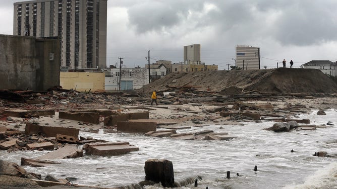
![]() Image 1 of 5
Image 1 of 5People stand on a mound of construction dirt to view the area where a 2,000-foot section of the "uptown" boardwalk was destroyed by flooding from Hurricane Sandy on October 30, 2012 in Atlantic City, New Jersey. (Mario Tama)
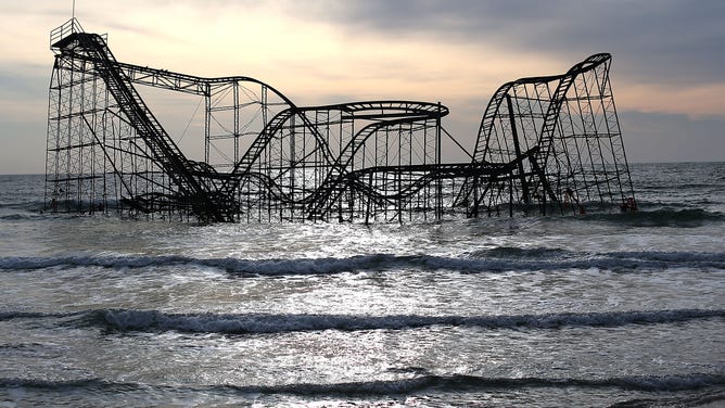
![The Star Jet roller coaster remains in the water after the Casino Pier it sat on collapsed from the forces of Superstorm Sandy.]() Image 2 of 5
Image 2 of 5The Star Jet roller coaster fell into the water after the Casino Pier it sat on collapsed from the forces of Superstorm Sandy in Seaside Heights, New Jersey. (Mark Wilson)
![Superstorm Sandy wiped out many homes in NYC's Breezy Point borough with both water and fire.]() Image 3 of 5
Image 3 of 5Superstorm Sandy wiped out many homes in NYC's Breezy Point borough with both water and fire. (Robert Nickelsberg)
![]() Image 4 of 5
Image 4 of 5Kenneth Miller's flooded home in Waretown, New Jersey after Superstorm Sandy. (Kenneth Miller)
![Aerial views of a house that was moved off its foundation and sits in the middle of the bay near Mantaloking, New Jersey after Superstorm Sandy hit.]() Image 5 of 5
Image 5 of 5Aerial views of a house that was moved off its foundation and sits in the middle of the bay near Mantaloking, New Jersey after Superstorm Sandy hit. (Debra L Rothenberg)
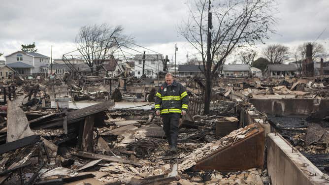
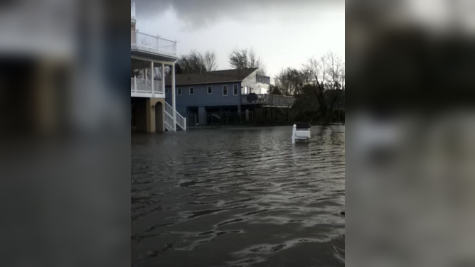
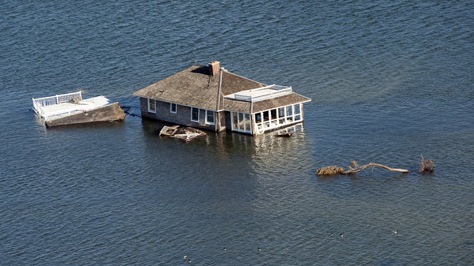
Those potential impacts have led some to compare the upcoming nor’easter to Superstorm Sandy that crashed ashore near Atlantic City, New Jersey, on Oct. 29, 2012.
However, the two storms are fundamentally different, aside from both impacting the Northeast and having non-tropical characteristics during part of their life cycles.
7 FACTS YOU SHOULD KNOW ABOUT FLASH FLOODS
Superstorm Sandy began as a powerful tropical cyclone before transitioning into a post-tropical storm shortly before making landfall. The storm was then pulled westward toward New Jersey by an upper-level trough of low pressure oriented from the northwest to the southeast.
A similarly positioned trough could potentially pull the upcoming nor’easter closer to the coast.
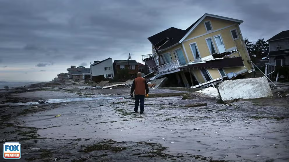
Superstorm Sandy (2012)
Superstorm Sandy was an entirely different storm when its effects were felt in New England.
Other than that, the two storms are very different.
Superstorm Sandy was a Category 3 hurricane at its peak before transitioning into a powerful post-tropical system. The upcoming nor’easter will be a non-tropical area of low pressure from the start as it develops off the East Coast.
WHAT MAKES A STORM A NOR'EASTER?
Sandy was also much more powerful than the nor’easter is expected to be. Its central pressure dropped to 940 millibars at landfall, while the nor’easter’s lowest pressure is expected to remain above 980 millibars.
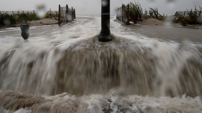
Waters from Hurricane Sandy start to flood Beach Ave. on October 29, 2012 in Cape May, New Jersey. Later today the full force of Hurricane Sandy is expected to hit the New Jersey coastline bringing heavy winds and floodwaters.
(Mark Wilson / Getty Images)
Sandy also had a massive wind field, with tropical storm-force winds extending more than 1,100 miles. At one point, wind gusts of at least 40 mph were recorded across 20 states, stretching from Florida to Maine and to Wisconsin.
The upcoming nor’easter is expected to produce over 40 mph wind gusts across roughly eight to 10 states at most.
NOR'EASTER LIVE TRACKER: FUTURE RADAR, WINDS, STORM SURGE, RAIN AND ALERTS
(FOX Weather)
When Sandy reached the Northeast, the storm produced wind gusts of up to 95 mph and generated catastrophic storm surge along the coasts of New Jersey and New York. Water levels reached as high as 12 feet above normally dry ground in some locations.
TIMELINE: HERE'S WHERE AND WHEN MAJOR US CITIES WILL SEE IMPACTS FROM THE DEVELOPING NOR'EASTER
Sandy also produced waves as high as 30 feet along the coast, triggering a storm surge that destroyed more than 600,000 structures in New York and New Jersey alone.
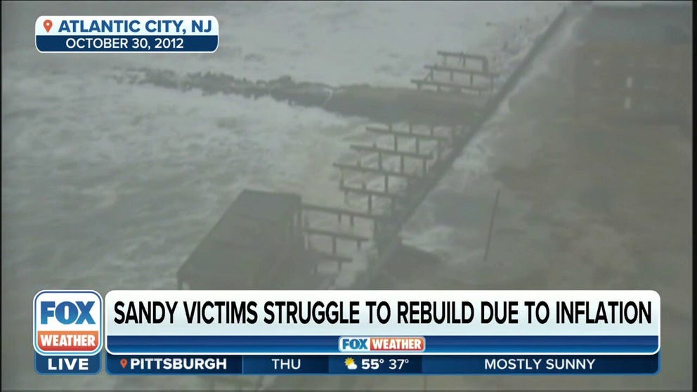
Superstorm Sandy's impact on New Jersey 10 years later
Joe Mangino, Sandy Survivor/ Founder of Jersey Organizing Project, reflects on the impact Sandy has had on him 10 years later and how his organization is continuing to help victims of the storm.
The upcoming nor’easter is expected to be hard-pressed to produce wind gusts of 70 mph on land and is forecast to bring minor to moderate coastal flooding, with water levels likely no more than about 3 feet above normally dry ground.
SUPERSTORM SANDY 10-YEAR ANNIVERSARY: WHY THE 2012 SUPERSTORM WAS SO DESTRUCTIVE IN THE NORTHEAST
The worst coastal flooding is expected to occur Wednesday, before the nor’easter even fully develops. Water levels are expected to rise no more than about 4 feet above normally dry ground.
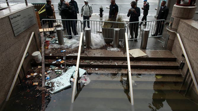
Water floods the Plaza Shops October 30, 2012 in lower Manhattan, New York.
(Allison Joyce / Getty Images)
Unlike Sandy, the upcoming nor’easter is not expected to cause widespread structural damage from coastal flooding, and peak waves along the coast are forecast to remain between 15 and 20 feet.
While the upcoming storm could still produce dangerous conditions along the East Coast, its expected strength and impacts are significantly different from those of Sandy.
(FOX Weather)
Superstorm Sandy was a historic tropical cyclone that formed in the central Caribbean on Oct. 22, 2012, before intensifying into a hurricane as it tracked north toward the U.S., passing over Jamaica, eastern Cuba and the Bahamas.
Sandy transitioned into a post-tropical cyclone just before making landfall near Atlantic City, New Jersey, on the evening of Oct. 29, 2012.
WILL THE MONSTER NOR'EASTER CANCEL YOUR WEEKEND PLANS? HERE'S WHAT TO KNOW
The New York City tri-state area and Jersey Shore were struck by the storm's core, but Sandy's impacts extended thousands of miles from its center.
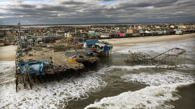
Waves break in front of a destroyed amusement park wrecked by Hurricane Sandy on October 31, 2012 in Seaside Heights, New Jersey.
(Mario Tama / Getty Images)
Kings Point, New York, on the north shore of Long Island, recorded a massive storm surge of 12.65 feet. In Manhattan, the water level at The Battery climbed to nearly 14 feet.
Closer to Sandy's landfall location, the casino-lined boardwalk in Atlantic City suffered significant damage as nearly 9 feet of water inundated the barrier island.
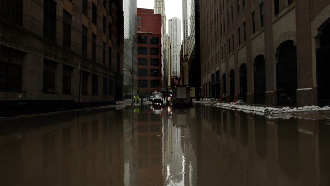
Water floods a street in October 30, 2012 in lower Manhattan, New York.
(Allison Joyce / Getty Images)
The iconic boardwalk in Seaside Heights, New Jersey, was also destroyed after it was unable to withstand Sandy's intense storm surge, with sections collapsing into the ocean.
THE LATEST FROM FOX WEATHER HURRICANE SPECIALIST BRYAN NORCROSS
By the time the storm had dissipated, Sandy had killed 159 people and caused billions of dollars in damage across the Caribbean and the U.S.
The storm was ranked as one of the deadliest billion-dollar weather disasters to hit the U.S.