Massive lake-effect snowstorm dumps feet of snow, shatters records in Syracuse with more coming in Great Lakes
New York State of Emergency remains due to ongoing dangerous lake effect snow & high winds that could knock out power and grind travel to a halt.

Lake-effect snow breaks records in Syracuse, New York, as more is set to slam the Great Lakes today
Severe winter weather continues across the Great Lakes after Syracuse received 2 feet of lake-effect snow Tuesday, marking its second-snowiest day on record. Gusty winds and a fast-moving clipper are expected to intensify snowfall and worsen travel conditions.
NEW YORK - After more snow bombarded the Great Lakes, portions of New York could continue to see feet of snow on New Year’s Day, as gusty northwest winds from the east will continue to usher in cold air, creating the perfect conditions for a heavy lake-effect storm.
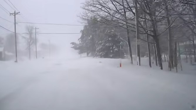
Parts of western and upstate New York, downwind of Lake Erie and Ontario, have already seen over a foot of snow, some even two, as a State of Emergency remains in New York.

New York top snow totals within the past 24 hours
(FOX Weather / FOX Weather)
Travel conditions are expected to be treacherous, as whiteout conditions caused dangers to the roads and sky yesterday, with the strong winds expected to trigger more today.
The eastern shores of Lake Michigan, parts of upstate New York and northwestern Pennsylvania could see 3 to 5 inches, with portions of Pennsylvania already seeing up to 9 inches.
Dangerous snow blankets Michigan during post-holiday winter storm
(Brandon Copic / FOX Weather)
While downwind of lakes Erie and Ontario, including areas just south of Buffalo, NY, and southward into Erie, PA, Syracuse and the Tug Hill Plateau could see even higher amounts, with localized totals of 12 to 18 inches.
Syracuse has already received 2 feet of snow yesterday, making it its second-snowiest day on record and the area could see up to another foot of snow by Saturday.
The storm caused low visibility and wind gusts up to 70 mph near the lake shores.
Governor Hochul continues to urge New Yorkers in affected areas to avoid travel and if possible, work from home, as treacherous roads and near whiteout conditions are expected.
Whiteout conditions are expected in several areas of Western and Central New York tomorrow, especially in the Syracuse-metro area.
— Governor Kathy Hochul (@GovKathyHochul) December 29, 2025
If you're in an impacted area, please avoid all unnecessary travel, follow the direction of local authorities, and telecommute whenever possible. https://t.co/LwYP72f6XU
As of Monday, more than 7,500 utility workers were engaged in damage assessment, response, repair and restoration efforts, stated Hochul.
Coastal flooding is also possible in some areas as the strong winds push the water levels above normal.
WHAT TO DO DURING A WINTER STORM POWER OUTAGE
Not only is New York under a State of Emergency, Winter Storm Warnings continue throughout portions of the state and Pennsylvania.

The amount of snow expected to impact the Great Lakes this week
(FOX Weather / FOX Weather)
According to the FOX Forecast Center, a dip in the jet stream settled just south of the Northern Tier, causing the northwest flow to continue to funnel air over the warmer water of the Great Lakes.
NYS has expanded the State of Emergency due to ongoing lake effect snow & high winds.
— NYSDOT (@NYSDOT) December 29, 2025
Hazardous travel and near whiteout conditions are expected for WNY, the Finger Lakes, CNY, and the North Country. Avoid travel and work from home if possible. More: https://t.co/lVNgX8GW88 pic.twitter.com/xOu1OhWKeN
Several weaker disturbances embedded within the jet stream will track from west to east, supplying additional moisture and potentially enhancing snowfall across the Great Lakes and upstate New York through the end of the week.
On New Year’s Eve into early New Year’s Day, a weaker clipper is expected to move south from Canada through the Great Lakes, increasing the intensity of snowfall across western New York and portions of eastern Lake Erie.
This could even extend further into the Northeast, bringing lighter, decorative flakes to New York City and Boston.

People walk across the Bow Bridge in a snow-covered Central Park in New York City on December 27, 2025. New York City received around 4 inches (10 centimeters) of snow overnight. Airlines canceled 1,500 US flights during the peak holiday travel period Friday, with severe winter storm warnings and heavy snow forecast across parts of the Midwest and northeast. (Photo by TIMOTHY A. CLARY / AFP via Getty Images)
(Photo by TIMOTHY A. CLARY / AFP via Getty Images / Getty Images)
This could cause a post-holiday travel headache as millions are expected to travel on New Year’s Eve and New Year’s Day.
SNOW POSSIBLE IN NEW YORK CITY AND BOSTON FOR NEW YEAR'S EVE CELEBRATIONS
Be sure to stay with FOX Weather for continuous coverage tracking the latest with the lake-effect snowstorm.