Powerful storms slam central US with hurricane-force wind gusts, teacup-sized hail
Tornado Watches were in place for nearly 10 states, from Texas to Wisconsin, on Monday evening. The threat of severe storms continued overnight and into the early hours of Tuesday.

Severe storms erupt across Central US with threat of tornado outbreak
Heading into Monday night, thunderstorms are charging across a large swath of the country from Texas to the Dakotas. FOX Weather Meteorologist Steve Bender says these storms have yet to get their act together but the threat of large hail and tornadoes remains through Monday night.
Fast Facts:
- Supercell thunderstorms were forecast to produce very large hail, damaging winds and strong tornadoes.
- The risk of strong tornadoes continued into early Tuesday morning for parts of Iowa, Minnesota and Wisconsin.
- Tornado Watches were issued from Texas to Wisconsin.
MINNEAPOLIS – Powerful thunderstorms slammed the central U.S. from the Plains to the Upper Midwest on Monday evening, with officials in numerous communities warning residents to brace for storms capable of producing very large hail, damaging wind gusts and strong tornadoes.
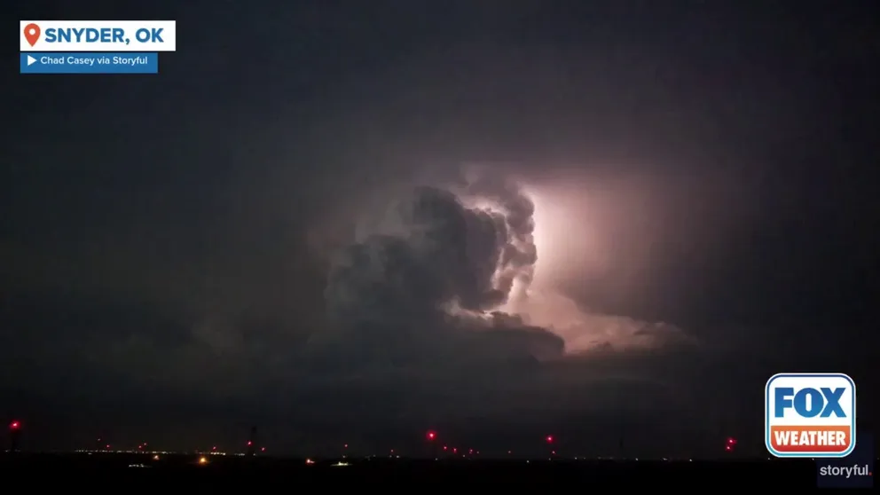
Watch: Timelapse video shows severe thunderstorm producing vivid lightning above Oklahoma town
A dramatic timelapse video recorded in Snyder, Oklahoma, shows a powerful thunderstorm producing vivid lightning as the storm swept across the area on Monday, April 28, 2025.
Storms continued to fire up late Monday night and moved across the region into the early hours of Tuesday. The greatest impacts came from large hail, strong winds and heavy rain.
Tornado Watches were in place for nearly 10 states, from Texas to Wisconsin, on Monday evening.

Watch: Funnel cloud spotted spinning above Wisconsin town
A video shared from Augusta, Wisconsin, shows a funnel cloud spinning across the region as severe weather slammed the state on Monday, April 28, 2025.
Officials in Eau Claire County in Wisconsin said emergency crews were responding to multiple locations that suffered damage from the storms on Monday.
Officials said there was a lot of debris, and residents were urged to avoid the area.
A video recorded in Augusta, Wisconsin, in Eau Claire County, showed a funnel cloud spinning toward the ground when severe weather was moving through.
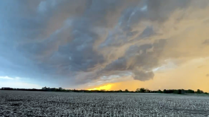
![A severe weather system against the dryline in northeast Kansas on Monday, April 28, 2025.]() Image 1 of 3
Image 1 of 3A severe weather system against the dryline in northeast Kansas on Monday, April 28, 2025. (Mark Sudduth)
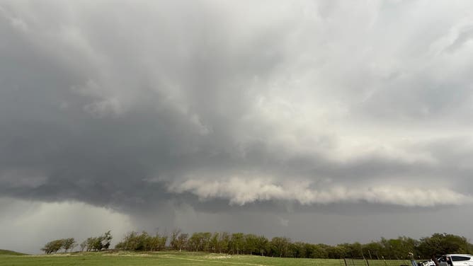
![Storm clouds in Junction City, Kansas on April 28, 2025.]() Image 2 of 3
Image 2 of 3Storm clouds in Junction City, Kansas on April 28, 2025. ( Andrew Pritchard)
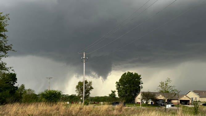
![Storm clouds seen in Junction City, Kansas on Monday, April 28, 2025 during severe thunderstorms.]() Image 3 of 3
Image 3 of 3Storm clouds seen in Junction City, Kansas on Monday, April 28, 2025 during severe thunderstorms. (KansasStormSpot/X)
On Monday evening, reports of large hail and strong winds came in from Kansas, Minnesota and South Dakota. FOX Weather Storm Chaser Mark Sudduth was in Westmoreland, Kansas, when massive hail pounded his chaser vehicle.
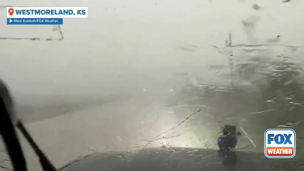
Crazy hail storm pounds Kansas during severe weather
FOX Weather Storm Chaser Mark Sudduth found himself smack in the middle of a hail storm in Westmoreland, Kansas during a severe weather event unfolding across the Central U.S. on Monday, April 28, 2025.
According to storm reports received by the National Weather Service, 3-inch hail fell in Mangum, Oklahoma. That's the size of a teacup.
Baseball-sized hail was also reported in Beaver Creek, Minnesota, and Abilene, Kansas.
A 74-mph wind gust was reported in Gruver, Iowa, which is as strong as a Category 1 hurricane.
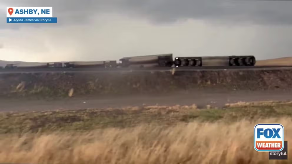
Watch: Possible tornado blows train off tracks in Nebraska
An empty coal train was thrown off its tracks in Ashby, Nebraska, during a Tornado Warning on Sunday. Footage from Alyssa James shows dark storm clouds looming over Nebraska State Highway 2.
Monday's threat came after severe weather plowed across portions of the Plains on Sunday, including in Nebraska. A dramatic video recorded near the communities of Bingham and Ashby shows a massive wedge tornado spinning across the landscape.
Another video showed a train that derailed due to the tornado's powerful winds near Ashby.
Multiday severe weather threat extends into Tuesday

(FOX Weather)
The multiday severe weather threat will continue into Tuesday, putting even more people at risk of extreme weather.
SEVERE WEATHER THREAT SPANS 2,000 MILES FROM NEW YORK TO TEXAS ON TUESDAY PLACING 73 MILLION AT RISK
More than 73 million people from Texas to the Northeast will be at risk of severe weather. However, the highest threat will be centered from Indiana and Ohio to western Pennsylvania and western and central New York, as well as portions of Texas and Oklahoma, where NOAA's Storm Prediction Center has posted a Level 3 out of 5 risk.
These Level 3 risk zones include more than 21 million people in cities such as Columbus and Cleveland in Ohio, Pittsburgh in Pennsylvania and Rochester in New York.