Rounds of fast-moving clippers blast millions across Great Lakes with snow as active La Niña winter rages on
Through the week, major cities like Minneapolis, Chicago, Buffalo, New York and Cleveland are in the bullseye to see the highest snow totals.

Fast-moving clippers bring more snow to Northern Tier
Fast-moving clippers will bring even more snow to the Northern Tier throughout the week, with the first round already bringing 8 inches to portions of Iowa and a Winter Weather Advisory to Chicago. This is the country’s earliest extensive snow coverage for the start of season since 2019. Watch FOX Weather to stay updated as this parade of storms moves across the U.S.
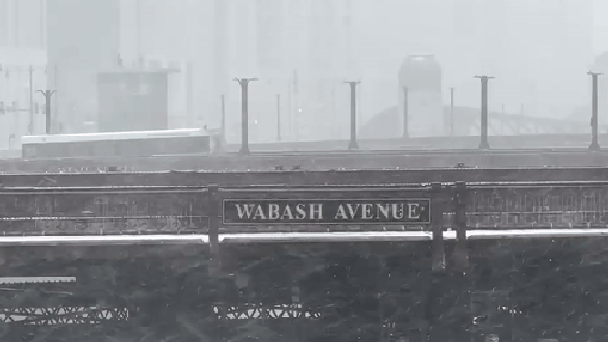
CHICAGO — The active December winter weather pattern fueled in part by La Niña is bringing another round of fast-moving snowstorms across the Northern Plains, Midwest and Northeast through this week.
The start of meteorological winter, which officially began last Monday, has already seen a cross-country winter storm and systems that have delivered feet of lake-effect snow.
FIRST SNOW OF LA NIÑA WINTER BLASTS MILLIONS IN MID-ATLANTIC, UNLEASHING HAZARDOUS TRAVEL CONDITIONS
The first clipper is racing into the Northern Plains, Midwest and Ohio Valley through Monday. Snow totals in the Midwest are projected to remain limited to 3–5 inches of new snow through Monday, including Chicagoland.
![]() Image 1 of 4
Image 1 of 4A snowplow drives down a street during a snowstorm in Chicago, Illinois, US, on Saturday, Nov. 29, 2025. Hundreds of flights have been canceled in and around Chicago and roads are becoming treacherous as one of the busiest travel weekends of the year collides with a major storm bringing wintery conditions throughout the US Midwest Saturday. (Getty Images)
![Snow covered vehicles parked on a street during a snowstorm in Chicago, Illinois, US, on Saturday, Nov. 29, 2025. Hundreds of flights have been canceled in and around Chicago and roads are becoming treacherous as one of the busiest travel weekends of the year collides with a major storm bringing wintery conditions throughout the US Midwest Saturday.]() Image 2 of 4
Image 2 of 4Snow covered vehicles parked on a street during a snowstorm in Chicago, Illinois, US, on Saturday, Nov. 29, 2025. Hundreds of flights have been canceled in and around Chicago and roads are becoming treacherous as one of the busiest travel weekends of the year collides with a major storm bringing wintery conditions throughout the US Midwest Saturday. Photographer: Jim Vondruska/Bloomberg via Getty Images (Photographer: Jim Vondruska/Bloomberg via Getty Images)
![COLONIE, NY - FEBRUARY 6: An American Airlines jet is guided to the gate at Albany International Airport during a winter storm on Tuesday, Dec. 2, 2025, in Colonie N.Y.]() Image 3 of 4
Image 3 of 4COLONIE, NY - FEBRUARY 6: An American Airlines jet is guided to the gate at Albany International Airport during a winter storm on Tuesday, Dec. 2, 2025, in Colonie N.Y. ((Will Waldron/Albany Times Union via Getty Images))
![Washington, DC declared a snow emergency to go into effect Tuesday night.]() Image 4 of 4
Image 4 of 4Washington, DC declared a snow emergency to go into effect Tuesday night. (@MayorBowser)


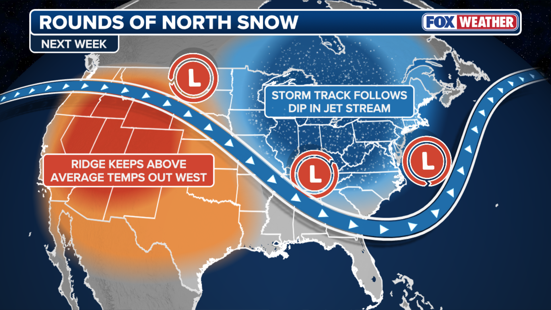
An expansive ridge of high pressure over the Pacific Northwest intensified this weekend and is acting like a conveyor belt, directing the bulk of incoming Pacific moisture over a large dip in the jet stream.
The snow continues in the Windy City - at least 4 inches @fly2ohare #ORD #Chicago @foxweather pic.twitter.com/Jg7zCeRowD
— Robert Ray (@RobertRayWx) December 7, 2025
This moisture is tapping into arctic air spilling in from Canada to produce several fast-moving snowstorms, known as clippers.
(FOX Weather)
Chicago has received 9 inches of snow above average for this time of year and has not seen this much snow year-to-date since 2018.
By Tuesday, another clipper is forecast to develop over southern Canada and track into the Upper Midwest.
Scenic shot of heavy snowfall in Chicago.
(Robert Ray / FOX Weather)
While uncertainty remains regarding its exact path and intensity, computer forecast models are confident that it will be another fast-moving storm.
VOLUNTEER FIREFIGHTER RESCUES WEST VIRGINIA DRIVER FROM DANGLING TRUCK
Current indications suggest the heaviest snow will fall across the Great Lakes region and far northern New England per the FOX Forecast Center.

(FOX Weather)
By midweek another blast of cold air from Canada is expected to settle across that same area, providing ideal snowmaking conditions for ski resorts.
ANOTHER ROUND OF EXTREME ARCTIC AIR TO INVADE NATION
Once this cold air is established, a third clipper system could move through the area on Thursday and Friday, again affecting parts of the Midwest.
Through the week, cities most likely to see accumulating snow include Minneapolis, Chicago, and Buffalo, New York.

(FOX Weather)
Cleveland could see snow every day next week.
People in states from North Dakota through Ohio and into Maine should monitor the latest forecast.