Snow, ice create slippery roads Wednesday afternoon across northern New England
Winter Weather Advisories and a Winter Storm Warning have been issued in northern Maine, where snow, sleet and/or freezing rain could lead to a dicey Wednesday evening commute.
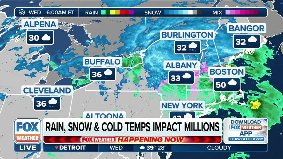
Snow, ice create slippery commute from upstate New York to interior New England
After dropping the first snow of the season for millions, a fall storm will be playing its final act as snow, sleet and freezing rain create hazardous travel conditions Wednesday morning.
A fall storm tracking across the U.S. this week has brought the first measurable snow of the season to millions of people from the Midwest to the interior Northeast, and this system's final chapter is now creating slippery roads Wednesday afternoon as a wintry mix continues across northern New England.
Winter Weather Advisories and a Winter Storm Warning have been issued by the National Weather Service in northern Maine, where snow, sleet and/or freezing rain could lead to a dicey Wednesday evening commute.

(FOX Weather)
Between 1 and 3 inches of snow is expected across the lower elevations in northern New England, while 3 to 8 inches could fall in the higher elevations of the White Mountains of New Hampshire.
In northern Maine, where the Winter Storm Warning is in effect, some spots could see 6 to 12 inches of snow by Wednesday night.
"We're off to a good start in terms of getting some snow on the ground, but of course, it is going to be a mess of (an evening drive), so lots of extra time needed," FOX Weather meteorologist Britta Merwin said.
WHEN IS THE EARLIEST IT CAN SNOW IN YOUR CITY?
Meanwhile, areas along the coast in northern New England will see rain instead of snow or ice, including cities such as Manchester in New Hampshire and Portland in Maine. A narrow corridor of sleet and freezing rain is possible right along the transition line between rain and snow.
According to the FOX Forecast Center, any freezing rain could provide a light glaze of ice, making roads extra slick Wednesday afternoon and evening, particularly across the higher elevations of the White Mountains of New Hampshire and portions of northern Maine.

(FOX Weather)
The storm system is expected to move out of the Northeast Wednesday night, with a long-duration lake-effect snow event then developing across the typical Great Lakes snowbelts from Thursday through the weekend.
WHAT ARE THE WORST AIRPORTS TO FLY INTO DURING WINTER?
For many areas of the country, this fall storm provided the season's first measurable snow, defined as an accumulation of at least 0.1 inches.
Pennsylvania has reported the highest snowfall totals so far, where more than 5 inches was measured in State College.

(FOX Weather)