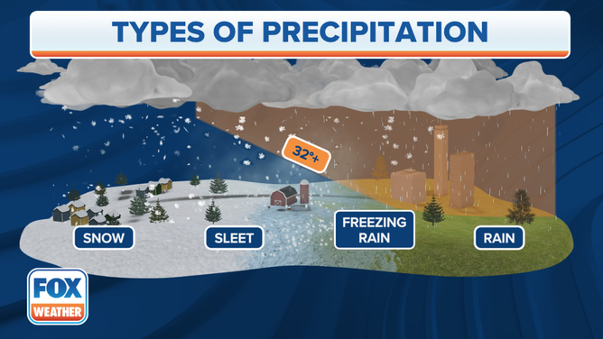
Snow, sleet, freezing rain and hail: What's the difference?
Depending on the journey through the atmosphere, it could be snow, hail, sleet, or freezing rain falling from the sky. Three of those require winter storm ingredients but hail can happen any time of year.
Snow, sleet, freezing rain and hail: What's the difference?
Three of the four listed need it to be a winter storm, but one can happen year-round -- even in the summer.
A storm has passed through, and the ground is covered in frozen precipitation, which, depending on its journey through the atmosphere, could be snow, hail, sleet, or freezing rain.
Three of the four listed require winter storm conditions, but one can happen year-round—even in the summer.
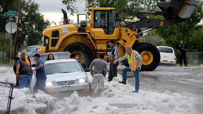
Snowstorm? Nope -- it's hail! Crews from Denver Public works to assist people as they dig out from several feet of hail that fell and pooled at the intersection and in the surrounding area.
(Kathryn Scott Osler/The Denver Post)
What makes Snow?
Snow is the most common, of course. Snowflakes form when water vapor freezes directly to ice while skipping the part of being a raindrop first.
"Snowflakes that most of us are used to seeing are not individual snow crystals but are actually aggregates, or collections, of snow crystals that stick or otherwise attach to each other," according to NOAA. "Aggregates can grow to very large sizes compared to individual snow crystals."
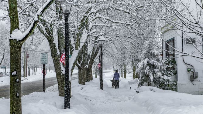
A woman walks her dog on a snow-covered sidewalk in Milford, Pennsylvania.
(Preston Ehrler/SOPA Images/LightRocket / Getty Images)
Precipitation remains snow as long as the air mass stays below freezing throughout the snowflake's journey from cloud to ground.
It begins to snow between 18,000 and 25,000 feet in the upper atmosphere, and the precipitation changes based on the air it encounters. If the air remains below 32 degrees, it will fall to the ground as snow.
HOW COLD DOES IT HAVE TO BE TO SNOW?
If warmer air starts to intrude into the region, then things get dicey.
How do freezing rain and sleet form?
Both sleet and freezing rain start with a snowflake that melts into a raindrop as it encounters a slice of warmer air on its free-fall through the atmosphere. But if there is a renewed area of freezing temperatures near the ground, the drop will refreeze.
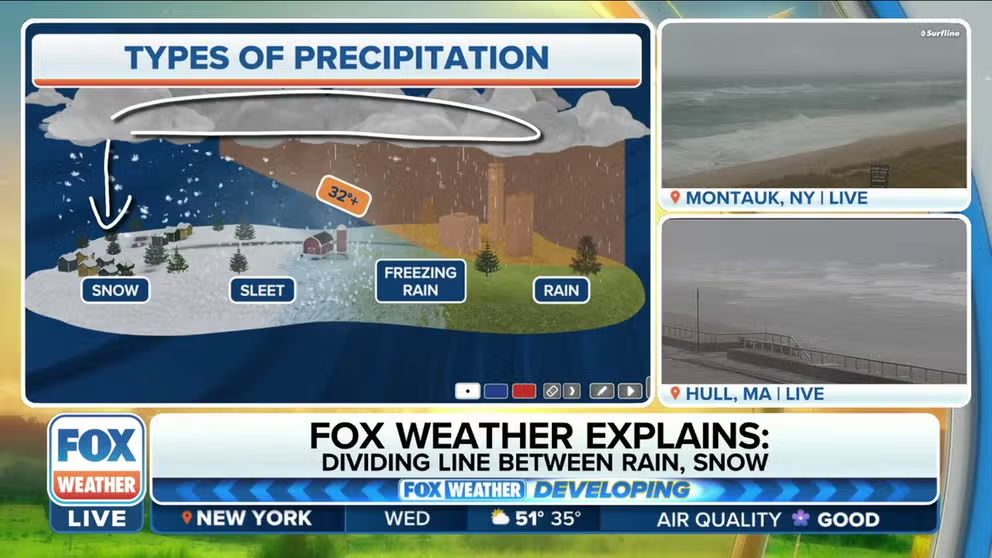
FOX Weather Explains: Dividing line between snow, sleet and freezing rain
FOX Weather's Jason Frazer explains the dividing line between snow, sleet and freezing rain.
If the wedge of warm air is relatively narrow and the area of freezing air is fairly thick, the raindrop will have time to freeze back into an ice pellet. This is known as sleet (or on weather observations as "ice pellets" or "P").
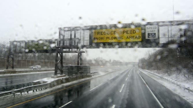
Signs advise motorists to reduce speed as severe weather conditions, including sleet snarl traffic and cause accidents on the Interstate 95 highway between Trenton, NJ and Newark, NJ, on March 2, 2019.
(Bastiaan Slabbers/NurPhoto / Getty Images)
Sleet can accumulate on the ground, but it is like stepping on zillions of tiny frozen raindrops.
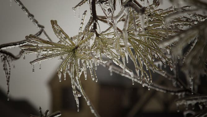
Thick ice coats a tree after an ice storm on November 28, 2015 in Edmond, Oklahoma.
(J Pat Carter / Getty Images)
Freezing rain comes when the wedge of warm air is relatively thick, and the area of freezing air hugging the ground is shallow. In this case, the raindrop doesn't have quite enough time to freeze into a solid but instead becomes "supercooled" to the cusp of freezing.
Once it hits the surface, it will instantly freeze to wherever it landed.
(FOX Weather)
This process will result in freezing rain, or part of an "ice storm," and can be the most dangerous frozen precipitation. If you ever see a weather observation with the code "ZR," it's short for "freezing rain."
Unlike sleet, which is more of an accumulation of pellets, freezing rain creates an icy glaze and turns streets and sidewalks into increasingly-thick sheets of ice, making driving and walking quite treacherous.

The fire truck spins on an icy neighborhood road in Imperial, Missouri. Jan. 22, 2025.
(Katelynn Voisey via Storyful / FOX Weather)
What's worse, the ice is transparent, and many unsuspecting drivers can find themselves hurtling forward with no traction and no way to control their vehicle if they suddenly reach a road that was just hit by a freezing rain event.
Some of America's worst crashes, involving dozens to hundreds of cars, have happened in freezing rain events.
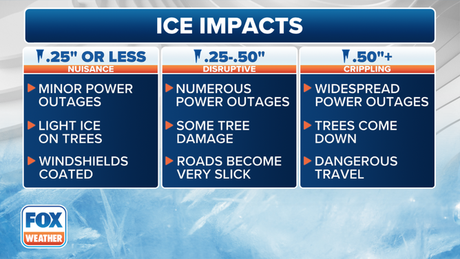
Impacts from various thicknesses of ice accretion.
(FOX Weather)
HOW MUCH ICE IS NEEDED TO KNOCK OUT POWER, DAMAGE TREES?
Freezing rain will also coat tree branches and power lines, and if enough weight accumulates, it can topple them both, leading to widespread power outages and tree damage.
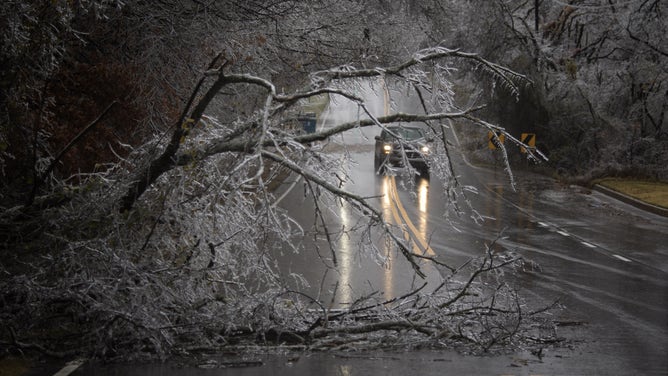
A truck makes its way around a downed ice-covered tree limb covering much of the roadway on November 28, 2015, in Edmond, Oklahoma.
(J Pat Carter / Getty Images)
Simply put: Freezing rain and ice storms are a mess and require extreme caution during these events.
What makes hail?
Hail is the one frozen precipitation that can fall no matter the date on the calendar or the temperature outside.
Hail refers to balls of ice that can range from the size of a pea to a volleyball, and fall from a cumulonimbus (thunderstorm) cloud.
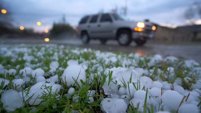
Two overnight storms produce hail, some reported to be as large as tennis balls, on March 17, 2016 in Fort Worth, Texas.
(Rodger Mallison/Fort Worth Star-Telegram/Tribune News Service / Getty Images)
Hailstones’ sizes are dependent on the strength of the storm's updraft.
WHAT CAUSES DIFFERENCES IN HAIL SIZE?
A raindrop freezes into an ice pellet and then falls, picking up raindrops through warmer sections of the cloud until it hits the updraft and gets blown skyward where that extra water freezes, making the hail larger and heavier before it falls again.
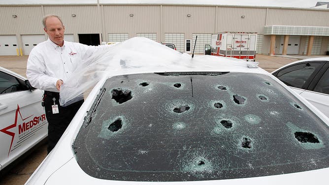
Matt Zavadsky of MedStar, ambulance service, shows hail damage on a response vehicle at their main office on Thursday, March 17, 2016 in Fort Worth, Texas.
The process repeats until the hailstone is heavier than the updraft can support, and then it falls to the ground.
Updrafts of 50-plus mph can create huge hailstones that are golf ball, baseball-sized or even "gargantuan"-sized.
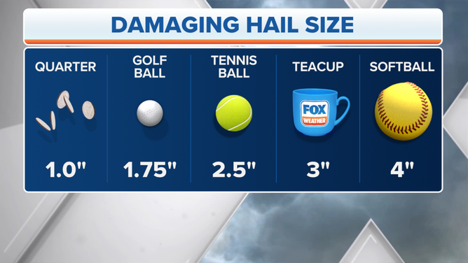
The chart above will assist you in estimating hail size.
(FOX Weather)