The Daily Weather Update from FOX Weather: Cross-country storm to impact millions across US this week
Start your day with the latest weather news – A powerful storm will bring a variety of impactful weather across the U.S. this week, beginning with heavy snow and possible blizzard conditions out West.
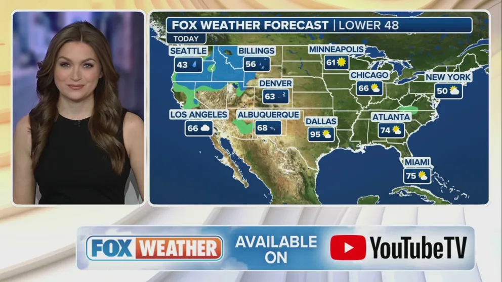
Weather in America: February 26, 2024
FOX Weather has you covered with the breaking forecasts and weather news headlines for your Weather in America on Monday, February 26, 2024. Get the latest from FOX Weather Meteorologist Britta Merwin.
Welcome to the Daily Weather Update from FOX Weather. It’s Monday, Feb. 26, 2024. Start your day with everything you need to know about today's weather. You can also get a quick briefing of national, regional and local weather whenever you like with the FOX Weather Update podcast.
Cross-country storm begins assault in Western mountains
The FOX Forecast Center is tracking a powerful cross-country storm that is impacting the West to begin the workweek. It's expected to dump feet of snow across the various mountain ranges in the region and could even produce blizzard conditions in some of the higher elevations.
The Cascades in Washington and Oregon are expected to be hit especially hard by winter weather, as this will be the most impactful storm since early January. The FOX Forecast Center said there is a high chance of more than 2 feet of snow through Tuesday at elevations above 1,500 feet.
However, higher mountain passes in Washington, including Snoqualmie Pass, and Oregon could see locally as much as 4 feet of snow as the storm blasts through the West on its way to the Midwest later this week.
Lowering snow levels will also bring some light snowfall down to the valley floors from Monday night into Tuesday morning, potentially including portions of the Interstate 5 corridor between Seattle and Portland, Oregon.

(FOX Weather)
Severe weather threatens nearly 45 million in Midwest by Tuesday
As the cross-country storm advances off to the east, it will bring the risk of severe weather to major cities in the Midwest like St. Louis, Chicago and Indianapolis by Tuesday.
Severe thunderstorms threaten nearly 45 million people from parts of the mid-Mississippi Valley through the southwestern Great Lakes from late Tuesday afternoon into the evening and overnight hours.
Strong to severe storms that develop will be capable of producing large hail, damaging wind gusts and a few tornadoes.

(FOX Weather)
Soaring temps could shatter over 300 temperature records this week
An unseasonable warmup will continue to spread throughout most of the U.S. this week, with high temperatures from Texas to the Midwest feeling more like May than the end of meteorological winter.
Hundreds of temperature records are expected to fall through midweek, with Monday and Tuesday forecast to be the warmest days across the Plains and Midwest. On Monday, more than 250 million Americans will experience above-average temperatures.
When combining the expected number of record highs and record-warm lows, more than 300 temperature records could be matched or broken between Monday and Wednesday.

(FOX Weather)
Watch this
A waterfall illuminated by the sun at the exact right time created the illusion of lava from a volcano flowing down the side of El Capitan at Yosemite National Park in California, and the spectacular and popular event at the national park was captured in a mesmerizing time-lapse video last week.

Watch: Spectacular time-lapse video shows Firefall in all its glory
Time-lapse video shows the mesmerizing Firefall at Horsetail Fall, a seasonal waterfall within Yosemite National Park. Firefall occurs when the sun is setting and sends beams of light shining down to give the illusion that a river of molten lava is flowing off El Capitan.
Before you go
Here are a few other stories we think might interest you.
- Some major East Coast cities are sinking as sea levels rise, study finds
- Which US counties are most at risk of tornado damage?
- Photos from Odysseus Moon lander expected soon, even if it's tipped over
- Female great white shark found dead on Florida Panhandle beach
Need more weather? Check your local forecast plus 3D radar in the FOX Weather app. You can also watch FOX Weather wherever you go using the FOX Weather app, at foxweather.com/live or on your favorite streaming service.
It’s easy to share your weather photos and videos with us. Email them to weather@fox.com or add the hashtag #FOXWeather to your post on your favorite social media platform.