Some major East Coast cities are sinking as sea levels rise, study finds
Charleston, South Carolina, a city of 800,000 people, is one of the fastest-sinking cities on the East Coast, according to researchers.
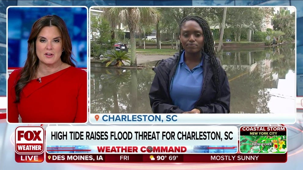
High tide raises flood threat for Charleston, SC
File: Coastal concerns extend along the Atlantic seaboard all the way to the Carolinas and Florida. It’s a variety of issues from persistent winds, leftover energy from last weekend's tropical storm and one culprit that exaggerates the problem -- the full moon which leads to king tides. FOX Weather's Brandy Campbell is live from Charleston, South Carolina, with the latest.
Satellite imagery taken of the U.S. East Coast shows major regions are sinking, which scientists warn could threaten infrastructure, farmland and wetlands for more than a 2,000-mile stretch of coastline.
A study conducted by Virginia Tech’s Earth Observation and Innovation (EOI) Lab, found that most coastal communities are sinking at a rate of 1-2 millimeters (0.04-0.08 inches) per year, but in areas of the Carolinas and mid-Atlantic, the rate could be near 4 mm (0.16 inches) or even more.
Some of the many impacted communities include New York; Baltimore; Norfolk, Virginia; and Charleston, South Carolina.
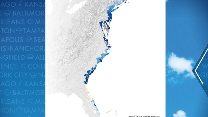
A map showing annual vertical motion of land along the East Coast of the U.S.
(NASA)
"Subsidence is a pernicious, highly localized, and often overlooked problem in comparison to global sea level rise, but it’s a major factor that explains why water levels are rising in many parts of the eastern U.S.," Leonard Ohenhen, a geophysicist at Virginia Tech, said in a statement.
According to NOAA, subsidence can either be caused by natural changes in the terrain or by human actions. Removing water, minerals or other resources from the ground can cause terrain to shift and slowly sink.
The combination of the sinking terrain and impacts from melting ice and rising sea levels can cause significant flooding of low-lying coastal communities.
According to the study, some 77-99% of interstate highways and between 81-99% of railways along the East Coast are subject to some magnitude of subsidence, which could be a strain on the economy.
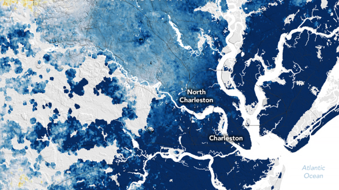
A map showing the annual vertical motion of land in the Charleston, South Carolina, area.
(FOX Weather)
Charleston is one the fastest-sinking cities in America
According to researchers, Charleston, South Carolina, is one of the fastest-sinking cities on the East Coast. The city of 800,000 people is estimated to be sinking at a rate of about 4 mm (0.16 inches) per year.
While residents may not notice the drop of 1-2 inches every decade, the increase in sunny-day flooding is just one of the noticeable impacts. Flooding, outside the effects of a major storm system, that used to occur just once or twice a year could increase in frequency to about 2-3 months a year by 2050 in the Lowcountry.
To try to combat some of the flooding, the City of Charleston and the Army Corps of Engineers are negotiating to construct an 8-mile seawall. The price of the protection isn’t cheap, and it won’t come quickly. According to the Corps, the price tag will likely be more than $1.1 billion and will take several years to complete.
NEW FORECAST CONE TO BE TESTED BY NATIONAL HURRICANE CENTER DURING 2024 SEASON

Rendering of future Charleston, South Carolina, seawall.
(U.S. Army Corps of Engineers / FOX Weather)
Gulf Coast to be studied next
NASA said the next project will be to map out the Gulf Coast as it, too, faces significant impacts from subsidence.
Separate studies have highlighted Louisiana and Houston as being at risk of significant sinking.
University of Houston researchers previously found parts of the Lone Star State sank by as much as 3.5 inches between 2016 and 2020.
"Our long-range goal is to map all of the world’s coastlines using this technique," Manoochehr Shirzaei, a co-author of the East Coast study and director of the EOI Lab, stated. "We know that planners in several U.S. cities are already using our data to make our coastlines more resilient, and we want cities all over the world to be able to do the same."
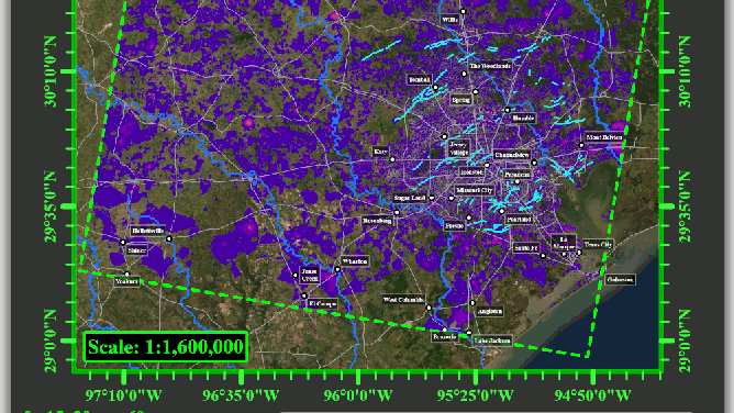
This animation depicts subsidence over time in the Houston area from 2016 to 2020.
(University of Houston)