Damage reported after tornadoes rumble across Midwest, Ohio Valley
The combination of springlike ingredients across the Midwest triggered thunderstorms from Tuesday into early Wednesday, with millions being put under severe weather alerts.
Severe thunderstorms slam Ohio Valley with wind damage, possible tornadoes
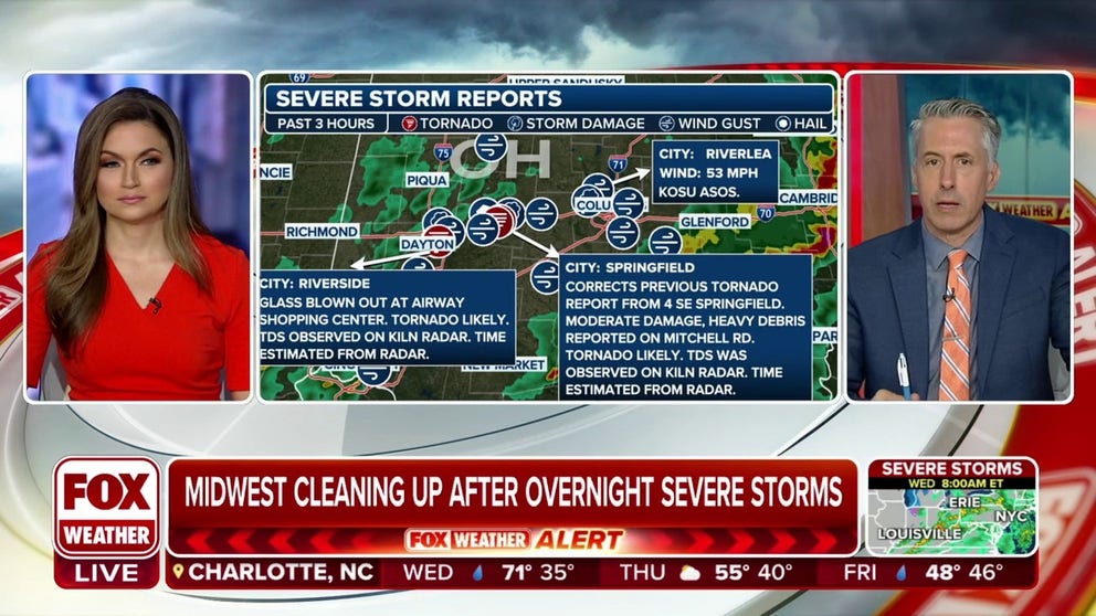
More than two-dozen Tornado Warnings dotted Illinois and the Ohio Valley into Wednesday morning with some tornado damage reported near Dayton and Springfield, Ohio.
SPRINGFIELD, Ohio – Over a million people across central Ohio, including Columbus, were awakened Wednesday morning by blaring weather alarms and urgent instructions to seek shelter as a line of severe thunderstorms triggered numerous Tornado Warnings.
While Columbus appears to have escaped any damage, a handful of tornadoes were reported in Illinois, Indiana and Ohio between Tuesday evening and early Wednesday morning.
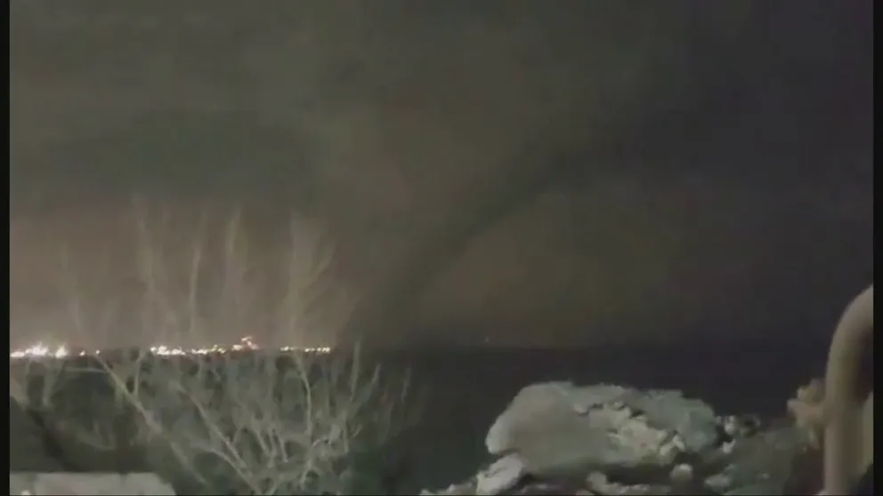
Watch: Video shows tornado near Gary, Indiana
A video recorded during severe weather in Indiana on Tuesday night shows a tornado spinning near Gary.
At least 4 tornadoes reported in Ohio
A spotter near Springfield, Ohio, reported a likely tornado strike with moderate damage, including damage to multiple homes, southeast of town.
"We did have reports of a woman trapped in that home," FOX 45 Dayton reporter Malena Brown told FOX Weather as she showed video of a damaged home. "Fortunately, she was able to get out safely."
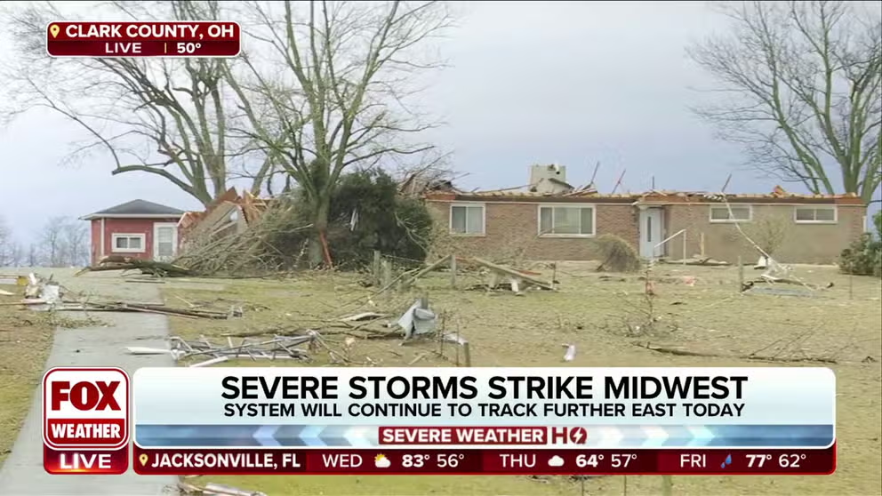
Tornado causes damage near Springfield, Ohio
A tornado swept through Clark County, Ohio early Wednesday morning, causing damage to a handful of homes, but luckily no one was injured.
In the Dayton area, a possible tornado blew out glass at the Airway Shopping Center, with likely tornado-caused tree damage nearby, according to National Weather Service storm reports. Strong thunderstorms knocked a large tree into a home near Huber Heights.
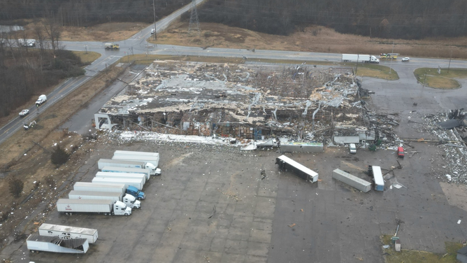
Significant damage was reported at Wright-Patterson Airforce Base, east of Dayton.
Damage assessments were ongoing on Wednesday, but photos showed significant damage to at least one hanger.
![Wright-Patterson Airforce Base damage]() Image 1 of 3
Image 1 of 3Wright-Patterson Airforce Base damage (Wright-Patterson Airforce Base)
![Wright-Patterson Airforce Base damage]() Image 2 of 3
Image 2 of 3Wright-Patterson Airforce Base damage (Wright-Patterson Airforce Base)
![Wright-Patterson Airforce Base damage]() Image 3 of 3
Image 3 of 3Wright-Patterson Airforce Base damage (Wright-Patterson Airforce Base)


Tornado Warnings also wailed in Columbus before dawn Wednesday as the line of thunderstorms moved through. Columbus’ John Glenn Airport urged travelers in the terminal to seek shelter while the warning was in effect.
The threat had passed through Columbus by about 6 a.m. EST, but the dangerous line of thunderstorms along a potent cold front was still pushing east through Ohio and Kentucky into the late morning, triggering additional Severe Thunderstorm Warnings.
EF-2 tornado reported in southeast Michigan
The tornado that tore through a community outside of Detroit was given an initial rating of an EF-2 with winds of 115 mph.
Grand Blanc Township said several homes and businesses were heavily damaged in the storm, but there were no reported fatalities.
Drone video showed significant damage to a warehouse in the township with several tractor trailers that were flipped during the rare winter event.
According to the local NWS office, the twister was the second-ever tornado to touch down in southeast Michigan during February.
Tornado damage in Grand Blanc Township, Michigan
(Grand Blanc Township, Michigan / FOX Weather)
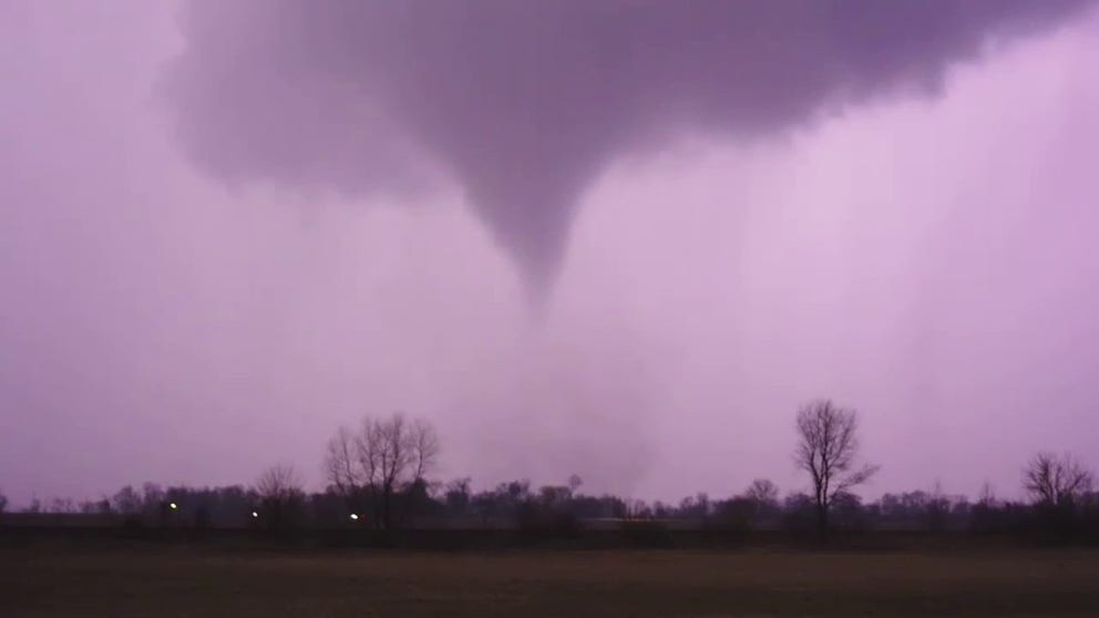
Tornadoes first strike Illinois, Indiana Tuesday night
A combination of springlike ingredients across the Midwest with warm, moist unstable air colliding with an encroaching cold front triggered the initial round of thunderstorms Tuesday, with millions being put under severe weather alerts. Nearly 30 Tornado Warnings and almost 100 Severe Thunderstorm Warnings had been issued for the storm system through mid-Wednesday morning.
The first Tornado Warning of the event was issued for Henry County, Illinois, which is located along Interstate 80 between the Quad Cities and Chicago. Rotation in the supercell was radar indicated, and sizable hail was also reported.
Storm spotters witnessed a twister on the ground near the town of Atkinson, Illinois, but there were no initial reports of widespread damage in the community.
Tornado-warned storms rumble through Northern Illinois
A series of tornado-warned storms rolled through Northern Illinois on Tuesday evening. The storms triggered some communities to sound warning sirens
Photos from about 6 miles away in the town of Annawan, Illinois, showed a much different story.
The National Weather Service received reports of damage to farms and planned to dispatch a team to investigate how strong the possible tornado was.
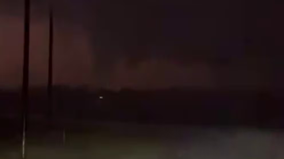
Watch: Likely tornado illuminated by lightning near Hinckley, Illinois
Video recorded near Hinckley, Illinois, shows what appears to be a tornado being illuminated by lightning during severe weather on Tuesday night.
Another tornado was sighted near Gary, Indiana.
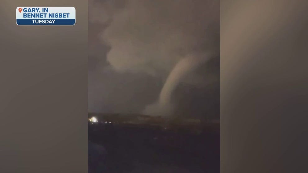
Watch: Nighttime video shows tornado sweeping across landscape near Gary, Indiana
Dramatic video recorded near Gary, Indiana, shows a tornado sweeping across the landscape during severe weather in the Midwest and Ohio Valley Tuesday night.
Tornado Warnings were also issued north of Chicago and included Cook, DuPage and Lake counties. Some communities in the warned area sounded tornado sirens late Tuesday evening. One of those communities was Arlington Heights, outside of Chicago.
In all, the local NWS reported nearly a dozen tornadoes impacted the Chicagoland region, but damage was relatively sporadic.
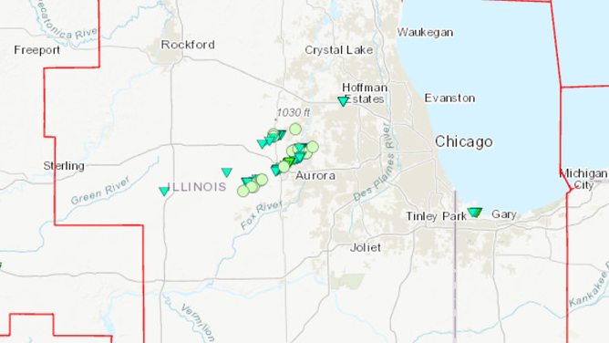
NOAA damage assessment map after tornadic thunderstorms on Feb. 27
(NOAA)
All of the twisters were either rated an EF-0 or an EF-1 on the Enhanced Fujita Scale, which means winds never topped more than 110 mph.
A large tree was reported down in the Hoffman Estates area, and a peak of around 10,000 power outages were reported Tuesday evening.

Wind damage in Hoffman Estates, Illinois.
(@NathanHansen_Wx / FOX Weather)
Out of abundance of caution, a ground stop was issued at Chicago's O'Hare International Airport and Midway International Airport.
As is common during threats of severe weather, the control tower at O'Hare was briefly evacuated as workers and travelers were urged to seek shelter during the storm.
Air traffic was able to resume after the storm pushed eastward out over Lake Michigan, but hundreds of flights were delayed or canceled into the major airports.
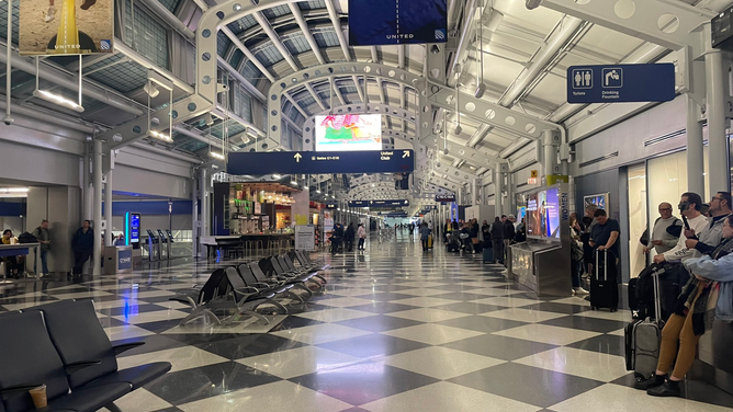
Chicago O'Hare storm impacts
(Michael O’Neil / FOX Weather)
The severe weather threat in the Midwest was over by mid-morning Wednesday, replaced by a blast of cold air as the cold front swept through. Temperatures had been in the mid- to upper 60s in Chicago before the storms Tuesday but had plummeted to the lower 20s by late Wednesday morning. Similar stories of 30-50 degree drops or more in just hours were common across the northern Plains and Great Lakes.
Meanwhile, the line of storms that wreaked havoc Wednesday morning was on its way to the Northeast, where it was set to cause more mayhem later Wednesday.