What is a cold front?
It might be self explanatory when you ask yourself what a cold front is, but in actuality, there is a lot more going on.
When looking at a surface map of an area or even the entire United States, it can be quite confusing with multiple lines, temperatures, and other variables.
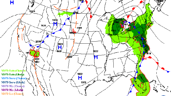
Surface map for Sept. 21, 2021. (Photo: Weather Prediction Center/NOAA)
Something easy to find if there is a lot going on the map is a cold front. If it is an active weather day, it is often associated with an area of low pressure or an ‘L’ on the map.
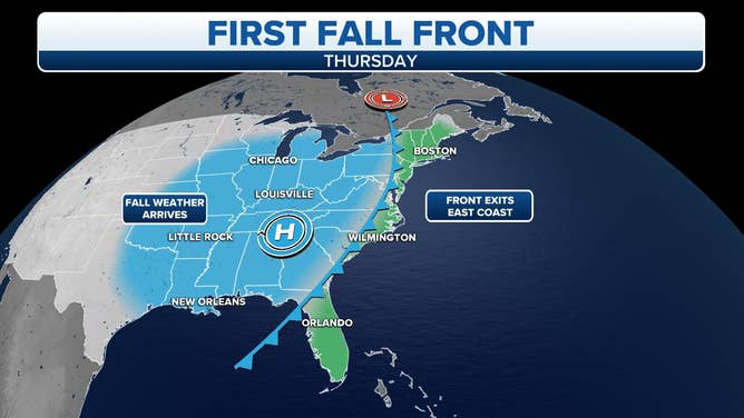
A cold front will usher in the first real taste of fall by the end of this week.
(FOX Weather)
It might be self-explanatory when you ask yourself what a cold front is, but in actuality, there is a lot more going on.
Let's start with the basics:
What does it look like?
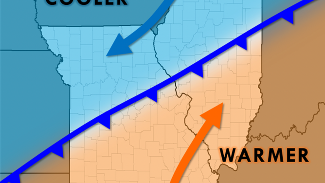
A cold front is depicted on a map with a blue line with triangles. The direction of where the triangles are pointing is where that front is headed.
(Photo: NWS St. Louis)
Notice the temperatures behind the cold front are colder than the temperatures ahead of it.
How does a cold front form?
A cold front forms when a cold mass of air pushes into a warmer mass of air.
What happens as it moves through?
As the cold front moves through a region, the cold air (denser and heavier), pushes the warmer air (lighter and less dense) up into the troposphere. Once this warm air rises, it creates clouds and even thunderstorms. If it is a strong cold front, some of those thunderstorms may become severe, producing large hail, gusty winds, and even the possibility of a tornado if conditions are right.

3D image of a cold front (Photo: National Weather Service)
What happens once it has passed?
The air behind the front is noticeably colder and drier. Clouds usually dissipate behind the front and you are left with clear skies.