Winter storm blankets Texas, snarls travel in Dallas before chugging east
The Dallas-Fort Worth Metroplex saw a mix of snow, sleet and freezing rain Thursday, canceling schools across the region and scrubbing over 1,600 flights at Dallas-Forth Worth International (DFW) and Dallas’ Love Field - nearly half their daily air traffic

Winter storm threatens nearly 90 million from Dallas into the mid-Atlantic
Winter Storm Warnings cover 16 states as several inches of snow spread across the nation's mid-section Thursday into the Eastern Seaboard by the weekend.
DALLAS – Nearly 90 million Americans are under winter weather alerts as another high-impact storm is blasting across the nation's midsection, snarling travel with several inches of snow and glazes of freezing rain and sleet.
The incoming storm is affecting cities farther south than the most recent winter storm that blasted a 1,000-mle stretch from Kansas City to Washington, D.C., this time putting millions of people in cities such as Dallas, Little Rock in Arkansas, Memphis and Nashville in Tennessee and Atlanta under the threat of impactful winter weather.

Snow piles up in Texas as winter storm blankets southern Plains
FOX Weather's Brandy Campbell reports from Frisco, Texas, where snow has started covering the ground as a winter storm moves across the southern U.S.
The Dallas-Fort Worth Metroplex saw a mix of snow, sleet and freezing rain Thursday, canceling schools across the region and scrubbing over 1,600 flights at Dallas-Forth Worth International (DFW) and Dallas’ Love Field - nearly half their daily air traffic. DFW reported 1.5 inches of a mix of snow and sleet.
Heavier snow accumulations were reported north of the Metroplex, with 4-6 inches in Salinas and Anna.
WINTER STORM LIVE TRACKER: RADAR LOOPS, SNOW FORECASTS, CURRENT ALERTS

(FOX Weather)
"It is very heavy (snow) and very wet," FOX Weather Storm Specialist Mike Seidel said while walking in about 5 inches of snow and sleet in Anna, Texas. "Roads are not in great shape — a lot of slush."
Snow showers were expected to linger there through much of the night.
"Maybe we pick up another 3-4 inches tonight because we’re thinking we could see as much as 8 inches in this area," Seidel said.

Crews rush to clear roads of snow, ice as winter storm blankets northern Texas
FOX Weather Storm Specialist Mike Seidel reports from near Dallas, Texas, where snow is creating slippery roads and airport delays.
FOX Weather Exclusive Storm Tracker Brandon Copic witnessed the terrifying moment a car spun out on a snow-covered highway in McKinney, Texas, north of Dallas.

FOX Weather Exclusive Storm Tracker Brandon Copic spots spinout in Texas as winter storm intensifies
Winter weather impacts travel on US Route 380 just east of McKinney, TX. The ongoing wintry precipitation across Texas will expand north and eastward across the Red River Valley, southern Ozarks, the Mid-South, and the Tennessee Valley Thursday into Friday.
With wintry weather lingering in the Dallas area through Friday, Cotton Bowl officials tell FOX Weather that they are routinely monitoring weather reports and are in close contact with stadium and local officials.
Heavy snows sweep through Oklahoma, Arkansas
Bands of snow also moved through Oklahoma and Arkansas Thursday, with up to 7 inches likely in parts of Oklahoma. Significant impacts on travel were expected along interstates 35, 20 and 40.

(FOX Weather)
Steady snow was moving into the Little Rock area just as the evening commute was set to get under way. An Arkansas DOT camera showed multiple spinouts along Interstate 40 in Menifee northwest of Little Rock as snow coated the roads.
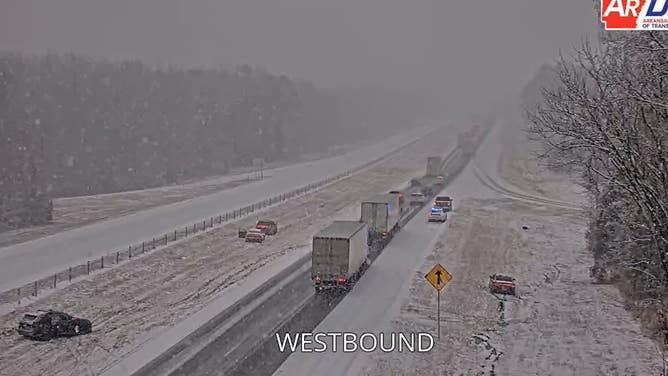
DOT camera shows spinouts on Interstate 40 in Menifee, Arkansas on Jan. 9, 2025.
(Arkansas DOT)
Plowable snow totals were expected there by Friday.
"If you were to ask me if we were going to be on the higher end of that threshold in Little Rock of 5-8 inches, my gut tells me we’re going to be on the higher end," said FOX Weather Meteorologist Jane Minar while reporting from Little Rock. "We’re going to get some decent banding set up on the I-30 that’s going to bump up those snow totals."
DRIVING ON THE ICE AND DRIVING IN THE SNOW: WEATHER DRIVING TIPS FOR DRIVING IN INCLEMENT WEATHER
Ice threat grows for Atlanta area on Friday
On Friday, the mix of snow and ice will spread into the Southeast, with cities like Memphis, Nashville and Knoxville in Tennessee looking at plowable snow, while cities like Birmingham, Alabama, and Atlanta flirting with both snow and a significant ice storm.
ATLANTA FACES THREAT OF ‘SIGNIFICANT ICE’ FRIDAY AS FAR-REACHING WINTER STORM CHUGS ACROSS SOUTHEAST
Steady snows will sweep into Tennessee Thursday night, reaching Memphis just after midnight and into Nashville by daybreak Friday.

(FOX Weather)
Memphis could see 3-5 inches through Friday with 5-8 inches possible by Friday night in Nashville. Memphis schools already canceled classes Friday.

Nashville preparing for winter storm to dump several inches of snow
FOX Weather Meteorologist Haley Meier reports from Nashville, Tennessee, which is bracing for a winter storm that could blanket the Music City with several inches of snow.
Meanwhile, there is increasing concern for the potential for a significant freezing rain event in northern Georgia – including the Atlanta area. Forecasts now show a possible 0.25 inches of ice accretion or more along I-85 and I-20 corridors.
"Significant accumulations are possible elsewhere if snow transitions to freezing rain sooner than expected," the National Weather Service said in Atlanta.

(FOX Weather)
Atlanta is inside a Winter Storm Warning for the potential of 1-3 inches of snow and/or sleet and up to 0.33 inches ice accretion Friday into early Saturday.
Higher snow totals are possible in northern Georgia of up to 3-6 inches or more, though a more impactful freezing rain event will cut down on the snowfall totals.
The storm is expected to push east on Saturday spreading some wintry weather into the mid-Atlantic and even the Northeast with some light snow.