Weather alerts cover nearly all of Lower 48 as winter storm brings snow to Midwest
Heavy snow and high winds are moving across the Midwest, with severe storms tracking across the South and heavy rain predicted in the East.
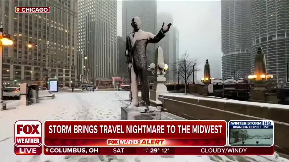
Chicago braces for more snow as winter storm barrels through Midwest
FOX Weather's Robert Ray reports on conditions in Chicago as a powerful winter storm moves across the Midwest.
In a case of déjà vu, for the second time this week, a sprawling winter storm tracking across the central and eastern U.S. is packing a trio of threats, including blizzard conditions in the Midwest, severe weather in the South and flash flooding in the East.
Just a few days ago, a deadly winter storm slammed the central U.S. and brought nearly a foot of snow and whiteout conditions from the Plains to the Great Lakes as deadly severe storms and tornadoes raked the South, while high winds and flooding rain knocked out power to hundreds of thousands of Americans on the East Coast and sent rivers rising to historic levels.
Weather alerts of all types have been issued in nearly every state in the Lower 48. The majority of them are related to winter weather, covering about 60 million people across the U.S.

(FOX Weather)
An active January pattern will continue into next week, even as the latest winter storm continues its trek across the nation. Here are the latest impacts and timing for the winter weather system the FOX Forecast Center is tracking into the weekend.
Major winter storm blasting Chicago, Midwest cities
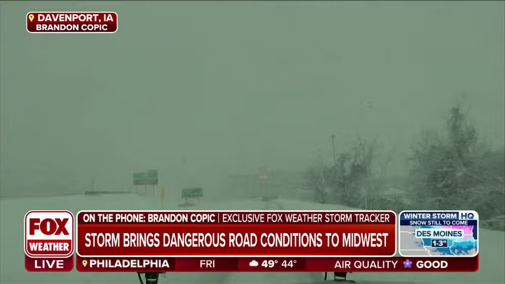
Winter storm brings dangerous road conditions to Iowa
The Midwest is currently experiencing the third major storm of the week and FOX Weather is providing comprehensive coverage of the event from the ground up to the roads affected by the storm. Exclusive FOX Weather storm tracker Brandon Copic joins by phone with the latest conditions in Davenport, Iowa.
A major winter storm has charged into the Midwest and is blasting major cities such as Chicago and Milwaukee with heavy snow and high winds.
A Blizzard Warning already covers parts of several Midwest states, including Iowa. That is where a ground blizzard – fallen snow being blown around by high winds – will be a problem. If Blizzard Warnings are issued for the city of Chicago, it would be the first time that has happened in about five years (Nov. 26, 2018). The city of Milwaukee has not been under a Blizzard Warning in nearly 13 years (Feb. 1, 2011).
The storm has already snarled travel at Chicago's O'Hare International Airport, where a ground stop was issued early Friday. Hundreds of flights have been canceled or delayed at both of Chicago's airports – O'Hare and Midway.
Highways across Iowa, Wisconsin and Illinois are treacherous, with most transportation agencies are reporting impassable or snow-covered roads.
Snowfall totals between 5 and 8 inches are forecast for cities like Chicago and Des Moines, Iowa. Even higher amounts are expected to the north across Wisconsin, where Milwaukee and Green Bay could pick up a foot or more of snow.
Click here for the latest on the Midwest blizzard.

(FOX Weather)
Storms march across South
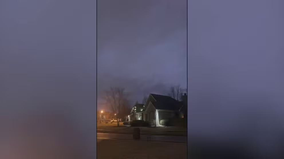
Watch: Roaring thunder, lightning in Arkansas as Tornado Warning issued
Video from National Weather Service storm spotter Dylan Atkinson shows rumbling thunder and lightning over homes in Bryant, Arkansas, in the early hours of Friday, January 12.
Thunderstorms are tracking across the South through Friday, packing threats of damaging wind, large hail and tornadoes.
The highest risk of dangerous storms stretches from Alabama to the Carolinas through Friday evening. Damaging wind is the main threat before the storms push offshore into the Atlantic.
Click here for a more detailed forecast on the severe weather threat.

(FOX Weather)
Flooding rain, gusty winds eye the East
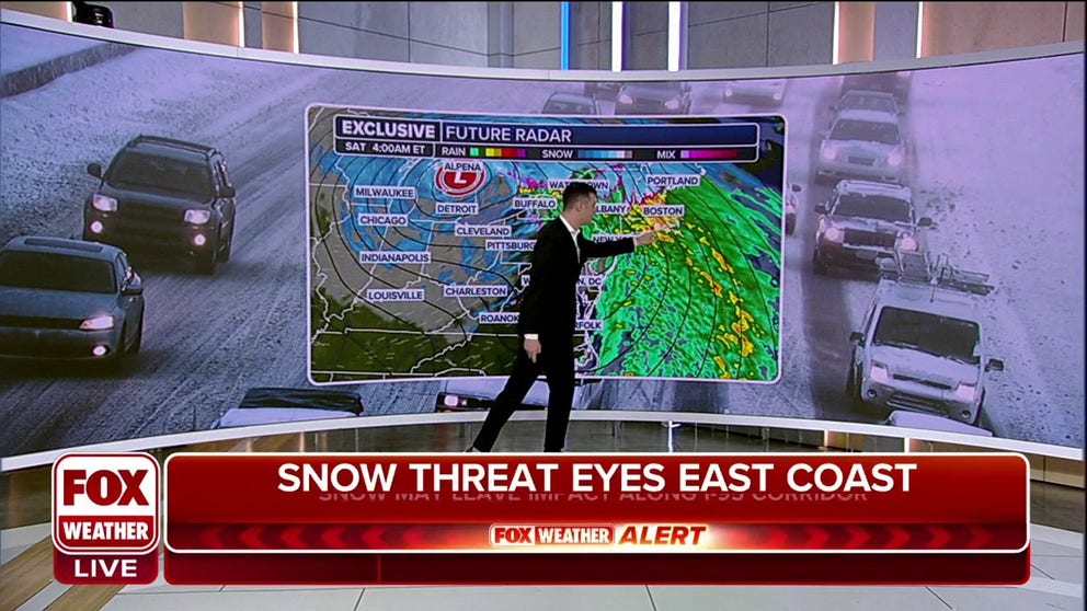
Flooding possible along the I-95 corridor as winter storm moves east
A winter storm is also set to bring heavy rain to the mid-Atlantic and Northeast late Friday, raising the risk of flooding.
Much of Friday should be relatively quiet along the East Coast, but a slug of heavy rain is forecast to push into the mid-Atlantic and Northeast on Friday evening. Much of the region will pick up an inch or two of rainfall by Saturday afternoon.
Given the ground is already saturated after the heavy rainfall earlier this week, flash flooding could become a concern from Friday night into early Saturday before the rain exits off the coast later Saturday.
New York City, Philadelphia and Boston have all been highlighted for a Level-2-out-of-4 risk of flash flooding by NOAA's Weather Prediction Center.
Gusty winds will also accompany the rain, but the gusts are not expected to be as strong as those from Tuesday's storm when some areas reported gusts over 70 mph.

(FOX Weather)