Winter storm impacts travel in Denver area as snow, ice threat expands to Plains
Winter weather alerts remain in effect across the central Rockies and Plains through Sunday as more snow and ice are expected.
Winter storm causes travel delays in Denver as system slides east
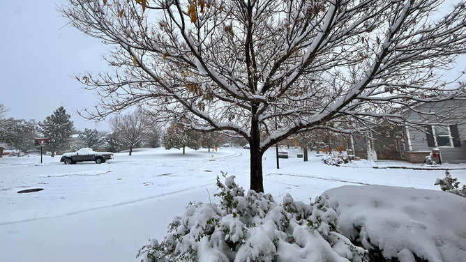
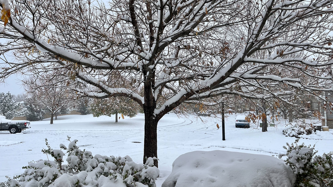
Several inches of snow fell in the Denver area on Saturday and Sunday thanks to a winter storm in the central Rockies that's now bringing winter weather to the Plains.
DENVER – The first significant winter storm of the season swept into the Plains on Sunday after dumping several inches of snow in Colorado that led to numerous delays and cancellations at Denver International Airport (DEN) and on the state's roads and highways.
Data from FlightAware.com showed about 100 flight cancellations and hundreds of delays at DEN on Saturday evening. By Sunday, delays jumped to nearly 700, with more than 26 flight cancellations.

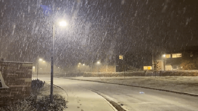
Watch: Flakes flying outside National Weather Service office in Boulder
The National Weather Service in Boulder, Colorado, shared video of snow falling outside the office during a winter storm on Saturday, October 28, 2023.
Travel on the state’s roadways was also impacted, with the Colorado State Patrol warning drivers to be aware of the conditions and to keep speeds down while allowing for extra room between vehicles.
The snow didn’t stop efforts to transport a massive rocket through Arapahoe County on Saturday, however.
Photos and video posted to X, formerly known as Twitter, showed wet roads and snowflakes flying in the air as police escorted the SpaceX rocket through Centennial, Colorado.
Deputies said at certain points, utility cables had to be lifted in order to make sure the 190-foot rocket made it safely through intersections.
WHY US HOUSEHOLDS WILL LIKELY PAY LESS FOR HEATING THIS WINTER
Colorado snow totals

(FOX Weather)
Snow totals varied between locations in Colorado, with Copper Mountain picking up nearly 17 inches of snow. Breckenridge picked up 16 inches of snow, while Silverthorne picked up 15.6 inches. The Eldora and Loveland Pass areas both received 14 inches of snow.
The Denver metro saw anywhere between 3 and 9 inches of snow, with southern sections of Denver seeing 6 to 9 inches, with some locally higher amounts, and the northern side of the Mile High City seeing 3 to 6 inches, with locally higher amounts. Denver International Airport reported 6.5 inches on Sunday morning.
HOW FORECASTERS USE THE WINTER STORM SEVERITY INDEX TO WARN OF HAZARDOUS WEATHER
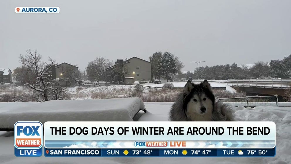
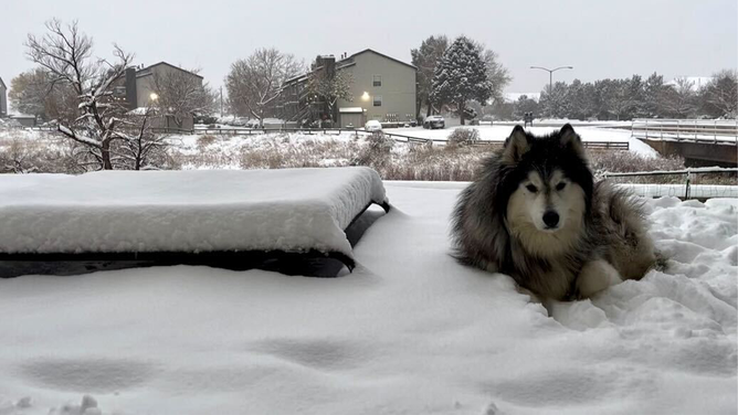
![A photo showing Halen unbothered by recent snowfall in the Denver area on Sunday, October 29, 2023.]() Image 1 of 11
Image 1 of 11A photo showing Halen unbothered by recent snowfall in the Denver area on Sunday, October 29, 2023. (Heather Brinkmann)
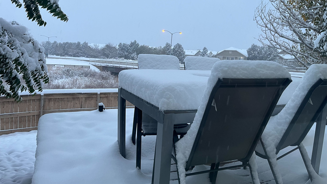
![Several inches of snow can be seen covering a table in the Denver area on Sunday, October 29, 2023.]() Image 2 of 11
Image 2 of 11Several inches of snow can be seen covering a table in the Denver area on Sunday, October 29, 2023. (Heather Brinkmann)
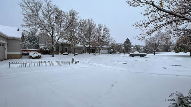
![Denver residents woke up to a winter wonderland on Sunday, October 29, 2023.]() Image 3 of 11
Image 3 of 11Denver residents woke up to a winter wonderland on Sunday, October 29, 2023. (Heather Brinkmann)
![Snow is seen covering roads and trees in the Denver area on Sunday, October 29, 2023.]() Image 4 of 11
Image 4 of 11Snow is seen covering roads and trees in the Denver area on Sunday, October 29, 2023. (Heather Brinkmann)
![Several inches of snow can be seen on trees in the Denver area on Sunday, October 29, 2023.]() Image 5 of 11
Image 5 of 11Several inches of snow can be seen on trees in the Denver area on Sunday, October 29, 2023. (Heather Brinkmann)
![A photo showing snow falling outside the National Weather Service office in Boulder, Colorado.]() Image 6 of 11
Image 6 of 11A photo showing snow falling outside the National Weather Service office in Boulder, Colorado. (NWS Boulder)
![A heavier band of snow is seen at the National Weather Service office in Boulder, Colorado, on Saturday, Oct. 28, 2023.]() Image 7 of 11
Image 7 of 11A heavier band of snow is seen at the National Weather Service office in Boulder, Colorado, on Saturday, Oct. 28, 2023. (@NWSBoulder / X)
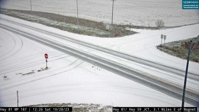
![Nebraska snow]() Image 8 of 11
Image 8 of 11Snowfall between Norfolk, NE and Yankton, SD (Nebraska DOT)
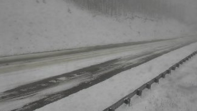
![CDOT camera]() Image 9 of 11
Image 9 of 11US 50 at Monarch Pass in Colorado (CDOT)
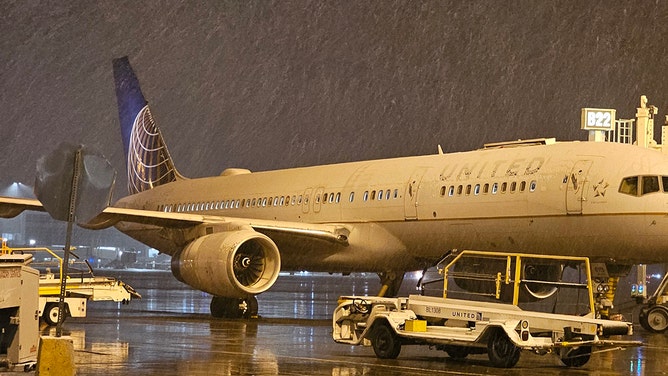
![Snow arrived at Denver International Airport on Saturday morning.]() Image 10 of 11
Image 10 of 11Snow arrived at Denver International Airport on Saturday morning. (@grassbruh / X)
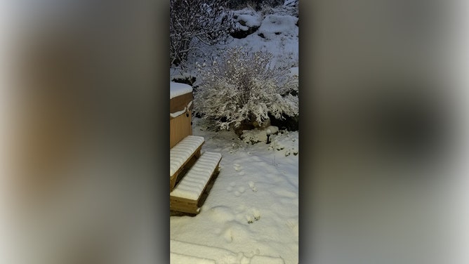
![Snow began to accumulate Saturday morning in Alma, Colorado.]() Image 11 of 11
Image 11 of 11Snow began to accumulate Saturday morning in Alma, Colorado. (Tessie Nay / X)

"But you know how Denver is. Very finicky, and it depends on where these bands set up," FOX Weather meteorologist Craig Herrera said. "And if you got just enough downsloping wind shear, you don't see the higher amounts in the city itself. Plus, you've got urban heating in and around, although there are plenty of spots dealing with snow."
The FOX Forecast Center says the snow will continue through at least Sunday afternoon, with the highest additional accumulations occurring along the Sangre de Cristo Mountains, where there is a high probability of more than 4 inches of snow and even the potential of seeing an additional foot of snow.
Storm system spreads east
It wasn’t only the Denver area seeing its first winter weather impacts of the season.
Cities across Nebraska, Iowa, Minnesota and Wisconsin also saw snow, but not nearly in the amounts seen in the Rockies and in the Denver area.
The FOX Forecast Center expects between a dusting and 3 inches for most areas through central and eastern Colorado, northern New Mexico and portions of Kansas and Nebraska. Local areas across northern Nebraska have already seen double that. O'Neill, Nebraska has had 6 inches and Big Springs, Nebraska saw 5.5 inches so far.
Because of the threat, a variety of winter weather alerts through Sunday evening.
Winter Weather Advisories are in effect across a larger area, spreading from eastern New Mexico through the Texas and Oklahoma panhandles, western Kansas and central Nebraska, to account for the light snow and/or the possibility of freezing rain, according to the FOX Forecast Center.

(FOX Weather)
Where the dividing line meets between the snow and rain, a narrow band of precipitation will likely fall as ice.
Locations that could see the heaviest ice accretions are in Kansas, Oklahoma and Texas, but amounts are expected to remain light.
Behind the frontal boundary, temperatures are expected to drop 10 to 20 degrees as an arctic air mass invades most of the country during the Halloween week.
HALLOWEEN ARCTIC BLAST TO PLUMMET TEMPERATURES TO FREEZING IN EVERY STATE EXCEPT FLORIDA
Wintry precipitation won't be the only impacts
In addition to the threat of ice and snow, tropical moisture streaming northward from the remnants of Hurricane Otis and the Gulf of Mexico will lead to heavy rainfall from Texas to the Great Lakes.
Temperatures are simply too warm in southern zones for the precipitation to fall as ice or snow, meaning it will fall as rain – and there could be a lot of it.
HOW FORECASTERS USE THE WINTER STORM SEVERITY INDEX TO WARN OF HAZARDOUS WEATHER

(FOX Weather)
Areas that see rainfall from the same storm system could approach 1 to 3 inches of rain, with the threat of isolated higher amounts.
Flooding southeast of Dallas was blamed for killing at least two people and leading to the rescue of several others on Saturday.