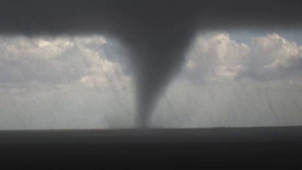
Destructive tornadoes rip through Oklahoma on Thursday
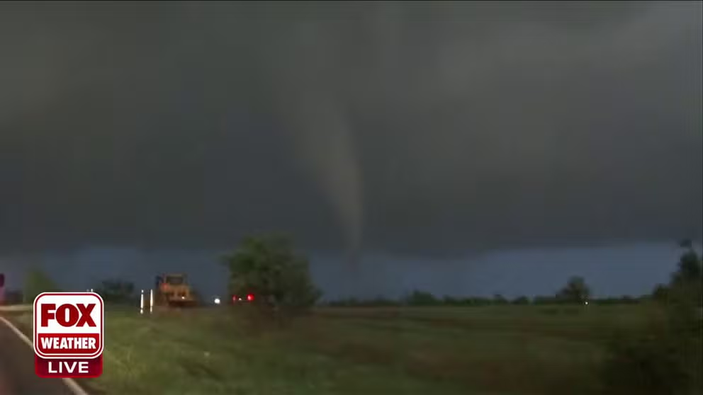
A few tornadoes were spotted around the Oklahoma City metro area Thursday evening into Thursday night, including twisters reported in the towns of Cole and Noble.
EF-1 tornado damage found in Noble and Cole, Oklahoma
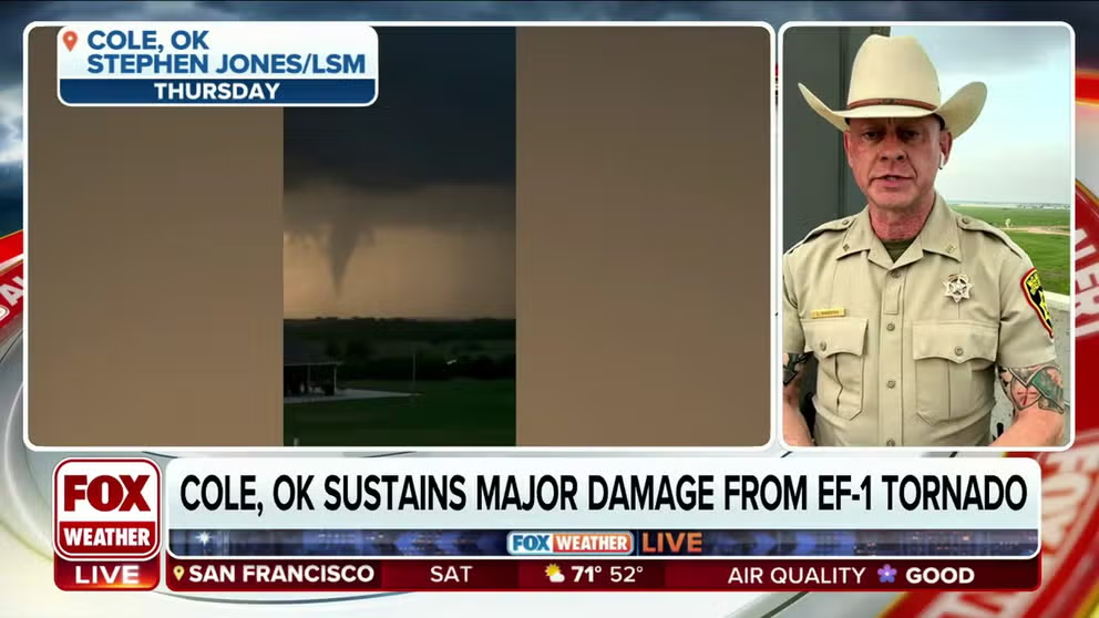
Scott Gibbons of the McClain County Sheriff's Office said roughly ten structures were damaged in Cole, Oklahoma from a tornado Thursday night. In April, an EF-3 tornado left three dead in McClain County.
OKLAHOMA CITY, Okla. – The latest round of severe weather to sweep through the central U.S. focused much of its wrath in Oklahoma, Kansas and Arkansas on Thursday with reports of tornadoes, large hail and flooding downpours.
In Oklahoma, there were a few tornadoes spotted around the Oklahoma City metro area Thursday evening into Thursday night.
South of Oklahoma City, daylight revealed the extent of damages in the town of Cole. The photo below shows a large portion of its roof having been obliterated. Another image shows piles of rubble strewn across a driveway and almost covering a car.
The National Weather Service tweeted that the twister was rated EF-1, meaning that it was caused by a tornado with wind speeds between 86 and 110 mph.
One tornado was observed in the town of Noble, which is also south of Oklahoma City.
Tornadoes cause damage in Oklahoma and Kansas
In Oklahoma, there were a few tornadoes were spotted around the Oklahoma City metro area Thursday evening into Thursday night, including twisters reported in the towns of Cole and Noble.
A few businesses, homes and power lines were damaged by the suspected tornado, according to the Cleveland County Sheriff's Office. The NWS reported some power flashes were also visible along the funnel's path, but no one was injured.
Tornado seen moving through Cole, Oklahoma
Confirmed tornado hits the ground of Cole, Oklahoma live on FOX Weather. This comes after a deadly EF-3 tornado hit the town back in April.
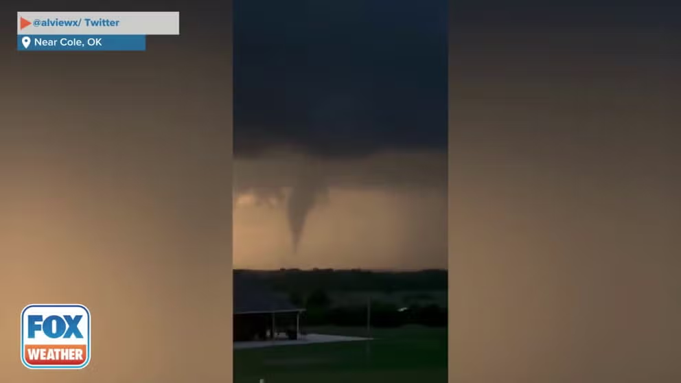
A weather enthusiast captured video of one of those tornadoes near Cole, Oklahoma. The tornado appeared to briefly touch the ground west of Interstate 35 and triggered the issuance of a Tornado Warning.
McClain County Sheriff's Office spokesperson Scott Gibbons said there were six homes damaged by tornadoes in Cole, two of which were total losses. There were no injuries.
Tornado touches down in Cole, Oklahoma
A tornado is caught on video touching down in Cole, Oklahoma on Thursday night. (Credit:@alviewx/ Twitter)
Farther east, wind gusts exceeded 60 mph as the severe storms marched onward. Haywood, Oklahoma recorded a gust of 66 mph while McAlester hit a gust of 64 mph, according to NWS spotter reports. But power outages were minimal in the state as of Friday morning.
MAY IS THE PEAK MONTH FOR TORNADOES IN THE U.S.
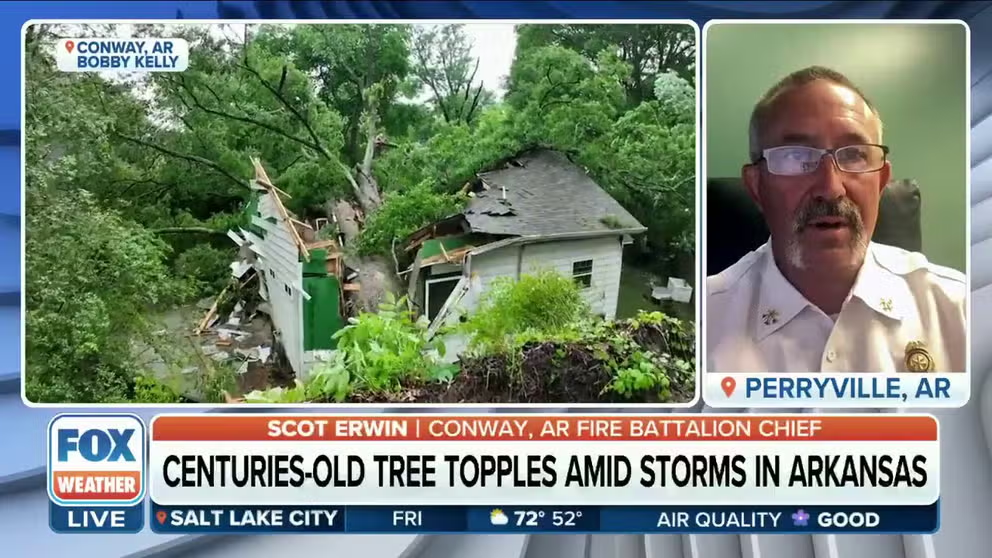
In Conway, Arkansas, a tree that is thought to be around 600 years old crushed a house during the heavy storms.
Enormous 600-year-old tree crushes home in Arkansas, woman rescued
Battalion Chief for Conway Fire Department in Arkansas Scot Erwin on how his department rescued a resident after a 600-year-old oak tree damaged their home. Heavy rains led to the tree being toppled.
Additionally, the NWS said that an EF-1 tornado touched down not far from the Shreveport Regional Airport Thursday morning. The NWS reported that a few structures were damaged, and winds topped 80 mph.
Several weak tornadoes were also reported in Kansas, and at least one was captured on video moving through the rural lands near the town of McDonald.
The storms came on the heels of widespread severe thunderstorms Wednesday that brought large hail to the Denver metro area Wednesday and prompted the area's first Tornado Watch in nearly two years.
Storm tracker captures stunning views of tornadoes moving through Kansas
Storm tracker Max Olson captured stunning views of tornadoes moving through Kansas Thursday evening during severe storms.
The severe weather threat wasn't done yet with the Plains this week. Strong to severe thunderstorms are expected to develop again Friday afternoon, extending from South Dakota and Iowa down to southern Texas, according to the FOX Forecast Center. A few tornadoes will be possible across the northern extent, particularly in Nebraska and Iowa, where NOAA's Storm Prediction Center has issued a Level 3 out of 5 risk for severe weather, including the towns of Omaha, Nebraska and Sioux City, Iowa.
