'Good chance' another arctic blast happens in February, polar vortex expert says
Don't be fooled by the warmer weather being experienced in the U.S. for the next couple weeks. Winter is expected to make a comeback in February.
Models point to a warmer end to winter for US
Atmospheric Research Scientist Judah Cohen explains what models show the rest of winter will look like for the U.S.
Don't "put a fork into winter" just yet, warns a climate scientist, despite a little taste of spring this and next week after the deadly cold outbreak. Round 2 of winter could be on the horizon.
"As Yogi Bera described, 'It's déjà vu all over again,' with the polar vortex and its influence on our weather," said Judah Cohen, a VERISK atmospheric and environmental research scientist. "A very complicated and rapidly transitioning situation, but I do believe that it'll come down to rinse, lather, repeat."
That means a repeat of the record low snow levels and warm temperatures of December. That is followed by a repeat of the record cold felt across much of the U.S. in early January when wind chills dropped as low as 60 below.
"Cold is likely to return to eastern North America in mid-February, a region where cold has been more ephemeral," Cohen wrote on his blog about the polar vortex.
Break after first round of winter
First comes the warm, but don't let it lure you into canceling ski vacations or putting away the snow shovels.
270 MILLION AMERICANS TO FEEL ABOVE-AVERAGE TEMPERATURES AFTER WEEKS OF BITTER COLD
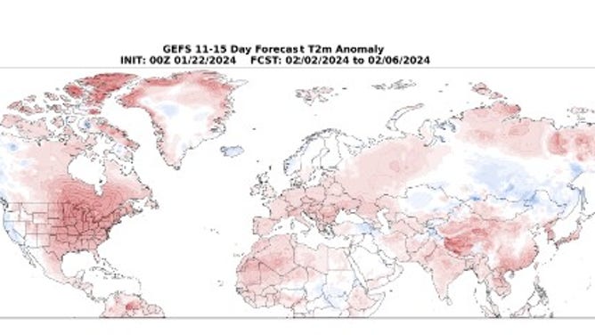
Notice the warmer temperatures indicated in red east of the Rockies for February 2-6, according to a weather model.
(NOAA)
"For the first half of January, that polar vortex kind of stumbled and fell foul there, moved south. We had the arctic outbreak," Cohen explained to FOX Weather on Tuesday. "But now it's, it's back together, let's say, and, it's a very tight spin, rotation of the polar vortex. All the cold air is receding back towards the North Pole, and we're going to have a milder end of the month of January."
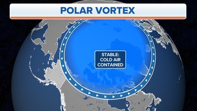
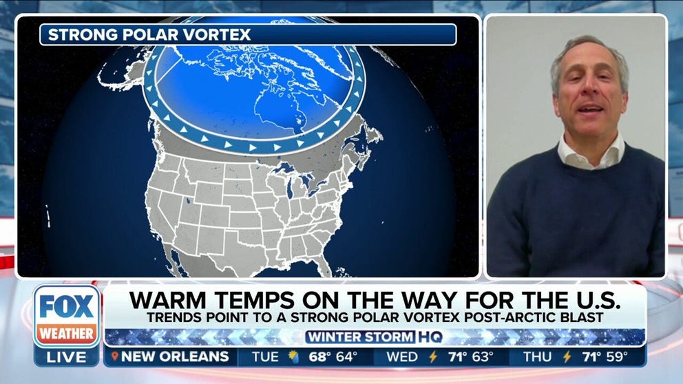
Polar Vortex Stable
(FOX Weather)
The polar vortex is a band of strong winds circling the North Pole. A constant, stable spin of those winds keeps the arctic air locked in place. When the winds slow and become unstable, just like a top, the vortex wobbles and drops south into the U.S. and Europe, according to Cohen.
"We're probably going to see a record warm, like we had that happen in December," said Cohen of the near term. "But I do think then, often when you have these Canadian warmings, the polar vortex then tends to transition into a very large disruption called a sudden stratospheric warming or a stretching event, like a rubber band (pulling cold air south)."
Weather changes in the stratosphere, a layer in Earth's atmosphere about 19 miles above the surface, lead weather changes people feel at the surface by about two weeks.
Round 2 of winter to come
Sudden stratospheric warming triggered the January arctic blast. Air in the stratosphere warmed by 55 degrees in a six-day period, wrote Amy Butler of NOAA's Chemical Sciences Laboratory. That slowed the polar vortex winds.
"That's what we had in January that brought the arctic air, and I think that there's a good chance that will repeat itself in February," Cohen said. "So look for a mild pattern. I don't think it's the end of winter. I think it's not a breakdown of the pattern, but I think a relaxing pattern."
CAN COLD WEATHER MAKE YOU SICK?
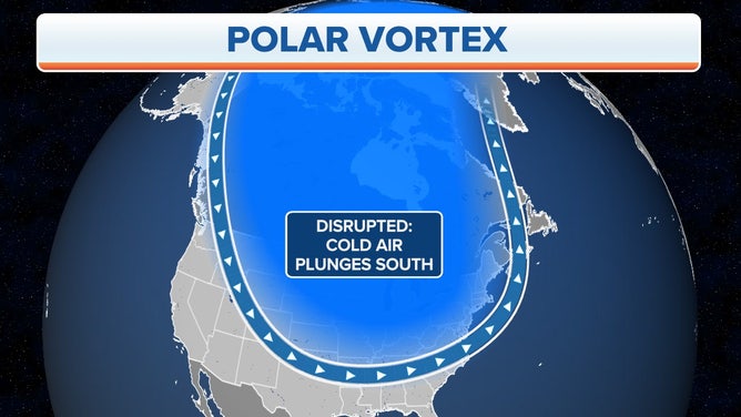
Polar Vortex Disrupted
(FOX Weather)
That would mean another arctic blast and a return of widespread snow.
"I think in the time frame of the second week of February and even possibly mid-February a stretched polar vortex is becoming more likely," Cohen said. "This should help end the very mild pattern in place across North America. The intensity and duration of cold weather associated with the stretched polar vortex is yet to be determined."