Snow 101: The basics of snow
Snow makes great snowmen, snowballs, ski slopes and even better snow days from school. But what happens before it hits the ground?
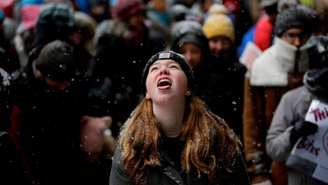
A girl tries to catch a snowflake on her tongue in Chicago.
(JOSHUA LOTT/AFP via Getty Images / Getty Images)
We all know, water freezes and it falls as snow, but, its not that simple. There are a few extra steps along the way.
Let’s start high up in clouds where water vapor is freezing on bits of dust or pollen forming ice crystals — the seed. The seed bounces around in wind currents and more water vapor freezes onto the seed making intricate, crystal arms and patterns. When the accumulation of crystals, the snowflake, is heavy enough, gravity takes over and it falls towards the ground.
During that journey the snowflake falls through different levels of the atmosphere with different moisture and temperatures. So the new crystals that glom on to the snowflake look a little different from prior crystals — but they are always 6-sided and appear symmetrical to the naked eye (each arm looks similar with the same shape crystals, but there are variations.) That’s why every snowflake looks different. No single flake falls in the same exact path as any other. Different temperatures net different crystal shapes. An article in The Chanhassen Villager newspaper says snow travels to the ground between 1-6 feet per second (up to 9 feet per second if it has a lot of ice). That means our snowflake starting generally above 10,000 is falling and picking up more crystals for 45 minutes to an hour.
Shapes of snow crystals
The temperature of the air determines the six-sided, lacy, and intricate crystal shape. Some of the most common in snowflake shapes are needles, plates, dendrites (arms or branches), columns, and prisms. As the crystals fall and join together, they can be a mix of shapes depending on the temperature in each specific layer.
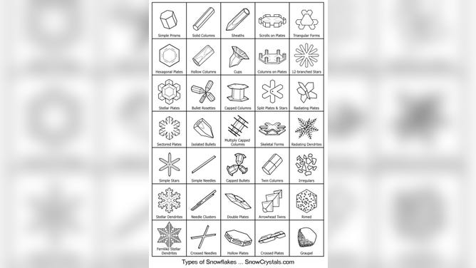
35 crystal shapes making up most snowflakes.
(Dr. Ken Libbrecht)
Dr. Ken Libbrecht has spent a lot of time studying snow at the California Institute of Technology. He says different shapes form at different temperatures (at different altitudes) in the clouds, but they all mix and match into a snowflake. "The largest crystals only grow in a narrow temperature range around -15 C (5 F). Needles and columns are best found around -6 C (21 F). Capped columns appear when the temperature changes as the crystals grow. You can also see that more elaborate, branched crystals grow when the humidity is high. Simple prisms grow when the humidity is low (or when the crystals are tiny)."
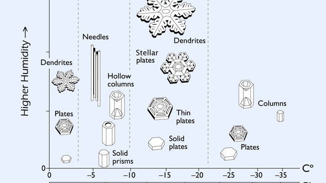
The Snow Crystal Morphology Diagram shows different crystal shapes forming at different temperatures and humidity levels.
(Snowcrystals.com)
If the air in the lower level of the cloud is slightly above 32 degrees F, more crystals will join for a bigger, heavier snowflake (better for snowmen). If the temperature is 32 degrees f and colder, the smaller the flake (better for skiing).
How to measure the rate of snowfall
As the snow falls toward the ground meteorologists measure snowfall intensity using visibility and the precipitation rate per hour/s. Technical definitions of visibility differ a bit in colder vs. warmer air and day vs. dark but here they are in general:
- Heavy Snow — quarter mile or less of visibility and snow falling at more than 1.0 mm/hr (liquid equivalent)
- Moderate Snow — half to a quarter of a mile of visibility and snow falling at 1.0 to 2.5mm/hr (liquid equivalent)
- Light Snow - over 5/8 of a mile visibility and snow falling at less than 1.0 mm/hr (liquid equivalent)
Liquid equivalent means the amount of water after melting the snow. Check out our FOX Weather post on properly measuring snow for more information. Meteorologists measure snow depth and the water equivalent for climatological records only once a day.
You may hear meteorologists mention a snow flurry which is snow falling in short durations if little or no accumulation. A snow squall is brief as well but heavy (significantly reduces visibility) and frequently with strong winds. A snowburst is heavy snow netting a significant amount of accumulation but in a short time. The NWS defines heavy snow as snowfall accumulating 4 inches or more in up to 12 hours or accumulating up to 6 inches or more in 24 hours. Blowing snow is actually snow from the ground picked up by the wind — low visibility but no accumulation because snow is not actually falling. And, it doesn’t actually have to be snowing to have a blizzard -- check out our FOX Weather post, Why a blizzard is different from a snow storm.
Why is snow white?
As we know, water and ice are colorless, so why is snow white? The many facets and prisms within a snowflake’s many crystals reflect all visible wavelengths of light, so we see white. (The color we see is the reflected color. I.e. A leaf absorbs all visible wavelengths of light except green which is reflected. So we see green.)

Lacy snowflake cutouts creating an indoor snowfall.
(Harold Hoch/MediaNews Group/Reading Eagle via Getty Images / Getty Images)
Next time you see snow, take a little closer look at it. That flake went through a lot to land on your windshield.