First big freeze of season grips Eastern US, as arctic air and snow reach the South
Snow accumulated as far south as Blairsville, Georgia, overnight Tuesday, with some flakes even spotted in Atlanta. Numerous record low temperatures were set across parts of the South and Southeast.

First arctic blast of the season grips Eastern US
More than 190 million Americans woke up to cold temperatures Tuesday, with most people 15-25 degrees below average from the Plains across the eastern half of the U.S. Wind chills will drop feel-like temperatures into the teens for the Midwest and interior Northeast. Meanwhile, record low temperatures were recorded across parts of Florida Tuesday morning, as the coldest air of the season spread through the southern and southeastern part of the country.
More than 190 million Americans woke up to an arctic blast Tuesday, with most people seeing temperatures 15–25 degrees below average from the Plains across the eastern half of the U.S., including the South, which set numerous record low temperatures.
![Snow blanketed a Walmart parking lot in Bluefield, Virginia Monday evening.]() Image 1 of 7
Image 1 of 7Snow blanketed a Walmart parking lot in Bluefield, Virginia Monday evening. (RASweather23 via Storyful)
![Snow accumulated Monday evening in Lancaster County, South Carolina.]() Image 2 of 7
Image 2 of 7Snow accumulated Monday evening in Lancaster County, South Carolina. (@robbie_clanton/X)
![Snow accumulated Monday evening in Lancaster County, South Carolina.]() Image 3 of 7
Image 3 of 7Snow accumulated Monday evening in Lancaster County, South Carolina. (@robbie_clanton/X)
![Snow coats a local driveway in Bristol, Tennessee Monday evening.]() Image 4 of 7
Image 4 of 7Snow coats a local driveway in Bristol, Tennessee Monday evening. (Eric_Waldorf/X)
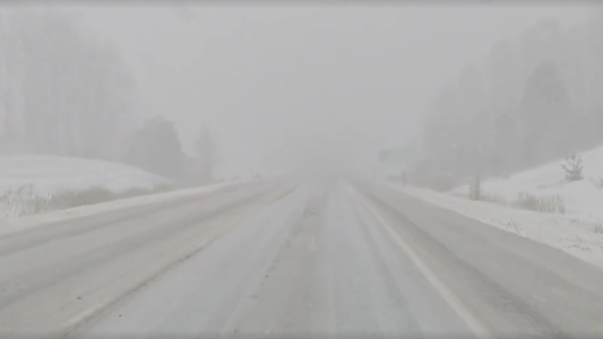
![FOX Weather Storm Specialist Mike Seidel recorded near-whiteout conditions in Findlay, New York Tuesday morning.]() Image 5 of 7
Image 5 of 7FOX Weather Storm Specialist Mike Seidel recorded near-whiteout conditions in Findlay, New York Tuesday morning. (Mike Seidel/FOX Weather)
![Another band of lake-effect snow looms in the distance over Lake Michigan in Chicago, after heavy bands of snow Sunday night.]() Image 6 of 7
Image 6 of 7Another band of lake-effect snow looms in the distance over Lake Michigan in Chicago, after heavy bands of snow Sunday night. (Brandy Campbell/FOX Weather)
![]() Image 7 of 7
Image 7 of 7DERBY, NEW YORK - NOVEMBER 11: A woman and her dog walk along the Shoreline Trail on November 11,2025 in Derby, New York. The season's first Artic air made its way across the Great Lakes, through the Northeast, and as far south as the Gulf Coast bringing some of the earliest snowflakes in years for some regions. ((Photo by John Normile/Getty Images))


A large dip in the jet stream has ushered in polar air from Canada, some three weeks before the start of meteorological winter.
Communities around the eastern Great Lakes in the Midwest and Northeast dealt with powerful lake-effect snowstorms throughout the weekend and into Monday, with a final burst expected Tuesday.
SHOULD YOU WARM UP YOUR CAR ON COLD DAYS BEFORE DRIVING?

Arctic blast reaches the South, as flakes fall across northern Georgia
The coldest air of the season moved across the South, setting record low temperatures on Tuesday. The cold air allowed some snow to accumulate on grassy surfaces in northern Georgia. FOX 5 Atlanta reporter Marc Teichner has the details.
Meanwhile, snow accumulated on grassy surfaces as far south as Blairsville, Georgia overnight Tuesday, with some flakes even spotted in Atlanta.
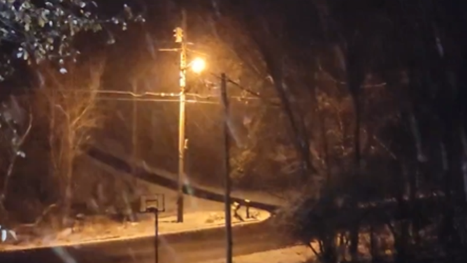
Lancaster County in northeastern South Carolina received a fresh coating of snow Monday night.
HOW LA NIÑA, POLAR VORTEX WINDS COULD FUEL A FAST-START TO BRUTAL WINTER FOR PARTS OF THE US
Storm Chaser Mike Boylan recorded powerful snow flurries at higher elevations in Roan Mountain, Tennessee.
The snow was heavy at times in the mountains of western North Carolina Monday, creating treacherous travel conditions on State Route 194 near Boone, an area that is still recovering from Hurricane Helene last year.
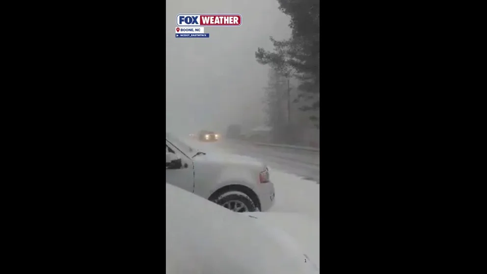
Snow created hazardous travel conditions in Western North Carolina Mountains
Snow created hazardous travel conditions Monday in Western North Carolina Mountains on State Route 194 near Boone.
Mobile, Alabama, Savannah, Georgia and Tampa, Florida were just some of the cities across the South that set record low temperatures.
The temperature in Orlando also broke a record, falling to 37 degrees, its coldest November morning in nine years.
Tallahassee, Florida reached freezing Tuesday morning, colder than several major Northeast metro areas like New York City and Boston. However, New York saw its first snowflakes of the season later Tuesday morning.

(FOX Weather)
A Cold Weather Advisory covers parts of southern Alabama, southern Georgia and much of the Florida panhandle and Central Florida.
Freeze Alerts cover a broad stretch of the Gulf and Southeast Coast from Louisiana to Virginia Tuesday morning.
The polar preview will be short-lived, with temperatures expected to rebound across the country by Wednesday.
WHAT’S THE DIFFERENCE BETWEEN FROST, A FREEZE AND A HARD FREEZE?
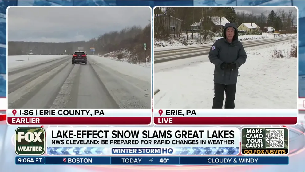
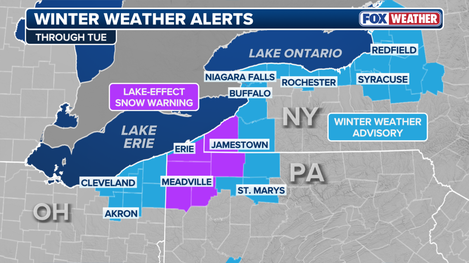
Final round of lake-effect snow creates hazardous travel conditions for eastern Great Lakes
A final round of lake-effect snow is cranking over Lakes Erie and Ontario, creating hazardous travel conditions for the Interstate 90 and 86 corridors. Winter Weather Advisories and Lake-Effect Snow Warnings remain for parts of Ohio, Pennsylvania and western New York. FOX Weather Storm Specialist Mike Seidel has the latest conditions.
Eastern Great Lakes face a final round of lake-effect snow
Meanwhile, wind chills will drop feel-like temperatures into the teens for the Midwest and interior Northeast, which is expected to see a final round of lake-effect snow.
Westerly winds will produce periods of heavy snow for the eastern shores of Lake Erie and Lake Ontario.
The National Weather Service Office in Cleveland warned drivers to watch out for rapidly changing conditions.
DANGEROUS LAKE-EFFECT SNOWSTORM BRINGS WINTER PREVIEW, WHITEOUT TRAVEL CONDITIONS ACROSS GREAT LAKES
(FOX Weather)
Snow bands brought traffic across parts of Interstate 57 south of Chicago to a halt early Monday morning. Indiana's Department of Transportation reported stalled vehicles and multiple crashes near Chicago.
According to the FOX Forecast Center, Tuesday's heaviest accumulation will be just inland from the lakeshore where elevation rises some 1,500 feet, part of a geographic feature called the Chautauqua Ridge.
Heavy snow is expected across southwest Ashtabula County in Ohio, southern Erie and Crawford counties in Pennsylvania and Chautauqua country in western New York, where an additional 5-8 inches of snow will be possible.