Atlantic hurricane season is officially underway: What to know about the 2026 forecast
The Atlantic hurricane season is underway, and forecasters are closely monitoring the global conditions that will influence the 2026 season.

Saharan dust blankets Atlantic basin as hurricane season officially begins
Atlantic hurricane season is officially underway. While outlooks indicate no tropical development over the next seven days, Saharan dust is already spreading westward, though its impacts will be limited to hazy skies. Full breakdown:
The Atlantic hurricane season is underway, and forecasters are closely monitoring the global conditions that will influence the 2026 season.
TROPICS: SEASON’S FIRST SIGNS OF DEVELOPMENT IN THE EASTERN PACIFIC WITH NEW AREA TO WATCH
In recent years, the first named storm in the Atlantic has typically formed in June, while the first hurricane has usually developed by August.
However, this year may be different.

(FOX Weather)
As of now, massive plumes of Saharan dust are moving across the Atlantic Ocean into the Caribbean and Gulf. This dust is expected to eventually spread into the Southeast and potentially parts of the Southern Plains.
While Saharan dust does not have a direct impact on most people, thick layers can create noticeably hazy skies and produce exceptionally vibrant sunrises and sunsets.
EL NIÑO COULD MEAN MORE TROPICAL ACTIVITY FOR THE WESTERN PACIFIC
According to the FOX Forecast Center, current conditions show these large dust plumes spreading directly through the Main Development Region (MDR), a key area for tropical development in the Atlantic.

(FOX Weather)
This hot, dry air typically suppresses the development of early-season tropical activity by creating a more stable atmosphere. As a result, the MDR is expected to remain relatively quiet in the near future.
Additionally, the FOX Forecast Center noted that sea surface temperatures across the central and eastern MDR are running cooler than in recent years, which featured record-breaking warmth. This is contributing to even greater atmospheric stability.
BEYOND SUPER EL NIÑO: THE SECRET OCEAN PATTERN THAT COULD FUEL HURRICANES IMPACTING HAWAII THIS YEAR
Meanwhile, a developing El Niño in the Pacific Ocean is expected to play a major role during hurricane season, as it is forecast to strengthen by the peak of the season.
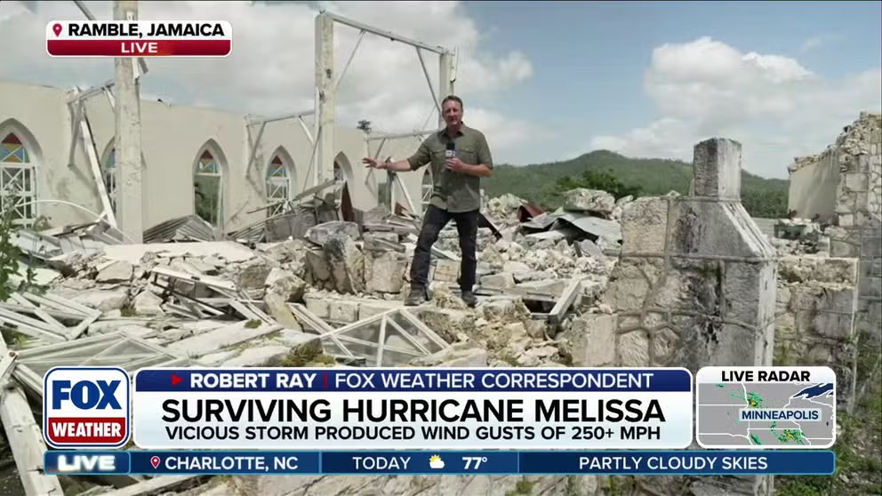
Jamaica still on the road to recovery months after Hurricane Melissa slams the island
Seven months after tragedy hit, Jamaica is still reeling from Hurricane Melissa, with the start of hurricane season at the forefront. FOX Weather Correspondent Robert Ray is traveling from Montego Bay to Black River, where landfall occurred, bringing wind gusts up to 250 mph to the island. He has an inside look at how the community is rebuilding and recovering.
When El Niño develops, it typically increases wind shear across the Atlantic Basin, disrupting developing tropical systems before they can organize and strengthen.
Due to these competing factors, major forecasting agencies, including the National Oceanic and Atmospheric Administration (NOAA) and Colorado State University, are predicting a below-normal hurricane season overall.
East Pacific hurricane season becomes more active
While experts continue to monitor conditions in the Atlantic, the East Pacific hurricane season has officially started to become more active.

(FOX Weather)
According to the National Hurricane Center, there are currently two areas being monitored for potential tropical development.
The first area currently carries only a 30% chance of development over the next seven days. However, some computer forecast models show that the system will eventually develop.
7 FACTS TO KNOW ABOUT HURRICANES
While it is too early to determine exact impacts, there are growing signs that it could bring significant rainfall to portions of Mexico as it organizes off the coast.

Emergency vehicles respond to flooding in Ruidoso, New Mexico.
(Lorr Mrtz/Facebook / FOX Weather)
Current trends suggest the system will likely remain just offshore, even if it develops into a tropical depression or a named storm.
The second area being monitored is located over the open waters of the East Pacific. Development chances have increased to 90%.
The system has been designated as Invest 90E. The term "invest" is used every hurricane season in the Atlantic and the Eastern and Central Pacific basins, accompanied by a number from 90 to 99 and either the suffix "L," "E" or "C," respectively.
WHAT'S THE DIFFERENCE BETWEEN A TROPICAL DEPRESSION, TROPICAL STORM, AND HURRICANE?
The meaning of invest is simply a naming convention used to identify areas that are being investigated for possible development into a tropical depression or tropical storm within the next seven days.
Once a system is dubbed an invest, a collection of specialized datasets and computer forecast model guidance can begin on that area of disturbed weather. These computer models simulate the system’s projected track possibilities and predict its future intensity.
WHAT IS AN INVEST DURING HURRICANE SEASON?
Computer forecast models continue to show this disturbance organizing over warmer ocean waters during the middle of the week. Fortunately, the system is expected to remain well offshore, posing no threat to land.
The disturbance will eventually move over cooler waters and encounter stronger upper-level winds, both of which should disrupt the system and prevent significant strengthening.
(FOX Weather)
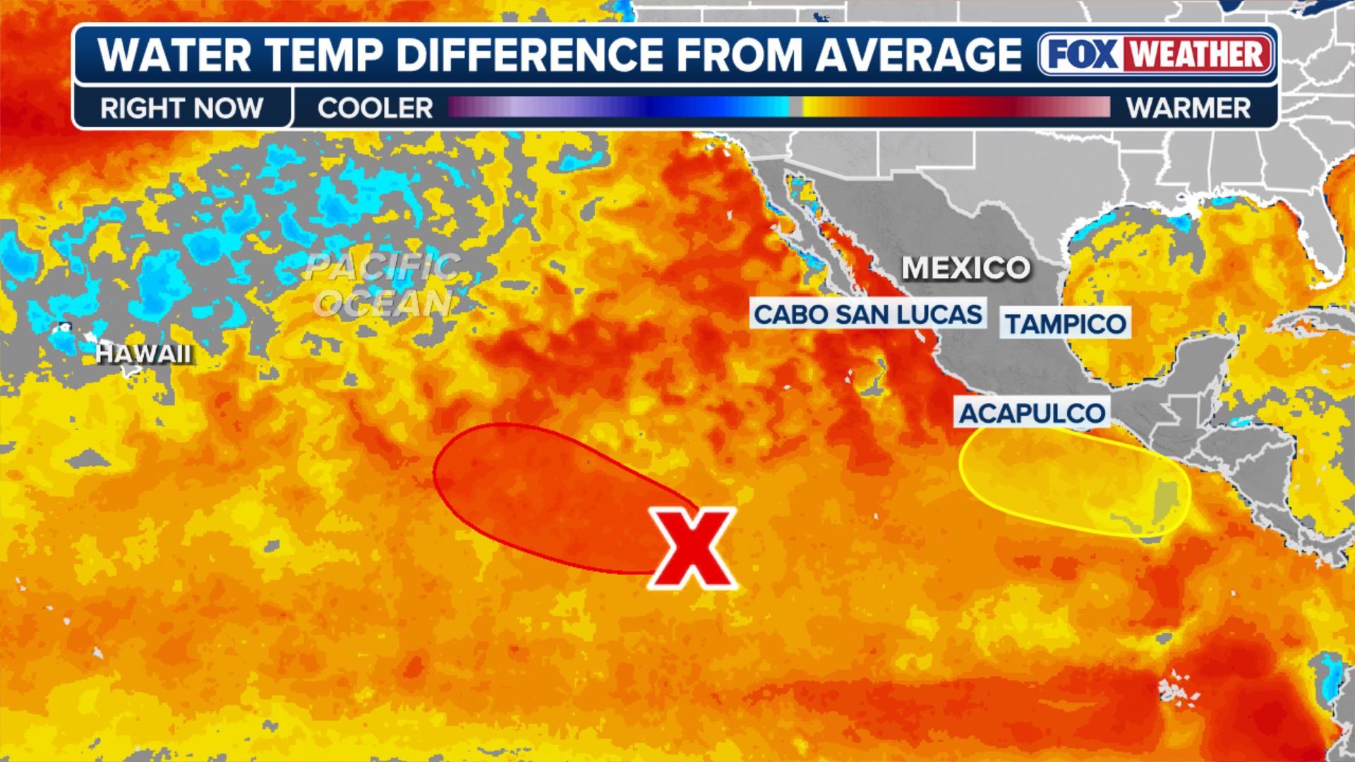
According to the FOX Forecast Center, ocean temperatures across much of the East Pacific remain warmer than average and are expected to influence tropical activity in the coming weeks.
Waters near Mexico and farther west into the open Pacific are currently running two to three degrees above average.
Typically, the East Pacific hurricane season produces 15 named storms, eight hurricanes and four major hurricanes each year.
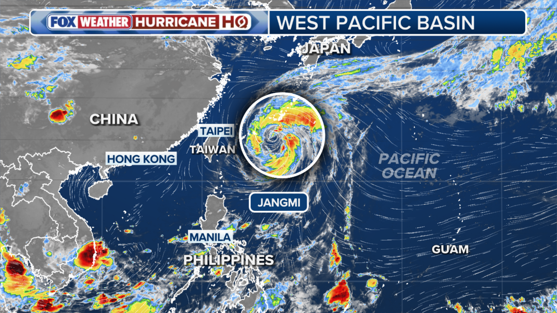
Typhoon Jangmi forms in the Western Pacific
The East Pacific hurricane season is not the only region to keep an eye on.
Officials are also tracking Typhoon Jangmi, which strengthened into a typhoon on Saturday and is currently located a few hundred miles west of Guam.
(FOX Weather)
Low wind shear and warm ocean temperatures are expected to allow the storm to gradually organize over the next several days as it moves northwest.
Tropical Storm Jangmi first impacted Japan's Ryukyu Islands, bringing hurricane-force winds and heavy rainfall. This includes the island of Okinawa, where the U.S. maintains a large military presence across multiple bases.
Kadena Air Base has reported a wind gust of 74 mph and Naha International Airport reported a gust of 77 mph, according to the FOX Forecast Center.
HERE'S WHY ATLANTIC HURRICANE SEASON RUNS FROM JUNE TO NOVEMBER
By Tuesday, the storm is expected to begin affecting parts of mainland Japan, including cities such as Osaka, Hamamatsu and Tokyo.
By that time, the system will likely be weakening, but could still produce heavy rainfall and wind gusts exceeding 50 mph.
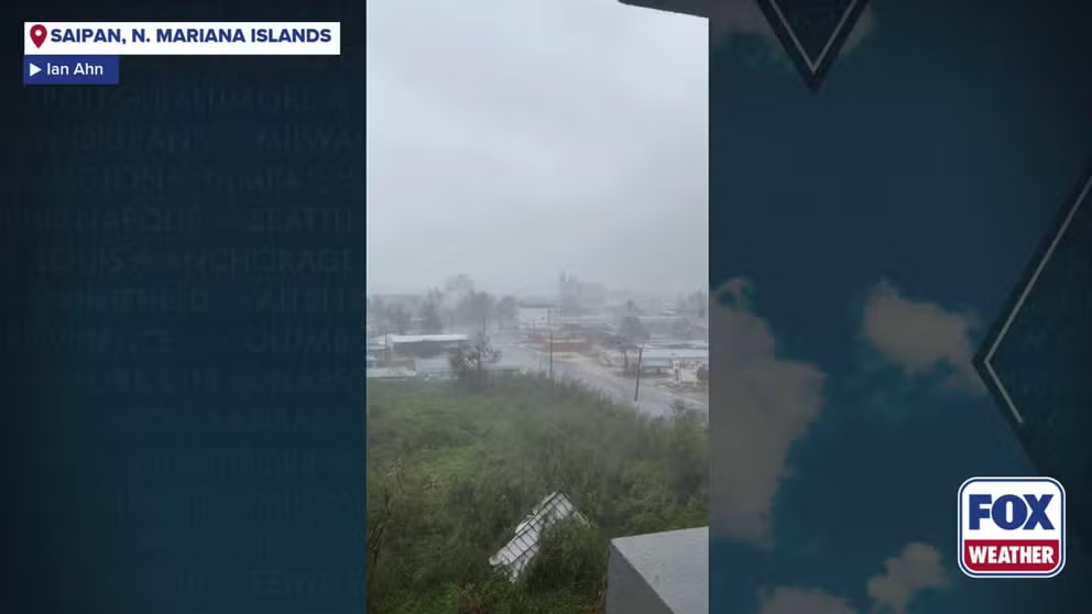
Watch: Winds gusts from super typhoon Sinlaku roar across Saipan
Winds gusts from super typhoon Sinlaku roared across Saipan Tuesday.
Tropical Storm Jangmi follows Typhoon Sinlaku, which rapidly intensified into a super typhoon with winds of 175 mph in April. The storm caused extensive damage across the Northern Mariana Islands and Guam and became one of the strongest typhoons ever observed this early in the year.
Typically, the West Pacific hurricane season produces 26 named storms, 16 typhoons and nine major typhoons each season.
HOW ARE HURRICANES RATED? THE SAFFIR-SIMPSON HURRICANE WIND SCALE EXPLAINED
With an active start already underway, including four named storms, one typhoon and one major typhoon, this trend could continue as El Niño intensifies.
Named storms you could see

'Melissa' officially retired from hurricane names after destruction in Caribbean
There will never be another Hurricane Melissa, after the World Meteorological Organization Hurricane Committee officially retired the name for good after the death and destruction caused by Melissa in Oct. 2025. FOX Weather Hurricane Specialist joins FOX Weather to talk about Melissa and the name retirement.
The names used for hurricanes in the Atlantic and Eastern Pacific rotate on a six-year cycle, with new names swapped in for storms that are retired due to their significance.
Hurricanes are named in alphabetical order, beginning with A on both lists.
HURRICANE SEASON 2026: THESE ARE THE STORM NAMES YOU'LL SEE THIS SEASON
There are 21 names on the Atlantic season list and 24 names on the Eastern Pacific season list.
Hurricanes names are recycled every six years, meaning names that were used and not retired in 2020 will be used again in 2026.
A hurricane name is retired when a storm is so deadly or costly that the future use of its name on a different storm would be inappropriate for sensitivity reasons, the National Hurricane Center said.
The World Meteorological Organization then chooses the replacement name.