First tropical depression of the Eastern Pacific season forms over open waters
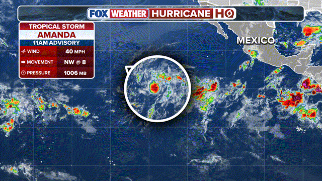
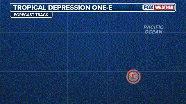
Computer models show Tropical Depression One-E strengthening in the coming days, and as a result, it is forecast to become Tropical Storm Amanda on Wednesday night.

First tropical depression of the season likely to form soon in Eastern Pacific
An area of thunderstorms in the middle of the Eastern Pacific Ocean designated as Invest 90E by the National Hurricane Center (NHC) will likely develop over the next two days into the first tropical depression of the 2026 hurricane season. Meanwhile, the NHC identified another area to watch for tropical development closer to the Mexican coast.
The tropics in the Eastern Pacific have woken up, with the formation of the first tropical depression of the 2026 hurricane season, according to the National Hurricane Center (NHC).
NOAA REVEALS 2026 ATLANTIC HURRICANE SEASON ACTIVITY FORECAST AS SUPER EL NIÑO LOOMS
(FOX Weather)
An area of thunderstorms in the middle of the Eastern Pacific Ocean was designated as an invest before developing into a tropical depression.
This is the first tropical depression of 2026 designated in either the Atlantic or the Eastern Pacific basins.
Computer models show Tropical Depression One-E strengthening in the coming days, and as a result, it is forecast to become Tropical Storm Amanda on Wednesday night.
The tropical depression is expected to stay well offshore with no impact to land. Conditions are not expected to remain favorable for long once it forms, according to the FOX Forecast Center.
(FOX Weather)
The system will eventually move over cooler waters and encounter stronger upper-level winds, both of which should disrupt the storm and prevent significant strengthening.
The latest forecast has the storm dissipating in about a week.
Meanwhile, the NHC identified another area to watch for tropical development closer to the Mexican coast, which is being given a medium chance of development over the next seven days.
7 FACTS TO KNOW ABOUT HURRICANES
Even if the system doesn't make landfall, its proximity to land is noteworthy. Current trends suggest it will likely skirt the coastline if it becomes a tropical depression or named storm.
Regardless of development, the FOX Forecast Center said these storms will bring a widespread 3 to 5 inches of rain across southeastern Mexico and Central America over the next 10 days.
(FOX Weather)
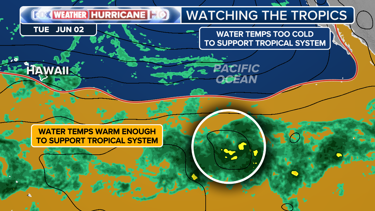
Sea surface temperatures near Mexico and farther west into the open Pacific are currently running about 2 to 3 degrees above average — favorable conditions for tropical formation.
"Development at this point in the year is right on schedule, as the first named storm in the East Pacific typically forms around June 10," the FOX Forecast Center said.
WHAT'S THE DIFFERENCE BETWEEN A TROPICAL DEPRESSION, TROPICAL STORM, AND HURRICANE?
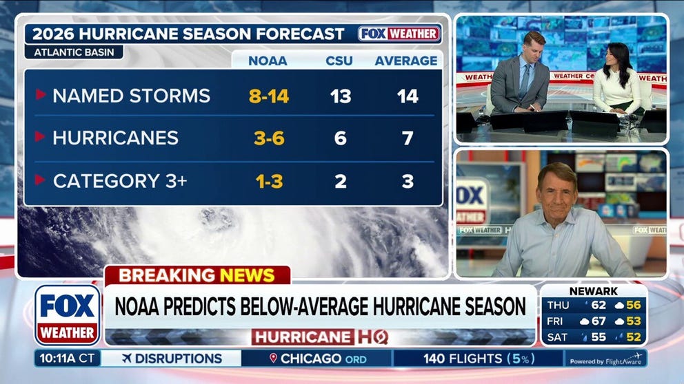
Exclusive analysis: NOAA predicts below-average Atlantic hurricane season with high chance of El Niño
FOX Weather Hurricane Specialist Bryan Norcross joins us to talk about the NOAA hurricane season outlook released on Thursday. The agency predicts a below-average season in the Atlantic, with 8-14 named storms, 3-6 hurricanes and 1-3 Category 3+ hurricanes. Norcross talks about how El Niño plays into this outlook.
These temperatures are consistent with a developing super El Niño climate pattern that is expected to play a dominant role this hurricane season, likely increasing tropical activity in the Eastern Pacific, while simultaneously suppressing tropical development in the Atlantic.
HOW ARE HURRICANES RATED? THE SAFFIR-SIMPSON HURRICANE WIND SCALE EXPLAINED
The Eastern Pacific averages around 15 named storms, 8 hurricanes, and 4 major hurricanes each season.