

Typhoon Sinlaku makes direct hit on US territories in Pacific, blasting Saipan with 130 mph winds
Sinlaku exploded into a super typhoon in the western Pacific Ocean over the weekend, reaching wind speeds of 180 mph — equivalent to a monster Category 5 hurricane.
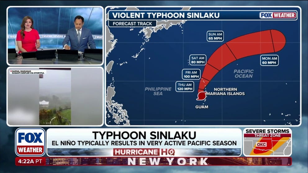
Typhoon Sinlaku still powering through West Pacific
Most of the land impacts from Typhoon Sinlaku have passed, but the storm is still pretty strong with winds of 125 mph as it moves through the West Pacific Ocean. The typhoon is expected to continue northeast through the weekend, weakening as it goes. Typhoon Sinlaku peaked with winds at 180 mph, making it a super typhoon.
Typhoon Sinlaku is moving past the Northern Mariana Islands on Wednesday after its eyewall made landfall on the islands of Saipan and Tinian on Tuesday night, with wind gusts of 130 mph.
Sinlaku exploded into a super typhoon in the western Pacific Ocean over the weekend, reaching wind speeds of 180 mph — equivalent to a monster Category 5 hurricane.
HURRICANE SEASON 2026: THESE ARE THE STORM NAMES YOU'LL SEE THIS SEASON
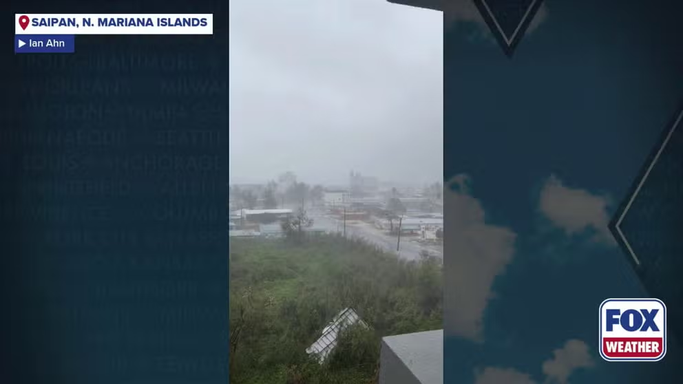
Watch: Wind gusts from super typhoon Sinlaku roar across Saipan
Wind gusts from super typhoon Sinlaku roared across Saipan Tuesday.
This is the first super typhoon to make a direct hit on Saipan and Tinian since Yutu caused widespread destruction in 2018.
The powerful storm made its closest point of approach to Guam Tuesday night, passing to the north and east of the island Tuesday night, but still lashed the island with heavy rain and wind gusts up to 80 mph.
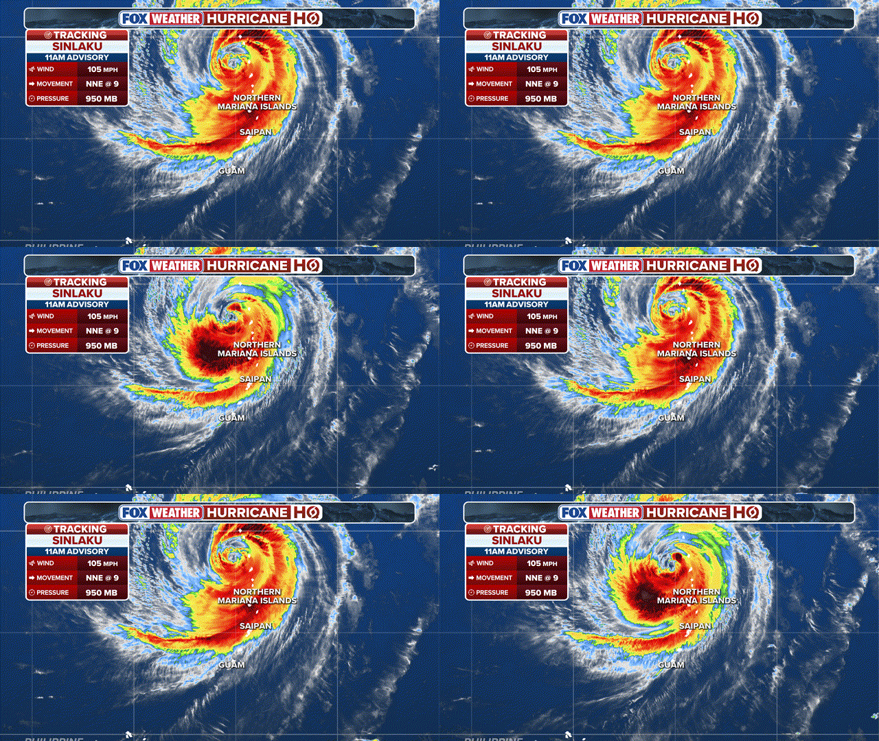
(FOX Weather)
The Joint Information Center in Guam said the eye of Sinlaku slowed to a virtual standstill before making landfall as a destructive Category 4 typhoon — the equivalent of a Category 4 hurricane.
The northern part of Saipan was continuously pounded by the eyewall which moved slowly over that part of the territory on Tuesday night.
BRYAN NORCROSS: THINKING ABOUT EL NIÑO, HURRICANE SEASON 2026, AND AI
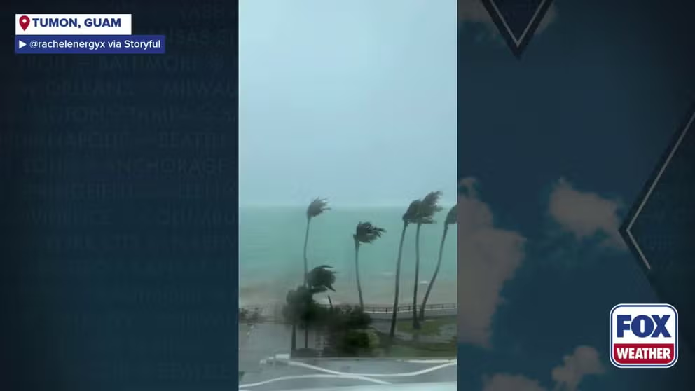
Watch: Winds from super typhoon Sinlaku lash Guam
Powerful wind gusts lashed Guam as super typhoon Sinlaku passed just north of the island.
The Office of the Governor and Lieutenant Governor of the Northern Mariana Islands urged everyone on Saipan, Tinian to shelter as the worst of the storm raked across the islands.
"The safest place to be during this situation is in a reinforced interior room away from windows," officials said on social media.
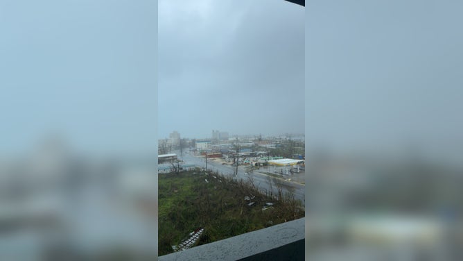
![A look at Saipan on Wednesday after Typhoon Sinlaku passed through.]() Image 1 of 2
Image 1 of 2A look at Saipan on Wednesday after Typhoon Sinlaku passed through. (Ian Ahn)
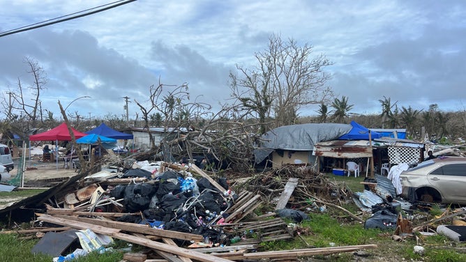
![Damage from Typhoon Sinlaku in Saipan on Wednesday.]() Image 2 of 2
Image 2 of 2Damage from Typhoon Sinlaku in Saipan on Wednesday. (Ian Ahn)

"Put as many walls between yourself and the outside as possible. Remain in shelter through the passage of these life-threatening conditions."
On Monday, Guam Governor Lou Leon Guerrero and the Commander of Joint Region Marianas, U.S. Navy Rear Admiral Brett Mietus, placed Guam and U.S. military bases under a Tropical Cyclone Condition of Readiness. Businesses were closed and people were advised to shelter in place.
Officials said more than 760 people were in emergency shelters across the island.
LA NIÑA DEAD, NEUTRAL CONDITIONS TAKE OVER IN PACIFIC AS EL NIÑO BECOMES INCREASINGLY LIKELY
Guam's Homeland Security department said late Monday that power crews are on standby to restore service once the worst of the storm passes, with power outages already reported earlier in the evening.
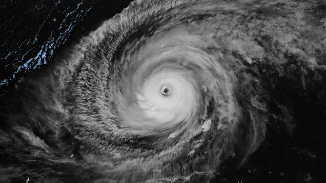
Satellite imagery of super typhoon Sinlaku as it made landfall on Saipan and Tinian Tuesday night, April 14, 2026.
(CIRA / FOX Weather)
Only one storm, Jean in 1968, has made landfall on Saipan during the month of April, according to the FOX Forecast Center.
Super Typhoon Yutu made a direct hit on Saipan in Oct. 2018, killing two people and injuring more than 130 others, as well as destroying homes and critical infrastructure, according to FEMA.
Over 180 Red Cross disaster workers went to Guam and the Northern Mariana Islands after Mawar.
(American Red Cross / FOX Weather)
Most recently, Typhoon Mawar in 2023 passed just north of Guam as a Category 4 equivalent storm.
This comes amid an early surge of tropical activity in the western Pacific, which typically doesn't see super typhoons until the summer months.
(FOX Weather)
Meanwhile, the Eastern Pacific hurricane season officially begins on May 1.
"Winds on the bottom of Sinlaku's giant circulation are propelling Pacific Ocean water and wave energy from west to east. Bursts of west wind like this support warming in the El Niño region," Norcross said Monday.
El Niño plays a significant role in the Pacific, often increasing storm activity and contributing to above-average storm seasons in parts of the region.
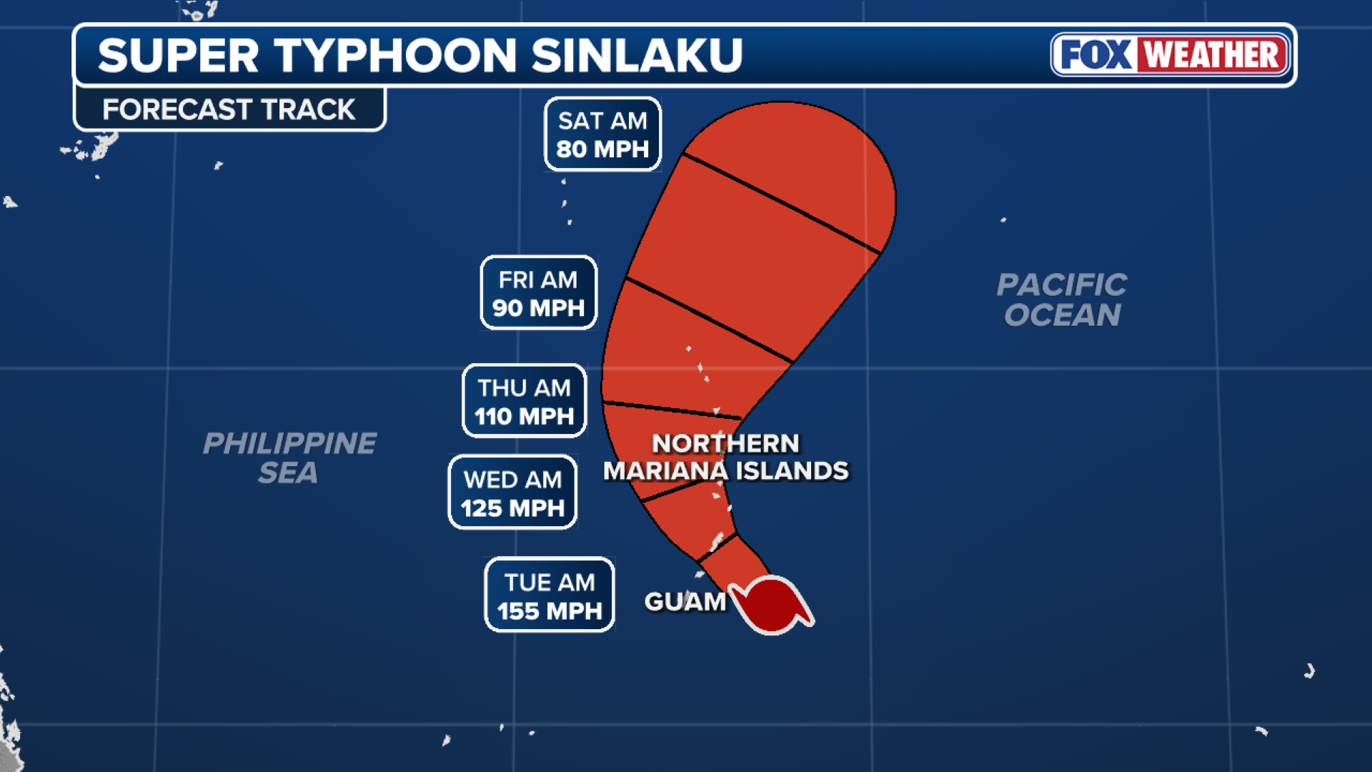
Sinlaku will continue to gradually weaken as it passes the Northern Mariana Islands through Thursday and eventually out to sea by Friday.
Stay with FOX Weather as we continue tracking this developing story.