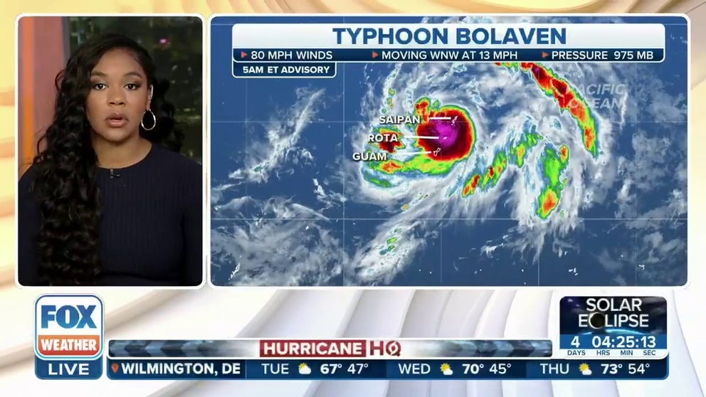
Typhoon Bolaven lashes US territories as ferocious winds, torrential tropical rains hit Guam
Typhoon Bolaven is passing just north of Guam, where Tropical Storm Warnings remain in effect, with its center scraping the island of Rota. Typhoon Warnings remain posted for Rota, Tinian and Saipan in the Northern Mariana Islands.
Typhoon Bolaven bears down on Guam, Mariana Islands
Winds of 80-90 mph with gusts nearing 120 mph were expected in Rota while tropical storm-force winds lashed Guam Tuesday as Typhoon Bolaven passed through the island chain.
SANTA RITA, Guam – Typhoon Bolaven pummeled the U.S. territories of Guam and the Northern Mariana Islands Tuesday evening local time, lashing the islands with up to 65-80 mph winds, torrential rains and pounding surf. But the islands dodged a bullet as the Bolaven's eyewall managed to miss making any direct hits.
The storm passed about 50 miles north of Guam Tuesday afternoon, where Tropical Storm Warnings remain in effect, with its center scraping just 20 miles north of the island of Rota. Typhoon Warnings remain posted for Rota, Tinian and Saipan in the Northern Mariana Islands as the storm slowly pulls away from the islands Tuesday night.
A typhoon is similar storm to a hurricane, just given a different name in the Western Pacific Ocean.
5 DIFFERENT NAMES FOR HURRICANES AROUND THE WORLD

(FOX Weather)
Typhoon Bolaven's impacts
The islands of Rota and Saipan were taking the brunt of Bolaven as the storm center passed right between the two islands Tuesday evening.
The storm had estimated peak sustained winds of 80 mph with gusts of 100 mph or more near its eyewall, according to the National Weather Service in Guam.
On the island of Saipan, the airport recorded a gust of 68 mph while a private weather station on Wireless Ridge recorded a gust over 80 mph, according to the NWS. Guam registered a peak gust of 46 mph.

(FOX Weather)
But it could have been worse.
"The strongest winds went right through between Rota and Tinian keeping those strongest typhoon-force winds in the open waters between Tinian and Rota," Science Operations Officer Brandon Aydlett, with NWS Guam, said in a storm update posted to Facebook. "So it’s a significant turn of events, and I’m sure across all the islands we’re thankful that was the case."
Still, surf heights were expected to reach 20-24 feet in Rota, while Guam will see winds up to 60 mph and heavy surf of 14-17 feet, the NWS warned.
Aside from the wind, torrential tropical rains prompted Flood Warnings and Flash Flood Watches for the entire area. As much as 8-14 inches of rain is expected with Typhoon Bolaven. Some locations in northern Guam have already received nearly 7 inches of rain, according to the NWS.
Residents were asked to stay inside and off roads until conditions improved, likely around 10 a.m. Wednesday.

(FOX Weather)
Once past Guam, the U.S. Joint Typhoon Warning Center writes that the storm will turn north away from the islands then undergo rapid intensification and top out with winds of 150 mph, reaching super typhoon status.
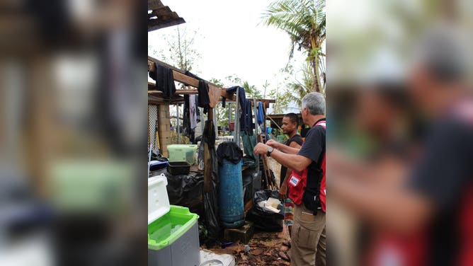
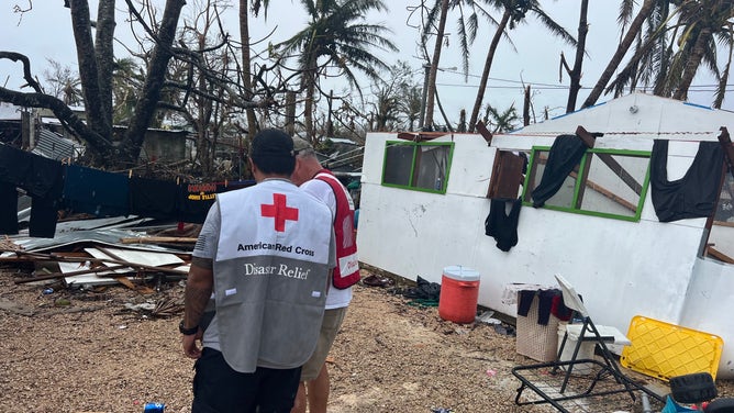
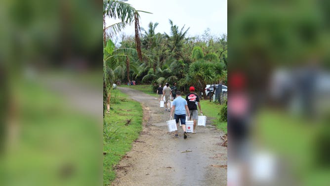
Area damaged by May super typhoon
Almost 200,000 people live along coastal areas of the island chain, according to the American Red Cross. The islands are still cleaning up after Category 4 Super Typhoon Mawar battered the area in May. Most buildings are still damaged and susceptible to further destruction.
"Mawar made landfall in May and left most of the islands without power, damaged water systems and communication towers and heavily damaged or destroyed a number of structures," announced the Red Cross in a statement. "Hundreds of Red Cross disaster workers from all over the country deployed to the region to help. The Red Cross is still there, working with partners to support people as they get back on their feet."
TYPHOON MAWAR DAMAGE IN GUAM REVEALED IN BEFORE AND AFTER SATELLITE IMAGERY OVER US TERRITORY
![]() Image 1 of 4
Image 1 of 4Over 180 Red Cross disaster workers went to Guam and the Northern Mariana Islands after Mawar. (American Red Cross)
![]() Image 2 of 4
Image 2 of 4Over 180 Red Cross disaster workers went to Guam and the Northern Mariana Islands after Mawar. (American Red Cross)
![]() Image 3 of 4
Image 3 of 4Over 180 Red Cross disaster workers went to Guam and the Northern Mariana Islands after Mawar. (American Red Cross)
![]() Image 4 of 4
Image 4 of 4Over 180 Red Cross disaster workers went to Guam and the Northern Mariana Islands after Mawar. (American Red Cross)

FEMA already had 200 additional staff on Guam supporting Mawar survivors. The agency deployed an additional 175 people ahead of Bolaven.
The U.S. Coast Guard sent larger ships out to sea to ride out the waves and pulled smaller boats on land. Search and rescue crews are standing by, but the USCG warns that they won't be able to get on the scene until the storm passes.