Typhoon Mawar damage in Guam revealed in before and after satellite imagery over US territory
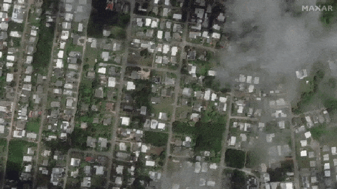
The before and after satellite images show about one out of every five homes missing after the storm battered the island 1,600 miles south of Japan and 1,550 miles east of the Philippines last Wednesday and Thursday.
Aerial views of Typhoon Mawar's path of destruction: Before and after
Satellite pictures show widespread destruction after Typhoon Mahwar slammed into Guam. Before and after images show destroyed homes, debris strewn streets and major damage to NASA's Remote Ground Terminal.
Guam continues to clean up after Typhoon Mawar slammed the small Pacific island and U.S. territory last week. At landfall, the storm's estimated sustained winds of 140 mph destroyed homes, flipped cars and demolished wind sensors at the airport after it logged a 105-mph gust. The damage is so widespread that only satellite images can capture the enormous swath of destruction.
Guam Gov. Lou Leon Guerrero said in a social media post that the island suffered "a frightening experience that hasn't been felt for over two decades."
Tropical cyclones that reach hurricane-equivalent intensity are called typhoons in the Western Pacific.
At one point, 98% of Guam lost power during Typhoon Mawar. The governor announced that it took the Guam Power Authority almost two days to fully restore power to the Guam Memorial Hospital. Crews continue to fork on 24-hour shifts to restore power to the rest of the island.
ANALYSIS: TYPHOON MAWAR'S LAST-MINUTE SWERVE SPARED GUAM EVEN WORSE WINDS
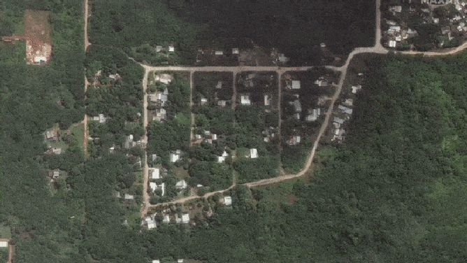
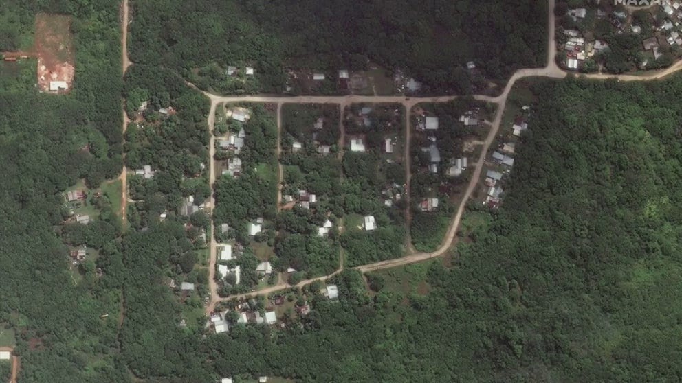
The 140-mph winds destroyed whole neighborhoods in Dededo, Guam.
(Maxar Technologies via Storyful / FOX Weather)
Dededo, on the northern part of the island, was left in ruin. The after picture above shows just a few surviving homes when compared to satellite imagery taken before the powerful typhoon struck. Neighboring homes are reduced to piles of debris.
"We are waking up to a rather disturbing scene out there across Guam," a National Weather Service meteorologist said during a video update posted to Facebook once the storm departed. "We’re looking out our door, and what used to be a jungle looks like toothpicks."
5 DIFFERENT NAMES FOR HURRICANES AROUND THE WORLD
Dededo, Guam, suffered great loses.
(Maxar Technologies via Storyful / FOX Weather)
The before and after satellite images show about one out of every five homes missing after the storm battered the island 1,600 miles south of Japan and 1,550 miles east of the Philippines last Wednesday and Thursday.
The governor reported that there were no deaths due to the storm.
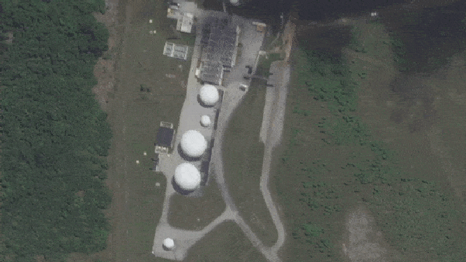
Typhoon Mawar not only knocked out wind equipment at the airport. It also demolished the radar dome, according to the NWS. NASA's Remote Ground Terminal also suffered significant losses.
(Maxar Technologies via Storyful / FOX Weather)
Typhoon Mawar not only knocked out wind equipment at the airport. It also demolished the radar dome, according to the NWS.
NASA's Remote Ground Terminal also suffered significant losses.
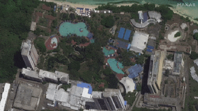
Resorts along Tumon Bay in Guam were ravaged.
(Maxar Technologies via Storyful / FOX Weather)
On the coast, resorts along Tumon Bay remain in tatters. High-rise buildings are still standing, but many of the smaller outbuildings have vanished. The pools are unrecognizable.
After making a direct strike on Guam, Mawar strengthened into a super typhoon with winds over 150 mph as it charged toward the Philippines. The massive storm jogged north and spared the country and is currently churning well off of Taiwan. Mawar weakened but still packs winds of 120 mph as of Sunday, U.S. time.