Winter storm to dump snow, ice across Plains, Midwest and Northeast on Monday
Most areas can expect to see a few inches of snow
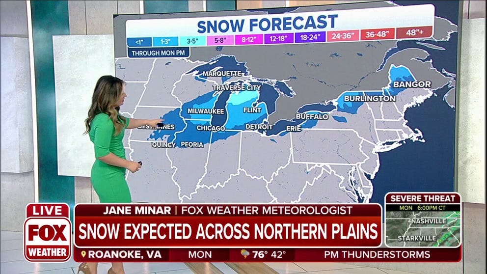
Snow expected from Great Lakes to Northeast on Monday
A storm system will bring a few inches of snow from parts of the Great Lakes into the Northeast and northern New England on Monday.
A storm system is continuing to dump snow in parts of the Midwest and Great Lakes region before moving into northern New England by Monday night.

FOX WEATHER APP GETS A SPRING REFRESH
Here's our current outlook for this storm. Be sure to download the FOX Weather app for the latest forecast and weather alerts for your exact location, plus our channel's 24/7 livestream.
Heavy snow has been reported across Iowa, which saw warm temperatures and deadly tornadoes over the weekend.
THESE ARE THE 7 SNOWIEST CITIES IN THE U.S.
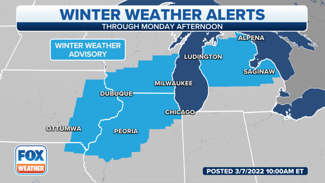
Winter weather alerts in effect through Monday afternoon.
As the day continues, the snow will continue to push off to the east into Wisconsin, northern Illinois and eventually overspread Michigan before impacting northern New England later in the evening.
Winter weather advisories are in effect in northern Missouri, southern Iowa, northern Illinois, southern Wisconsin and central Michigan through at least Monday afternoon.
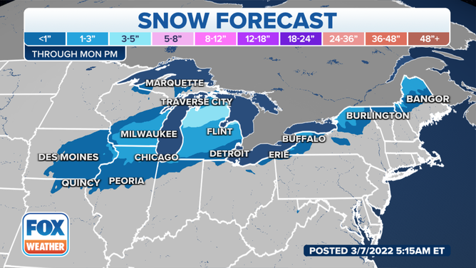
The snow forecast through Monday night.
(FOX Weather)
As the system continues to push off to the east, light accumulations are expected in Iowa and parts of northern Illinois and southern Wisconsin. The heaviest accumulations will be across Michigan, where 3-5 inches could fall in the central and northern parts of the state.
Light accumulations are also expected in parts of the Northeast and northern New England. Most areas from Buffalo, New York to Burlington, Vermont and Bangor, Maine could pick up 1-3 inches of snow.