

Life-threatening flooding and damaging winds slam the Gulf Coast as Arthur packs a punch
The NHC forecasts rainfall totals of 5 to 10 inches, with isolated amounts approaching 20 inches, through early Friday from the middle and upper Texas coast across much of Louisiana and into portions of central and southern Mississippi and Alabama.
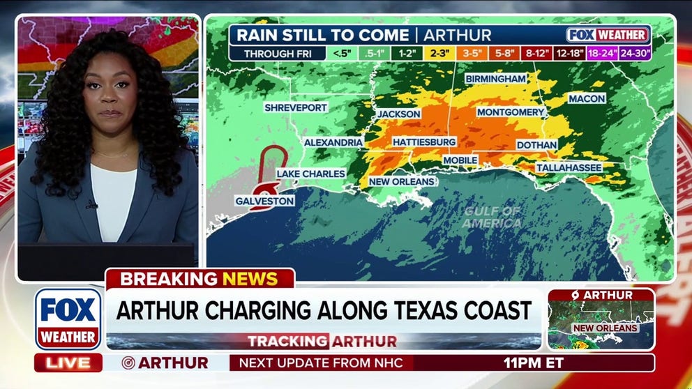
Tropical Storm Arthur’s center re-forms near Galveston, Texas
Tropical Storm Arthur’s center has re-formed, placing it just 10 miles northwest of Galveston, Texas. The storm currently has maximum sustained winds at 40 mph and officials expect some areas may see up to 10 inches of rain. Stay with FOX Weather for the latest.
Arthur was downgraded from a tropical storm to a post-tropical cyclone, but life-threatening flooding associated with the storm will still pack a punch in the South overnight and into Thursday.
Tropical storm watches and warnings were issued as Arthur reached parts of Texas and Louisiana on Wednesday, bringing damaging winds, torrential rainfall and storm surge.
WATCH: HEAVY RAIN TRIGGERS DANGEROUS FLASH FLOODING ACROSS TEXAS, PROMPTING MULTIPLE WATER RESCUES
Arthur was the first named storm of the 2026 Atlantic hurricane season. It strengthened into a named storm after being designated Potential Tropical Cyclone One.
But in their 11 p.m. update, the National Hurricane Center (NHC) said the storm was downgraded to Post-Tropical Cyclone Arthur.
All tropical storm watches and warnings have been discontinued.
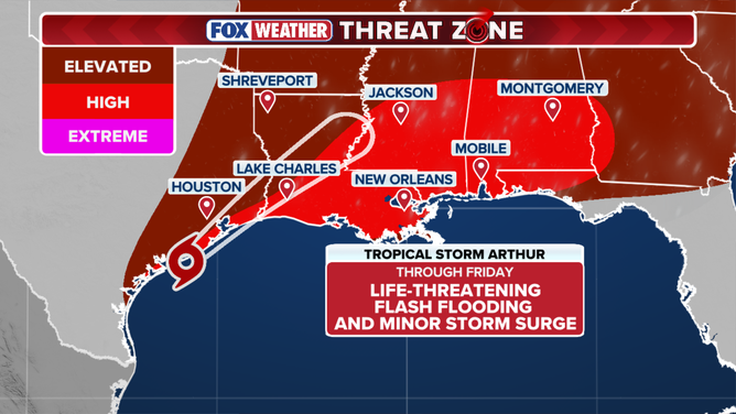
FOX Weather Threat Zone
(FOX Weather)
A tropical storm is a tropical cyclone with maximum sustained winds between 39 and 73 mph, making it stronger than a tropical depression.
Arthur reached maximum sustained winds of 45 mph and produced a storm surge of up to 3 feet of storm surge along the Texas coastline.
The disturbance is still holding strong with sustained winds of 35 mph overnight, according to the NHC.
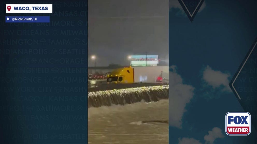
Watch: Torrential downpours turn Texas Highway into a river amid life-threatening flash flooding
Torrential downpours have turned hazardous in Waco, Texas, leaving Interstate 35 flowing like a river amid life-threatening flash flooding.
According to the FOX Forecast Center, the system strengthened as it moved northwest over the Gulf's warm waters, which provided the thermal energy needed to fuel the storm.
In addition, a large-scale lift associated with a sharp dip in the jet stream helped remove air from the storm's center, encouraging storms to develop and organize.
However, because the system spent limited time over water and continued to encounter moderate wind shear, strengthening remained limited, keeping Arthur as a mid-tier tropical storm.
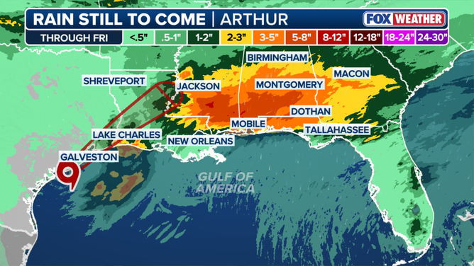
Rain forecast for Tropical Storm Arthur
(FOX Weather)
Forecasters warn that Post-Tropical Cyclone Arthur could still bring damaging winds and a life-threatening flash flood threat to the Gulf Coast through the end of the week.
WHAT’S THE DIFFERENCE BETWEEN A TROPICAL DEPRESSION, TROPICAL STORM AND HURRICANE?
A Level 3 out of 4 flood threat is in effect through Thursday morning, with the potential for widespread and locally catastrophic flooding across numerous cities, including Baton Rouge, New Orleans and Morgan City.
The NHC forecasts rainfall totals of 5 to 10 inches, with isolated amounts approaching 20 inches, through early Friday from the middle and upper Texas coast across much of Louisiana and into portions of central and southern Mississippi and Alabama.
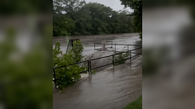
Heavy rain swells waterways in Boerne, Texas, triggering severe flooding Monday.
(City of Boerne/Facebook)
Earlier this week, Texas Gov. Greg Abbott issued a disaster declaration for 101 counties and urged residents to take precautions and avoid driving on flooded roadways as severe weather continues to impact the state.
"Texas is prepared to respond to the severe weather threats that continue to move across our state," Abbott said in a statement. "Texans should heed the guidance of state and local officials and take all necessary precautions to stay safe during this severe weather."
Meanwhile, nearly three million Louisiana residents remain under flash flood alerts.
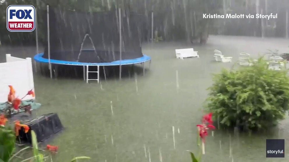
Heavy flooding cause the drowning of chickens in Mississippi
TRAGIC: Due to persistent heavy rain in Mississippi, which has resulted in heavy flooding, a resident's chickens in a backyard drowned.
Flooding concerns are expected to worsen, with Baton Rouge among one of the major cities located near the bull's eye of the heaviest rainfall.
HERE'S WHAT TO DO IF YOU ENCOUNTER A FLOODED ROAD
"This is a long-lasting event. It comes in phases," FOX Weather Hurricane Specialist Bryan Norcross said. "It might look like the rain is letting up, but the worst of it could still be to come."
Stay with FOX Weather for the latest updates.