Tropical Storm Melissa likely to form in Caribbean Tuesday as Invest 98L becomes better defined
The National Hurricane Center said that those with interests in Puerto Rico, Hispaniola, Jamaica and Cuba should continue to monitor the progress of likely Tropical Storm Melissa due to a risk of heavy rain and flooding, strong winds and rough surf at local beaches later this week.

Tropical Storm Melissa likely to form in Caribbean on Tuesday
Invest 98L is getting its act together over the warm waters of the Caribbean Sea, and the National Hurricane Center now says the system will likely develop into Tropical Storm Melissa on Tuesday. FOX Weather Meteorologists Marissa Torres and Stephen Morgan have the latest on Oct. 21, 2025.
Invest 98L strengthened into Tropical Storm Melissa on Tuesday, Oct. 21, and coverage continues by clicking here.
MIAMI – Invest 98L is continuing to become better organized, and forecasters with the National Hurricane Center (NHC) now say that Tropical Storm Melissa is likely to form Tuesday as the system slowly spins across the region.
The term "invest" is used by the NHC to identify weather disturbances it is investigating for possible development into a tropical depression or tropical storm within the next seven days. Additionally, the designation allows the NHC to run special hurricane computer forecast models on the system.
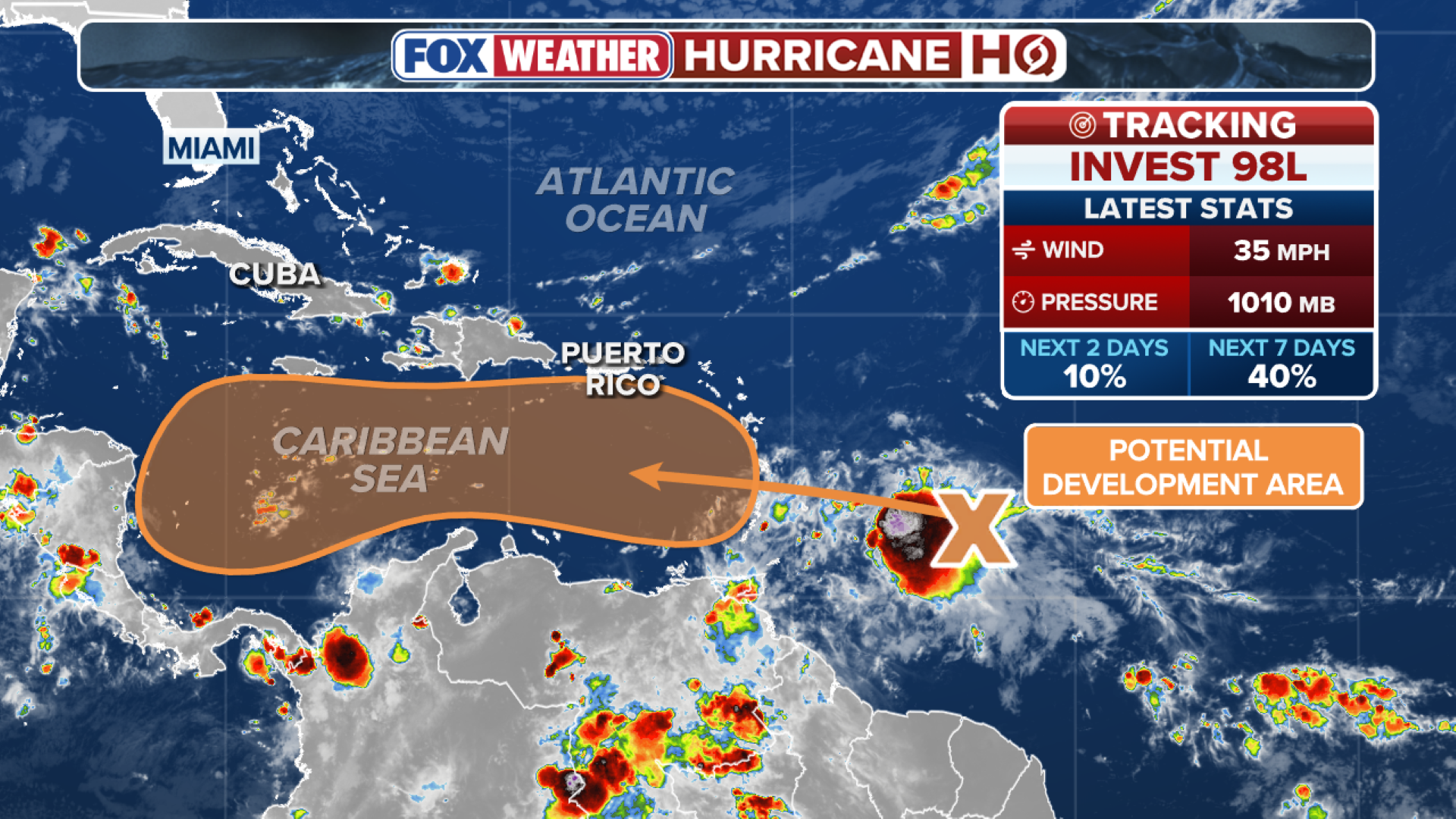
(FOX Weather)
According to the latest information from the NHC, satellite, radar and surface observations have indicated that Invest 98L is continuing to become better defined, with winds near 50 mph, but it is still lacking a well-defined center.
However, environmental conditions are expected to become more favorable for development, and a tropical storm is likely to form Tuesday as the low-pressure system moves slowly over the central Caribbean.
NOAA’s Hurricane Hunters are set to take off from Curaçao on Tuesday on a low-level investigation to get a better look at what is likely to become Tropical Storm Melissa.
That mission is set to conclude later on Tuesday afternoon.
DOWNLOAD THE FREE FOX WEATHER APP

This satellite image shows Invest 98L in the Caribbean on Oct. 21, 2025.
(NOAA)
Heavy rain and gusty winds are possible over portions of the ABC Islands (Aruba, Bonaire and Curaçao) over the next few days.
The NHC said that those with interests in Puerto Rico, Hispaniola, Jamaica and Cuba should continue to monitor the progress of likely Tropical Storm Melissa due to a risk of heavy rain and flooding, strong winds and rough surf at local beaches later this week.
When Invest 98L becomes Tropical Storm Melissa, it will be the 13th named storm of the 2025 Atlantic hurricane season.
The Atlantic hurricane season runs from June 1 through Nov. 30.