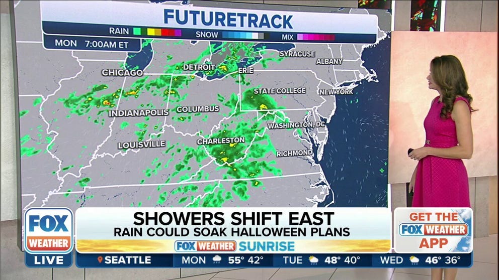
Rain showers could dampen Halloween plans from Great Lakes, Ohio Valley to East Coast
The rain showers will reach the Interstate 95 corridor in the Northeast and mid-Atlantic on Halloween evening, so trick-or-treating plans could be dampened in some areas.
Rain showers could dampen Halloween plans from Great Lakes, Ohio Valley to East Coast
The same low-pressure system that brought tornadoes to parts of the central Gulf Coast Saturday night will slowly shift east through Tuesday.
The same low-pressure system that spawned a regional tornado outbreak along the central Gulf Coast on Saturday will slide eastward Monday and Tuesday, and that could lead to an unsettled Halloween from the Great Lakes and Ohio Valley to parts of the East Coast.
According to the FOX Forecast Center, at least 10 tornadoes have been confirmed by the National Weather Service across parts of southeastern Mississippi and southwestern Alabama.
About half of the tornadoes surveyed by the NWS struck the Mobile, Alabama, metro area.
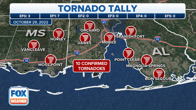
Map showing the 10 confirmed tornadoes across southeastern Mississippi and southwestern Alabama on Saturday, Oct. 29, 2022.
(FOX Weather)
The FOX Forecast Center said the regional tornado outbreak was sparked by an unusually high amount of wind shear – the change in wind speed and direction with height – that combined with moisture from the Gulf of Mexico.
While severe weather is not expected on Halloween or on Tuesday as this storm system slides eastward, it will bring occasional rounds of rain showers from the Great Lakes and Ohio Valley to parts of the East Coast. However, the days are not expected to be complete washouts, with several hours of dry time likely.
Forecasts for Monday, Tuesday and Wednesday.
(FOX Weather)
The rain showers will reach the Interstate 95 corridor in the Northeast and mid-Atlantic on Halloween evening, so trick-or-treating plans could be dampened in some areas.
The FOX Forecast Center expects some locally heavier bands of rain to develop, with up to an inch of rain possible in isolated spots east of the Appalachians from Virginia to South Carolina. Less than a half-inch of rain is expected in most locations, however.
YOUR HALLOWEEN WEATHER FORECAST FROM COAST TO GHOST

(FOX Weather)
Leftover rain showers could linger Tuesday along the East Coast from North Carolina to Maine before the storm system weakens and move offshore.
Dry weather will return Wednesday along with a gradual warming trend, with above-average temperatures expected from late week through the upcoming weekend.