

Tropical development chances rising in the Eastern Pacific ahead of early June
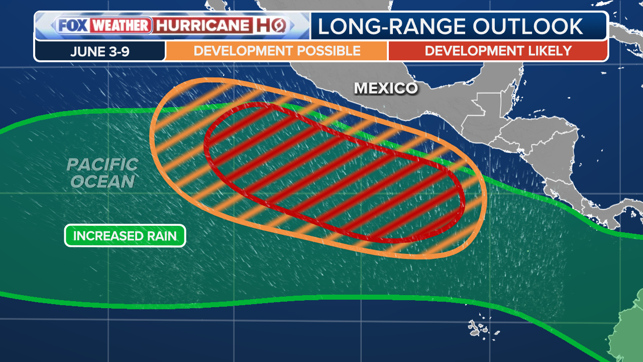
The latest outlooks from the Climate Prediction Center highlight an area off the southwestern coast of Mexico with an increased probability of tropical development between June 3 and June 9.
New outlook reveals rising odds for June Eastern Pacific tropical development
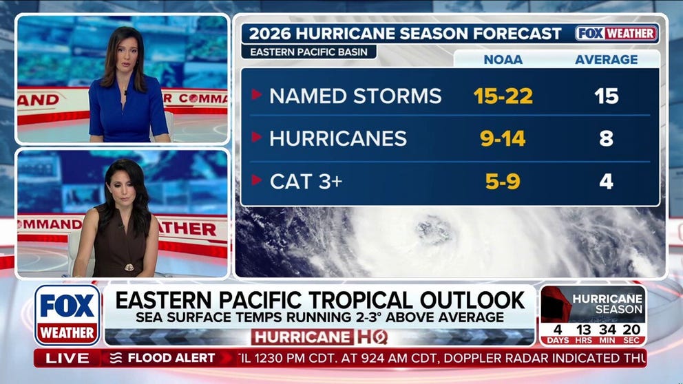
Following a quiet start to the Eastern Pacific hurricane season, new extended outlooks reveal increasing odds for tropical development heading into June. FOX Weather Meteorologist Marissa Torres and Melanie Black break down the new information and what to expect:
Since the Eastern Pacific hurricane season began May 15, tropical activity has remained quiet in the region. However, things may begin to take a twist as we head into the first few weeks of June.
The FOX Forecast Center has been tracking potential tropical activity closely, especially with El Niño expected to develop rapidly into summer.
Now, the latest two and three-week outlooks from the Climate Prediction Center highlight an area off the southwestern coast of Mexico with an increased probability of tropical development between June 3 and June 9.

(FOX Weather)
Being that the first named storm in the Eastern Pacific typically forms around June 10, development during this timeframe would not be unusual.
HURRICANE SEASON 2026: THESE ARE THE STORM NAMES YOU'LL SEE THIS SEASON
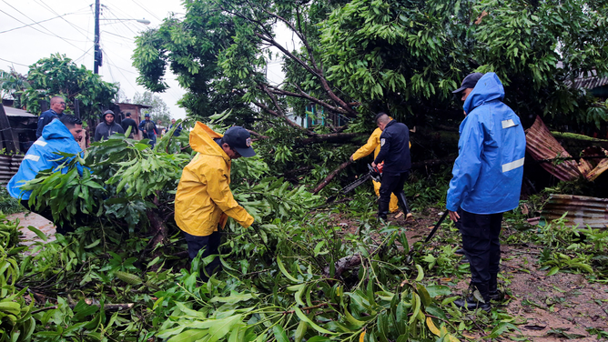
Nicaragua's National Police members try to prune fallen trees following the passage of Hurricane Julia in the town of Bluefields, on the Caribbean coast of Nicaragua on October 9, 2022. - Hurricane Julia raked across Nicaragua Sunday, lashing the country with winds and heavy rain and bringing potentially life-threatening flash flooding and mudslides to much of Central America.
(OSWALDO RIVAS/AFP / Getty Images)
Some longer-range forecast models, including the American GFS model and the European ECMWF model, have also highlighted this potential in their latest runs.
HURRICANE MELISSA TIES RECORD FOR STRONGEST HURRICANE IN ATLANTIC HISTORY
(FOX Weather)
Although the average first storm occurs in June, May tropical activity in the Eastern Pacific remains relatively common.
BREWING SUPER EL NIÑO COULD TURN THE CALIFORNIA COAST INTO A SUMMER HOTSPOT FOR GREAT WHITE SHARKS
According to the FOX Forecast Center, since 1950, there have been 25 tropical storms and 19 hurricanes during May, for a total of 44 named systems.

This frame grab from AFPTV video footage shows the popular tourist town of Puerto Escondido as Hurricane Erick approaches Mexico's Pacific coast as a powerful Category 3 storm in Oaxaca state, Mexico on June 18, 2025. Hurricane Erick barreled down on Mexico's Pacific coast Wednesday having strengthened to a powerful Category 3 storm, the US National Hurricane Center said, warning of potentially deadly floods. (Photo by Carlo ECHEGOYEN / AFPTV / AFP) (Photo by CARLO ECHEGOYEN/AFPTV/AFP via Getty Images)
(Getty Images)
The last storm in the Eastern Pacific in May was Hurricane Agatha in 2022, which moved into Mexico on May 30 as a Category 2 hurricane.
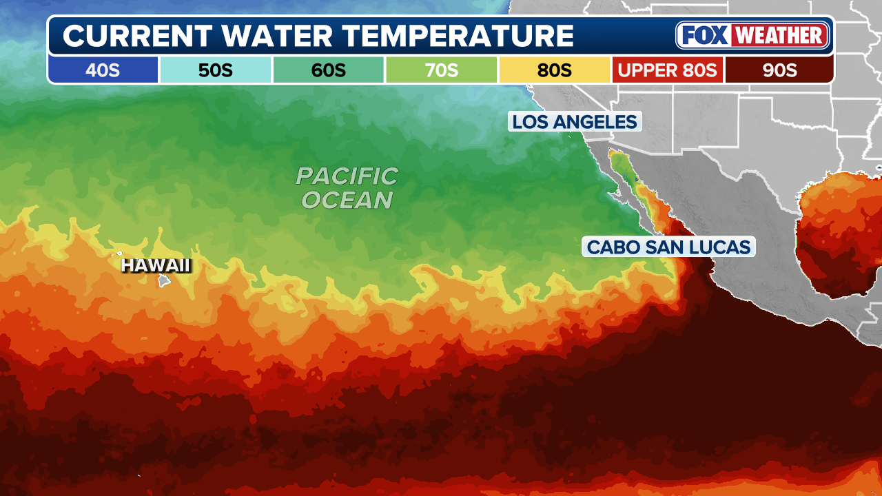
With that, ocean temperatures continue to run warmer than average across much of the basin and are expected to become even more conducive for development in the coming weeks as waters continue warming.
WHAT ARE EL NINO AND LA NINA CLIMATE PATTERNS?
Warmer ocean temperatures in the Eastern Pacific typically indicate the presence of an El Niño climate pattern.
(FOX Weather)
Sea surface temperatures off the coast of Mexico and extending westward into the open Pacific are currently running roughly 2 to 3 degrees above average.
HOW ARE HURRICANES RATED? THE SAFFIR-SIMPSON HURRICANE WIND SCALE EXPLAINED
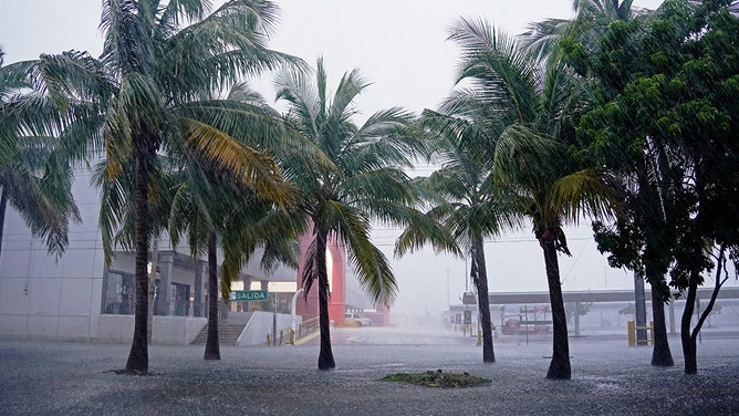
![Heavy rains from Hurricane Helene fall over Cancun, Quintana Roo State, Mexico, on September 24, 2024.]() Image 1 of 3
Image 1 of 3Heavy rains from Hurricane Helene fall over Cancun, Quintana Roo State, Mexico, on September 24, 2024. (ELIZABETH RUIZ/AFP)
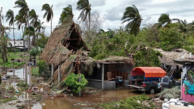
![MEXICO-HURRICANE-ERICK]() Image 2 of 3
Image 2 of 3Locals walk amid debris following the passage of Hurricane Erick in Bahia Principal, Puerto Escondido, state of Oaxaca, Mexico, on June 19, 2025. Erick, a category 4 hurricane on a scale of 5, made landfall in the Mexican state of Oaxaca (west) on the Pacific coast, the United States National Hurricane Center (NHC) reported. (Photo by CARLO ECHEGOYEN / AFP) (Photo by CARLO ECHEGOYEN/AFP via Getty Images) ( )
![MEXICO-HURRICANE-ERICK]() Image 3 of 3
Image 3 of 3An aerial view of the damages following the passage of Hurricane Erick in Chacahua, Oaxaca state, Mexico on June 19, 2025. Hurricane Erick was downgraded on June 19, 2025, to a tropical storm as it advanced through southern Mexico, after entering the country's Pacific coast early this morning, where it left only material damage, authorities reported. (Photo by CARLO ECHEGOYEN / AFP) (Photo by CARLO ECHEGOYEN/AFP via Getty Images) ( )

With that, increasing attention will continue to focus on these anomalously warm waters across the basin, along with the ongoing development of El Niño.
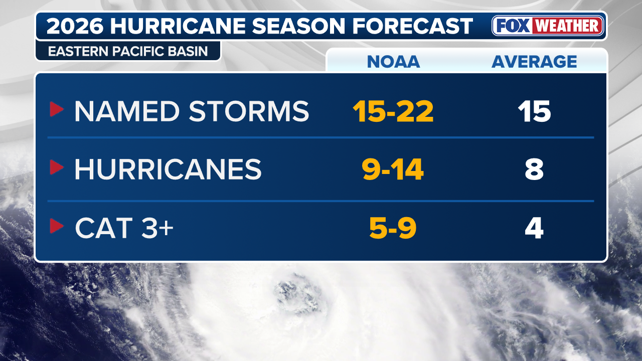
To put things into perspective, a typical Eastern Pacific hurricane season averages 15 named storms, eight hurricanes and four major Category 3 or higher hurricanes.
(FOX Weather)
7 FACTS TO KNOW ABOUT HURRICANES
By comparison, during El Niño years since 1990, those averages have increased to approximately 17 named storms, nine hurricanes and five major hurricanes, highlighting a measurable uptick in seasonal activity.