

Severe weather 'marathon' begins for Central US, as large hail, tornadoes impact the Plains
Thursday's severe weather threat has increased, now up to Level 3 out of 5 across south-central Kansas, including Wichita, according to NOAA's Storm Prediction Center (SPC).
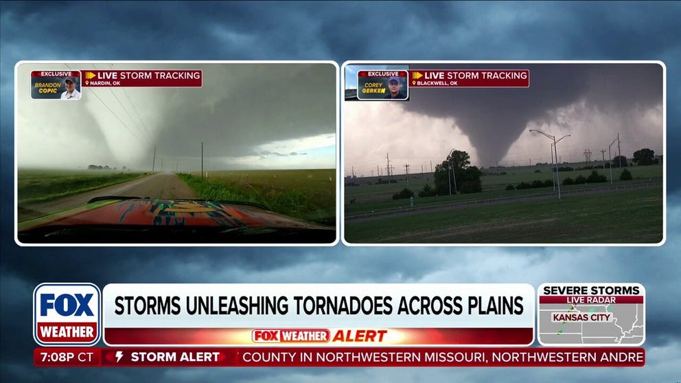
SEVERE WEATHER HQ🌪️: FOX Weather Storm Trackers Intercept Two Tornadoes at Once
SEVERE WEATHER HQ 🌪️: Storms are erupting across Oklahoma as FOX Weather Storm Trackers Brandon Copic and Corey Gerken race into the heart of the chaos, tracking dangerous severe weather in real time. Then, in a jaw-dropping moment, both storm trackers intercept on-going tornadoes at the same time, in different parts of Oklahoma.
Severe storms are moving through a corridor spanning more than 1,000 miles from Minnesota to Texas, bringing tornadoes and large hail to many in the storms' path.
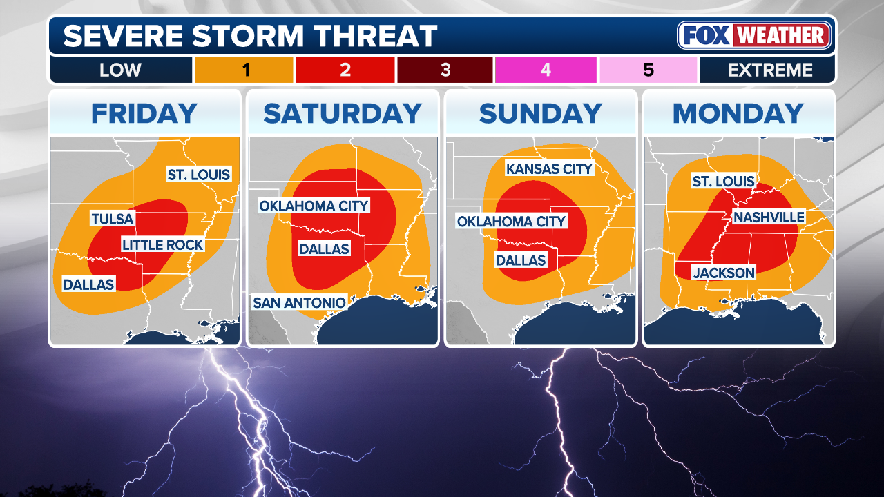
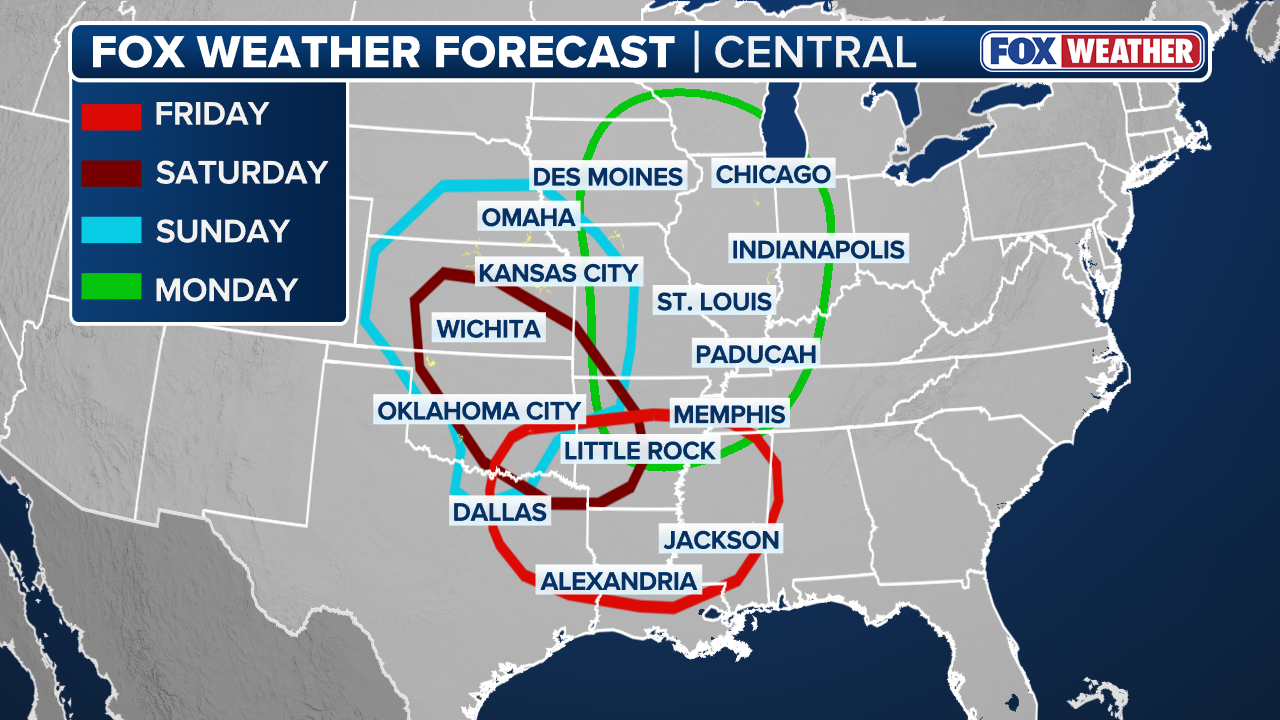
Thursday marks the opening act of a multi-day pattern that's expected to produce at least five consecutive days of damaging storms for the Heartland.
DEVASTATING DAMAGE REPORTED ACROSS MULTIPLE STATES AFTER TORNADO OUTBREAK HAMMERS THE MIDWEST
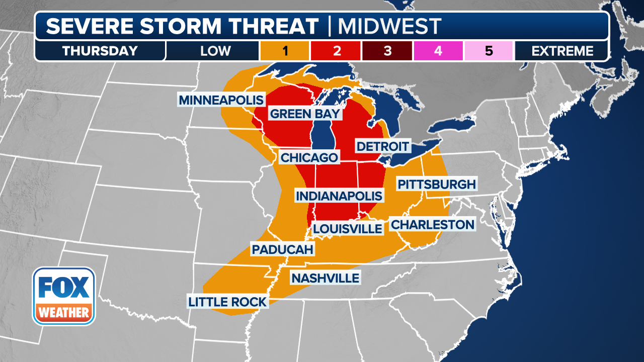 Severe storm threat on Thursday
(FOX Weather)
This comes after at least 79 tornadoes tore across the Heartland during last Friday's severe weather outbreak, destroying homes and causing hundreds of thousands of power outages.
Two EF-3 twisters were confirmed in Wisconsin, with surveys from the National Weather Service (NWS) still ongoing. Storms also produced damaging winds topping 85 mph, large hail greater than 3 inches in diameter, and destructive flooding across Wisconsin and Michigan.
Thursday's severe weather threat increased, now up to Level 3 out of 5 across south-central Kansas, including Wichita, according to NOAA's Storm Prediction Center (SPC).
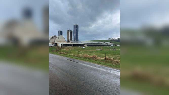
![]() Image 1 of 6
Image 1 of 6Tornado damage in Ringle, Wisconsin, on Friday, April 17, 2026. (Marathon County)
![]() Image 2 of 6
Image 2 of 6Numerous structures were destroyed, and power lines were knocked down, leaving widespread impacts in Montana, Wisconsin. (Derek Hanson )
![]() Image 3 of 6
Image 3 of 6Numerous structures in Montana, Wisconsin were destroyed by a violent tornado. (Derek Hanson)
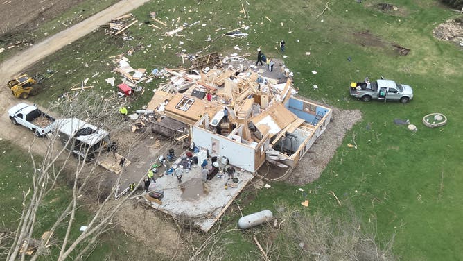
![A damaged home in Buffalo County, Wisconsin.]() Image 4 of 6
Image 4 of 6A damaged home in Buffalo County, Wisconsin. (Buffalo County Wisconsin Sheriff's Office)
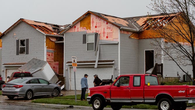
![Homes damaged in Belton, Missouri, after severe weather on Friday.]() Image 5 of 6
Image 5 of 6Homes damaged in Belton, Missouri, after severe weather on Friday. (Charlie Mizell/Facebook)
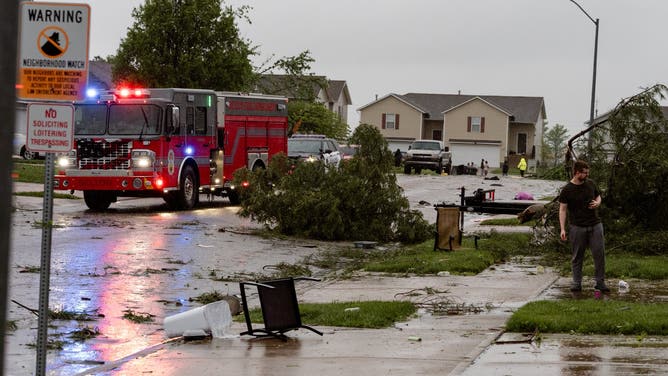
![A fire truck responds to reported tornado damage in Belton, Missouri.]() Image 6 of 6
Image 6 of 6A fire truck responds to reported tornado damage in Belton, Missouri. (Charlie Mizell/Facebook)
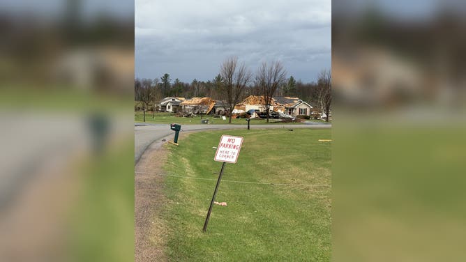
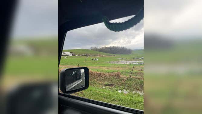
A broader Level 2 threat stretches from southern Minnesota to northern Oklahoma, placing more than 35 million people in the path of some kind of severe storms.
These dangerous thunderstorms will evolve across two main theaters: the Midwest and Central Plains, and the Oklahoma and Texas panhandles.
DANGEROUS SEVERE STORMS FIRE OFF STRONG TORNADOES, 'MONSTER' HAIL TARGETING 50M+ ACROSS 1,500 MILES
Midwest and Central Plains
A storm system that moved through southern Canada dragged several fronts that triggered Thursday's storms in the Midwest and Central Plains.

(FOX Weather)
According to the FOX Forecast Center, daytime heating fueled scattered thunderstorms from central Minnesota through eastern Nebraska, Iowa and northeast Kansas.
WHAT IS A SUPERCELL THUNDERSTORM?
Supercell thunderstorms are producing hail 2 inches in diameter and greater, and the storms could also produce strong tornadoes (EF-2+), with the greatest risk expected across eastern Kansas.

(FOX Weather)
Due to repeated rain over the same areas and high rainfall rates, a Level 1 out of 4 flash flood risk is also present from the Upper Midwest into the Central Plains.
Southern Plains
Farther south, a dryline — the boundary between dry air from the west and moist air from the Gulf — has formed over western Oklahoma and parts of North Texas.
Storms have formed along this dryline and are producing large hail and few tornadoes, with supercells possible.
(FOX Weather)
Severe weather is expected to continue through the weekend with storms targeting the Southern Plains, the mid-Mississippi Valley and the Deep South.
RISING WATERS: DAYS OF HEAVY RAIN CAUSE RIVERS IN MICHIGAN AND WISCONSIN TO EXCEED LIMITS
(FOX Weather)
Check back for updates on this developing story.