What is a supercell thunderstorm?
Supercells can produce very large hail, damaging winds and weak to strong tornadoes.
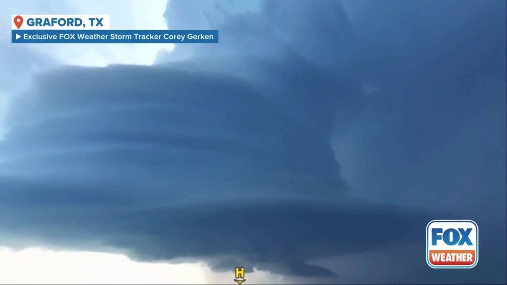
FILE: Drone video shows supercell cloud during Texas severe storms
Drone video from Exclusive FOX Weather Storm Tracker Corey Gerken shows an ominous supercell cloud over Graford, Texas during severe thunderstorms on Thursday, May 22, 2025.
Supercell thunderstorms are the least common type of thunderstorm, but they are the most likely to produce severe weather and become dangerous.
According to the National Weather Service, supercell thunderstorms look like very tall storm clouds that resemble an anvil.

A supercell thunderstorm moves into Norman, Oklahoma, on April 19, 2023.
(@tarver_garrett/WEATHER TRAKER /TMX / FOX Weather)
Supercell thunderstorms can last for hours if the conditions are favorable.
NIGHTTIME TORNADOES FAR MORE LIKELY TO TURN DEADLY THAN DAYTIME ONES
What makes a supercell unique from other thunderstorms is something called a mesocyclone.
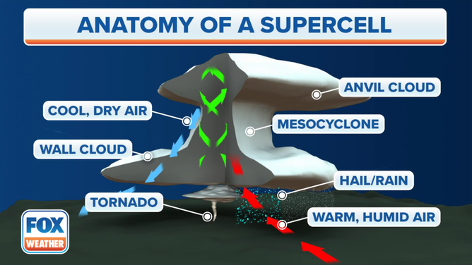
An image showing the anatomy of a supercell thunderstorm.
(FOX Weather)
A mesocyclone is a deep and persistent rotating updraft wind that pulls up warm, humid air from the ground and pushes down cool dry air, a downdraft.
One thing needed to create a mesocyclone is wind shear. Supercell thunderstorms have a moderate-to-strong speed and directional wind shear, according to the NWS.
WHAT CAUSES HAIL TO BE DIFFERENT SIZES?
Wind shear involves changes in wind speed and/or direction with height, according to the FOX Forecast Center.

Photo of a supercell in West Texas on 6/6/2025
(Brandon Copic / FOX Weather)
Wind shear not only creates the mesocyclone, but it also allows the storm to be tilted, which is important for maintaining a separate updraft and downdraft region.
Supercells can produce very large hail, damaging winds and weak to strong tornadoes.
These thunderstorms are most common in the central U.S., but they can occur in other parts of the country, according to the NWS.