Omega Pattern brings record heat across Central US while storms target Northwest and Northeast
This stagnant pattern will remain through Thursday and is known as an Omega Block due to its resemblance to the Greek letter Ω, when drawn on a map.

Record heat bakes Central US while storms target East and West Coasts during Omega Pattern
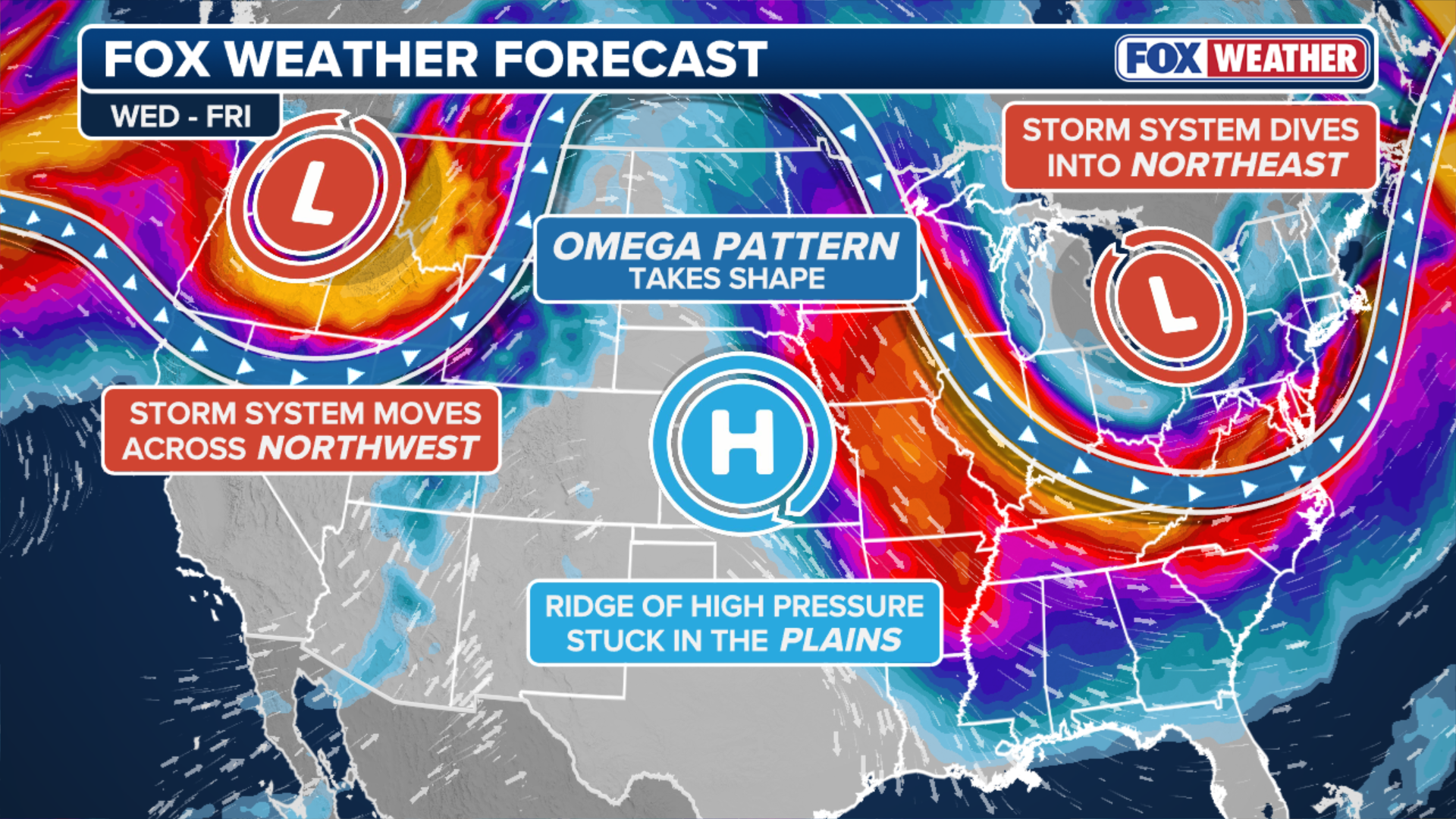
A massive ridge of high pressure is anchored over the Central U.S., sending temperatures soaring 15 to 25 degrees above average from parts of North Dakota to Texas. This heat dome is sandwiched between two storm systems, one impacting the Pacific Northwest and Montana, and the other set to deliver severe storms to parts of the Ohio Valley and interior Northeast. This stagnant pattern will remain through Thursday and is known as an "Omega Block" due to its resemblance to the Greek letter Ω, when drawn on a map.
A massive weather pattern known as an Omega Block is impacting the vast majority of the country Wednesday, sending temperatures soaring 15 to 25 degrees above average across the Central U.S. with storm systems sandwiching this heat dome in the Northwest and Northeast.
(FOX Weather)
This stagnant pattern will remain through Thursday and is known as an Omega Block due to its resemblance to the Greek letter Ω, when drawn on a map.
HOW HIGH PRESSURE AND LOW PRESSURE DRIVE THE WEATHER
This setup creates a type of atmospheric traffic jam, disrupting the normal west-to-east movement of weather systems along the Pacific jet stream.
Storms to soak Pacific Northwest
On the western side of the Omega Block, a storm system is spinning off the Pacific Northwest coast, sending waves of rain onshore and bringing a severe weather threat to a corridor from Montana to Salt Lake City.
TRIPLE-DIGIT HEAT RETURNS TO THE WEST AS DOZENS OF MAJOR CITIES EYE RECORD-BREAKING TEMPERATURES

(FOX Weather)
NOAA's Storm Prediction Center has issued a Level 2 out of 5 risk of severe thunderstorms for much of this area including Bozeman, Montana and Pocatello, Idaho. Moderate to light rain showers will persist through Thursday.
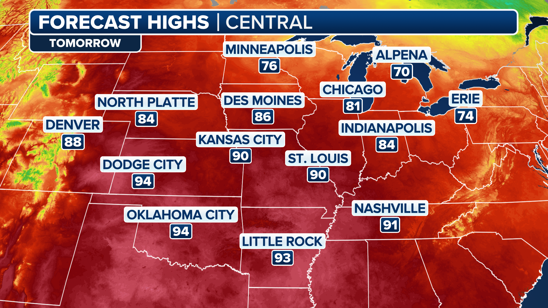
Potential record heat across Central US
The center of the Omega block features a massive ridge of high pressure, which is responsible for sending temperatures well into the 80s and 90s across the region, with dozens of record highs possible on Wednesday and Thursday.
(FOX Weather)
It will feel more like mid-to-late June across parts of the Mountain West, the Dakotas, the Central Plains and Texas.
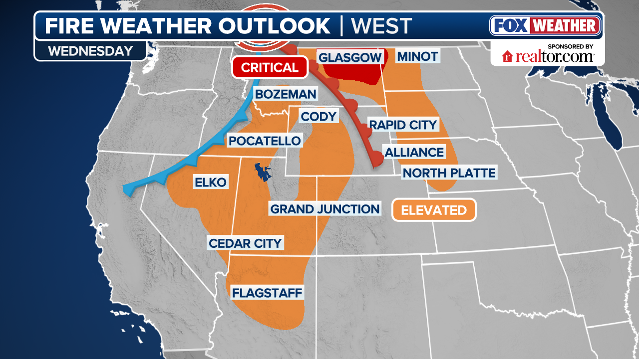
The hot and dry conditions are contributing to an increased Fire Weather threat along the western part of the heat dome from Idaho through Utah, western Colorado, Wyoming, and into Arizona.
Lightning from severe storms that fire in the Northern Rockies combined with wind gusts of 30 mph could ignite and fuel wildfires.
(FOX Weather)
Severe storms possible across Ohio Valley before reaching Northeast
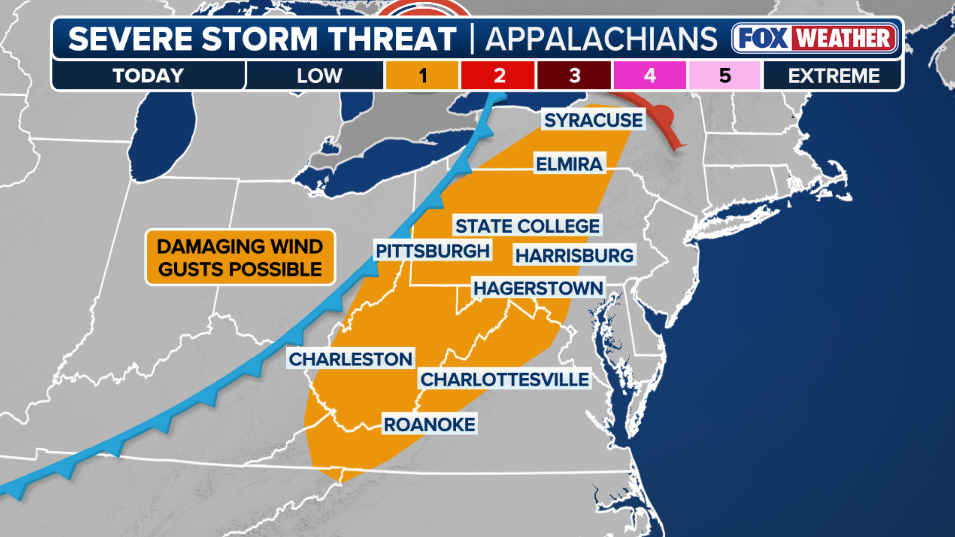
A deep dip in the jet stream across the eastern portion of the Omega Block will bring spring gloom and severe storms to the Ohio Valley and parts of Upstate New York.
A Level 1 risk of severe storms covers a corridor from Syracuse, New York south through Pennsylvania, West Virginia and the Blue Ridge Mountains of Virginia beginning Wednesday afternoon.
(FOX Weather)
Rain will reach parts of the Mid-Atlantic, including Philadelphia and Washington, D.C. late Wednesday before spreading into the northeastern part of the Interstate 95 corridor, including New York City and Boston by Thursday morning.
By Friday, the Omega pattern will begin to break down and severe storms will return to the Central U.S. and move east through next week.